Melbourne Village is a town in Brevard County, Florida. The population was 662 at the 2010 United States Census. It is part of the Palm Bay–Melbourne–Titusville Metropolitan Statistical Area, and is the smallest incorporated municipality (by population) in Brevard County.
| Name: | Melbourne Village town |
|---|---|
| LSAD Code: | 43 |
| LSAD Description: | town (suffix) |
| State: | Florida |
| County: | Brevard County |
| Incorporated: | 1957 |
| Elevation: | 23 ft (7 m) |
| Total Area: | 0.58 sq mi (1.51 km²) |
| Land Area: | 0.58 sq mi (1.51 km²) |
| Water Area: | 0.00 sq mi (0.00 km²) |
| Total Population: | 681 |
| Population Density: | 1,172.12/sq mi (452.31/km²) |
| ZIP code: | 32904 |
| Area code: | 321 |
| FIPS code: | 1244075 |
| GNISfeature ID: | 0286687 |
| Website: | www.MelbourneVillage.org |
Online Interactive Map
Click on ![]() to view map in "full screen" mode.
to view map in "full screen" mode.
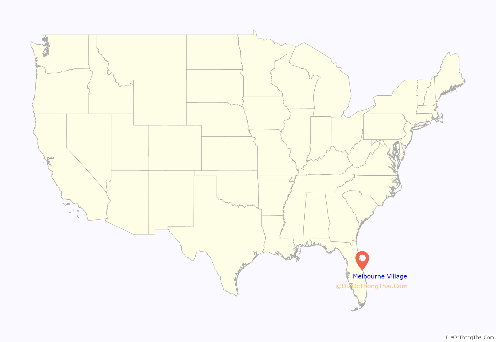
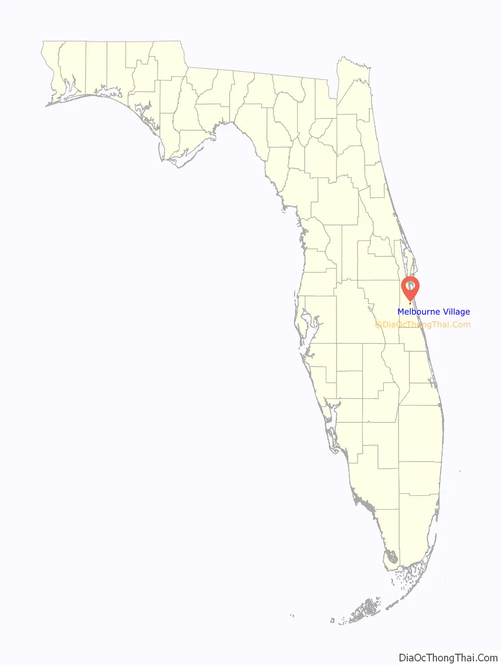
Melbourne Village location map. Where is Melbourne Village town?
History
Virginia Wood, Elizabeth Nutting, and Margaret Hutchinson came from Dayton, Ohio, following the end of World War II to the area of Melbourne, Florida. Their goal was to establish a community for people seeking a lifestyle that was simple and close to nature. This social experiment was an “intentional community”, a response to the hardships of the Great Depression. The founders were influenced by the concepts and teachings of Ralph Borsodi, who also lived in Melbourne Village from 1950 to 1960. Many early residents cleared their land, built their own houses, and ran small home businesses, from organic gardening to raising chinchillas, in order to help support themselves and their families. There was a community store run on the honor system. Early families overcame the lack of construction materials for civilian use immediately following World War II by purchasing and relocating surplus military barracks from nearby bases. Two of these barracks still remain, one being the Original Melbourne Village Hall and the other a private residence.
The Town of Melbourne Village was incorporated in 1957 out of concern of being annexed by Melbourne or included in the subsequent incorporation of West Melbourne.
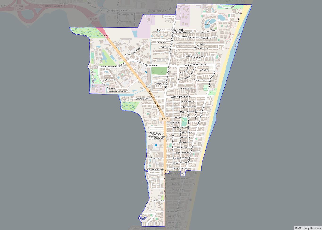
Melbourne Village Road Map
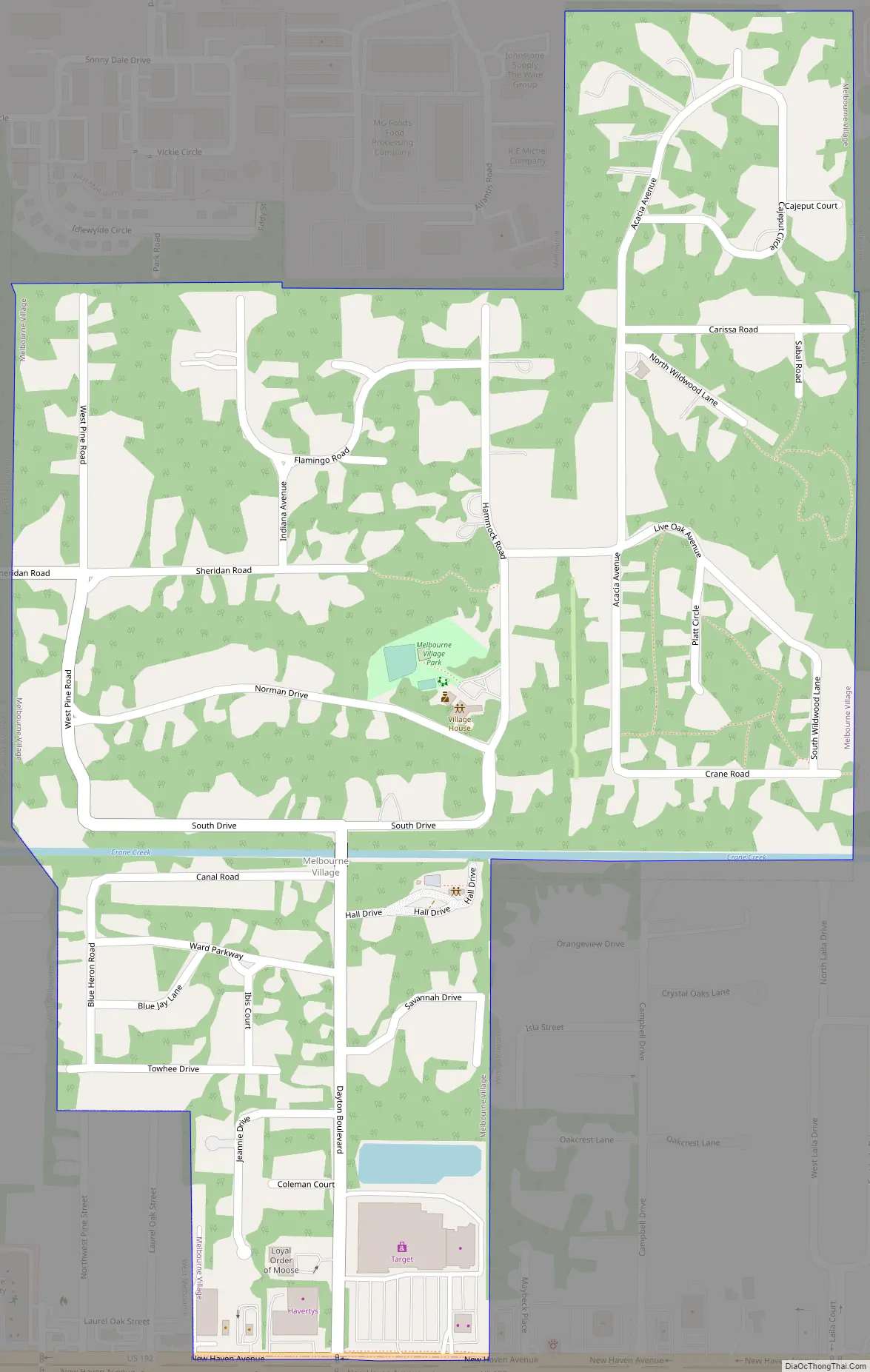
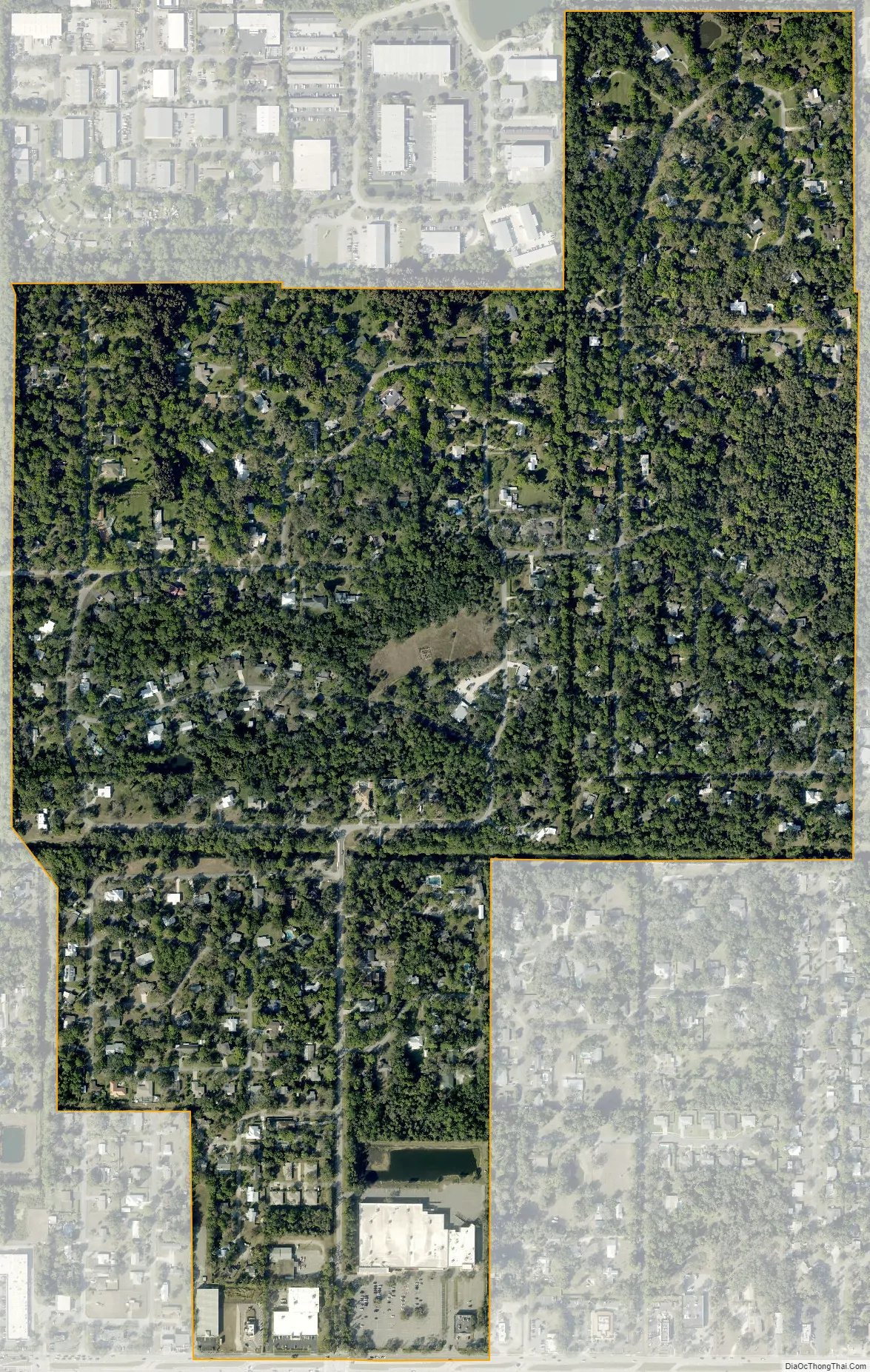
Melbourne Village city Satellite Map
Geography
According to the United States Census Bureau, the town has a total area of 0.6 square miles (1.0 km), primarily land, with several small ponds.
The village is surrounded by West Melbourne, except the northeastern portion of the town, where it is bordered by Melbourne.
Environment
Over 90% of lots are between 0.33 acres (0.13 ha) and 1.0 acre (0.40 ha), with houses nestled in among the native oaks and pines. It is common in Melbourne Village for a lot to have at least 30% canopy coverage, from mature live oaks and southern pines.
Climate
See also
Map of Florida State and its subdivision:- Alachua
- Baker
- Bay
- Bradford
- Brevard
- Broward
- Calhoun
- Charlotte
- Citrus
- Clay
- Collier
- Columbia
- Desoto
- Dixie
- Duval
- Escambia
- Flagler
- Franklin
- Gadsden
- Gilchrist
- Glades
- Gulf
- Hamilton
- Hardee
- Hendry
- Hernando
- Highlands
- Hillsborough
- Holmes
- Indian River
- Jackson
- Jefferson
- Lafayette
- Lake
- Lee
- Leon
- Levy
- Liberty
- Madison
- Manatee
- Marion
- Martin
- Miami-Dade
- Monroe
- Nassau
- Okaloosa
- Okeechobee
- Orange
- Osceola
- Palm Beach
- Pasco
- Pinellas
- Polk
- Putnam
- Saint Johns
- Saint Lucie
- Santa Rosa
- Sarasota
- Seminole
- Sumter
- Suwannee
- Taylor
- Union
- Volusia
- Wakulla
- Walton
- Washington
- Alabama
- Alaska
- Arizona
- Arkansas
- California
- Colorado
- Connecticut
- Delaware
- District of Columbia
- Florida
- Georgia
- Hawaii
- Idaho
- Illinois
- Indiana
- Iowa
- Kansas
- Kentucky
- Louisiana
- Maine
- Maryland
- Massachusetts
- Michigan
- Minnesota
- Mississippi
- Missouri
- Montana
- Nebraska
- Nevada
- New Hampshire
- New Jersey
- New Mexico
- New York
- North Carolina
- North Dakota
- Ohio
- Oklahoma
- Oregon
- Pennsylvania
- Rhode Island
- South Carolina
- South Dakota
- Tennessee
- Texas
- Utah
- Vermont
- Virginia
- Washington
- West Virginia
- Wisconsin
- Wyoming