North Lauderdale is a city in Broward County, Florida, United States. As of the 2020 census, the city’s population was 44,794. It is a principal city of the Miami metropolitan area, which was home to an estimated 6,166,488 people in the 2020 census.
| Name: | North Lauderdale city |
|---|---|
| LSAD Code: | 25 |
| LSAD Description: | city (suffix) |
| State: | Florida |
| County: | Broward County |
| Incorporated: | July 10, 1963 |
| Elevation: | 9 ft (3 m) |
| Land Area: | 4.62 sq mi (11.97 km²) |
| Water Area: | 0.07 sq mi (0.19 km²) 0.72% |
| Population Density: | 9,691.48/sq mi (3,742.06/km²) |
| ZIP code: | 33068, 33319 |
| Area code: | 754, 954 |
| FIPS code: | 1249425 |
| GNISfeature ID: | 0294455 |
| Website: | www.nlauderdale.org |
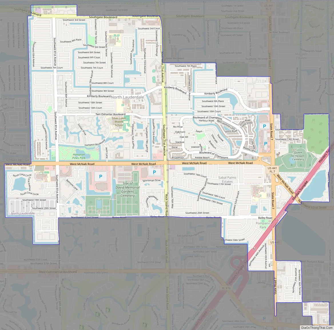
Online Interactive Map
Click on ![]() to view map in "full screen" mode.
to view map in "full screen" mode.
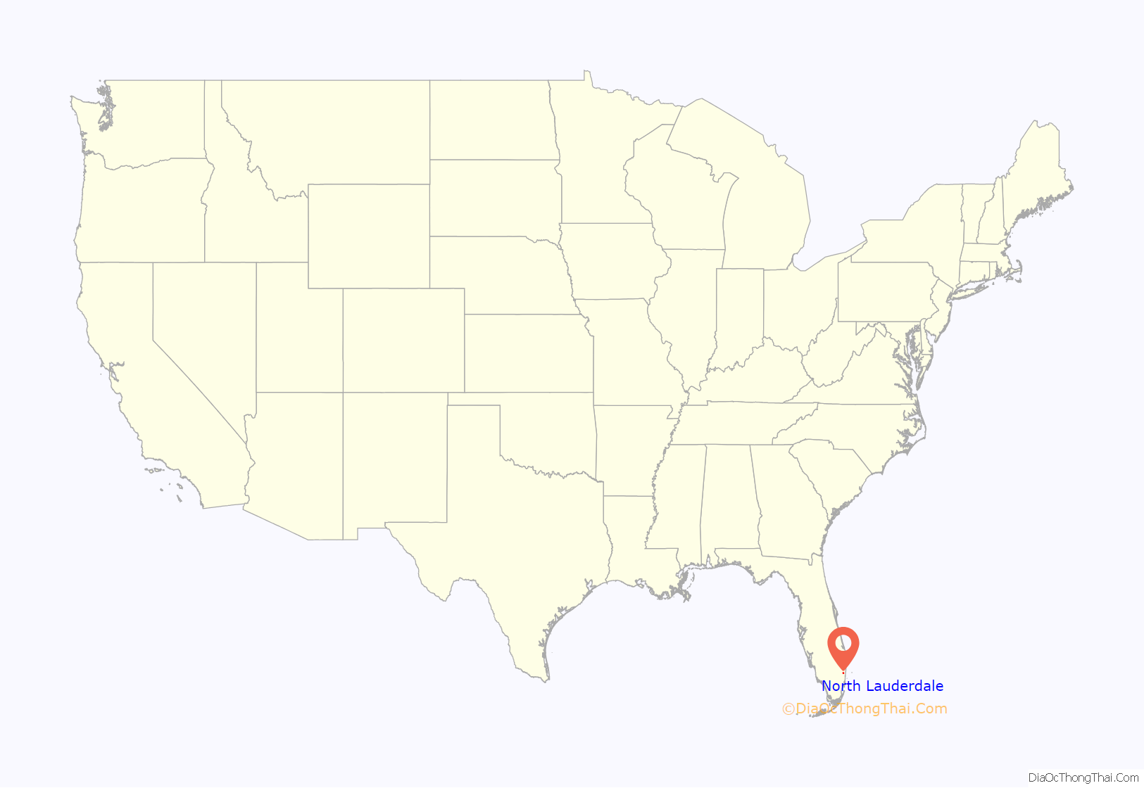
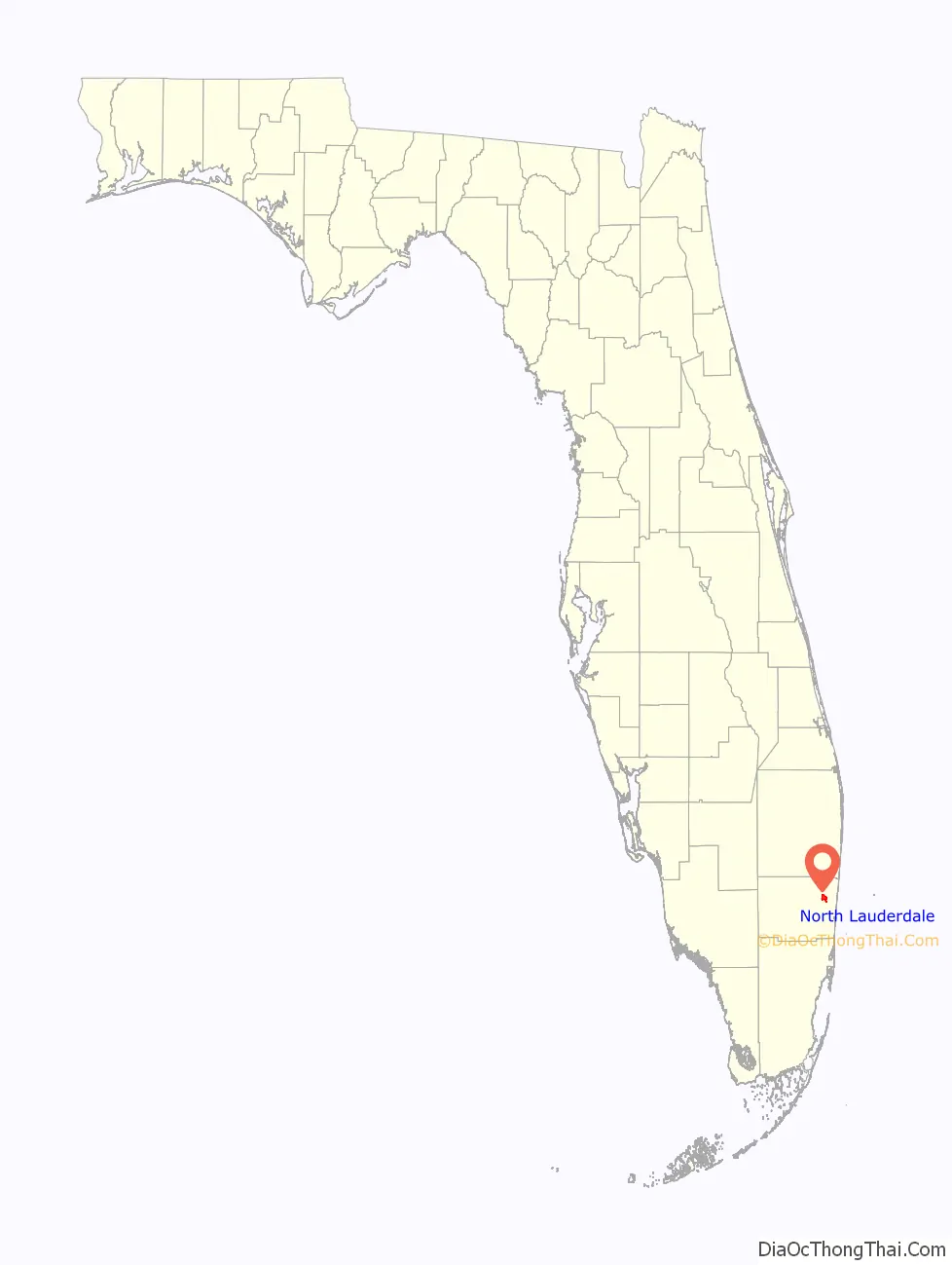
North Lauderdale location map. Where is North Lauderdale city?
History
At its creation in 1963, it was largely farmland on the western edge of development in Broward County. North Lauderdale was originally grazing pasture for cows and horses of the Anderson Dairy Farm and also an agricultural area for the Lena Lyons Stringbean Farm. Recognizing a rare opportunity to work with a blank slate, famed architect Morris Lapidus turned his attention to planning a city that would become North Lauderdale. Lapidus gained international notoriety for launching the 1950s “Miami Beach” style resort hotel. His design of the Fontainebleau Resort, the Eden Roc and Americana helped create the style of Miami Beach. After hotels, Lapidus turned to designing cities. North Lauderdale, “The City of Tomorrow”, was the first city he laid out. Residents still benefit from his influence and vision, which can be seen in the whimsical “beacons” lending the city prominence and in the distinct, amoebic shape of Boulevard of Champions. In the late 60’s, recognizing the growing demand for single-family homes, the Osias Organization, headed by Colonel Nathan Rood, who was also the first appointed Mayor, purchased most of the land and began the development of North Lauderdale proper. In April 1969, by straw vote, Michael Saraniero became the City’s first elected Mayor.
Once the city was laid out, the promise of affordable homes near the seaside ushered in a 10-year development boom in the 1970s. Where the rich and famous flocked to Miami Beach, regular families enamored with the Sun Belt, moved to North Lauderdale. Thousands moved in and neighborhood after neighborhood came to life. The city’s character took shape of a younger, family-oriented community where most social interaction took place after work around a softball field. North Lauderdale is a city where a week of hard work is rewarded with sunshine-filled weekends and family barbecues.
North Lauderdale Road Map
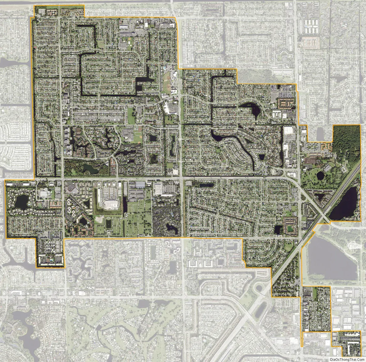
North Lauderdale city Satellite Map
Geography
North Lauderdale is located at 26°12′57″N 80°13′28″W / 26.215717°N 80.224491°W / 26.215717; -80.224491 in north-central Broward County. It is adjacent to the following municipalities:
On its north:
On its northwest:
On its west and south:
On its east:
On its northeast:
According to the United States Census Bureau, the city has a total area of 4.6 square miles (12.0 km), of which 4.6 square miles (11.9 km) is land and 0.039 square miles (0.1 km) (0.72%) is water.
See also
Map of Florida State and its subdivision:- Alachua
- Baker
- Bay
- Bradford
- Brevard
- Broward
- Calhoun
- Charlotte
- Citrus
- Clay
- Collier
- Columbia
- Desoto
- Dixie
- Duval
- Escambia
- Flagler
- Franklin
- Gadsden
- Gilchrist
- Glades
- Gulf
- Hamilton
- Hardee
- Hendry
- Hernando
- Highlands
- Hillsborough
- Holmes
- Indian River
- Jackson
- Jefferson
- Lafayette
- Lake
- Lee
- Leon
- Levy
- Liberty
- Madison
- Manatee
- Marion
- Martin
- Miami-Dade
- Monroe
- Nassau
- Okaloosa
- Okeechobee
- Orange
- Osceola
- Palm Beach
- Pasco
- Pinellas
- Polk
- Putnam
- Saint Johns
- Saint Lucie
- Santa Rosa
- Sarasota
- Seminole
- Sumter
- Suwannee
- Taylor
- Union
- Volusia
- Wakulla
- Walton
- Washington
- Alabama
- Alaska
- Arizona
- Arkansas
- California
- Colorado
- Connecticut
- Delaware
- District of Columbia
- Florida
- Georgia
- Hawaii
- Idaho
- Illinois
- Indiana
- Iowa
- Kansas
- Kentucky
- Louisiana
- Maine
- Maryland
- Massachusetts
- Michigan
- Minnesota
- Mississippi
- Missouri
- Montana
- Nebraska
- Nevada
- New Hampshire
- New Jersey
- New Mexico
- New York
- North Carolina
- North Dakota
- Ohio
- Oklahoma
- Oregon
- Pennsylvania
- Rhode Island
- South Carolina
- South Dakota
- Tennessee
- Texas
- Utah
- Vermont
- Virginia
- Washington
- West Virginia
- Wisconsin
- Wyoming


