South Miami is a city in Miami-Dade County, Florida, United States, in the Miami metropolitan area. The population was 12,026 as of the 2020 census.
| Name: | South Miami city |
|---|---|
| LSAD Code: | 25 |
| LSAD Description: | city (suffix) |
| State: | Florida |
| County: | Miami-Dade County |
| Incorporated: | June 24, 1927 |
| Elevation: | 10 ft (3 m) |
| Total Area: | 2.31 sq mi (5.98 km²) |
| Land Area: | 2.27 sq mi (5.87 km²) |
| Water Area: | 0.04 sq mi (0.11 km²) |
| Total Population: | 12,026 |
| Population Density: | 5,304.81/sq mi (2,048.07/km²) |
| Area code: | 305, 786 |
| FIPS code: | 1267550 |
| GNISfeature ID: | 0291395 |
| Website: | www.southmiamifl.gov |
Online Interactive Map
Click on ![]() to view map in "full screen" mode.
to view map in "full screen" mode.
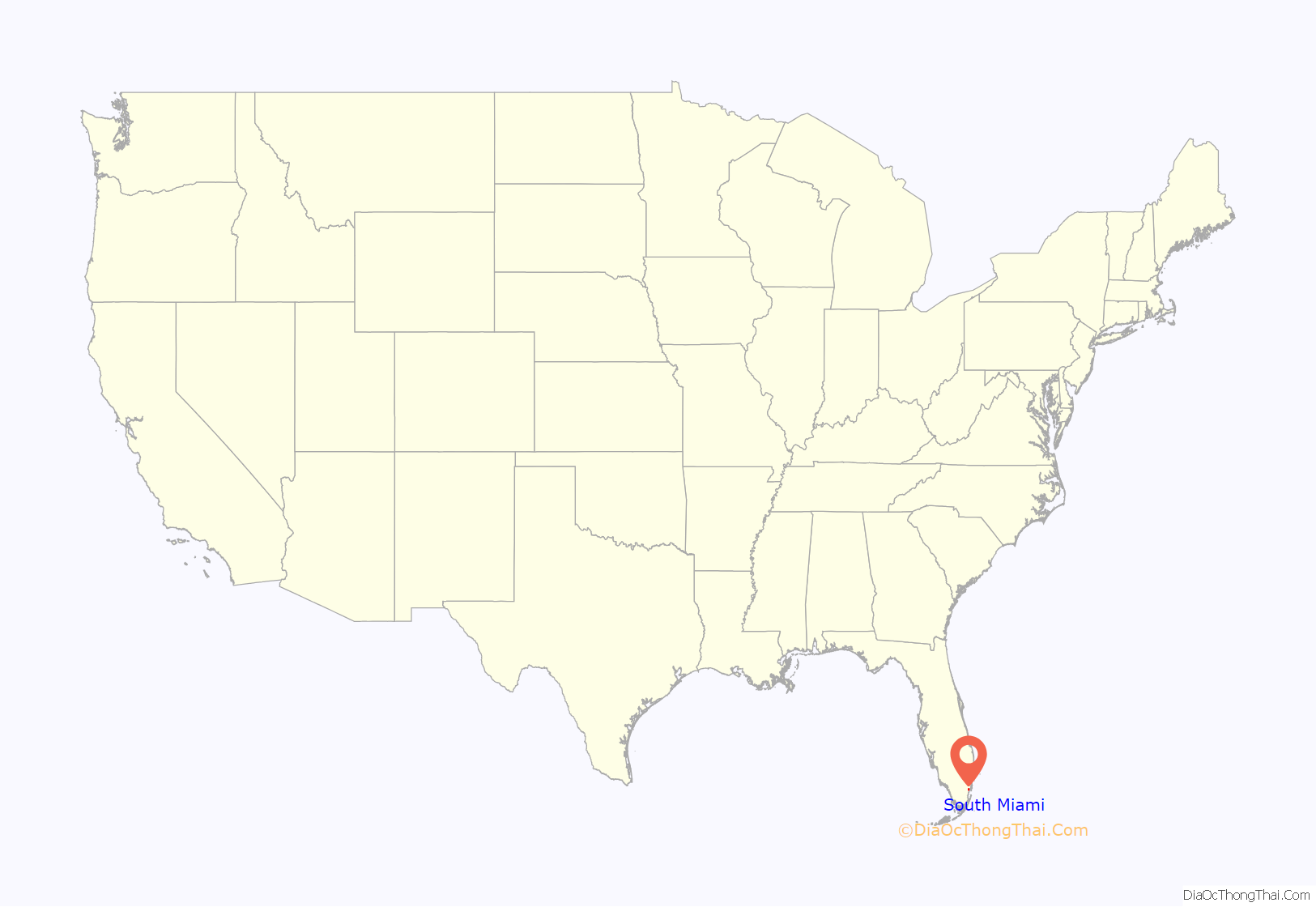
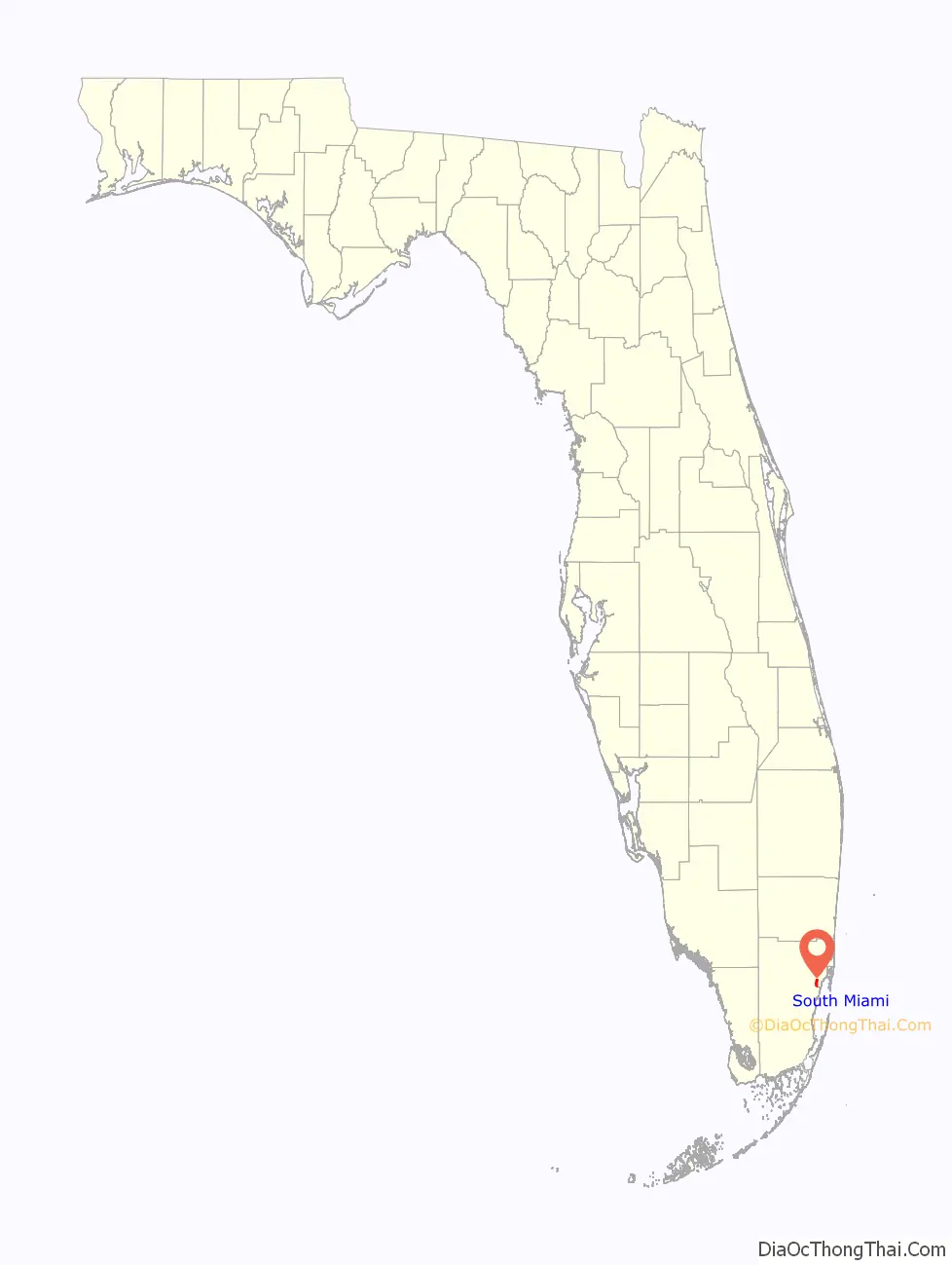
South Miami location map. Where is South Miami city?
History
South Florida had been roamed by Native Americans (Tequesta, Calusa, and Jaega), probably for centuries, before white pioneers advanced through Little Hunting Ground (later known as Miami‘s Coconut Grove neighborhood) to Big Hunting Ground (now known as the Cutler neighborhood of Palmetto Bay).
Wilson Alexander Larkins (1860–1946) was 36 years old when he, his wife (Katie Estelle Burtashaw) and five children, and their livestock arrived in Fort Dallas (now the Lummus Park Historic District of Miami) in 1896. He purchased property west of Red Road and Sunset Drive, where he built a home and barn. He also built the first general store east of that area in 1898 at what is known today as Cartagena Plaza or Cocoplum Circle (actually in Coral Gables). As the community grew, he established a post office in the community. Larkins became the first postmaster, a role he held for sixteen years; he named the area “Manila”, but the majority of the settlers, who began building homes around his store, preferred the name of “Larkins” in his honor.
A depot was placed along the Florida East Coast Railway in 1904, and in the same year, John Moses Dowling built the first house within what is now South Miami city limits. His son-in-law opened the first store on the west side of the tracks, called the White Palace Grocery.
Other prominent historic families have historic buildings and streets named for them, such as Dorn Avenue (Southwest 59th Avenue) and the Shelley Building, among others. Harold W. Dorn and his brother Robert moved to the area in 1910; their primary interest was growing mango and avocado. Mary E. Dorn was the first president of the Cocoplum Thimble Club, the first Women’s club in Larkins. In 1925, the Dorn brothers built the Riviera Theatre at 5700 South Dixie Highway; in 1934, Charles T. Fuchs moved his Holsum Bakery from Homestead to South Miami and turned the Riviera Theatre Building into a bakery.
The first African-American to purchase land in the Larkins area was Marshall Williamson, who moved there from Madison, Florida. He built his home at 6500 SW 60th Avenue and allowed it to be used for church services even before the construction was completed. In 1916, he donated land for the St. John’s AME (African Methodist Episcopal) Church, one of Larkins’ first churches and the first church in the black community; it is located at 6461 SW 59th Place. Later, Williamson also donated land for the J. R. E. Lee School. Because of his generosity, the black neighborhood became known as Madison Square, after Williamson’s hometown. Williamson died in 1972. Named after him is Marshall Williamson Park, at 6125 SW 68 Street.
In 1926, area residents wanted to incorporate their area, and because of the booming city to the north of them, they chose the name of “Town of South Miami”. The original town boundaries were Red Road on the east, Kendall Drive to the south, Palmetto Road to the west (now Palmetto Expressway), and Bird Road and Miller Drive to the north. The year 1926 also saw the first street lighting and the first incoming class of freshmen at the newly chartered University of Miami campus, which abuts the city of South Miami eastern boundary along Red Road (SW 57th Avenue). Also founded with a university theme that same year was the Cambridge Lawns neighborhood of South Miami, situated just 0.7 miles (1.1 km) from the university campus. The neighborhood’s Cambridge Lawns Historic District, some 30 homes in the Tudor Revival and Mediterranean revival style completed in 1928, were granted historic recognition by the City of South Miami in 2005.
Also in 1926, South Miami received extensive damage from the 1926 Miami hurricane. The town’s leaders asked Congress to “relieve the people of their income tax for the current year,” but federal assistance was not forthcoming. The Florida East Coast Railway station burned down, leaving the town without a station for many years. Residents suffered storm damage again from Hurricane Andrew in 1992 and from Hurricane Bonnie (1998).
On June 25, 1927, W. A. Forster was sworn in as South Miami’s first mayor.
In 1933, the original six square miles of South Miami were reduced to just over three miles (5 km) due to an effort to reduce municipal responsibilities. The city’s size was reduced again in 1937, and many of the northern city residents sued to get out of the city. This is why the city of South Miami has the most irregular boundaries of any city in Miami-Dade County today.
Of mid-century South Miami, local historian Donna Shelley writes:
Construction of the current City Hall building was approved by referendum in 1955. Designed by architect Henry George Fink, the governmental seat on Sunset Drive was dedicated in October 1956 by Mayor Paul U. Tevis.
Jack Block was elected mayor of the city in 1968, and was thereafter re-elected every two years until 1984 when, as he told interviewer Gregory W. Bush, “I started to not enjoy it as much.” In that interview, for the University of Miami Oral History Program, he gave snapshots of South Miami history when he told Bush (a history professor at the University of Miami),
In 1990, Catherine (Rutherford) McCann (1933–2009) was elected as South Miami’s first female Mayor, and was re-elected in 1992. She was responsible for the clean-up of South Miami after Hurricane Andrew; the Miami Herald wrote, “She had an encyclopedic knowledge of the South Miami city charter. She pushed for affordable housing and responsible development.”
In 2000, South Miami joined other municipalities in the country in forming city partnerships to help foster cultural and economic development between cities around the world. South Miami is a member of Sister Cities International and formed relationships with the cities of Grand Turk in Turks and Caicos Islands and Basseterre in Saint Kitts and Nevis.
According to reporting by SOMI magazine, a local publication, during early October 2018, “[o]n August 21, 2018, in the City of South Miami Commission Chambers the forging of a ‘Sister-City’ between the City of South Miami, Florida, and the Municipio de Medellin, Colombia, was formalized.”
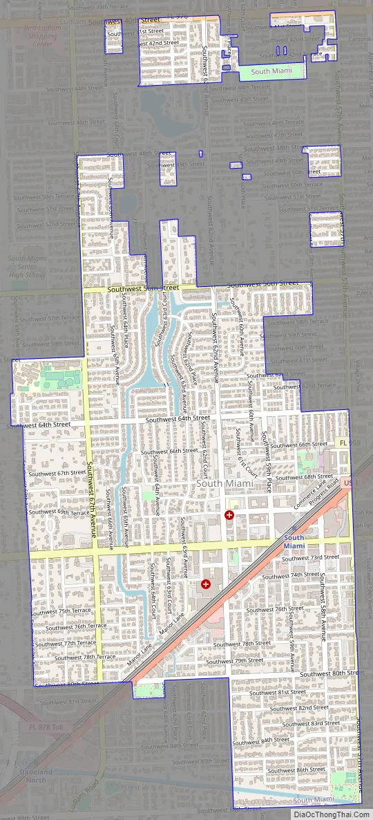
South Miami Road Map
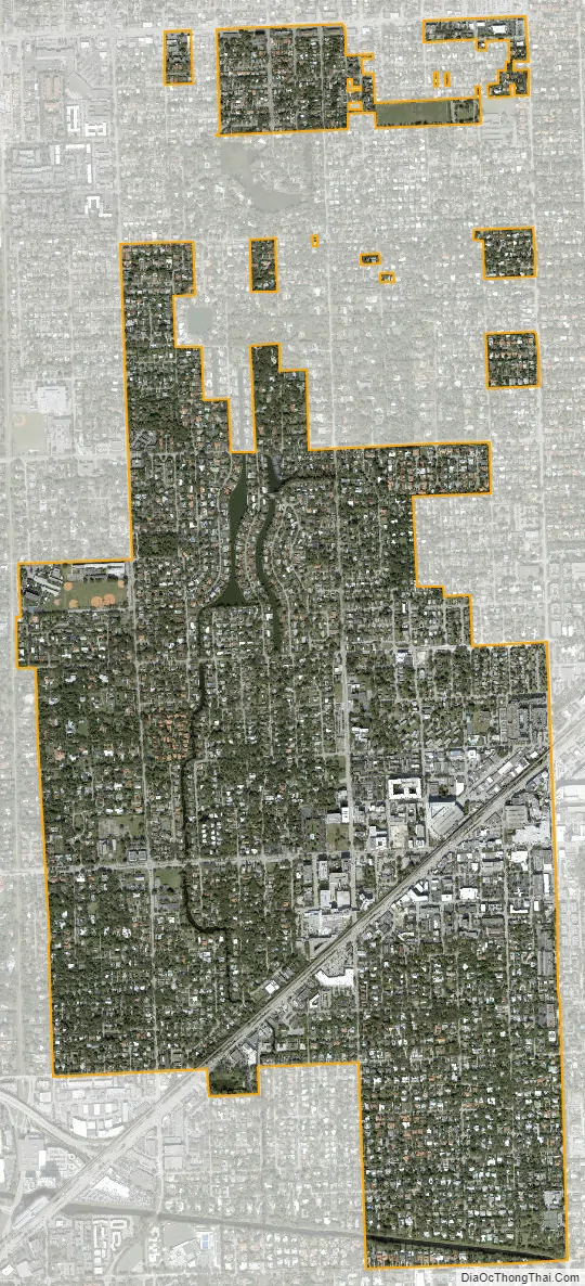
South Miami city Satellite Map
Geography
South Miami is located at 25°42′37″N 80°17′43″W / 25.71028°N 80.29528°W / 25.71028; -80.29528 (25.710279, −80.295170). It is bordered to the east by the city of Coral Gables, to the south by the town of Pinecrest, to the west by unincorporated Glenvar Heights, and to the north by unincorporated Coral Terrace. U.S. Route 1 (South Dixie Highway) passes through the city, leading northeast 8 miles (13 km) to Downtown Miami and southwest 20 miles (32 km) to Homestead.
According to the U.S. Census Bureau, South Miami has a total area of 2.3 square miles (6.0 km), of which 0.04 square miles (0.10 km), or 1.78%, are water.
Surrounding areas
- Glenvar Heights, Unincorporated Miami-Dade County, Coral Terrace
- Coral Terrace Coral Gables
- Unincorporated Miami-Dade County, Glenvar Heights Coral Gables, Unincorporated Miami-Dade County
- Glenvar Heights, Pinecrest Coral Gables
- Glenvar Heights, Pinecrest
See also
Map of Florida State and its subdivision:- Alachua
- Baker
- Bay
- Bradford
- Brevard
- Broward
- Calhoun
- Charlotte
- Citrus
- Clay
- Collier
- Columbia
- Desoto
- Dixie
- Duval
- Escambia
- Flagler
- Franklin
- Gadsden
- Gilchrist
- Glades
- Gulf
- Hamilton
- Hardee
- Hendry
- Hernando
- Highlands
- Hillsborough
- Holmes
- Indian River
- Jackson
- Jefferson
- Lafayette
- Lake
- Lee
- Leon
- Levy
- Liberty
- Madison
- Manatee
- Marion
- Martin
- Miami-Dade
- Monroe
- Nassau
- Okaloosa
- Okeechobee
- Orange
- Osceola
- Palm Beach
- Pasco
- Pinellas
- Polk
- Putnam
- Saint Johns
- Saint Lucie
- Santa Rosa
- Sarasota
- Seminole
- Sumter
- Suwannee
- Taylor
- Union
- Volusia
- Wakulla
- Walton
- Washington
- Alabama
- Alaska
- Arizona
- Arkansas
- California
- Colorado
- Connecticut
- Delaware
- District of Columbia
- Florida
- Georgia
- Hawaii
- Idaho
- Illinois
- Indiana
- Iowa
- Kansas
- Kentucky
- Louisiana
- Maine
- Maryland
- Massachusetts
- Michigan
- Minnesota
- Mississippi
- Missouri
- Montana
- Nebraska
- Nevada
- New Hampshire
- New Jersey
- New Mexico
- New York
- North Carolina
- North Dakota
- Ohio
- Oklahoma
- Oregon
- Pennsylvania
- Rhode Island
- South Carolina
- South Dakota
- Tennessee
- Texas
- Utah
- Vermont
- Virginia
- Washington
- West Virginia
- Wisconsin
- Wyoming


