Saint Kitts and Nevis is a twin island country covering an area of 261 sq. km (101 sq mi). It is located in the eastern Caribbean Sea. The dual island nation of Saint Kitts and Nevis is the smallest sovereign nation in the Western hemisphere. Both islands are actually the summits of a submerged volcanic mountain range.
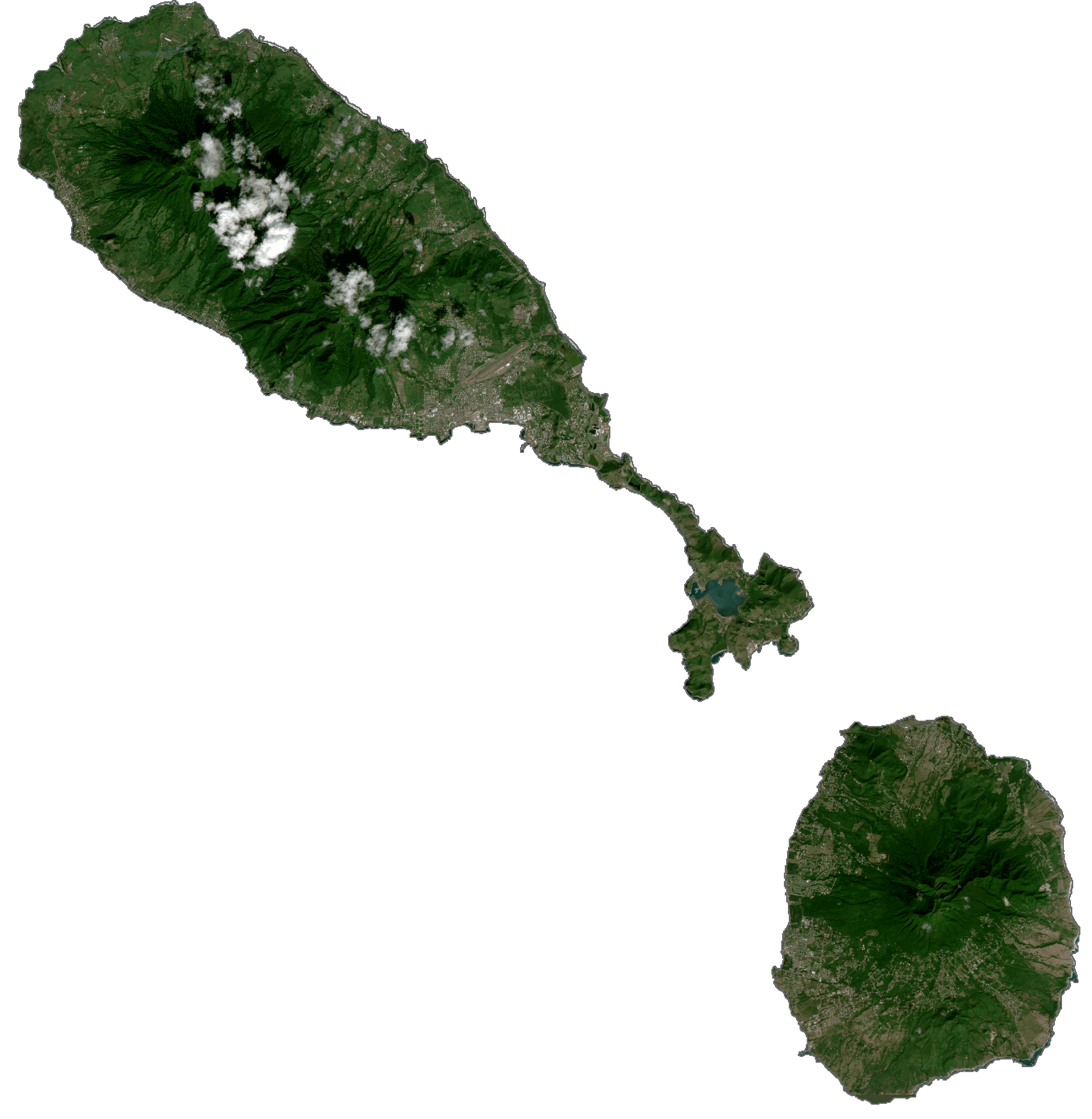
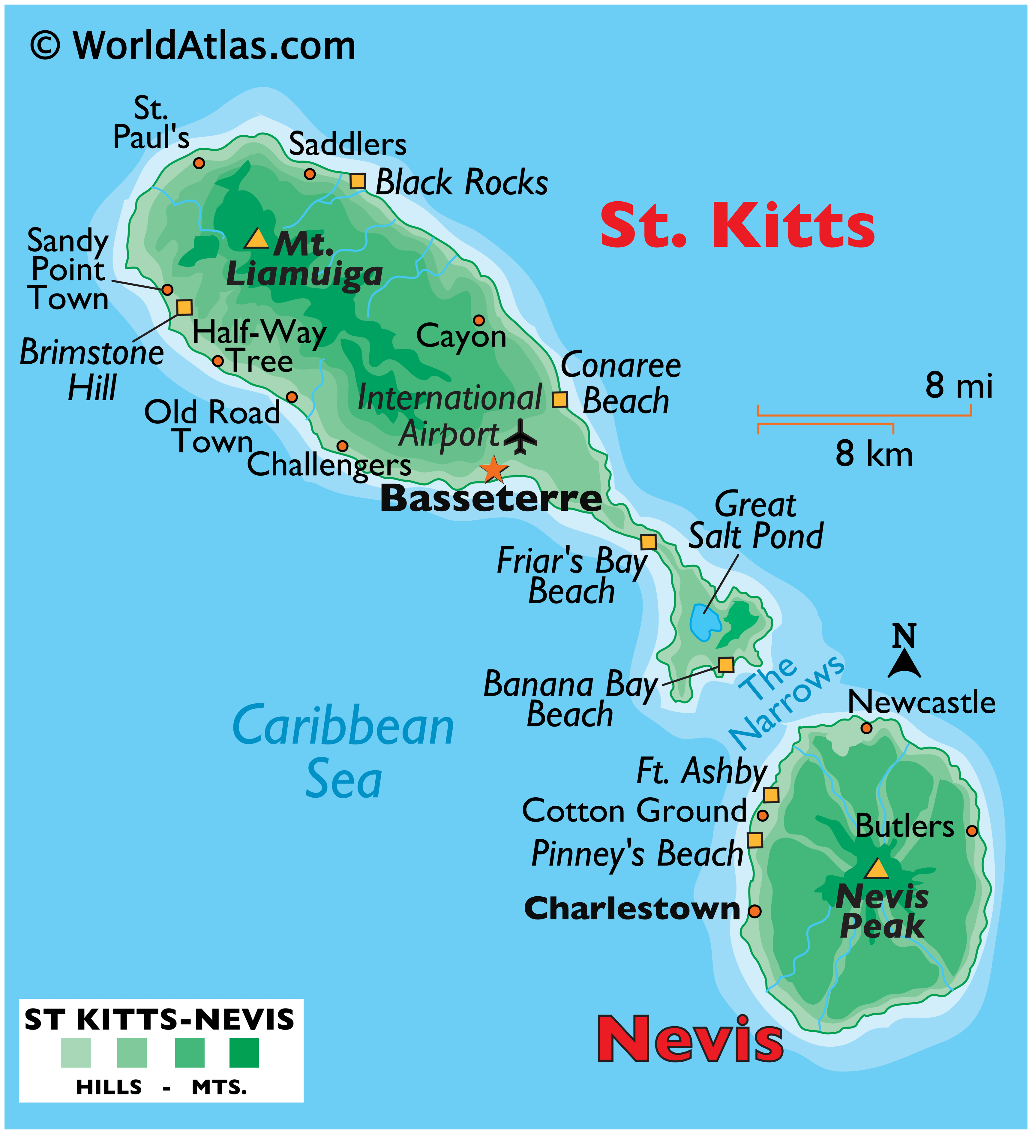
As observed on the physical map of Saint Kitts and Nevis above, Nevis is cone shaped, with a central volcanic peak; Nevis Peak. The island has a narrow coastal plain that rises gently into the upper elevations. There are a scattering of white and black sand beaches. St. Kitts is an elongated oval in shape, except for a long, narrow peninsula to the southeast. It’s narrow coastal plain rises steeply into the upper elevations. It is comprised of a group of volcanic peaks, the highest of which is Mount Liamuiga, formerly Mount Misery, a dormant volcano, some 1,156m (3,792 ft) high.
| Flag: |  |
|---|---|
| Legal Name: | Federation of Saint Kitts and Nevis |
| Capital Value: | Basseterre |
| Official languages: | English |
| Demonym(s): |
|
| Government: | Federal parliamentaryconstitutional monarchy |
| Legislature: | National Assembly |
| Total Area: | 261 km² |
| Land Area: | 261 km² |
| Population: | 52,823 |
| Density: | 164/km (424.8/sq mi) (64th) |
| GDP: | $1.05 Billion |
| GDP Per Capita: | $19,896.50 |
| Currency Value: | East Caribbean dollars (XCD) |
| Driving side: | left |
| Calling code: | +1 869 |
| Internet TLD: | .kn |
Discover the beauty of Saint Kitts and Nevis with this interactive map! Explore the islands’ stunning beaches, lush forests, winding roads, and tranquil bays. Zoom in to uncover the secrets of this Caribbean paradise.
<h2>Explore the Beauty of Saint Kitts and Nevis</h2><p>The Caribbean islands of Saint Kitts and Nevis offer a wealth of natural beauty and charm. With this interactive map, you can explore the islands in detail to uncover the secrets of this paradise.</p><p>The map contains populated places, roads, and bays. It includes satellite imagery that displays both islands of Saint Kitts in the north and Nevis to the south. Discover the beauty of Saint Kitts and Nevis with this interactive map! Zoom in to find stunning beaches, lush forests, winding roads, and tranquil bays.</p>
Online Interactive Political Map
Click on ![]() to view map in "full screen" mode.
to view map in "full screen" mode.
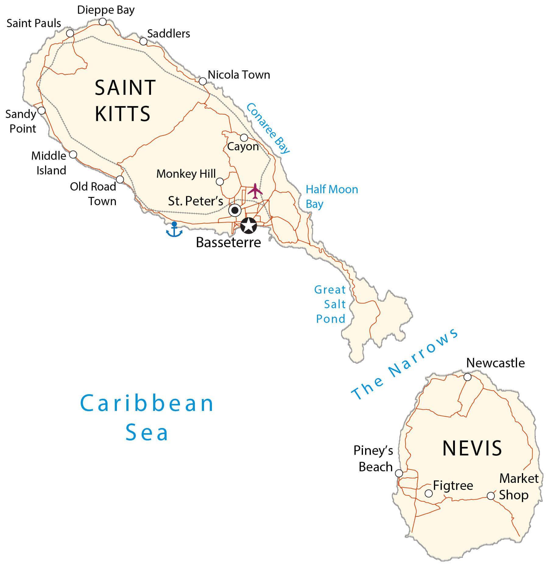
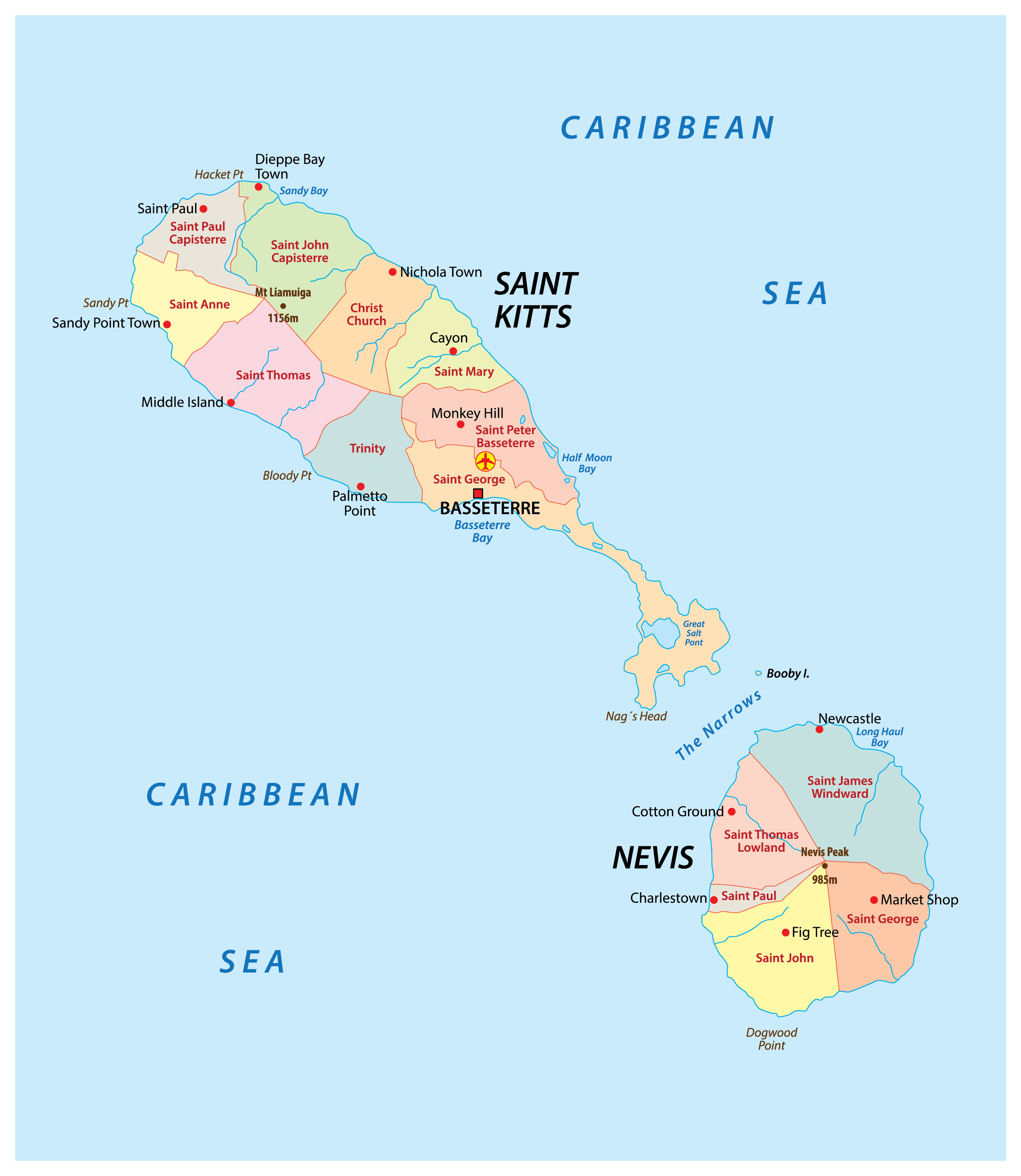
Saint Kitts and Nevis (officially, the Federation of Saint Christopher and Nevis) is divided into 14 parishes. The 9 parishes that are in Saint Kitts are: Christ Church Nichola Town, Saint Anne Sandy Point, Saint George, Saint John Capisterre, Saint Mary Cayon, Saint Paul Capisterre, Saint Peter Basseterre, Saint Thomas Middle Island and Trinity Palmetto Point. The 5 parishes that are in Nevis are: Saint George Gingerland, Saint James Windward, Saint John Figtree, Saint Paul Charlestown and Saint Thomas Lowland.
Covering a total combined area of 261 sq. km, the dual island nation of Saint Kitts and Nevis, is the smallest sovereign nation in the Western hemisphere. Located on the south western coast of the larger island of Saint Kitts is, Basseterre – the capital and the largest city of Saint Kitts and Nevis. It is a major port and an administrative center of the country and the industrial and economic center of St. Kitts.
Location Maps
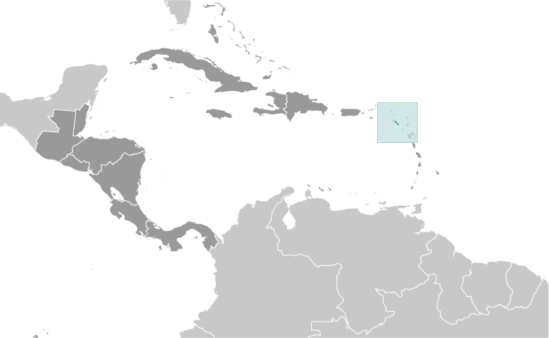
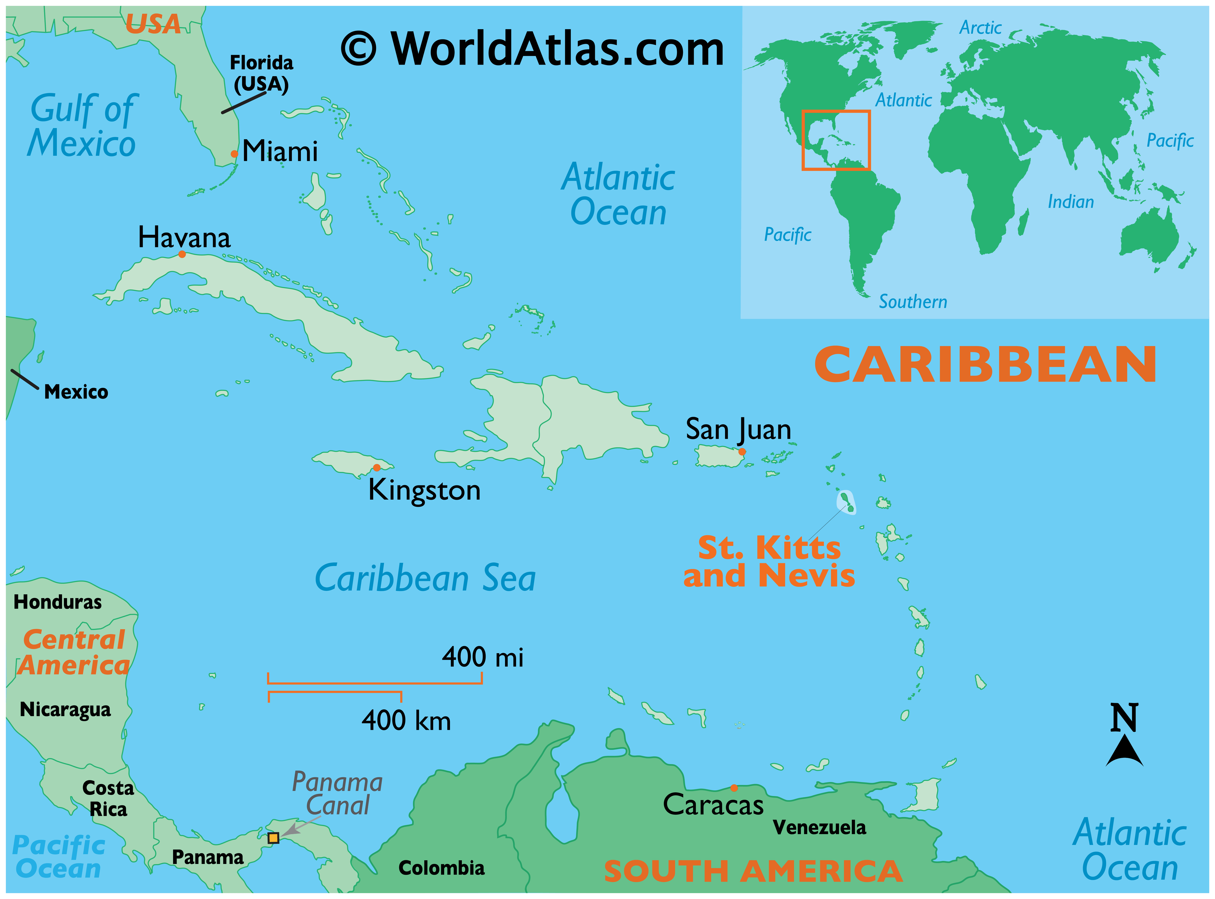
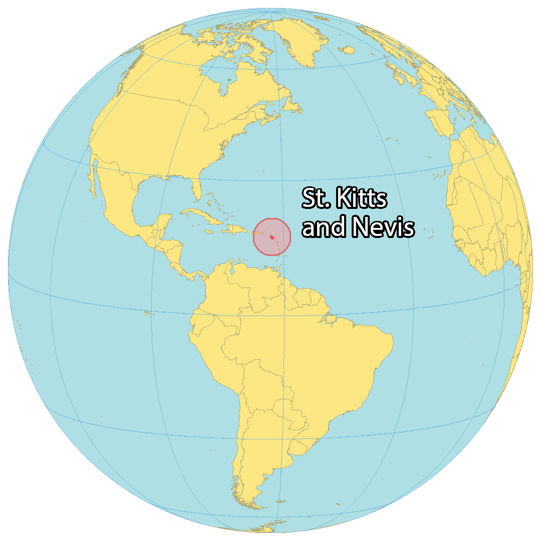
Where is Saint Kitts & Nevis?
Saint Kitts and Nevis is a two-island nation in the Caribbean Sea, occupying an area of 261 square kilometers (101 sq mi). It is the smallest island nation in the Caribbean, and is smaller than Grenada, Barbados, and St. Vincent and the Grenadines. Saint Kitts is the larger of the two islands at 168 square kilometers (65 sq mi), while Nevis is only 93 square kilometers (36 sq mi). It is situated at the northern end of the Lesser Antilles archipelago, 70 kilometers (44 mi) away from Antigua and Barbuda to the east, and 50 kilometers (31 mi) away from Montserrat to the southwest. The Dutch island of Oranjestad is only 13 kilometers (8 m) away to the north, and Basseterre is the capital and most populous city on the island of Saint Kitts.
High Definition Political Map of Saint Kitts & Nevis

History
Pre-colonial period
The name of the first inhabitants, pre-Arawakan peoples who settled the islands perhaps as early as 3000 years ago, is not known. They were followed by the Arawak peoples, or Taíno, about 1000 BC. The Island Caribs invaded about 800 AD.
European arrival and early colonial period
Christopher Columbus was the first European to sight the islands in 1493. The first settlers were the English in 1623, led by Thomas Warner, who established a settlement at Old Road Town on the west coast of St Kitts after achieving an agreement with the Carib chief Ouboutou Tegremante. The French later also settled on St Kitts in 1625 under Pierre Belain d’Esnambuc. As a result, both parties agreed to partition the island into French and English sectors. From 1628 onward the English also began settling on Nevis.
The French and English, intent on exploitation of the island’s resources, encountered resistance from the native Caribs (Kalinago), who waged war during the first three years of the settlements’ existence. The Europeans resolved to rid themselves of this problem. An ideological campaign was waged by colonial chroniclers, dating back to the Spanish, as they produced literature which denied the Kalinagos’ humanity (a literary tradition carried through the late-seventeenth century by such authors as Jean-Baptiste du Tertre and Pere Labat). In 1626 the Anglo-French settlers joined forces to massacre the Kalinago at a place that became known as Bloody Point, allegedly to preempt a Carib plan to expel or kill all European settlers. Thereafter, the English and French established large sugar plantations which were worked by imported African slaves. This made the planter-colonists rich, but drastically altered the islands’ demographics as black slaves soon came to outnumber Europeans.
A Spanish expedition of 1629 sent to enforce Spanish claims destroyed the English and French colonies and deported the settlers back to their respective countries. As part of the war settlement in 1630, the Spanish permitted the re-establishment of the English and French colonies. Spain later formally recognised Britain’s claim to St Kitts with the Treaty of Madrid (1670), in return for British cooperation in the fight against piracy.
As Spanish power declined, Saint Kitts became a key base for English and French expansion in the Caribbean. From St Kitts the British settled the islands of Antigua, Montserrat, Anguilla and Tortola, and the French settled Martinique, the Guadeloupe archipelago and Saint Barthélemy. During the late 17th century, France and England fought for control over St Kitts and Nevis, fighting wars in 1667, 1689–90 and 1701–13. The French renounced their claim to the islands with the Treaty of Utrecht in 1713. The islands’ economy, already shattered by war, was further harmed by natural disasters: In 1690 an earthquake destroyed Jamestown, capital of Nevis, forcing the construction of a new capital at Charlestown; further damage was caused by a hurricane in 1707.
British colonial period
The colony had recovered by the turn of the 18th century, and St Kitts had become the richest British Crown Colony per capita in the Caribbean as result of its slave-based sugar industry by the close of the 1700s. The 18th century also saw Nevis, formerly the richer of the two islands, being eclipsed by St Kitts in economic importance. Alexander Hamilton, the future U.S. secretary of the Treasury, was born on Nevis in 1755 or 1757.
As Britain became embroiled in war with its American colonies, the French decided to use the opportunity to re-capture St Kitts in 1782; however St Kitts was given back and recognised as British territory in the Treaty of Paris (1783).
The African slave trade was terminated within the British Empire in 1807, and slavery outlawed completely in 1834. A four-year “apprenticeship” period followed for each slave, in which they worked for their former owners for wages. On Nevis 8,815 slaves were freed, while St Kitts freed 19,780.
Saint Kitts and Nevis, along with Anguilla, were federated in 1882. In the first few decades of the 20th century economic hardship and lack of opportunities led to the growth of a labour movement; the Great Depression prompted sugar workers to go on strike in 1935. The 1940s saw the founding of the St Kitts-Nevis-Anguilla Labour Party (later renamed the Saint Kitts and Nevis Labour Party, or SKNLP) under Robert Llewellyn Bradshaw. Bradshaw later became Chief Minister and then Premier of the colony from 1966 to 1978; he sought to gradually bring the sugar-based economy under greater state control. The more conservative-leaning People’s Action Movement party (PAM) was founded in 1965.
After a brief period as part of the West Indies Federation (1958–62), the islands became an associated state with full internal autonomy in 1967. Residents of Nevis and Anguilla were unhappy with St Kitts’s domination of the federation, and Anguilla unilaterally declared independence in 1967. In 1971 Britain resumed full control of Anguilla, but it was formally separated in 1980. Attention then focused on Nevis, with the Nevis Reformation Party seeking to safeguard the smaller island’s interests in any future independent state. Eventually it was agreed that the island would have a degree of autonomy with its own Premier and Assembly, as well as the constitutionally-protected right to unilaterally secede if a referendum on independence resulted in a two-thirds majority in favour. St Kitts and Nevis achieved full independence on 19 September 1983. Kennedy Simmonds of the PAM, Premier since 1980, duly became the country’s first Prime Minister. St Kitts and Nevis opted to remain within the British Commonwealth, retaining Queen Elizabeth as Monarch, represented locally by a Governor-General.
Post independence era
Kennedy Simmonds went on to win elections in 1984, 1989 and 1993, before being unseated when the SKNLP returned to power in 1995 under Denzil Douglas.
In Nevis, growing discontent with their perceived marginalisation within the federation led to a referendum to separate from St Kitts in 1998, which though resulting a 62% vote to secede, fell short of the required two-thirds majority to be legally enacted.
In late-September 1998, Hurricane Georges caused approximately $458,000,000 in damages and limited GDP growth for the year and beyond. Meanwhile, the sugar industry, in decline for years and propped up only by government subsidies, was closed completely in 2005.
The 2015 Saint Kitts and Nevis general election was won by Timothy Harris and his recently formed People’s Labour Party, with backing from the PAM and the Nevis-based Concerned Citizens’ Movement under the ‘Team Unity’ banner.
In June 2020, Team Unity coalition of the incumbent government, led by Prime Minister Timothy Harris, won general elections by defeating Saint Kitts and Nevis Labour Party (SKNLP).
In snap general elections held in August 2022, the SKNLP again won, and Terrance Drew became the fourth prime minister of Saint Kitts and Nevis.
Physical Map of Saint Kitts & Nevis
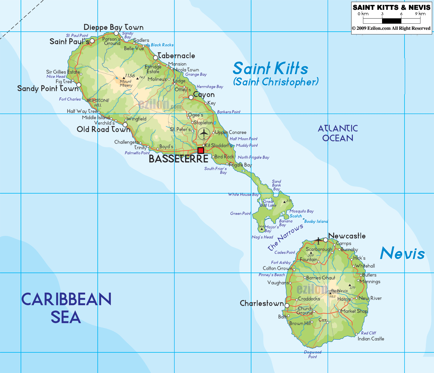
Geography
The country consists of two main islands, Saint Kitts and Nevis, separated at a distance of 2 miles (3 km) by The Narrows strait. Both are of volcanic origin, with large central peaks covered in tropical rainforest. The majority of the population live along the flatter coastal areas. St Kitts contains several mountain ranges (the North West Range, Central Range and South-West Range) in its centre, where the highest peak of the country, Mount Liamuiga 1,156 metres (3,793 ft) can be found. Along the east coast can be found the Canada Hills and Conaree Hills. The land narrows considerably in the south-east, forming a much flatter peninsula which contains the largest body of water, the Great Salt Pond. To the southeast, in The Narrows, lies the small isle of Booby Island. There are numerous rivers descending from the mountains of both islands, which provide fresh water to the local population. Nevis, the smaller of the two main islands and roughly circular in shape, is dominated by Nevis Peak 985 metres (3,232 ft).
Saint Kitts and Nevis contains two terrestrial ecoregions: Leeward Islands moist forests and Leeward Islands dry forests. The country had a 2019 Forest Landscape Integrity Index mean score of 4.55/10, ranking it 121st globally out of 172 countries.
Fauna
The national bird is the brown pelican. 176 species of bird have been reported from the country.
Flora
The national flower is Delonix regia. Common plants include palmetto, hibiscus, bougainvillea, and tamarind. Pinus species are common in the dense forests of islands, and are usually covered by various species of ferns.
Climate
By the Köppen climate classification, St Kitts has a tropical savanna climate (Köppen Aw) and Nevis has a tropical monsoon climate (Köppen Am). Mean monthly temperatures in Basseterre varies little from 23.9 °C (75.0 °F) to 26.6 °C (79.9 °F). Yearly rainfall is approximately 2,400 millimetres (90 in), although it has varied from 1,356 millimetres (53.4 in) to 3,183 millimetres (125.3 in) in the period 1901–2015.
Saint Kitts & Nevis Satellite Map