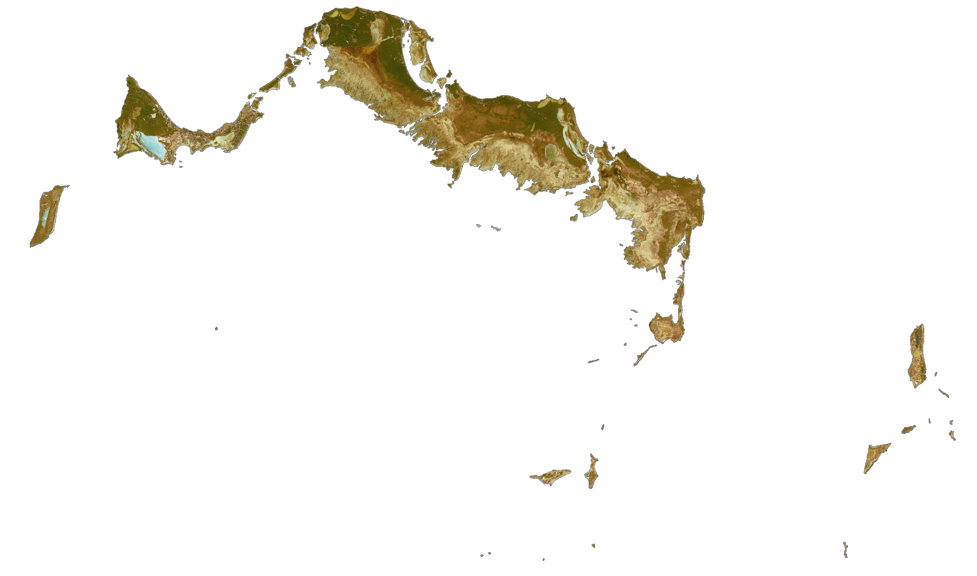
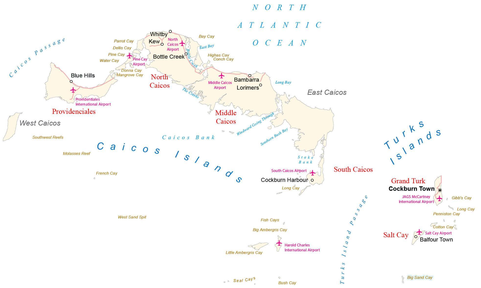
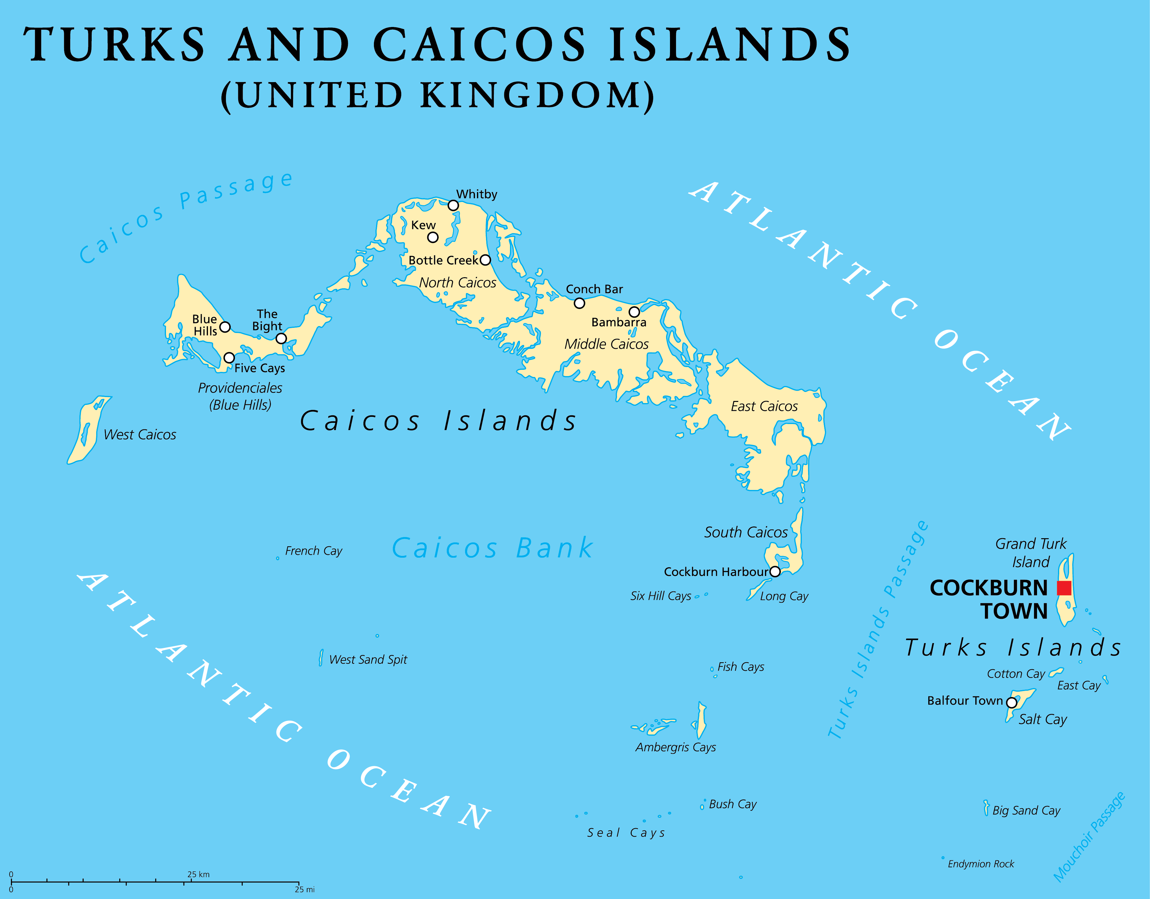
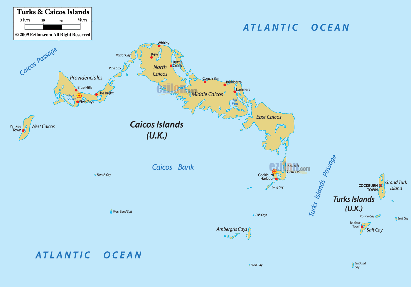
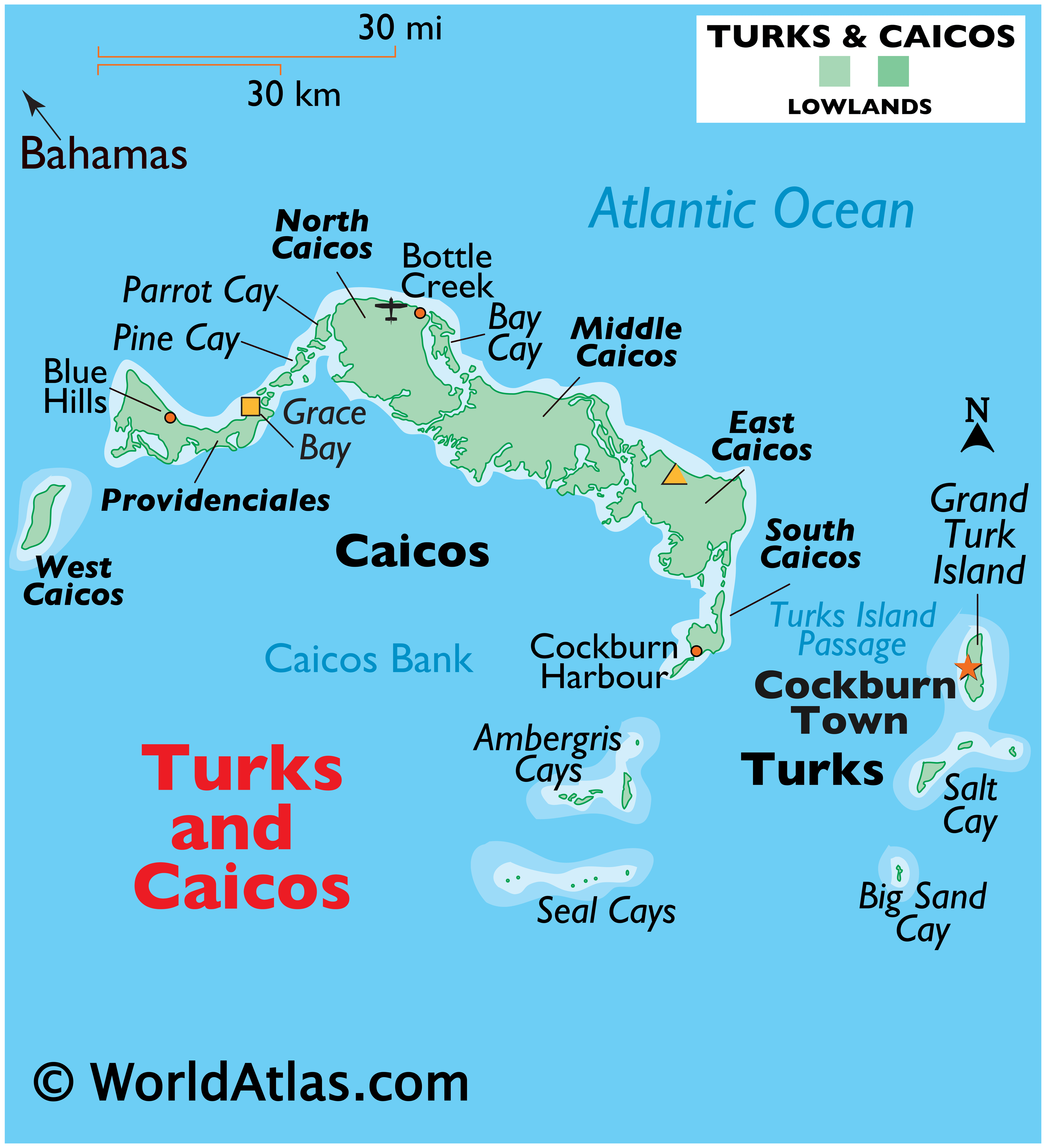
The Turks and Caicos Islands are a British Overseas Territory and comprises of two groups of tropical islands in the Lucayan archipelago, to the north of the Caribbean Sea. Covering a total land area of 616.3 sq. km (238.0 sq mi), the territory comprises of the smaller Turks Islands and the larger Caicos Islands as observed on the physical map of the territory above.
The islands (for most part) consist of low, flat limestone formed by coral reefs and include 8 main islands and over 22 smaller islands. The islands have extensive marshes and mangrove swamps, and all of them are ringed by sandy beaches. Middle Caicos and North Caicos are covered in some areas by green woodlands and a network of caves. The highest point in the Turks and Caicos islands are the Blue Hills on the north west Caicos (Providenciales) with an elevation of 49m (161 ft) and Flamingo Hills on East Caicos with an elevation of 156ft.
As observed on the map, Turks Islands are separated from Caicos Islands by a deep marine trench, measuring 2,200m (7,200ft) known as The Turks Island Passage.
| Flag: |  |
|---|---|
| Legal Name: | Turks and Caicos Islands |
| Capital Value: | Grand Turk (Cockburn Town) |
| Official languages: | English |
| Demonym(s): | Turks and Caicos Islander |
| Government: | Dependency under constitutional monarchy |
| Legislature: | House of Assembly |
| Total Area: | 948 km² |
| Land Area: | 948 km² |
| Population: | 38,191 |
| Density: | 121.7/sq mi (47.0/km) |
| GDP: | $1.02 Billion |
| GDP Per Capita: | $27,142.23 |
| Currency Value: | US Dollar (USD) |
| Driving side: | left |
| Calling code: | +1-649 |
| Internet TLD: | .tc |
Discover the beauty of the Turks and Caicos Islands with this detailed map. It showcases the satellite imagery, settlements, roads, points, bays, and islands of both the Caicos Islands and Turks Islands. Explore the stunning landscape and uncover the hidden gems of this majestic archipelago.
Online Interactive Political Map
Click on ![]() to view map in "full screen" mode.
to view map in "full screen" mode.
Turks and Caicos has five administrative divisions called districts including four in the Caicos Islands and one in the Turks islands. The island of Grand Turk in the Turks Islands is also a separate division. The four divisions in the Caicos Islands are Providenciales, North Caicos, Middle Caicos, and South Caicos. The district in the Turks Islands is named Salt Cay.
Located in the Grand Turk Island, Cockburn Town is the capital of Turks and Caicos. Providenciales, an island in the Caicos archipelago, is the most populated island.
Location Maps
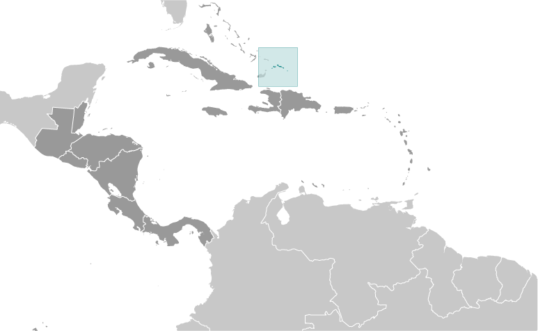
Where is Turks and Caicos?
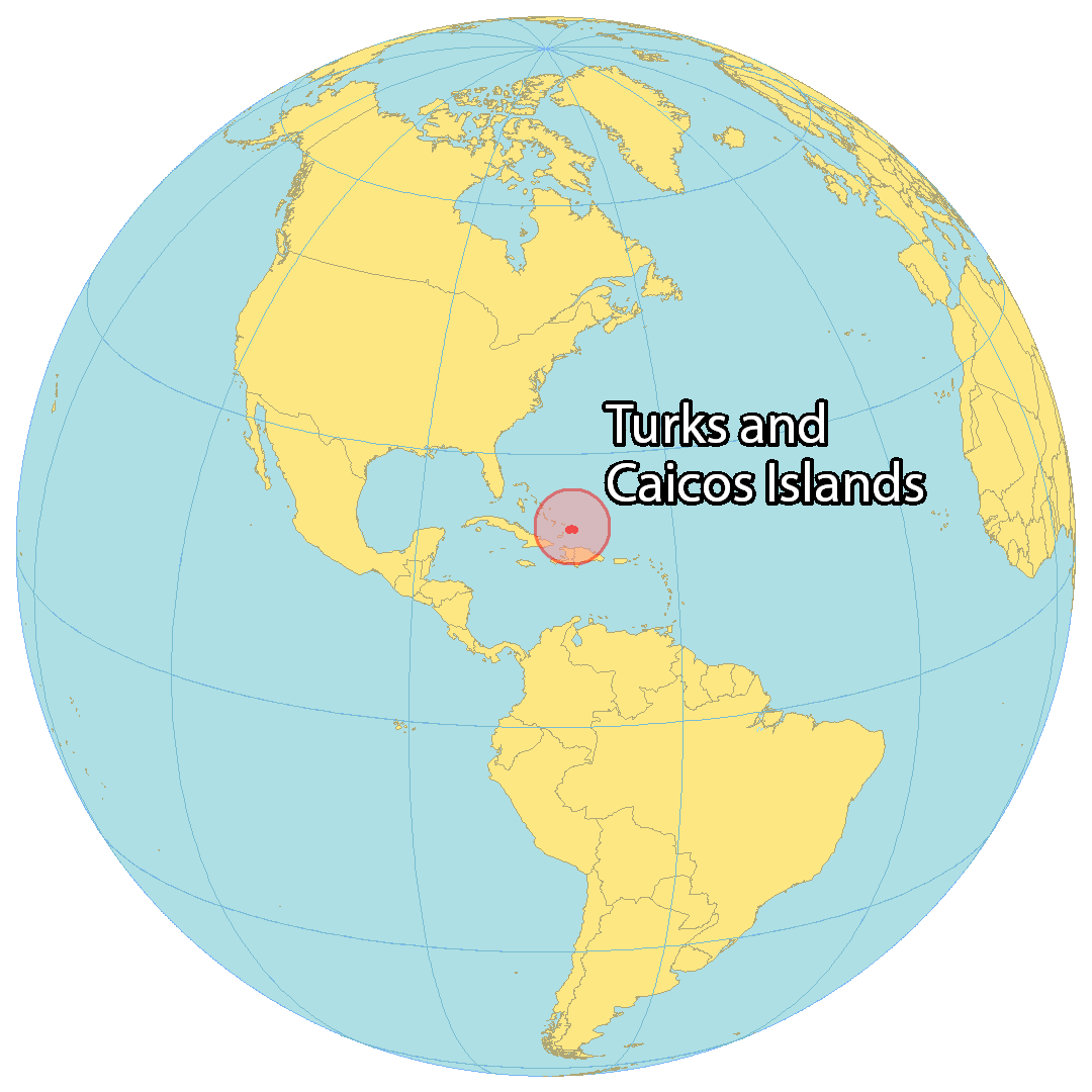
Turks and Caicos is an idyllic British Overseas Territory in the Caribbean. It’s made up of two main island groups, the Turks Islands and the Caicos Islands, with 8 main islands and over 22 smaller islands. The capital city of Cockburn Town is located on Grand Turk Island, while the largest population is on Providenciales, known for its beautiful beaches. Not only is Turks and Caicos a popular tourist destination, but it’s also a hub for offshore financial centers. It’s located southeast of the Bahamas, northeast of Cuba, north of Haiti and the Dominican Republic. Both main island groups are separated by the Turks Island Passage and surrounded by the Atlantic Ocean. Part of the Lucayan Archipelago and the northern West Indies, Turks and Caicos is a stunning Caribbean paradise.
High Definition Political Map of Turks and Caicos
Physical Map of Turks and Caicos
Geography
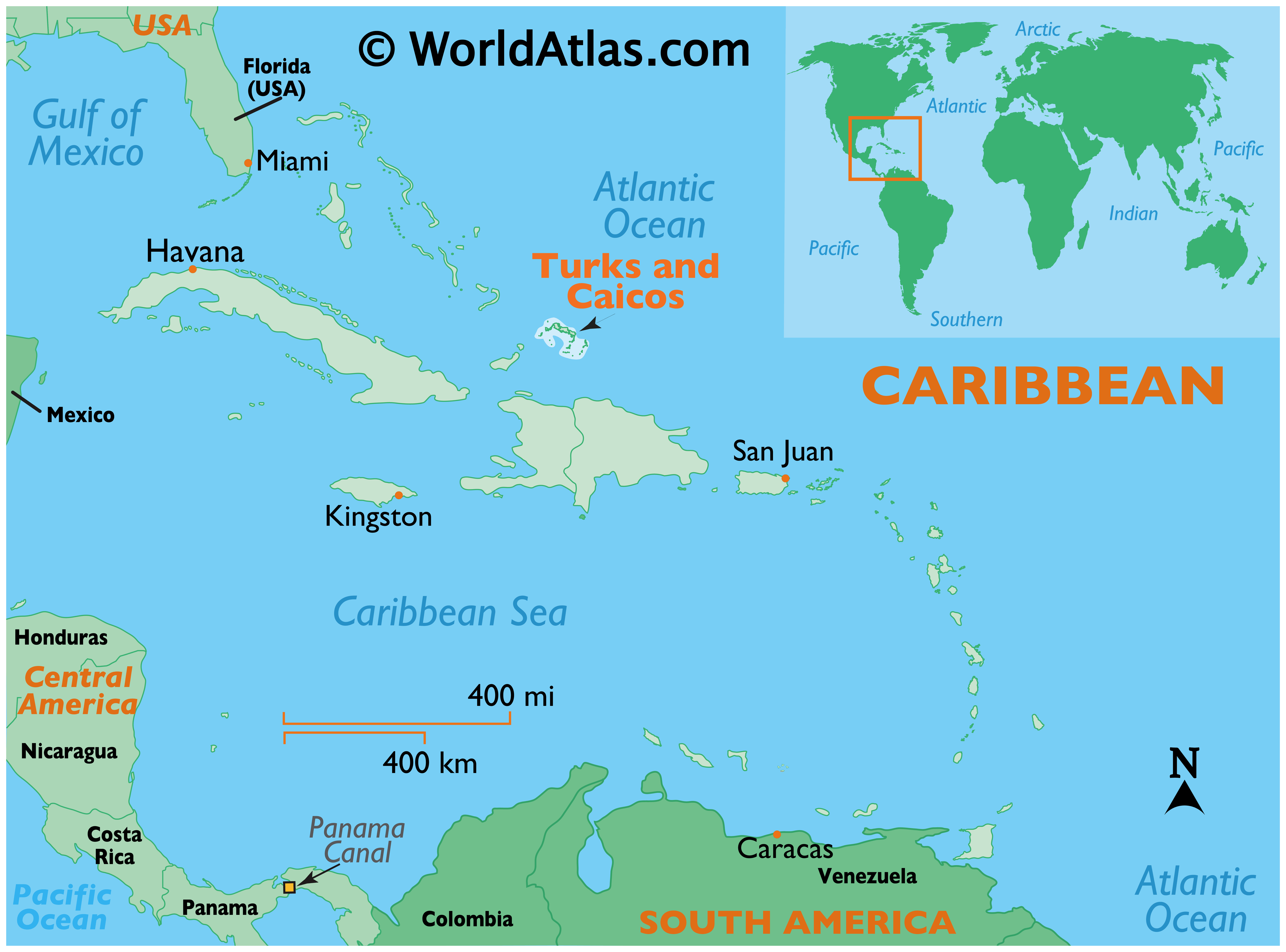
The two island groups are in the North Atlantic Ocean about 160 kilometres (99 mi) north of Hispaniola and about 1,000 kilometres (620 mi) from Miami in the United States, at 21°46′48″N 71°48′00″W / 21.78000°N 71.80000°W / 21.78000; -71.80000Coordinates: 21°46′48″N 71°48′00″W / 21.78000°N 71.80000°W / 21.78000; -71.80000. The territory is geographically contiguous to the Bahamas, both comprising the Lucayan Archipelago, but is politically a separate entity. The Caicos Islands are separated by the Caicos Passage from the closest Bahamian islands, Mayaguana and Great Inagua. The nearest foreign landmass from the Turks and Caicos Islands is the Bahamian island of Little Inagua, about 30 miles (48 km) from West Caicos.
The eight main islands and more than 22 smaller islands have a total land area of 616.3 square kilometres (238.0 square miles), consisting primarily of low, flat limestone with extensive marshes and mangrove swamps and 332 square kilometres (128 sq mi) of beach front. The tallest peaks in the islands are Blue Hills on Providenciales and Flamingo Hill on East Caicos, both at a modest 48 m. The weather is usually sunny (it is generally regarded that the islands receive 350 days of sun each year) and relatively dry, but suffers frequent hurricanes. The islands have limited natural fresh water resources; private cisterns collect rainwater for drinking. The primary natural resources are spiny lobster, conch, and other shellfish. Turks and Caicos contains three terrestrial ecoregions: Bahamian dry forests, Bahamian pineyards, and Bahamian-Antillean mangroves.
The two distinct island groups are separated by the Turks Island Passage.
Turks Islands
The Turks Islands are separated from the Caicos Islands by Turks Island Passage, which is more than 2,200 m (7,200 ft) deep. The islands form a chain that stretches north–south. The 2012 census population was 4,939 on the two main islands, the only inhabited islands of the group:
- Grand Turk (with the capital of the territory, area 17.39 km (6.71 sq mi), population 4,831)
- Salt Cay (area 6.74 km (2.60 sq mi), population 108)
Together with nearby islands, all on Turks Bank, those two main islands form the two administrative districts of the territory (out of six in total) that fall within the Turks Islands. Turks Bank, which is smaller than Caicos Bank, has a total area of about 324 km (125 sq mi).
The main uninhabited islands are:
- Big Sand Cay
- Cotton Cay
- East Cay
- Endymion Rock
- Gibbs Cay
- Pear Cay
Mouchoir Bank
25 kilometres (16 mi) east of the Turks Islands and separated from them by Mouchoir Passage is the Mouchoir Bank. Although it has no emergent cays or islets, some parts are very shallow and the water breaks on them. Mouchoir Bank is part of the Turks and Caicos Islands and falls within its Exclusive Economic Zone. It measures 958 square kilometres (370 sq mi) in area. Two banks further east, Silver Bank and Navidad Bank, are geographically a continuation, but belong politically to the Dominican Republic.
Caicos Islands
The largest island in the Caicos archipelago is the sparsely-inhabited Middle Caicos, which measures 144 square kilometres (56 sq mi) in area, but has a population of only 168 at the 2012 Census. The most populated island is Providenciales, with 23,769 inhabitants in 2012, and an area of 122 square kilometres (47 sq mi). North Caicos (116 square kilometres (45 sq mi) in area) had 1,312 inhabitants. South Caicos (21 square kilometres (8.1 sq mi) in area) had 1,139 inhabitants, and Parrot Cay (6 square kilometres (2.3 sq mi) in area) had 131 inhabitants. East Caicos (which is administered as part of South Caicos District) is uninhabited, while the only permanent inhabitants of West Caicos (administered as part of Providenciales District) are resort staff.
The Caicos Islands comprise the following main islands:
- Ambergris Cays
- Big Ambergris Cay
- Little Ambergris Cay
- Bay Cay
- Bush Cay
- Dellis Cay
- Donna Cay
- Dove Cay
- East Bay Cay
- East Caicos
- Fish Cays
- Five Cays
- Five Little Cays
- Fort George Cay
- French Cay
- Little Water Cay
- Long Cay
- Mangrove Cay
- Middle Caicos
- Middleton Cay
- North Caicos
- Parrot Cay
- Pine Cay
- Plandon Cay
- Providenciales
- Seal Cays
- Six Hill Cays
- South Caicos
- Stubbs Cay
- Water Cay
- West Caicos
- West Sand Spit
Climate
The Turks and Caicos Islands feature a tropical savannah climate (AW), with relatively consistent temperatures throughout the course of the year. Summertime temperatures rarely exceed 33 °C (91 °F) and winter nighttime temperatures rarely fall below 18 °C (64 °F).
Biodiversity
The Turks and Caicos Islands are a biodiversity hotspot. The islands have many endemic species and others of international importance, due to the conditions created by the oldest established salt-pan development in the Caribbean. The variety of species includes a number of endemic species of lizards, snakes, insects and plants, and marine organisms; in addition to being an important breeding area for seabirds.
The UK and Turks and Caicos Islands Governments have joint responsibility for the conservation and preservation to meet obligations under international environmental conventions.
Due to this significance, the islands are on the United Kingdom’s tentative list for future UNESCO World Heritage Sites.
Turks and Caicos Satellite Map