Vernon Hills is a suburb north of Chicago, Illinois in Lake County, Illinois, United States. The population was 26,850 at the 2020 census. Vernon Hills serves as a retail hub for its surrounding area (Libertyville, Lake Forest, Mundelein, Long Grove, Lincolnshire and Buffalo Grove).
| Name: | Vernon Hills village |
|---|---|
| LSAD Code: | 47 |
| LSAD Description: | village (suffix) |
| State: | Illinois |
| County: | Lake County |
| Total Area: | 7.94 sq mi (20.58 km²) |
| Land Area: | 7.74 sq mi (20.05 km²) |
| Water Area: | 0.20 sq mi (0.53 km²) |
| Total Population: | 26,850 |
| Population Density: | 3,468.54/sq mi (1,339.22/km²) |
| Area code: | 847 & 224 |
| FIPS code: | 1777694 |
| Website: | www.vernonhills.org |
Online Interactive Map
Click on ![]() to view map in "full screen" mode.
to view map in "full screen" mode.
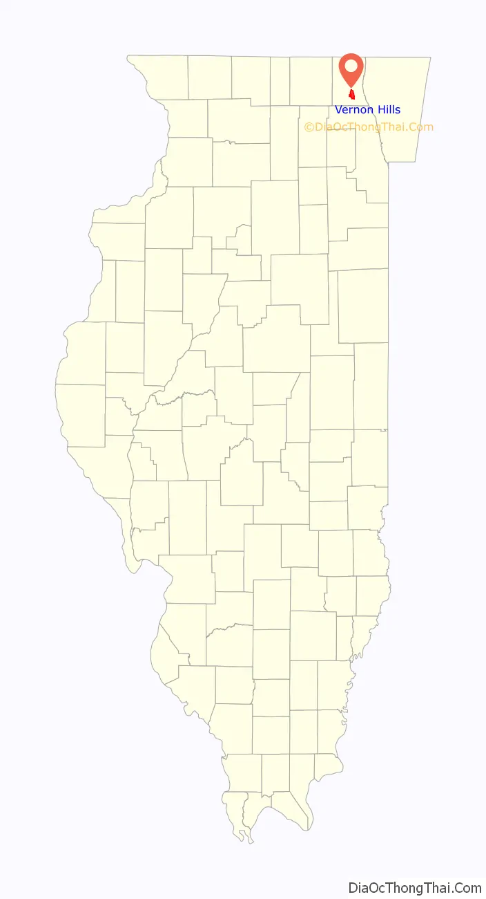
Vernon Hills location map. Where is Vernon Hills village?

History
The land that was to become Vernon Hills, founded by Richard Theodore Freese, Ron Freese, and Jim Carswell, began with the establishment of a 200-acre (0.81 km) farm in 1857. Use of the land remained relatively static until the 1960s, when part of it was purchased for a residential community and golf course; the development was the first use of the name “Vernon Hills.” On June 16, 1958, the village officially incorporated with 123 residents and 125 houses in a single subdivision built by Quinn Hogan and Barney Loeb. During these times, the village and police department were run from a local motel until 1971 when village trustees bought two portable buildings. It saw steady but slow growth until the annexing of a plot of land near the corner of IL-60 and IL-21 in 1971, which led to the building of 1,200,000-square-foot (110,000 m) Hawthorn Center. By 1980, the village’s population had grown to almost 10,000 residents, and by 2000, it had surpassed 20,000.
Through the 1980s and 1990s, the village grew geographically through the annexation of surrounding areas. This included land that would become the Corporate Woods business park and Centennial Crossing residential development (1986), a 1,200-acre (4.9 km) section of Hawthorne-Mellody Farms (1988), and part of the village of Half Day (1994).
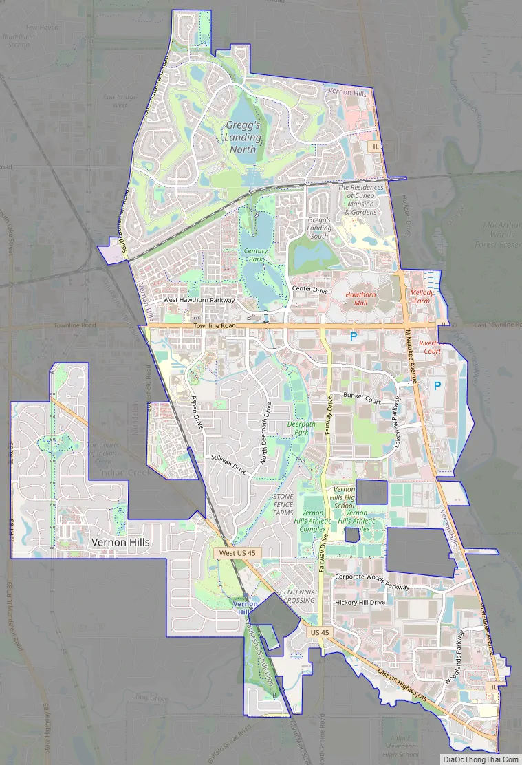
Vernon Hills Road Map
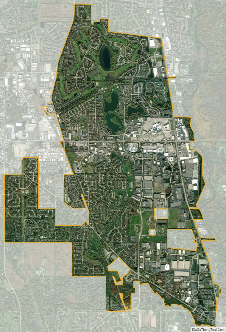
Vernon Hills city Satellite Map
Geography
According to the 2010 census, Vernon Hills has a total area of 7.917 square miles (20.50 km), of which 7.71 square miles (19.97 km) (or 97.39%) is land and 0.207 square miles (0.54 km) (or 2.61%) is water.
Climate
See also
Map of Illinois State and its subdivision:- Adams
- Alexander
- Bond
- Boone
- Brown
- Bureau
- Calhoun
- Carroll
- Cass
- Champaign
- Christian
- Clark
- Clay
- Clinton
- Coles
- Cook
- Crawford
- Cumberland
- De Kalb
- De Witt
- Douglas
- Dupage
- Edgar
- Edwards
- Effingham
- Fayette
- Ford
- Franklin
- Fulton
- Gallatin
- Greene
- Grundy
- Hamilton
- Hancock
- Hardin
- Henderson
- Henry
- Iroquois
- Jackson
- Jasper
- Jefferson
- Jersey
- Jo Daviess
- Johnson
- Kane
- Kankakee
- Kendall
- Knox
- La Salle
- Lake
- Lake Michigan
- Lawrence
- Lee
- Livingston
- Logan
- Macon
- Macoupin
- Madison
- Marion
- Marshall
- Mason
- Massac
- McDonough
- McHenry
- McLean
- Menard
- Mercer
- Monroe
- Montgomery
- Morgan
- Moultrie
- Ogle
- Peoria
- Perry
- Piatt
- Pike
- Pope
- Pulaski
- Putnam
- Randolph
- Richland
- Rock Island
- Saint Clair
- Saline
- Sangamon
- Schuyler
- Scott
- Shelby
- Stark
- Stephenson
- Tazewell
- Union
- Vermilion
- Wabash
- Warren
- Washington
- Wayne
- White
- Whiteside
- Will
- Williamson
- Winnebago
- Woodford
- Alabama
- Alaska
- Arizona
- Arkansas
- California
- Colorado
- Connecticut
- Delaware
- District of Columbia
- Florida
- Georgia
- Hawaii
- Idaho
- Illinois
- Indiana
- Iowa
- Kansas
- Kentucky
- Louisiana
- Maine
- Maryland
- Massachusetts
- Michigan
- Minnesota
- Mississippi
- Missouri
- Montana
- Nebraska
- Nevada
- New Hampshire
- New Jersey
- New Mexico
- New York
- North Carolina
- North Dakota
- Ohio
- Oklahoma
- Oregon
- Pennsylvania
- Rhode Island
- South Carolina
- South Dakota
- Tennessee
- Texas
- Utah
- Vermont
- Virginia
- Washington
- West Virginia
- Wisconsin
- Wyoming


