Buffalo Grove, officially the Village of Buffalo Grove, is a village in Lake and Cook County, Illinois. A suburb of Chicago, it lies about 30 miles (50 km) northwest of Downtown Chicago. As of the 2020 Census, Buffalo Grove has a population of 43,212. It totals 9.6 square miles (25 km) of land, with the top three-quarters in Lake County and the bottom quarter in Cook County. Roads in the village such as Lake Cook Road and Illinois Route 83 converge on I-294, which take drivers to O’Hare International Airport 20 miles (32 km) south of Buffalo Grove. A part of the Chicago Metropolitan Area, Buffalo Grove is consistently ranked as one of the best places to live in Illinois and Midwest, as well as one with the highest school district rankings in the country.
Before westward expansion, Native American Potawatomi tribes inhabited the present area. The name “Buffalo Grove” comes from the English translation of the Potawatomi name for Buffalo Creek, which flows through some of the village. Initial Homesteaders sold their land to agricultural Catholic German immigrants, who established St. Mary’s Church and a school. The rural area changed minimally until post-Korean War developers bought and suburbanized the region for veterans. After being incorporated in 1958, Buffalo Grove experienced a population boom for the next three decades and hosted a 50th Anniversary Celebration in 2008.
Nearly all schools in Buffalo Grove have achieved commendable status or received awards from the state in the 21st century. The village features dozens of recreational facilities, parks, and festivals, including a months-long Farmers’ market, two golf courses, and popular Buffalo Grove Days. Although its schools and low crime are attractive to moving families, the village’s population has plateaued since 2000. Buffalo Grove has an elected council-manager government with home rule status. Because of Buffalo Grove’s location in two counties, different state and national districts represent each portion. The local government’s public works department is nationally accredited. Economically, residents work in health care, education, and professional services, while businesses in the village employ 20,000 daytime workers in 10 million square feet of commercial and industrial space.
| Name: | Buffalo Grove village |
|---|---|
| LSAD Code: | 47 |
| LSAD Description: | village (suffix) |
| State: | Illinois |
| County: | Cook County, Lake County |
| Incorporated: | 1958 |
| Elevation: | 682 ft (208 m) |
| Total Area: | 9.58 sq mi (24.81 km²) |
| Land Area: | 9.56 sq mi (24.77 km²) |
| Water Area: | 0.02 sq mi (0.04 km²) |
| Total Population: | 43,212 |
| Population Density: | 4,518.67/sq mi (1,744.63/km²) |
| Area code: | 847 and 224 |
| FIPS code: | 1709447 |
| Website: | www.vbg.org |
Online Interactive Map
Click on ![]() to view map in "full screen" mode.
to view map in "full screen" mode.
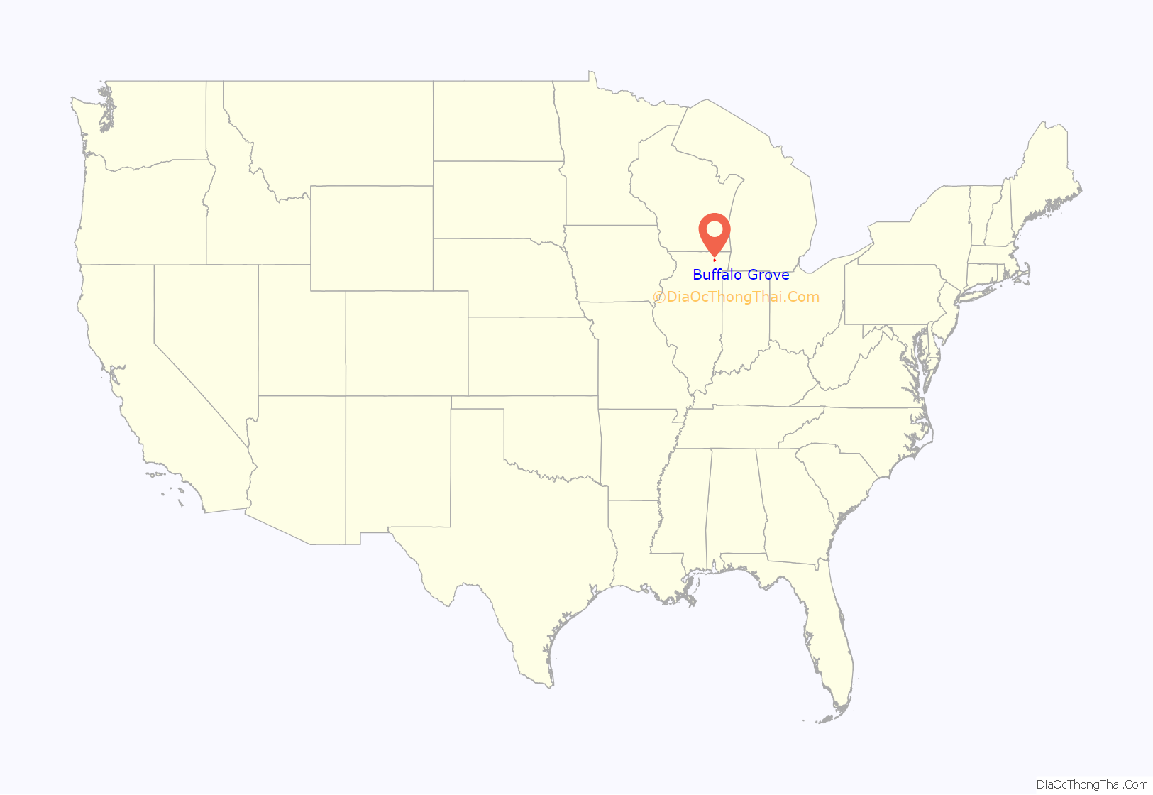
Buffalo Grove location map. Where is Buffalo Grove village?

History
Prior to incorporation
The first inhabitants of the region were the Illinois Confederation; they comprised multiple tribes and mainly lived in central Illinois. Throughout the 1700s, the Iroquois, Potawatomi, and others invaded and eventually destroyed the confederation. The Potawatomi’s success led them to inhabit areas near the present Buffalo Grove until 1833. Being the dominant group, the Potawatomi would frequently be involved in the conflicts between Europeans, such as the Beaver Wars. The first Europeans to stay the winter in what would become Chicago were the French Jesuit explorers Father Jacques Marquette and Louis Jolliet in 1673; they established trade relations with the Ojibwe. They were traveling west to find the mouth of the Mississippi River to map its entirety and to spread Christianity.
Consistent with Native American history in the United States, the tribes in Illinois were devastated by decades of war, diseases, and the ever-encroaching American settlers. The settlers caused a dwindling of food and game; in 1829, a group of Illinois River Potawatomi signed a land cession treaty that included what would become Lake County in exchange for annual delivery of $12,000 in cash and 50 barrels of salt, $12,000 in gifts, and an exclusive blacksmith shop for them. The Native Americans’ efforts to remain on their land failed because of the pressure of westward migration, aided by the recent opening of the Erie Canal. They signed the 1833 Treaty of Chicago, which ceded all their lands in Illinois and Wisconsin and opened the area to white settlement. Some Native Americans who left the area would move onto reservations in western Missouri and Kansas, while others went north into Canada or resettled in northern Michigan and Wisconsin.
The first white settler in Vernon Township was Daniel Wright, who arrived in 1833 and established a cabin and crops with the help of remaining natives. The first settlers in Buffalo Grove were homesteaders from New England who received land grants from the government. They stayed for five years and sold their land to Catholic German immigrants fleeing poor living conditions. The primarily agricultural immigrants subsequently established the St. Mary’s Roman Catholic Church and St. Mary’s School in the 1850s; they still stand today. Buffalo Grove expanded throughout the 19th century with the additions of the first school (St. Mary’s School), the Firnbach Tavern, and the Weidner General Store. The General Store served many purposes in the town, such as the post office, train ticket office, polling place, and first town telephone. Before World War II, Buffalo Grove was entirely rural, consisting of less than 150 people, mostly dairy farmers.
Incorporation and post-incorporation
All farmers eventually sold their land to developers like Al Frank, president of Buffalo Grove Home Builders Inc., who started developing his 100-acre purchase in the 1950s for World War II and Korean War veterans. The demand for single-family homes near Chicago led to a wave of “suburban settlers” in Buffalo Grove; they lived in Frank’s 1,000 square foot homes. Frank was instrumental in Buffalo Grove’s incorporation in 1958 because he successfully recruited many people; incidentally, most of them were related to him or working for him. He had wanted to incorporate Buffalo Grove to remove his development from Cook County city planners. The incorporated population was 164 people. The incorporation led to a population increase in Buffalo Grove, and as more developers came, the village annexed more land. Organization quickly commenced as the government created a plan commission and parks and recreation commission. Meanwhile, the government hired a professional planner to create a land-use plan, which prevented problems associated with rapid growth. Alcott School opened in 1960. In 1962, the village held its first Buffalo Days festival, and the new Buffalo Grove flag—depicting a majestic, fighting buffalo, green leaves, and gold bands—was chosen.
In the 1970s, Buffalo Grove experienced an 80 percent population growth, the third-highest rate in the northwest suburbs during the decade. The increasing population caused the village to continue to annex subdivisions such as the Highlands, Green Knolls, and Windfield and establish home rule status, thereby allowing the government greater ability to solve local problems. In addition to residential subdivisions, the Buffalo Grove Commerce Center was developed in 1981 with 50 acres of industrial park at Lake Cook Road and the Soo Line Railroad tracks. In the mid-1980s, the Corporate Grove industrial park was built to the east, and Buffalo Grove Business Park was constructed to the west. The Arbor Creek Business Center at Aptakisic Road and Barclay Boulevard, and Covington Corporate Center on Busch Road were also developed. Important buildings and organizations were completed in the 1970s, including Buffalo Grove High School, Adlai E. Stevenson High School, the park district, Indian Trails Public Library, and Vernon Area Public Library. In 1992, village representatives successfully pushed for a United States Postal Service in Buffalo Grove, the first main postal facility built in the United States in 20 years. The lack of a postal facility had many problems for residents, such as long lines, congestion, and parking hassles at the Wheeling facility. In 2006, the village became one of the first official smoke-free communities by banning smoking in public places and work environments.
Buffalo Grove Road Map
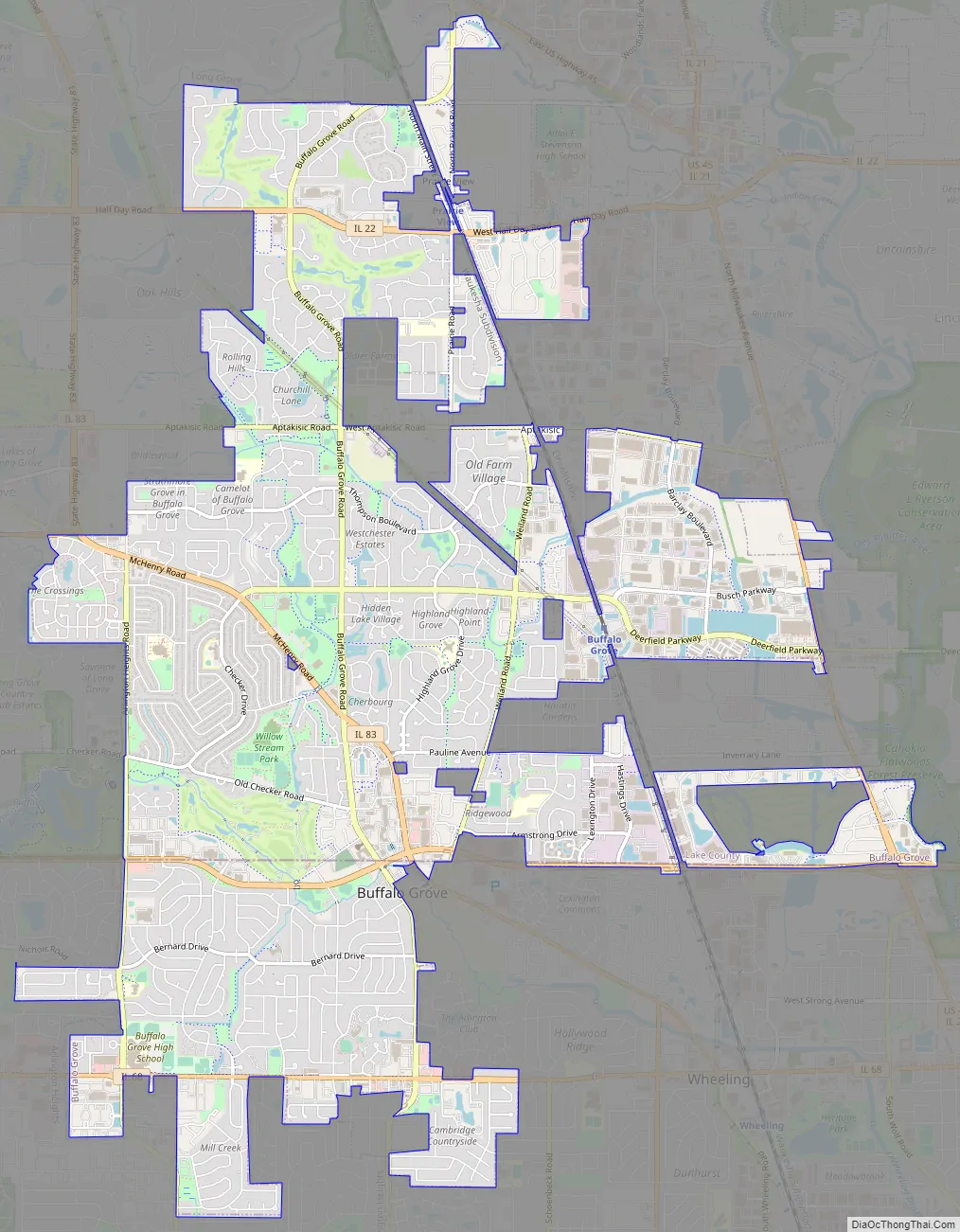
Buffalo Grove city Satellite Map

Geography
Buffalo Grove is a suburb of the city of Chicago, located in the extreme northeastern region of Illinois. Lake Cook Road splits Buffalo Grove into two parts: the Lake County Vernon Township portion and the Cook County Wheeling Township portion. Around three-quarters of the village is in Vernon Township. Both parts differ in their demographics and similarities with neighboring communities. Buffalo Grove shares a border with Wheeling to its southeast, Arlington Heights to its southwest and south, Riverwoods and Deerfield directly east, Lincolnshire to its northeast, Vernon Hills directly north, and Long Grove to its west and northwest. Unincorporated Prairie View is in two parts of the village. One large portion in the north includes Didier Farms, while the much smaller portion is on the Horatio Gardens subdivision just northeast of the intersection of Weiland Road and Pauline Avenue. Illinois Route 83 leads north towards central Lake County and south towards O’Hare International Airport. East–west streets can take residents east to Lake Michigan and other North Shore suburbs such as Lake Forest, Highland Park, and Glencoe.
According to the 2020 US gazetteer files, the village has a total area of 9.58 square miles (24.8 km; 2,480 ha), of which 9.563 square miles (24.77 km; 2,477 ha) is land, and 0.017 square miles (0.044 km; 4.4 ha) (or 0.31%) is water. Willow Stream Park is the largest park in Buffalo Grove at 54 acres. It includes picnic areas, handicap-accessible preschool and elementary play areas, sports fields, and bike paths. Buffalo Creek is a forest preserve located adjacent to Buffalo Grove. Before European settlement, the area featured a tallgrass prairie dotted with small wetlands and even now is a nesting spot for grassland birds, including bobolinks and eastern meadowlarks. Improvements in the 2010s include 1.7 miles of trails, seven boardwalks, two scenic overlooks, and a reservoir expansion. Buffalo Creek also functions as flood control and is built to look like a naturally occurring wetland. Buffalo Grove is in the Des Plaines River watershed.
Climate
Due to its proximity to the city, Buffalo Grove’s climate shares many of the same traits as Chicago. Buffalo Grove lies in a humid continental climate zone (Köppen: Dfa) and experiences four distinct seasons. Buffalo Grove receives an average of 28.93 inches (735 mm) of precipitation each year. According to MyForecast, Buffalo Grove’s record high is 104 °F (40 °C), and the record low is -24 °F (-31.1 °C). Summers are hot and humid, with frequent heat waves. July is the hottest month, and the daily average temperature is 84 °F (28.9 °C), while the daily low temperatures are around 65 °F (18.3 °C). On average, summer temperatures reach at least 90 °F (32 °C) on as many as 16 days. Winters are relatively cold and snowy, with blizzards sometimes occurring, as in 2011. There are many sunny but cold days in winter. The average winter high from December through March is about 34 °F (1.1 °C), with January and February being the coldest months; a polar vortex occurred in January 2019. Spring and autumn are mild, short seasons. Dew point temperatures in the summer range from an average of 56 °F (13.3 °C) in June to 62 °F (16.7 °C) in July. Like all Chicago suburbs, Buffalo Grove lies within USDA plant hardiness zone 5b.
See also
Map of Illinois State and its subdivision:- Adams
- Alexander
- Bond
- Boone
- Brown
- Bureau
- Calhoun
- Carroll
- Cass
- Champaign
- Christian
- Clark
- Clay
- Clinton
- Coles
- Cook
- Crawford
- Cumberland
- De Kalb
- De Witt
- Douglas
- Dupage
- Edgar
- Edwards
- Effingham
- Fayette
- Ford
- Franklin
- Fulton
- Gallatin
- Greene
- Grundy
- Hamilton
- Hancock
- Hardin
- Henderson
- Henry
- Iroquois
- Jackson
- Jasper
- Jefferson
- Jersey
- Jo Daviess
- Johnson
- Kane
- Kankakee
- Kendall
- Knox
- La Salle
- Lake
- Lake Michigan
- Lawrence
- Lee
- Livingston
- Logan
- Macon
- Macoupin
- Madison
- Marion
- Marshall
- Mason
- Massac
- McDonough
- McHenry
- McLean
- Menard
- Mercer
- Monroe
- Montgomery
- Morgan
- Moultrie
- Ogle
- Peoria
- Perry
- Piatt
- Pike
- Pope
- Pulaski
- Putnam
- Randolph
- Richland
- Rock Island
- Saint Clair
- Saline
- Sangamon
- Schuyler
- Scott
- Shelby
- Stark
- Stephenson
- Tazewell
- Union
- Vermilion
- Wabash
- Warren
- Washington
- Wayne
- White
- Whiteside
- Will
- Williamson
- Winnebago
- Woodford
- Alabama
- Alaska
- Arizona
- Arkansas
- California
- Colorado
- Connecticut
- Delaware
- District of Columbia
- Florida
- Georgia
- Hawaii
- Idaho
- Illinois
- Indiana
- Iowa
- Kansas
- Kentucky
- Louisiana
- Maine
- Maryland
- Massachusetts
- Michigan
- Minnesota
- Mississippi
- Missouri
- Montana
- Nebraska
- Nevada
- New Hampshire
- New Jersey
- New Mexico
- New York
- North Carolina
- North Dakota
- Ohio
- Oklahoma
- Oregon
- Pennsylvania
- Rhode Island
- South Carolina
- South Dakota
- Tennessee
- Texas
- Utah
- Vermont
- Virginia
- Washington
- West Virginia
- Wisconsin
- Wyoming


