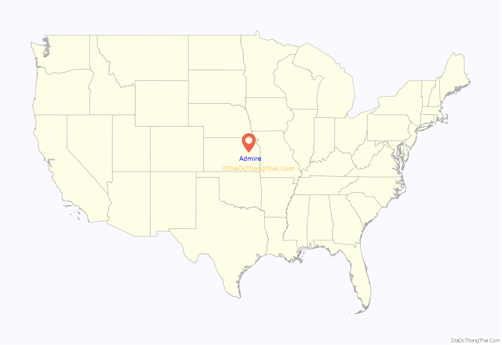
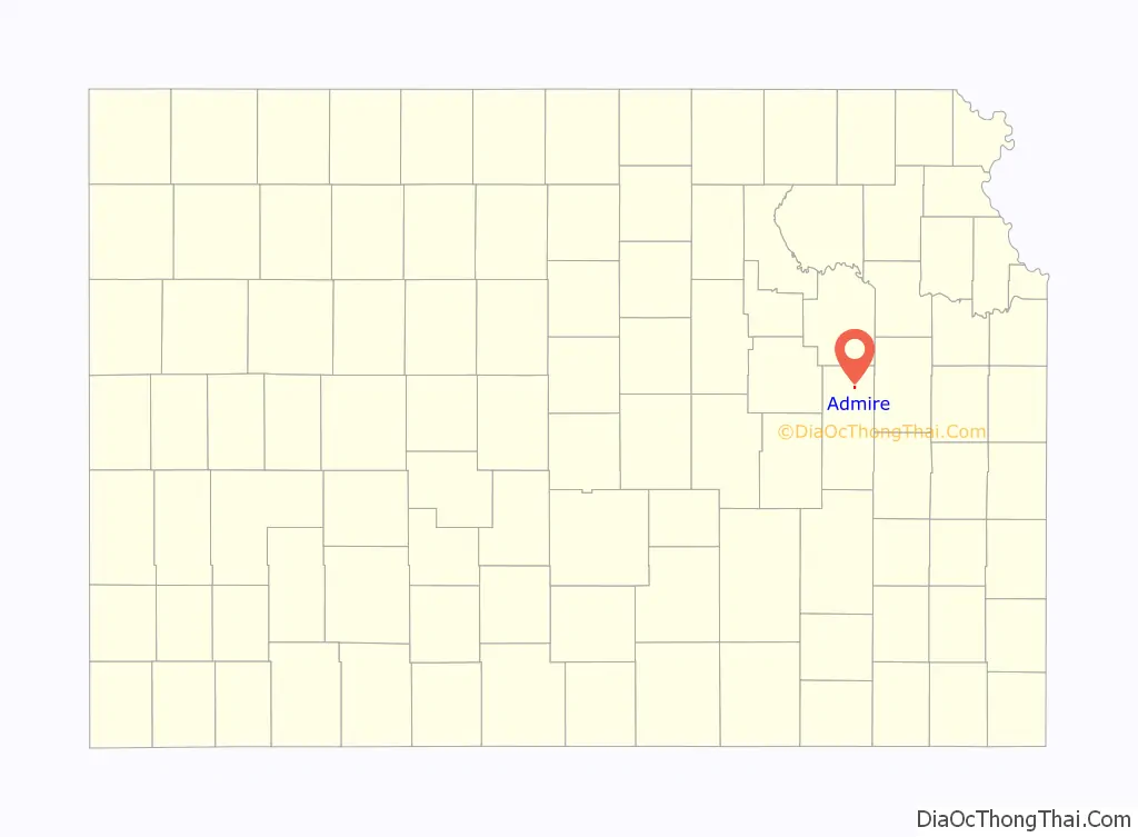
Admire is a city in Lyon County, Kansas, United States. As of the 2020 census, the population of the city was 130.
| Name: | Admire city |
|---|---|
| LSAD Code: | 25 |
| LSAD Description: | city (suffix) |
| State: | Kansas |
| County: | Lyon County |
| Founded: | 1886 |
| Incorporated: | 1916 |
| Elevation: | 1,237 ft (377 m) |
| Total Area: | 0.32 sq mi (0.84 km²) |
| Land Area: | 0.32 sq mi (0.84 km²) |
| Water Area: | 0.00 sq mi (0.00 km²) |
| Total Population: | 130 |
| Population Density: | 410/sq mi (150/km²) |
| ZIP code: | 66830 |
| Area code: | 620 |
| FIPS code: | 2000325 |
| Website: | admireks.com |
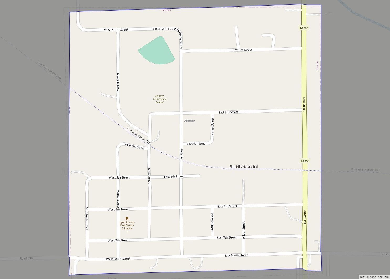
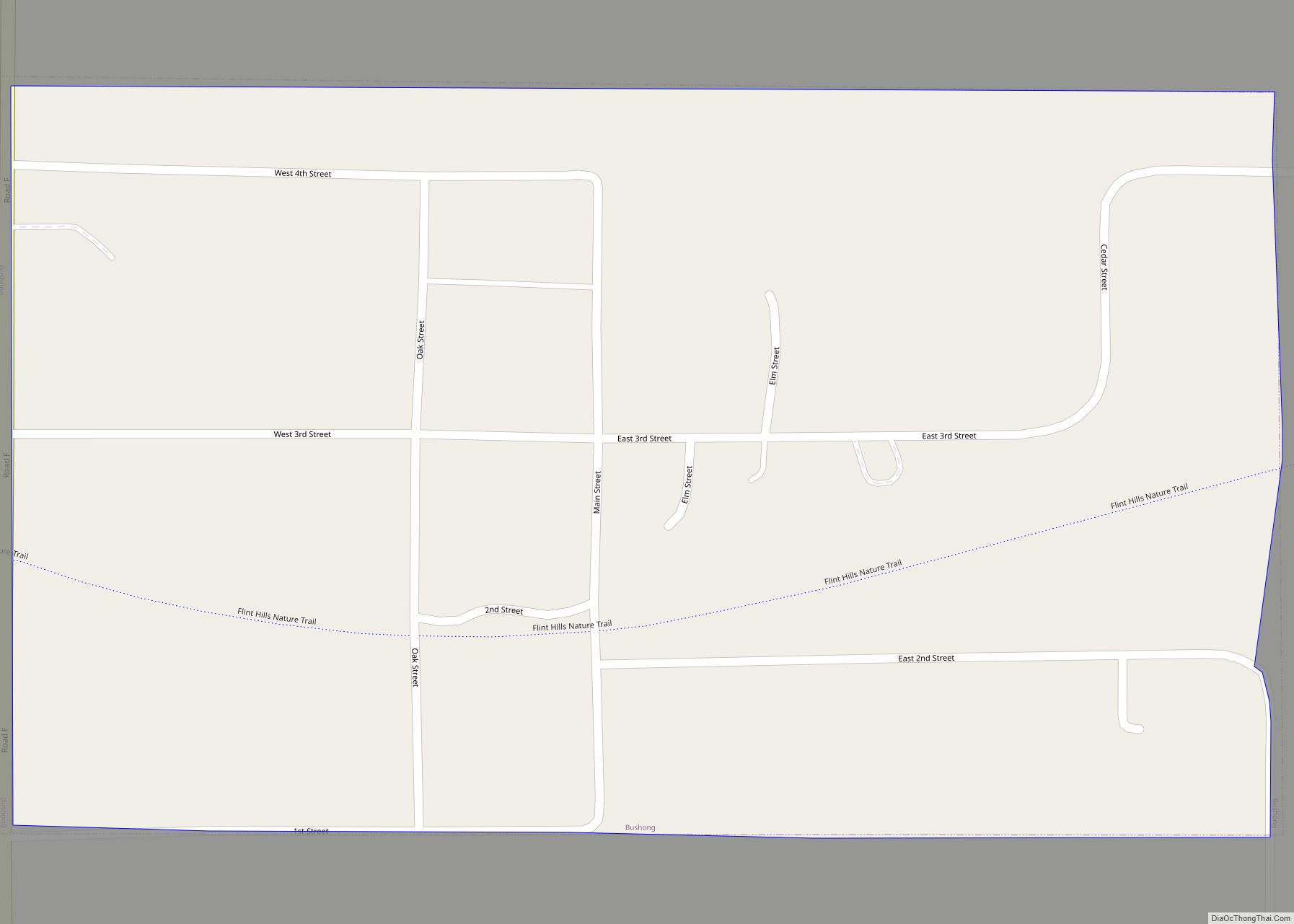
Online Interactive Map
Click on ![]() to view map in "full screen" mode.
to view map in "full screen" mode.
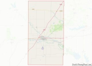
Admire location map. Where is Admire city?
History
Admire was founded in 1886. It was named for one of its founders, Jacob Admire.
The first post office in Admire was established in November 1886.
Admire was a station and shipping point on the Missouri Pacific Railroad. By the mid 1990s, rail service in Admire had been discontinued, and the tracks are now being used as a rail trail.
Admire’s current acting mayor is Robert Reust. The former mayor, prior to January 2022, was Michael Spade, a local farmer.
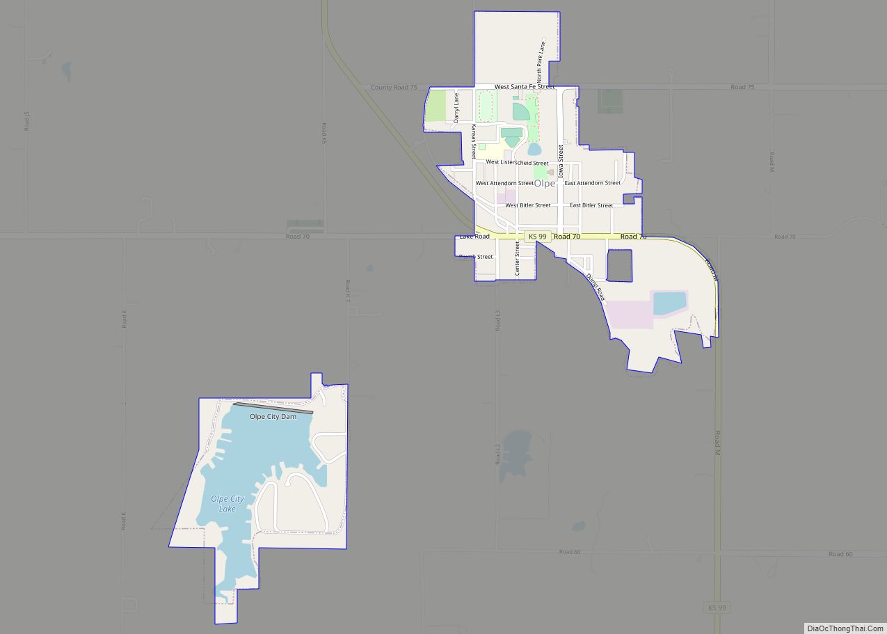
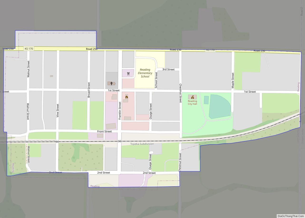
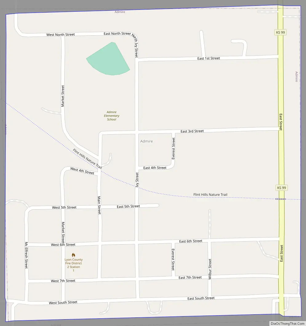
Admire Road Map
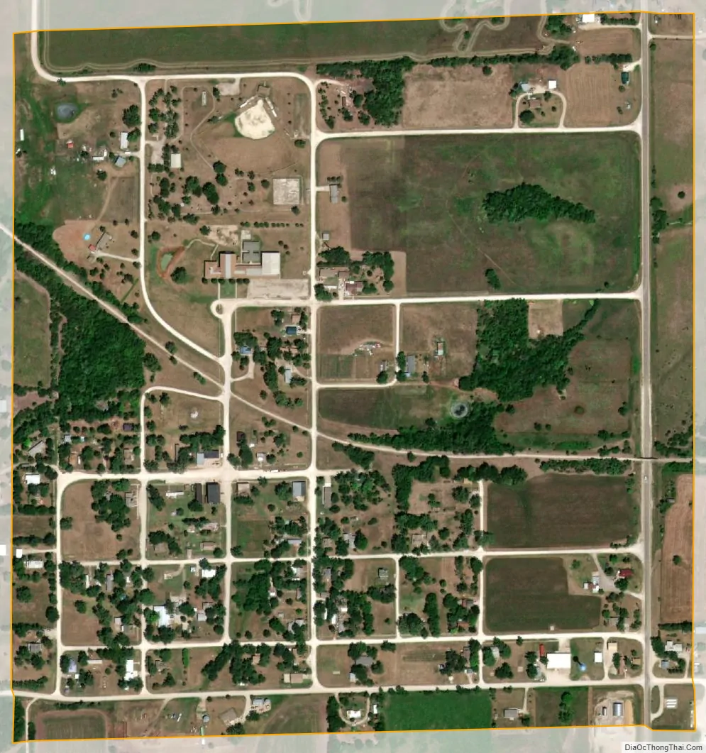
Admire city Satellite Map
Geography
Admire is located at 38°38′29″N 96°6′7″W / 38.64139°N 96.10194°W / 38.64139; -96.10194 (38.641416, -96.101932). According to the United States Census Bureau, the city has a total area of 0.33 square miles (0.85 km), all land.
See also
Map of Kansas State and its subdivision:- Allen
- Anderson
- Atchison
- Barber
- Barton
- Bourbon
- Brown
- Butler
- Chase
- Chautauqua
- Cherokee
- Cheyenne
- Clark
- Clay
- Cloud
- Coffey
- Comanche
- Cowley
- Crawford
- Decatur
- Dickinson
- Doniphan
- Douglas
- Edwards
- Elk
- Ellis
- Ellsworth
- Finney
- Ford
- Franklin
- Geary
- Gove
- Graham
- Grant
- Gray
- Greeley
- Greenwood
- Hamilton
- Harper
- Harvey
- Haskell
- Hodgeman
- Jackson
- Jefferson
- Jewell
- Johnson
- Kearny
- Kingman
- Kiowa
- Labette
- Lane
- Leavenworth
- Lincoln
- Linn
- Logan
- Lyon
- Marion
- Marshall
- McPherson
- Meade
- Miami
- Mitchell
- Montgomery
- Morris
- Morton
- Nemaha
- Neosho
- Ness
- Norton
- Osage
- Osborne
- Ottawa
- Pawnee
- Phillips
- Pottawatomie
- Pratt
- Rawlins
- Reno
- Republic
- Rice
- Riley
- Rooks
- Rush
- Russell
- Saline
- Scott
- Sedgwick
- Seward
- Shawnee
- Sheridan
- Sherman
- Smith
- Stafford
- Stanton
- Stevens
- Sumner
- Thomas
- Trego
- Wabaunsee
- Wallace
- Washington
- Wichita
- Wilson
- Woodson
- Wyandotte
- Alabama
- Alaska
- Arizona
- Arkansas
- California
- Colorado
- Connecticut
- Delaware
- District of Columbia
- Florida
- Georgia
- Hawaii
- Idaho
- Illinois
- Indiana
- Iowa
- Kansas
- Kentucky
- Louisiana
- Maine
- Maryland
- Massachusetts
- Michigan
- Minnesota
- Mississippi
- Missouri
- Montana
- Nebraska
- Nevada
- New Hampshire
- New Jersey
- New Mexico
- New York
- North Carolina
- North Dakota
- Ohio
- Oklahoma
- Oregon
- Pennsylvania
- Rhode Island
- South Carolina
- South Dakota
- Tennessee
- Texas
- Utah
- Vermont
- Virginia
- Washington
- West Virginia
- Wisconsin
- Wyoming