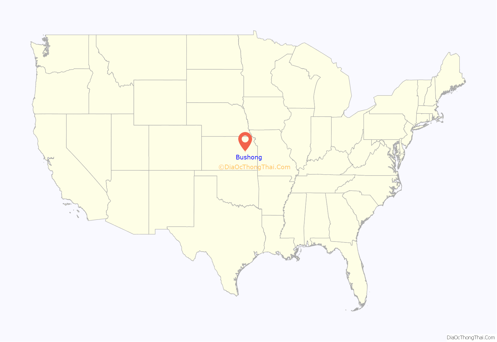
Bushong is a city in Lyon County, Kansas, United States. As of the 2020 census, the population of the city was 27.
| Name: | Bushong city |
|---|---|
| LSAD Code: | 25 |
| LSAD Description: | city (suffix) |
| State: | Kansas |
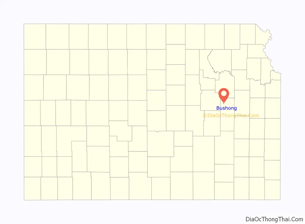
| County: | Lyon County |
| Incorporated: | 1923 |
| Elevation: | 1,391 ft (424 m) |
| Total Area: | 0.15 sq mi (0.39 km²) |
| Land Area: | 0.15 sq mi (0.39 km²) |
| Water Area: | 0.00 sq mi (0.00 km²) |
| Total Population: | 27 |
| Population Density: | 180/sq mi (69/km²) |
| ZIP code: | 66833 |
| Area code: | 620 |
| FIPS code: | 2009675 |
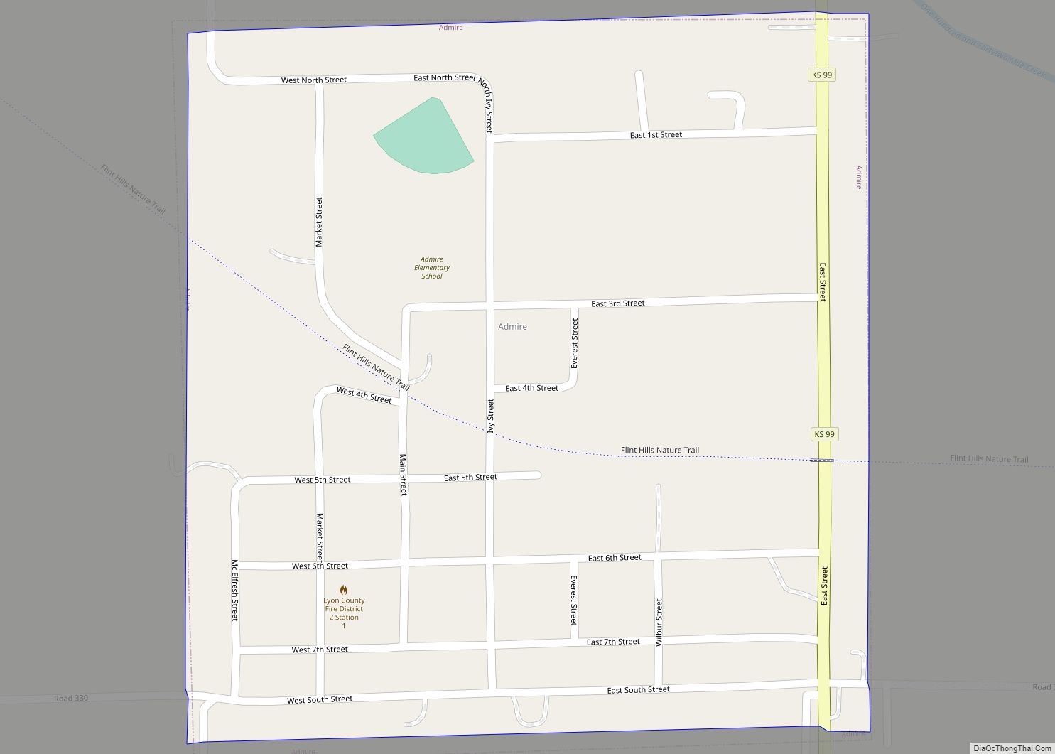
Online Interactive Map
Click on ![]() to view map in "full screen" mode.
to view map in "full screen" mode.
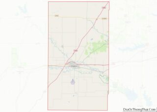
Bushong location map. Where is Bushong city?
History
The city, originally a whistle-stop of the Missouri Pacific Railroad, was first named Weeks. The city took its present name in 1886 in honor of St. Louis Browns catcher Albert J. “Doc” Bushong. Following the Browns’ victory in the 1886 World Series over the Chicago White Stockings, the Missouri Pacific Railroad honored several of the St. Louis players by naming some of their depots after the players. Bushong had played every game in the series and was at bat in Game Six, when the winning run scored by stealing home. The city of Bushong is the only one still carrying its name from the 1886 World Series.
During the Cold War, Bushong was the location of one of the first generations of nuclear-tipped intercontinental ballistic missiles. The site, active from 1961–1965, was part of the 548th Strategic Missile Squadron.
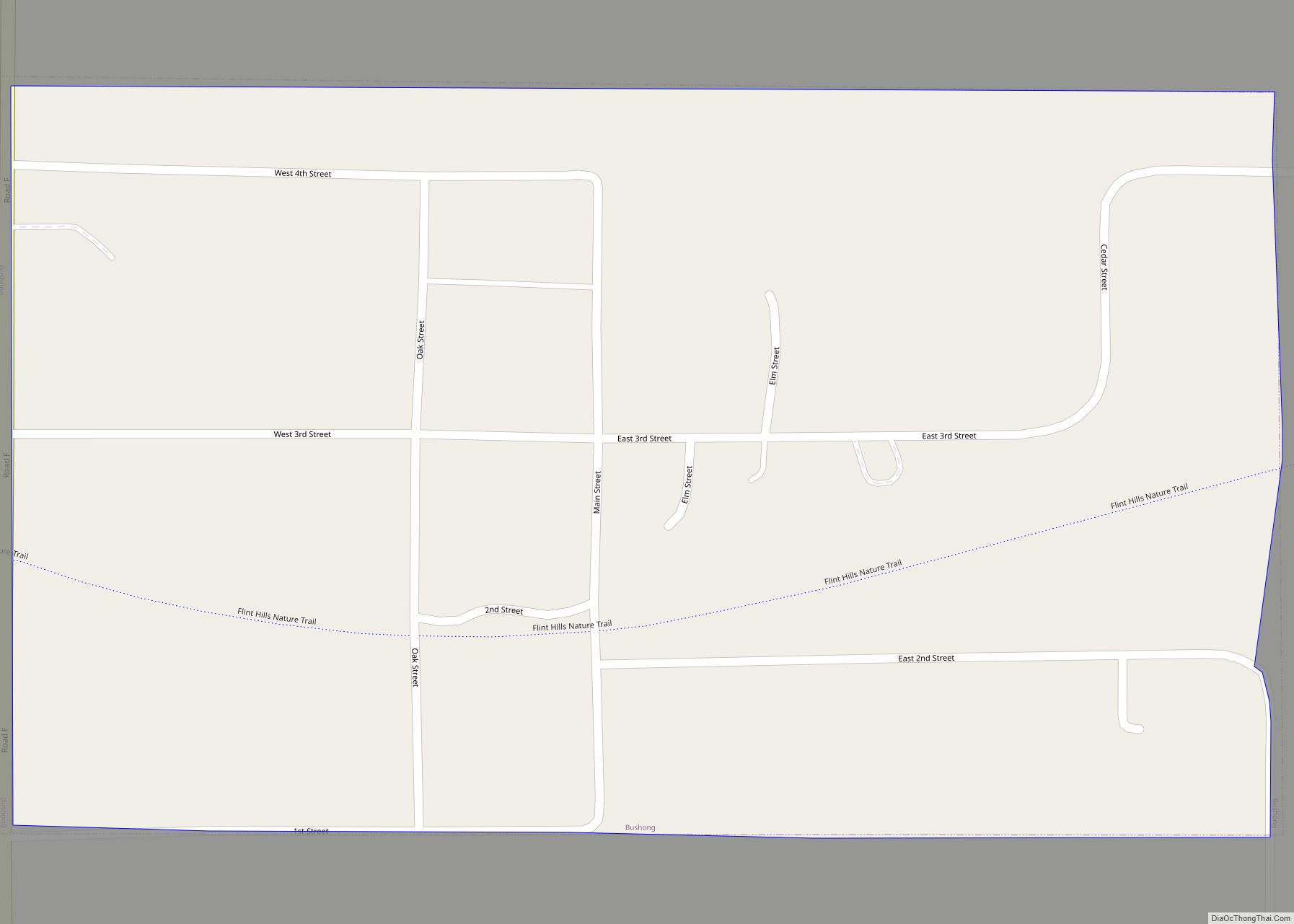
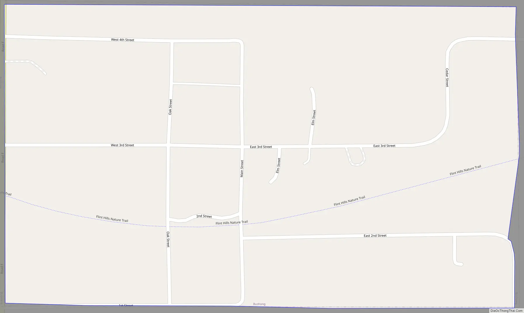
Bushong Road Map
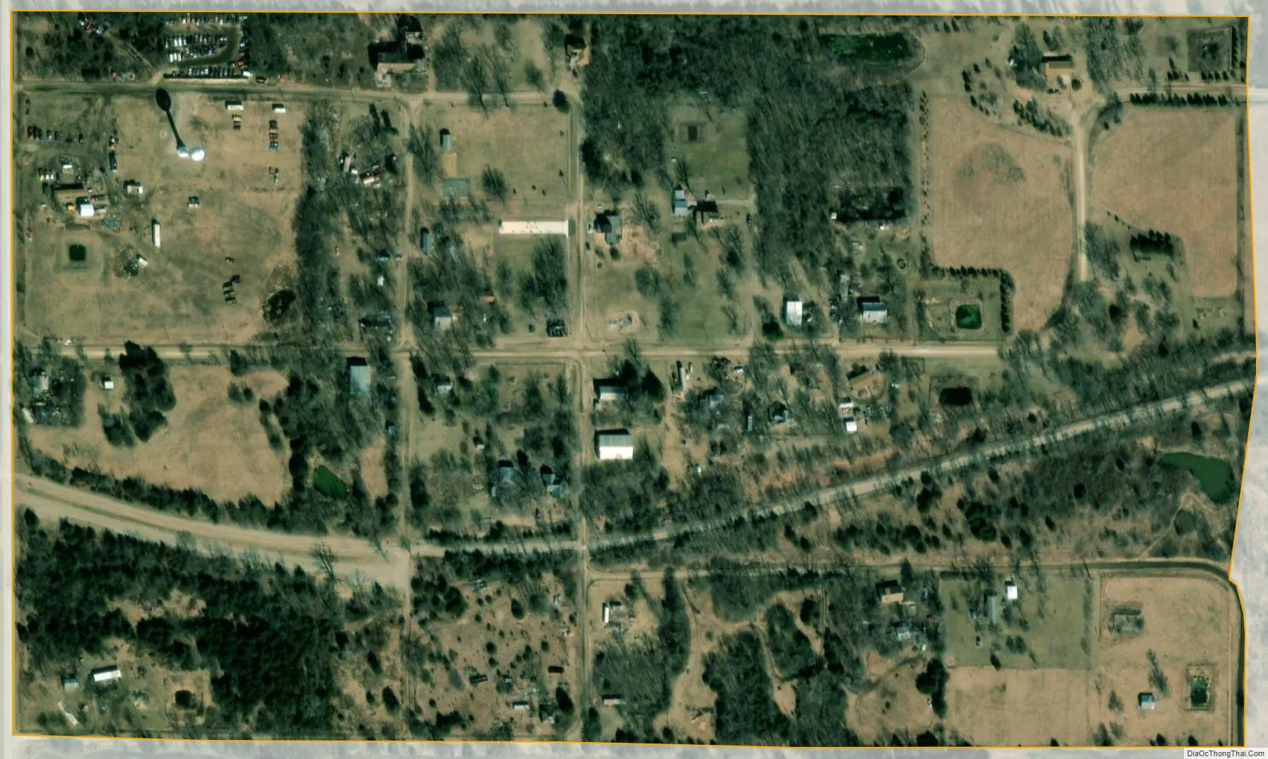
Bushong city Satellite Map
Geography
Bushong is located at 38°38′34″N 96°15′28″W / 38.64278°N 96.25778°W / 38.64278; -96.25778 (38.642699, -96.257753). According to the United States Census Bureau, the city has a total area of 0.15 square miles (0.39 km), all of it land.
See also
Map of Kansas State and its subdivision:- Allen
- Anderson
- Atchison
- Barber
- Barton
- Bourbon
- Brown
- Butler
- Chase
- Chautauqua
- Cherokee
- Cheyenne
- Clark
- Clay
- Cloud
- Coffey
- Comanche
- Cowley
- Crawford
- Decatur
- Dickinson
- Doniphan
- Douglas
- Edwards
- Elk
- Ellis
- Ellsworth
- Finney
- Ford
- Franklin
- Geary
- Gove
- Graham
- Grant
- Gray
- Greeley
- Greenwood
- Hamilton
- Harper
- Harvey
- Haskell
- Hodgeman
- Jackson
- Jefferson
- Jewell
- Johnson
- Kearny
- Kingman
- Kiowa
- Labette
- Lane
- Leavenworth
- Lincoln
- Linn
- Logan
- Lyon
- Marion
- Marshall
- McPherson
- Meade
- Miami
- Mitchell
- Montgomery
- Morris
- Morton
- Nemaha
- Neosho
- Ness
- Norton
- Osage
- Osborne
- Ottawa
- Pawnee
- Phillips
- Pottawatomie
- Pratt
- Rawlins
- Reno
- Republic
- Rice
- Riley
- Rooks
- Rush
- Russell
- Saline
- Scott
- Sedgwick
- Seward
- Shawnee
- Sheridan
- Sherman
- Smith
- Stafford
- Stanton
- Stevens
- Sumner
- Thomas
- Trego
- Wabaunsee
- Wallace
- Washington
- Wichita
- Wilson
- Woodson
- Wyandotte
- Alabama
- Alaska
- Arizona
- Arkansas
- California
- Colorado
- Connecticut
- Delaware
- District of Columbia
- Florida
- Georgia
- Hawaii
- Idaho
- Illinois
- Indiana
- Iowa
- Kansas
- Kentucky
- Louisiana
- Maine
- Maryland
- Massachusetts
- Michigan
- Minnesota
- Mississippi
- Missouri
- Montana
- Nebraska
- Nevada
- New Hampshire
- New Jersey
- New Mexico
- New York
- North Carolina
- North Dakota
- Ohio
- Oklahoma
- Oregon
- Pennsylvania
- Rhode Island
- South Carolina
- South Dakota
- Tennessee
- Texas
- Utah
- Vermont
- Virginia
- Washington
- West Virginia
- Wisconsin
- Wyoming