Cawker City is a city in Mitchell County, Kansas, United States. As of the 2020 census, the population of the city was 457. The city is located along the north shore of Waconda Lake and Glen Elder State Park. It is one of several places claiming to be home of the largest ball of twine in the world.
| Name: | Cawker City city |
|---|---|
| LSAD Code: | 25 |
| LSAD Description: | city (suffix) |
| State: | Kansas |
| County: | Mitchell County |
| Founded: | 1870 |
| Incorporated: | 1874 |
| Elevation: | 1,493 ft (455 m) |
| Total Area: | 1.01 sq mi (2.61 km²) |
| Land Area: | 1.01 sq mi (2.61 km²) |
| Water Area: | 0.00 sq mi (0.00 km²) |
| Total Population: | 457 |
| Population Density: | 450/sq mi (180/km²) |
| ZIP code: | 67430 |
| Area code: | 785 |
| FIPS code: | 2011175 |
| Website: | cawkercitykansas.com |
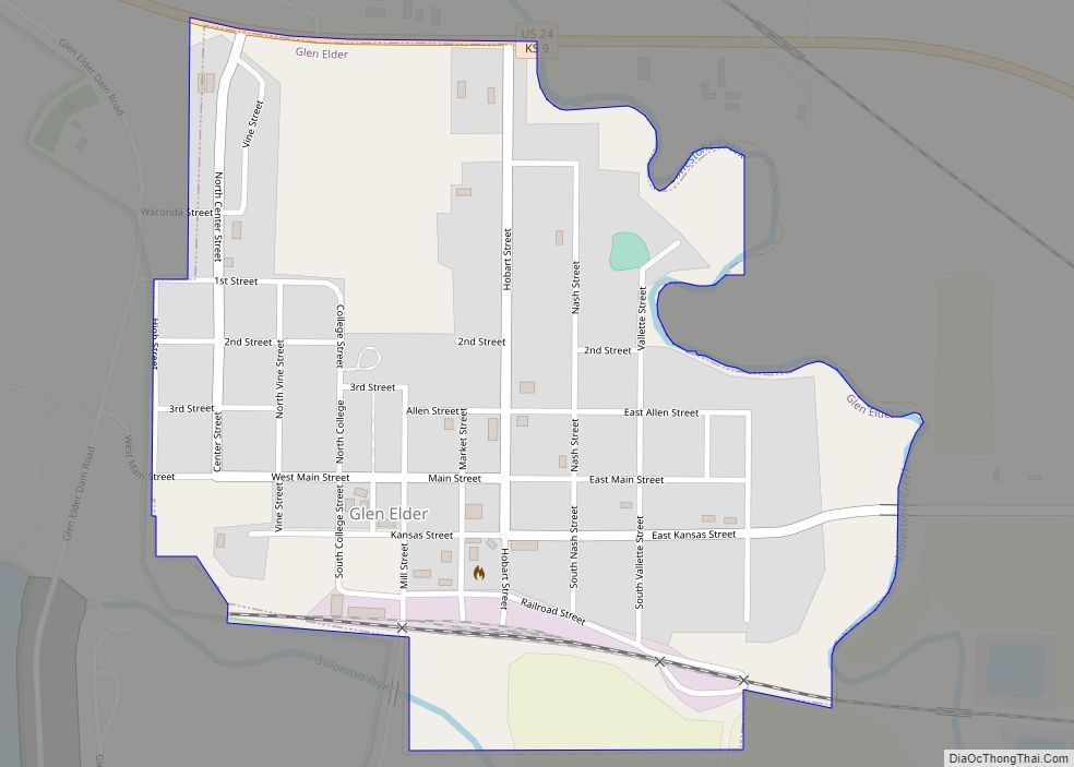
Online Interactive Map
Click on ![]() to view map in "full screen" mode.
to view map in "full screen" mode.
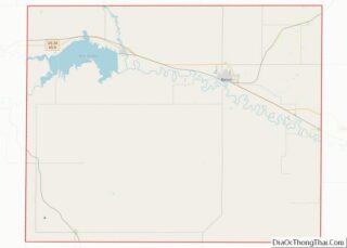
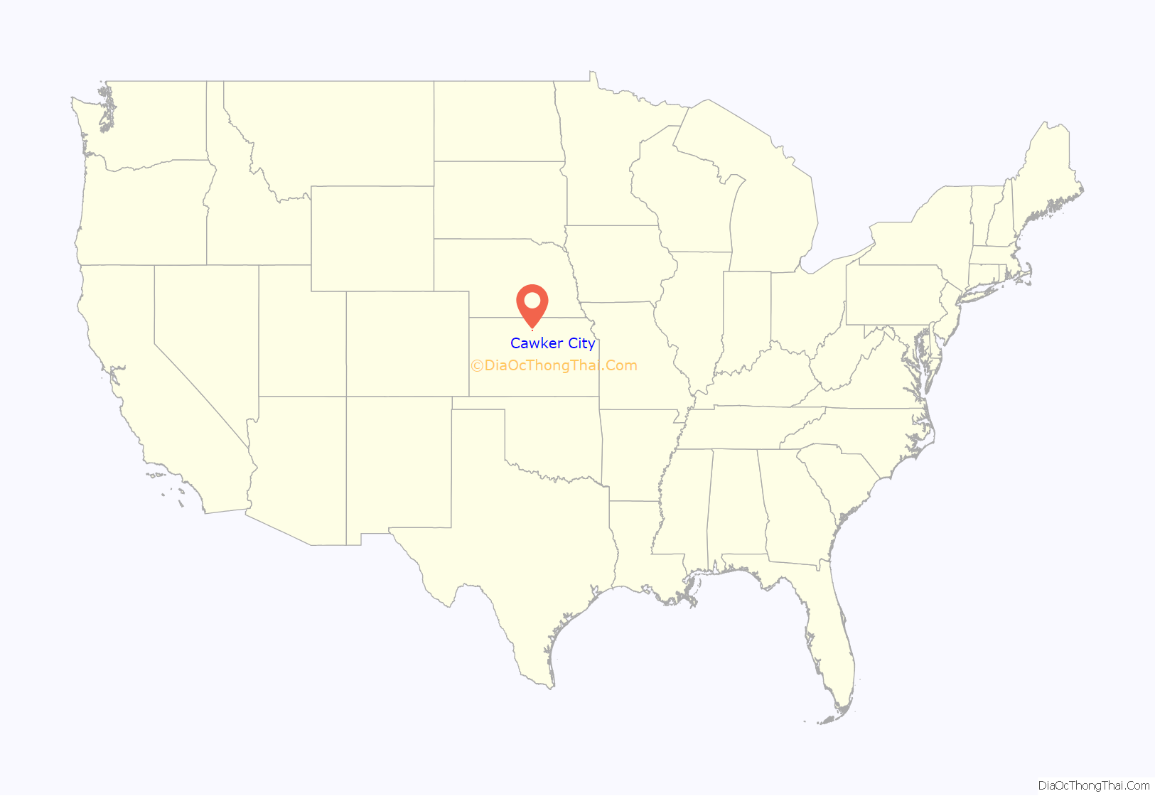
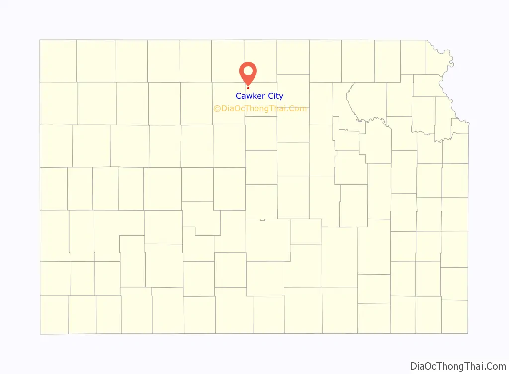
Cawker City location map. Where is Cawker City city?
History
Cawker City was founded in 1870. According to tradition, Colonel E. H. Cawker won naming rights for the town with a winning hand at poker. Cawker City was incorporated as a city in 1874. The first post office in Cawker City was established in June 1870.
The city previously served many families living on small farms. A resident stated that Cawker City had three grocery stores in the 1960s. By 2017 the community had no grocery stores. Many young adults were leaving to find work elsewhere. In the area family sizes decreased and farm plot sizes increased. These factors caused the community’s population to decline.
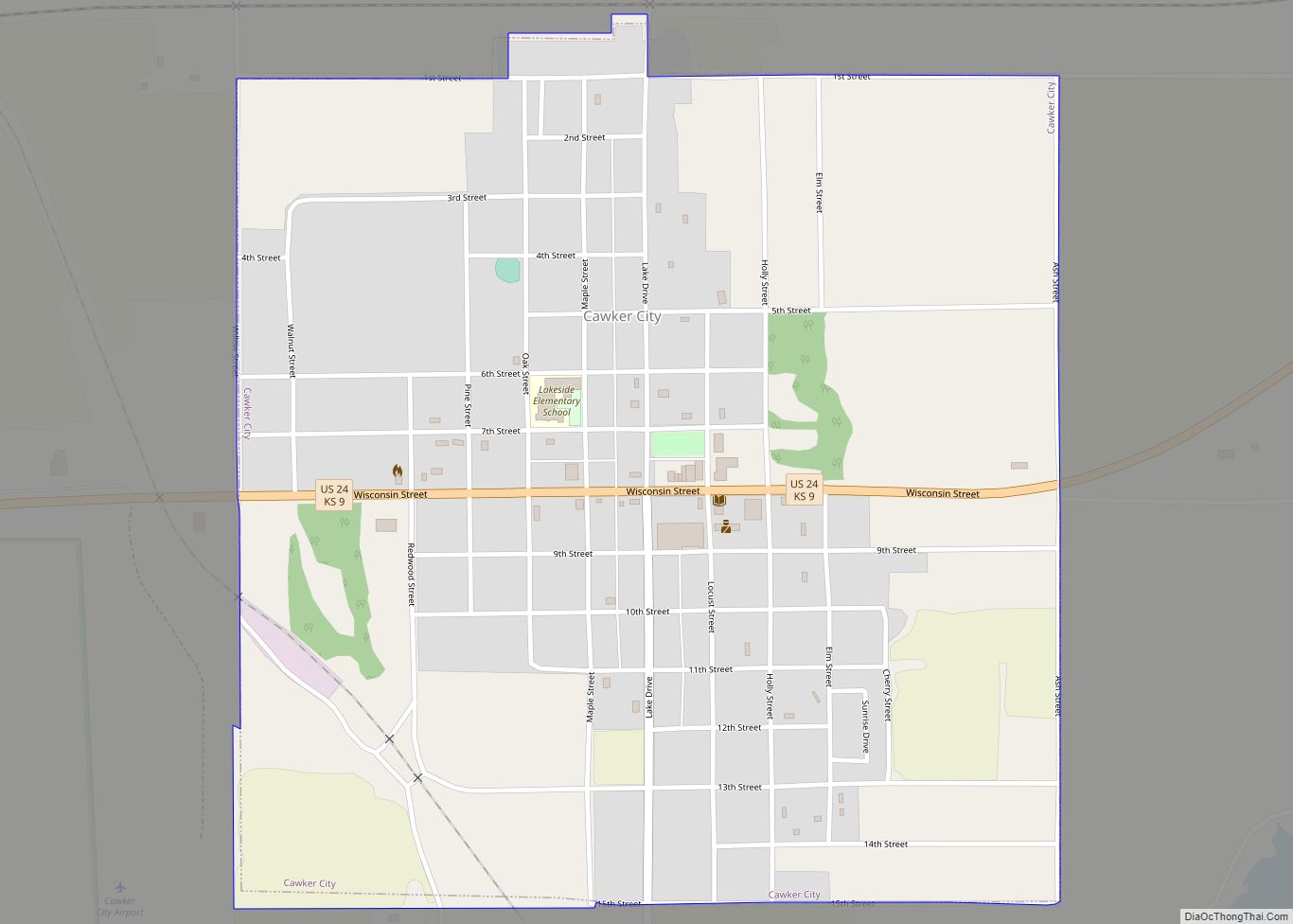
Cawker City Road Map
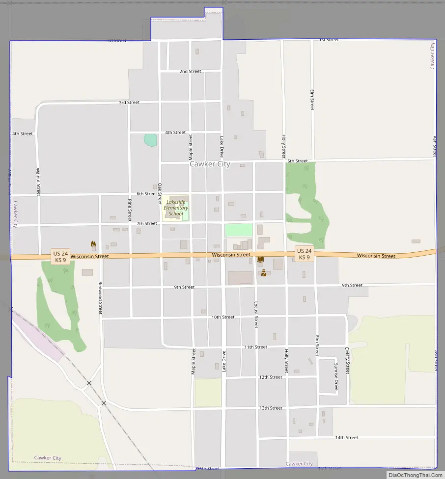
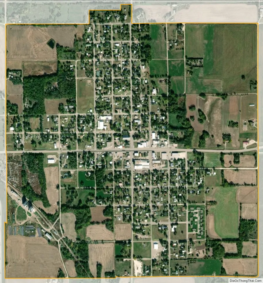
Cawker City city Satellite Map
Geography
Cawker City is located at 39°30′32″N 98°26′2″W / 39.50889°N 98.43389°W / 39.50889; -98.43389 (39.508835, -98.433842). According to the United States Census Bureau, the city has a total area of 1.00 square mile (2.59 km), all of it land. The city is located along the north shore of Waconda Lake.
See also
Map of Kansas State and its subdivision:- Allen
- Anderson
- Atchison
- Barber
- Barton
- Bourbon
- Brown
- Butler
- Chase
- Chautauqua
- Cherokee
- Cheyenne
- Clark
- Clay
- Cloud
- Coffey
- Comanche
- Cowley
- Crawford
- Decatur
- Dickinson
- Doniphan
- Douglas
- Edwards
- Elk
- Ellis
- Ellsworth
- Finney
- Ford
- Franklin
- Geary
- Gove
- Graham
- Grant
- Gray
- Greeley
- Greenwood
- Hamilton
- Harper
- Harvey
- Haskell
- Hodgeman
- Jackson
- Jefferson
- Jewell
- Johnson
- Kearny
- Kingman
- Kiowa
- Labette
- Lane
- Leavenworth
- Lincoln
- Linn
- Logan
- Lyon
- Marion
- Marshall
- McPherson
- Meade
- Miami
- Mitchell
- Montgomery
- Morris
- Morton
- Nemaha
- Neosho
- Ness
- Norton
- Osage
- Osborne
- Ottawa
- Pawnee
- Phillips
- Pottawatomie
- Pratt
- Rawlins
- Reno
- Republic
- Rice
- Riley
- Rooks
- Rush
- Russell
- Saline
- Scott
- Sedgwick
- Seward
- Shawnee
- Sheridan
- Sherman
- Smith
- Stafford
- Stanton
- Stevens
- Sumner
- Thomas
- Trego
- Wabaunsee
- Wallace
- Washington
- Wichita
- Wilson
- Woodson
- Wyandotte
- Alabama
- Alaska
- Arizona
- Arkansas
- California
- Colorado
- Connecticut
- Delaware
- District of Columbia
- Florida
- Georgia
- Hawaii
- Idaho
- Illinois
- Indiana
- Iowa
- Kansas
- Kentucky
- Louisiana
- Maine
- Maryland
- Massachusetts
- Michigan
- Minnesota
- Mississippi
- Missouri
- Montana
- Nebraska
- Nevada
- New Hampshire
- New Jersey
- New Mexico
- New York
- North Carolina
- North Dakota
- Ohio
- Oklahoma
- Oregon
- Pennsylvania
- Rhode Island
- South Carolina
- South Dakota
- Tennessee
- Texas
- Utah
- Vermont
- Virginia
- Washington
- West Virginia
- Wisconsin
- Wyoming