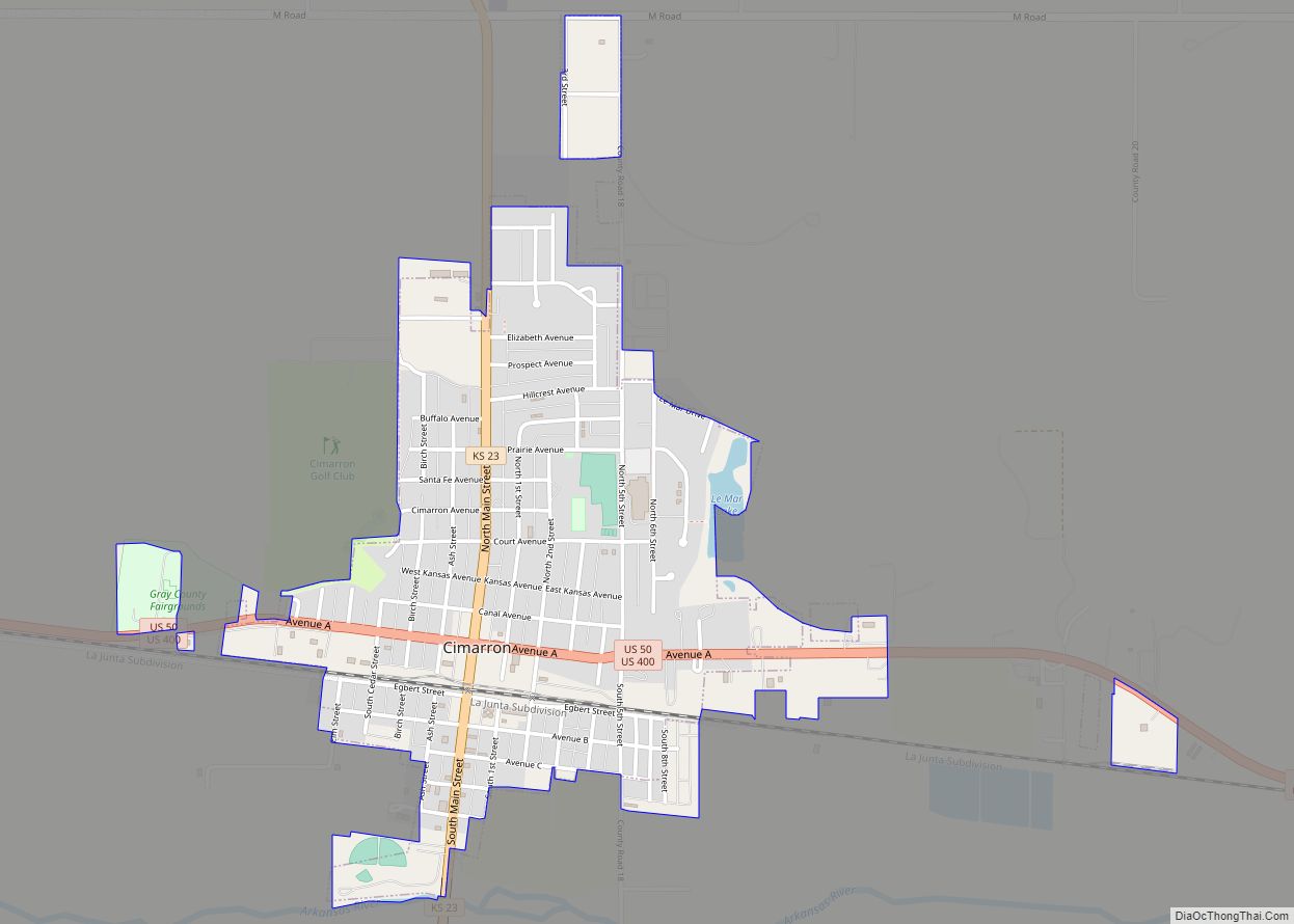
Cimarron is a city in and the county seat of Gray County, Kansas, United States. As of the 2020 census, the population of the city was 1,981.
| Name: | Cimarron city |
|---|---|
| LSAD Code: | 25 |
| LSAD Description: | city (suffix) |
| State: | Kansas |
| County: | Gray County |
| Founded: | 1878 |
| Incorporated: | 1885 |
| Elevation: | 2,635 ft (803 m) |
| Total Area: | 1.15 sq mi (2.98 km²) |
| Land Area: | 1.15 sq mi (2.98 km²) |
| Water Area: | 0.00 sq mi (0.00 km²) |
| Total Population: | 1,981 |
| Population Density: | 1,700/sq mi (660/km²) |
| ZIP code: | 67835 |
| Area code: | 620 |
| FIPS code: | 2013275 |
| Website: | cimarronks.org |
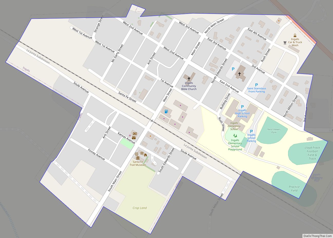
Online Interactive Map
Click on ![]() to view map in "full screen" mode.
to view map in "full screen" mode.
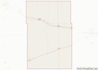
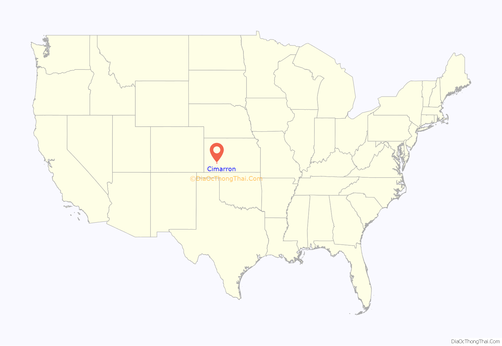
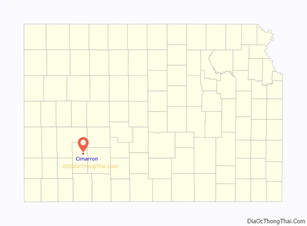
Cimarron location map. Where is Cimarron city?
History
Cimarron was first settled in 1878. It took its name from a fork in the Chisholm Trail which led travelers to the Cimarron River.
Between 1887 and 1893, a county seat war took place in Gray County that involved several notable Old West figures, such as Bat Masterson, Bill Tilghman, and Ben Daniels. As a result of the dispute, Cimarron became the permanent county seat of Gray County.
In the wee hours of June 10, 1893, Bill Doolin and four members of his gang robbed a train one-half mile east of Cimarron.
In 2016 the Southwest Chief owned by Amtrak derailed, and Amtrak and BNSF filed a lawsuit against one of the companies in Cimarron for damaging the rails by a road vehicle.
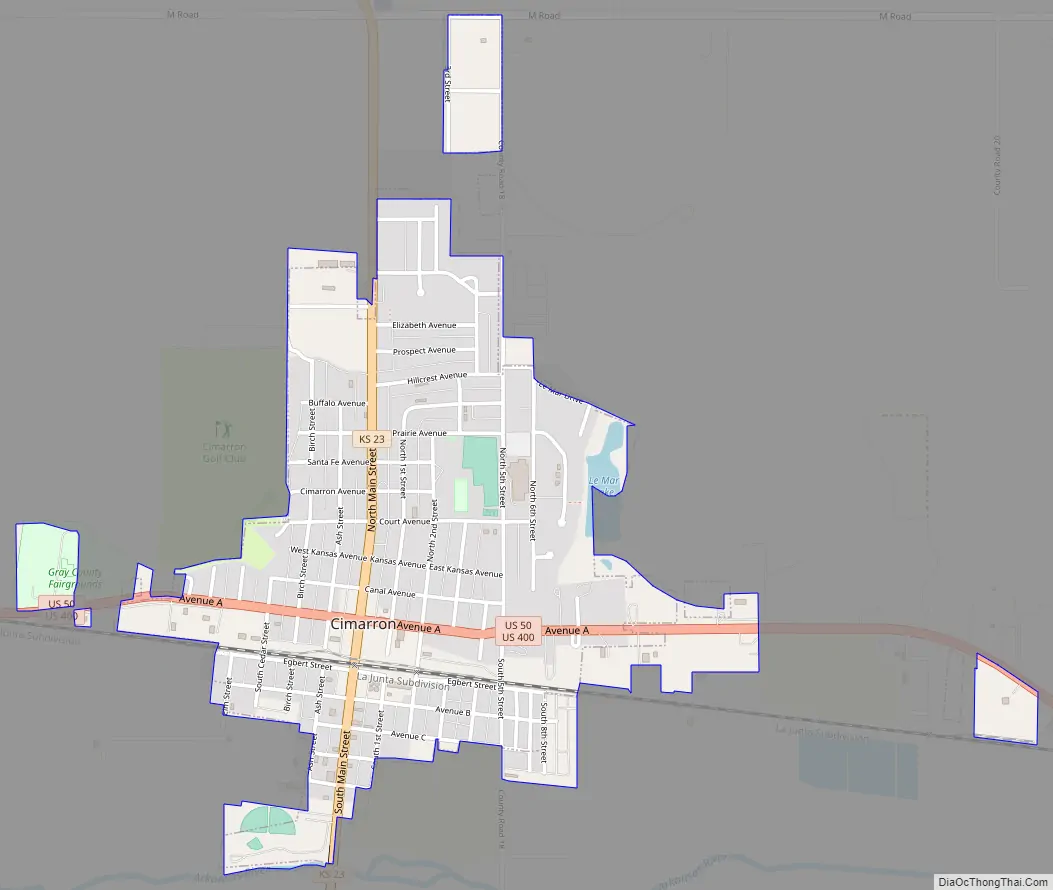
Cimarron Road Map
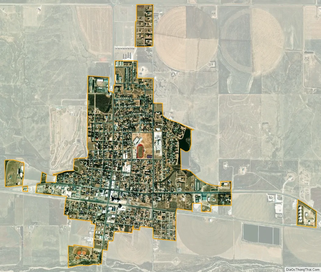
Cimarron city Satellite Map
Geography
Cimarron is located at 37°48′30″N 100°20′51″W / 37.80833°N 100.34750°W / 37.80833; -100.34750 (37.808332, −100.347413). According to the United States Census Bureau, the city has a total area of 1.14 square miles (2.95 km), all of it land.
Climate
According to the Köppen Climate Classification system, Cimarron has a semi-arid climate, abbreviated “BSk” on climate maps.
See also
Map of Kansas State and its subdivision:- Allen
- Anderson
- Atchison
- Barber
- Barton
- Bourbon
- Brown
- Butler
- Chase
- Chautauqua
- Cherokee
- Cheyenne
- Clark
- Clay
- Cloud
- Coffey
- Comanche
- Cowley
- Crawford
- Decatur
- Dickinson
- Doniphan
- Douglas
- Edwards
- Elk
- Ellis
- Ellsworth
- Finney
- Ford
- Franklin
- Geary
- Gove
- Graham
- Grant
- Gray
- Greeley
- Greenwood
- Hamilton
- Harper
- Harvey
- Haskell
- Hodgeman
- Jackson
- Jefferson
- Jewell
- Johnson
- Kearny
- Kingman
- Kiowa
- Labette
- Lane
- Leavenworth
- Lincoln
- Linn
- Logan
- Lyon
- Marion
- Marshall
- McPherson
- Meade
- Miami
- Mitchell
- Montgomery
- Morris
- Morton
- Nemaha
- Neosho
- Ness
- Norton
- Osage
- Osborne
- Ottawa
- Pawnee
- Phillips
- Pottawatomie
- Pratt
- Rawlins
- Reno
- Republic
- Rice
- Riley
- Rooks
- Rush
- Russell
- Saline
- Scott
- Sedgwick
- Seward
- Shawnee
- Sheridan
- Sherman
- Smith
- Stafford
- Stanton
- Stevens
- Sumner
- Thomas
- Trego
- Wabaunsee
- Wallace
- Washington
- Wichita
- Wilson
- Woodson
- Wyandotte
- Alabama
- Alaska
- Arizona
- Arkansas
- California
- Colorado
- Connecticut
- Delaware
- District of Columbia
- Florida
- Georgia
- Hawaii
- Idaho
- Illinois
- Indiana
- Iowa
- Kansas
- Kentucky
- Louisiana
- Maine
- Maryland
- Massachusetts
- Michigan
- Minnesota
- Mississippi
- Missouri
- Montana
- Nebraska
- Nevada
- New Hampshire
- New Jersey
- New Mexico
- New York
- North Carolina
- North Dakota
- Ohio
- Oklahoma
- Oregon
- Pennsylvania
- Rhode Island
- South Carolina
- South Dakota
- Tennessee
- Texas
- Utah
- Vermont
- Virginia
- Washington
- West Virginia
- Wisconsin
- Wyoming