Elmdale is a city in Chase County, Kansas, United States. As of the 2020 census, the population of the city was 40. It is located along U.S. Route 50 highway.
| Name: | Elmdale city |
|---|---|
| LSAD Code: | 25 |
| LSAD Description: | city (suffix) |
| State: | Kansas |
| County: | Chase County |
| Incorporated: | 1899 |
| Elevation: | 1,201 ft (366 m) |
| Total Area: | 0.17 sq mi (0.43 km²) |
| Land Area: | 0.17 sq mi (0.43 km²) |
| Water Area: | 0.00 sq mi (0.00 km²) |
| Total Population: | 40 |
| Population Density: | 240/sq mi (93/km²) |
| ZIP code: | 66850 |
| Area code: | 620 |
| FIPS code: | 2020675 |
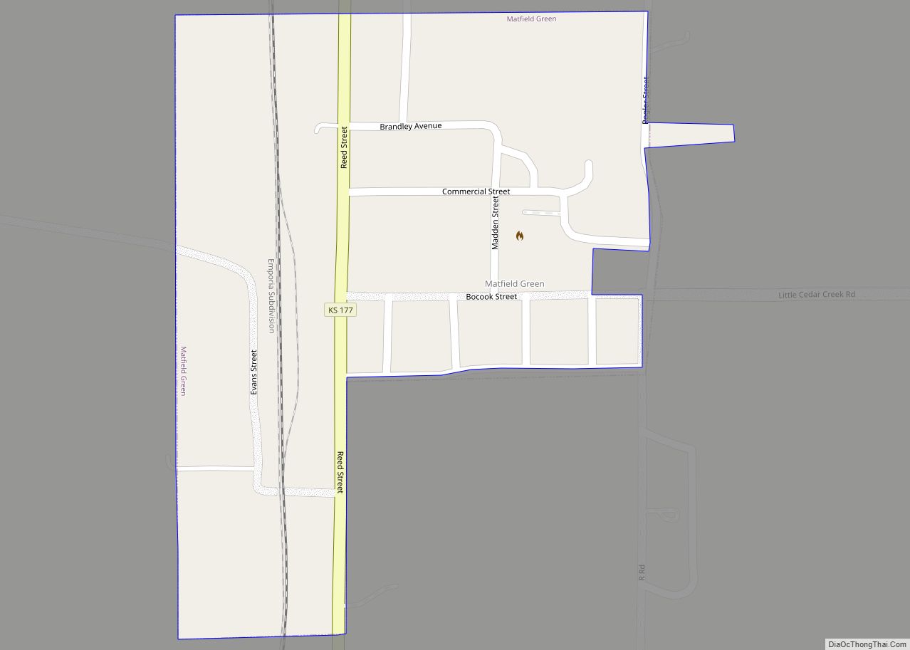
Online Interactive Map
Click on ![]() to view map in "full screen" mode.
to view map in "full screen" mode.
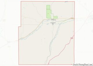
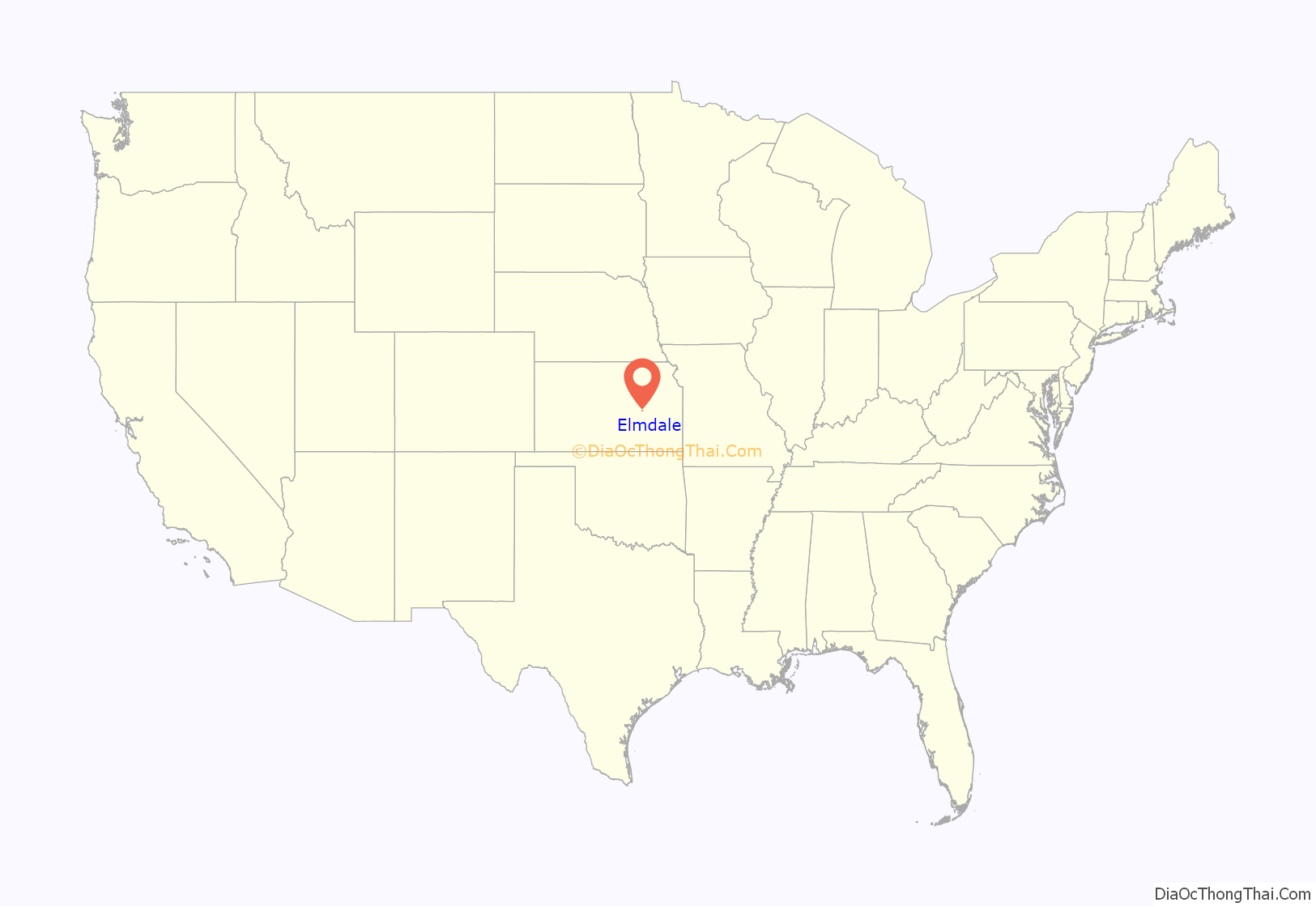
Elmdale location map. Where is Elmdale city?
History
In 1806, Zebulon Pike led the Pike Expedition westward from St Louis, Missouri, of which part of their journey followed the Cottonwood River through Chase County near the current city of Elmdale.
In 1854, the Kansas Territory was organized, then in 1861 Kansas became the 34th U.S. state. In 1859, Chase County was established within the Kansas Territory, which included the land for modern day Elmdale.
In 1871, the Atchison, Topeka and Santa Fe Railway built a main line east-west through Elmdale. In 1873, a post office was relocated from Middle Creek (an extinct town), to the rail community of Elmdale. Elmdale was incorporated in 1904.
In 1916, Camp Wood YMCA was built about 1.5 miles south of Elmdale.
There have been numerous floods during the history of Elmdale. In June and July 1951, due to heavy rains, rivers and streams flooded numerous cities in Kansas, including Elmdale. Many reservoirs and levees were built in Kansas as part of a response to the Great Flood of 1951. A levy was built and saved the town from numerous floods, but in 1998 a flood went over the levy.
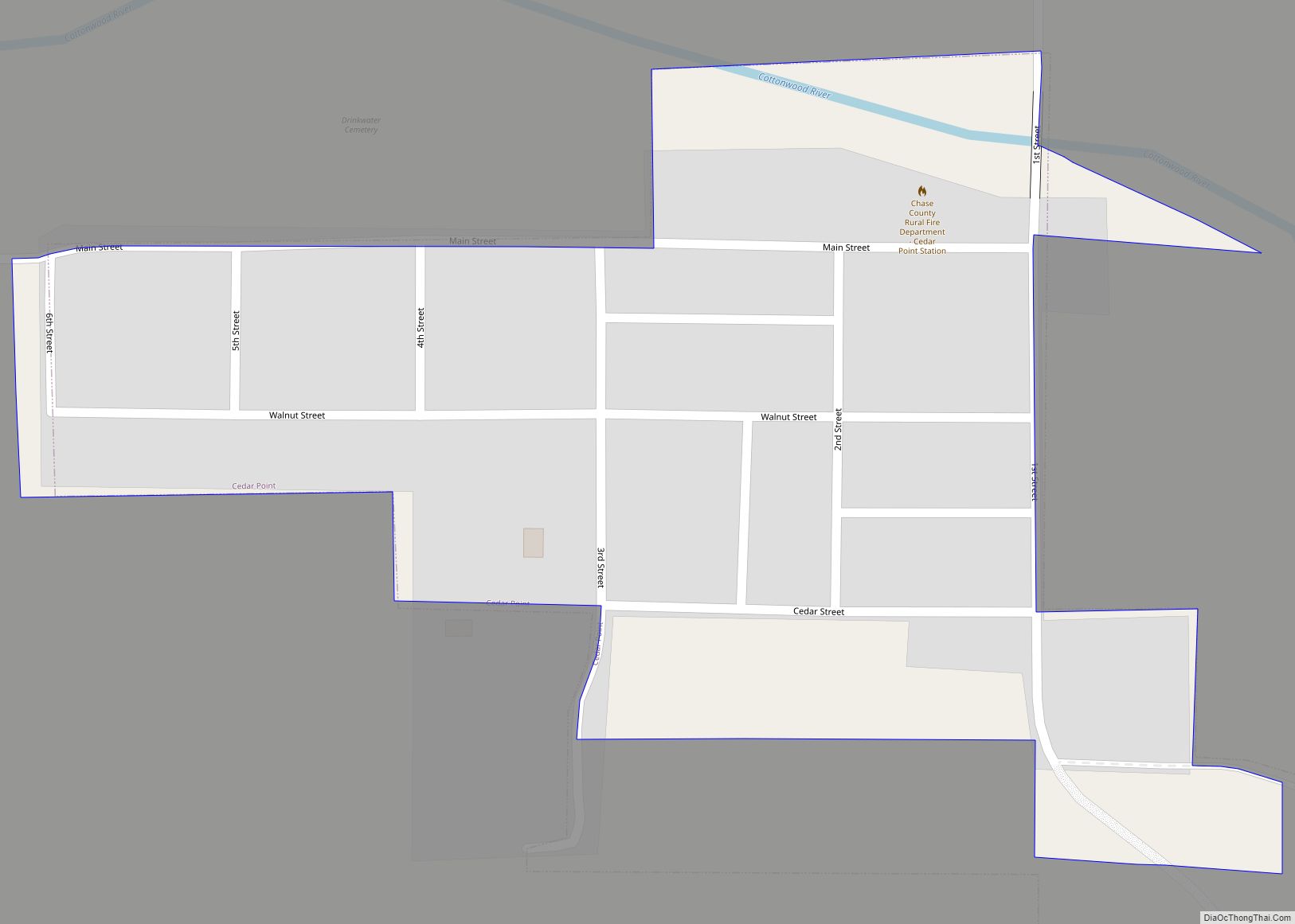
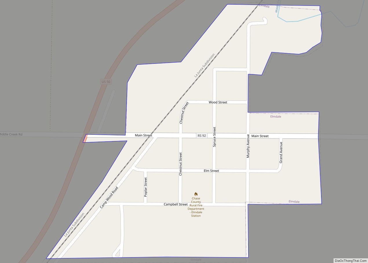
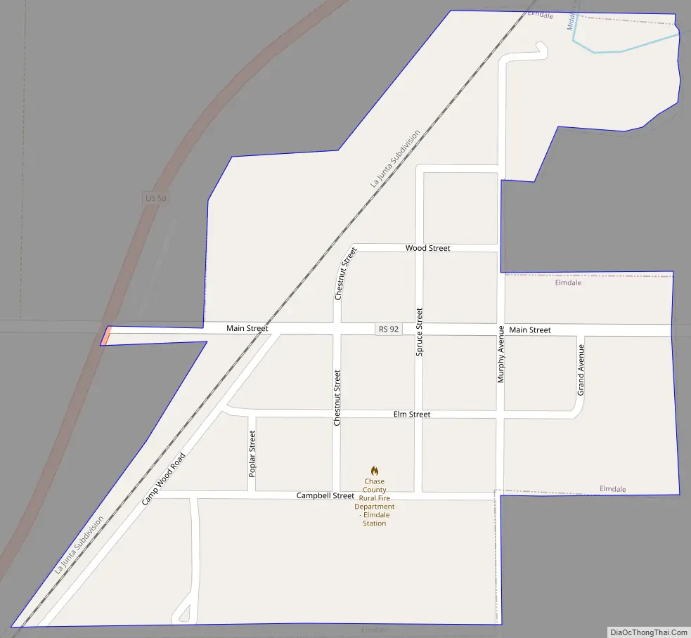
Elmdale Road Map
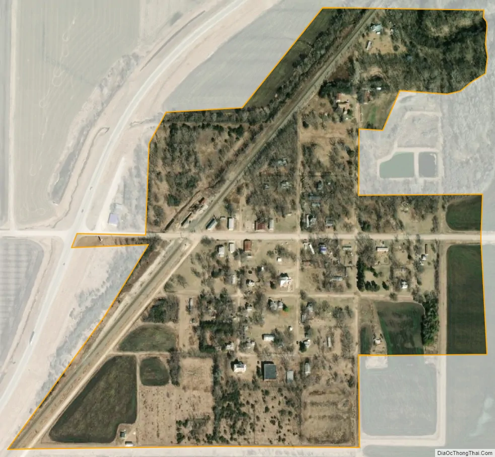
Elmdale city Satellite Map
Geography
Elmdale is located in the Flint Hills of the Great Plains. According to the United States Census Bureau, the city has a total area of 0.17 square miles (0.44 km), all of it land. The Cottonwood River is approximately 0.5 miles east of the city.
Climate
The climate in this area is characterized by hot, humid summers and generally mild to cool winters. According to the Köppen Climate Classification system, Elmdale has a humid subtropical climate, abbreviated “Cfa” on climate maps.
See also
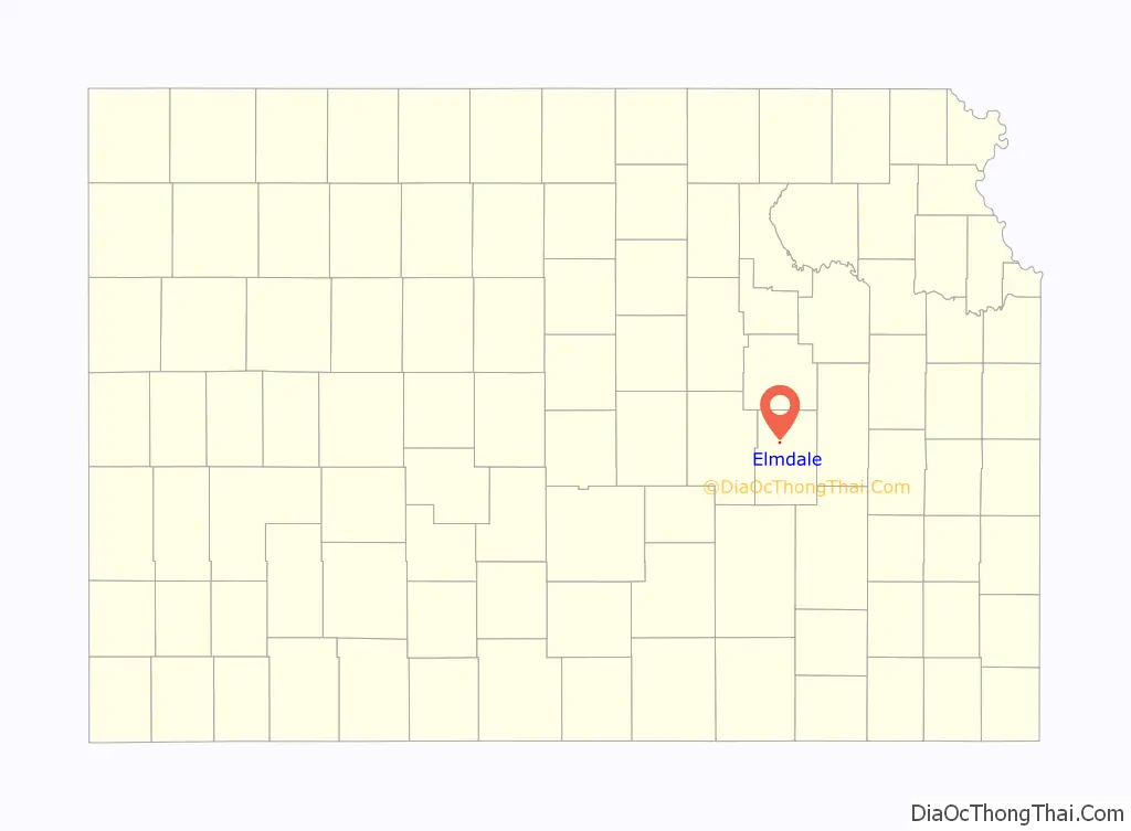
Map of Kansas State and its subdivision:- Allen
- Anderson
- Atchison
- Barber
- Barton
- Bourbon
- Brown
- Butler
- Chase
- Chautauqua
- Cherokee
- Cheyenne
- Clark
- Clay
- Cloud
- Coffey
- Comanche
- Cowley
- Crawford
- Decatur
- Dickinson
- Doniphan
- Douglas
- Edwards
- Elk
- Ellis
- Ellsworth
- Finney
- Ford
- Franklin
- Geary
- Gove
- Graham
- Grant
- Gray
- Greeley
- Greenwood
- Hamilton
- Harper
- Harvey
- Haskell
- Hodgeman
- Jackson
- Jefferson
- Jewell
- Johnson
- Kearny
- Kingman
- Kiowa
- Labette
- Lane
- Leavenworth
- Lincoln
- Linn
- Logan
- Lyon
- Marion
- Marshall
- McPherson
- Meade
- Miami
- Mitchell
- Montgomery
- Morris
- Morton
- Nemaha
- Neosho
- Ness
- Norton
- Osage
- Osborne
- Ottawa
- Pawnee
- Phillips
- Pottawatomie
- Pratt
- Rawlins
- Reno
- Republic
- Rice
- Riley
- Rooks
- Rush
- Russell
- Saline
- Scott
- Sedgwick
- Seward
- Shawnee
- Sheridan
- Sherman
- Smith
- Stafford
- Stanton
- Stevens
- Sumner
- Thomas
- Trego
- Wabaunsee
- Wallace
- Washington
- Wichita
- Wilson
- Woodson
- Wyandotte
- Alabama
- Alaska
- Arizona
- Arkansas
- California
- Colorado
- Connecticut
- Delaware
- District of Columbia
- Florida
- Georgia
- Hawaii
- Idaho
- Illinois
- Indiana
- Iowa
- Kansas
- Kentucky
- Louisiana
- Maine
- Maryland
- Massachusetts
- Michigan
- Minnesota
- Mississippi
- Missouri
- Montana
- Nebraska
- Nevada
- New Hampshire
- New Jersey
- New Mexico
- New York
- North Carolina
- North Dakota
- Ohio
- Oklahoma
- Oregon
- Pennsylvania
- Rhode Island
- South Carolina
- South Dakota
- Tennessee
- Texas
- Utah
- Vermont
- Virginia
- Washington
- West Virginia
- Wisconsin
- Wyoming