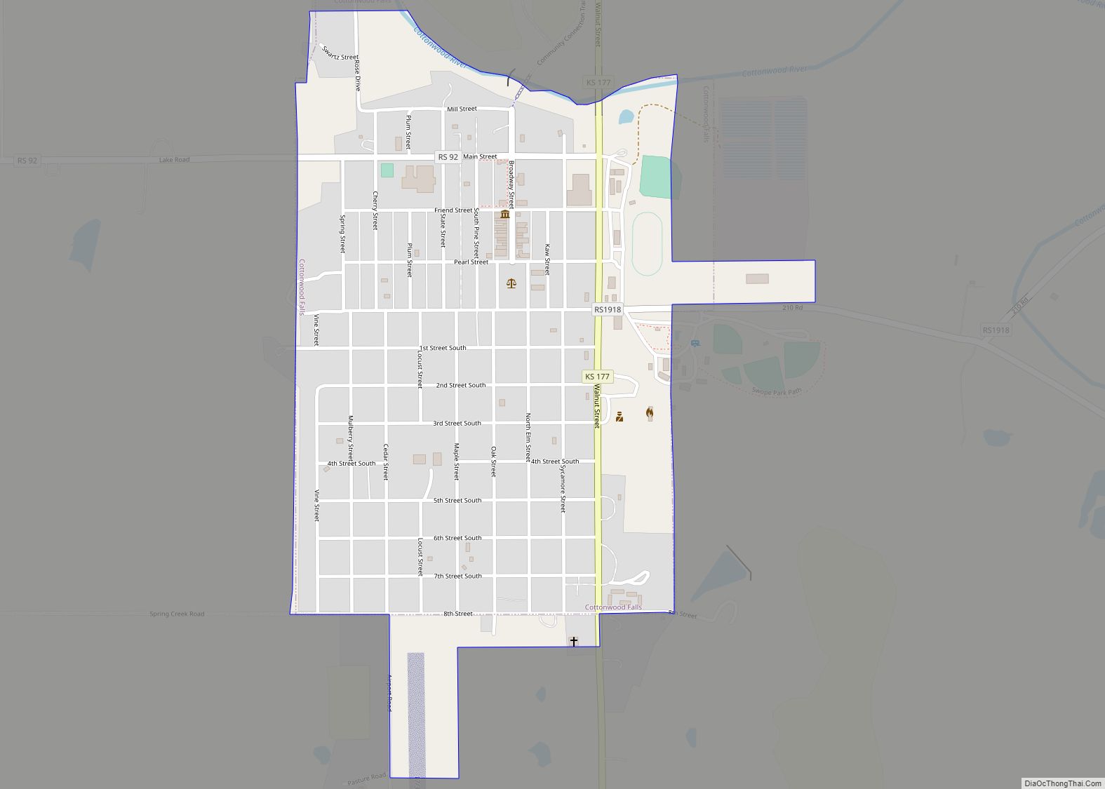
Cottonwood Falls is the largest city and county seat of Chase County, Kansas, United States. As of the 2020 census, the population of the city was 851. It is located south of Strong City along the south side of the Cottonwood River.
| Name: | Cottonwood Falls city |
|---|---|
| LSAD Code: | 25 |
| LSAD Description: | city (suffix) |
| State: | Kansas |
| County: | Chase County |
| Founded: | 1859 |
| Incorporated: | 1872 |
| Elevation: | 1,207 ft (368 m) |
| Total Area: | 0.64 sq mi (1.65 km²) |
| Land Area: | 0.63 sq mi (1.63 km²) |
| Water Area: | 0.01 sq mi (0.01 km²) |
| Total Population: | 851 |
| Population Density: | 1,300/sq mi (520/km²) |
| ZIP code: | 66845 |
| Area code: | 620 |
| FIPS code: | 2015900 |
| Website: | cwfks.org |
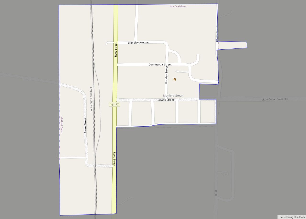
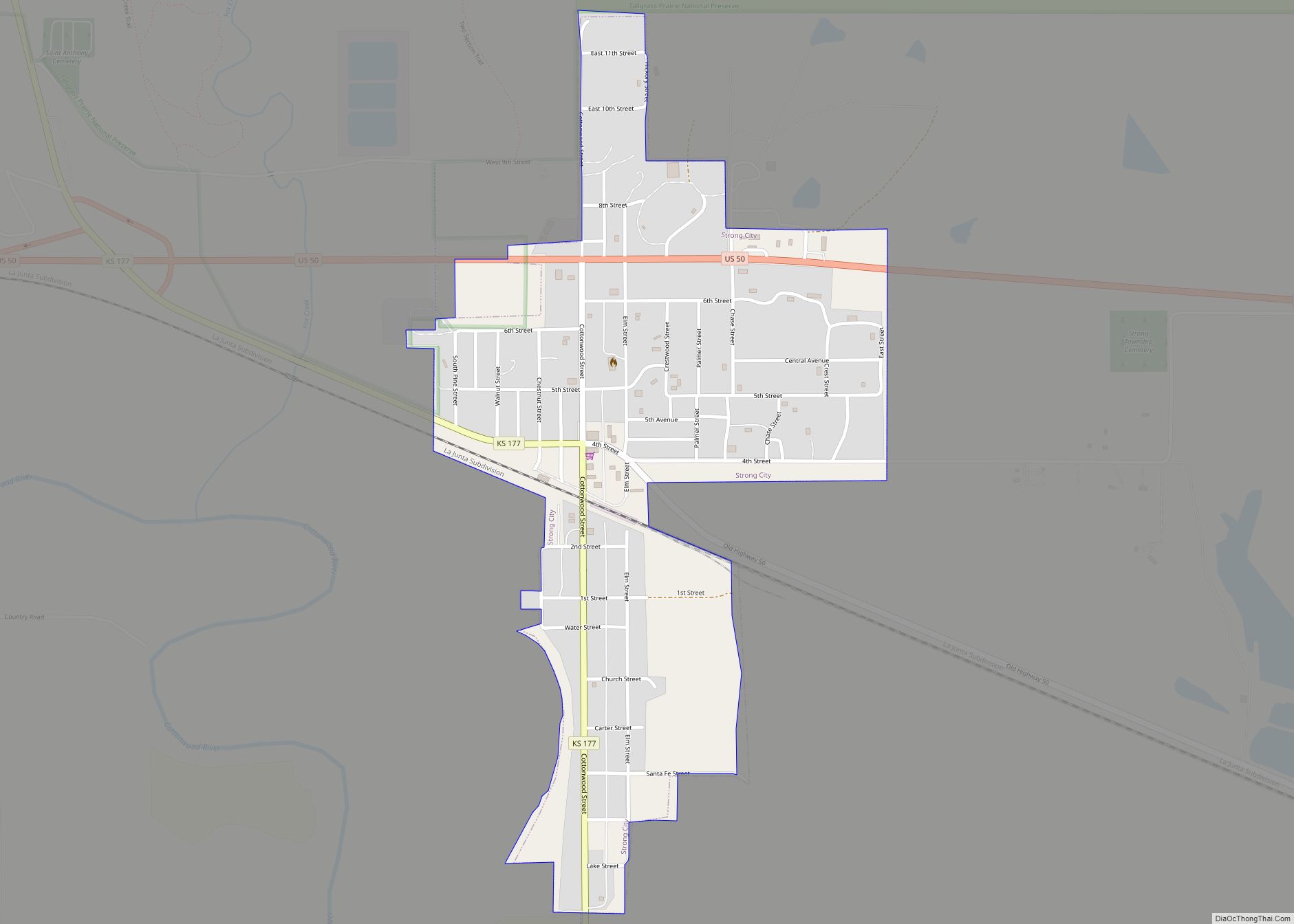
Online Interactive Map
Click on ![]() to view map in "full screen" mode.
to view map in "full screen" mode.
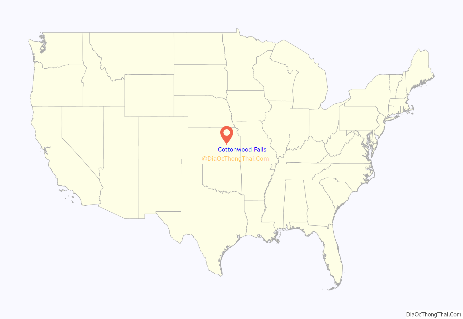
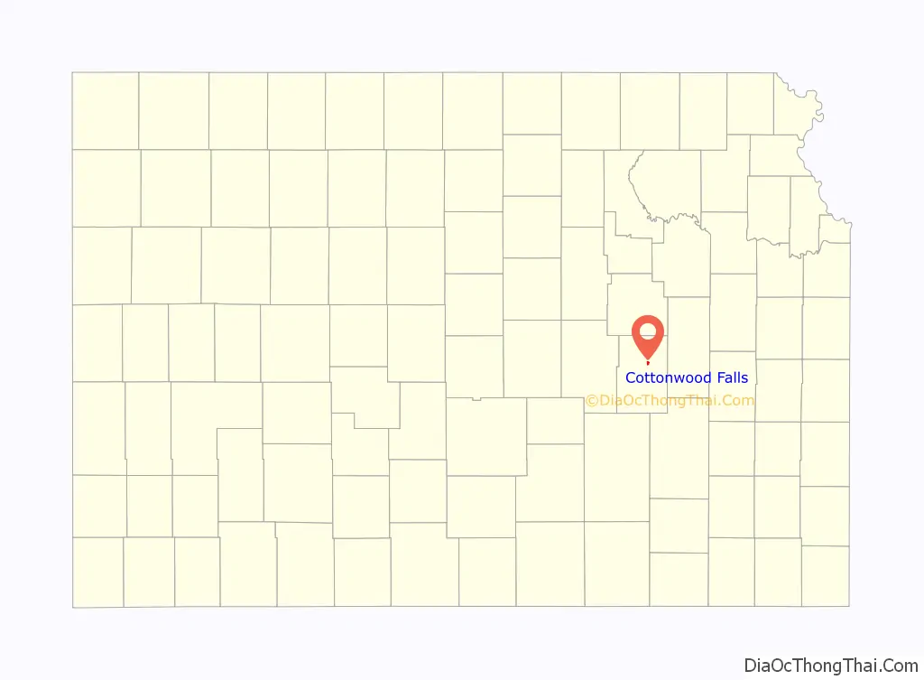
Cottonwood Falls location map. Where is Cottonwood Falls city?
History
Early history
For many millennia, the Great Plains of North America was inhabited by nomadic Native Americans. From the 16th century to 18th century, the Kingdom of France claimed ownership of large parts of North America. In 1762, after the French and Indian War, France secretly ceded New France to Spain, per the Treaty of Fontainebleau.
19th century
In 1802, Spain returned most of the land to France. In 1803, most of the land for modern day Kansas was acquired by the United States from France as part of the 828,000 square mile Louisiana Purchase for 2.83 cents per acre.
In 1854, the Kansas Territory was organized, then in 1861 Kansas became the 34th U.S. state. In 1859, Chase County was established within the Kansas Territory, which included the land for modern day Cottonwood Falls.
The first settlement in the area of Cottonwood Falls was in 1854, when an Indian trader named Seth Hayes founded a cattle ranch on the Cottonwood River close to the mouth of Diamond Spring Creek. The area around the town was organized as Chase County in 1859, and Cottonwood Falls was designated the temporary county seat. Other early settlers arrived in Cottonwood and surrounding lands in 1856 to 1858.
The first post office in Cottonwood Falls was established in 1858. In 1873 the city’s French Renaissance style Chase County courthouse was built; at roughly the same time, the Atchison, Topeka and Santa Fe Railway reached Cottonwood Falls area. Through the late 19th and early 20th centuries the area around the city was mainly divided into farms and cattle ranches.
20th century
In 1931, a Transcontinental & Western Air flight crashed ten miles south of Cottonwood Falls near the community of Bazaar, killing all eight on board, including University of Notre Dame football coach Knute Rockne. A monument to the crash is located on private property.
There have been numerous floods during the history of Cottonwood Falls. In June and July 1951, due to heavy rains, rivers and streams flooded numerous cities in Kansas, including Cottonwood Falls. Many reservoirs and levees were built in Kansas as part of a response to the Great Flood of 1951.
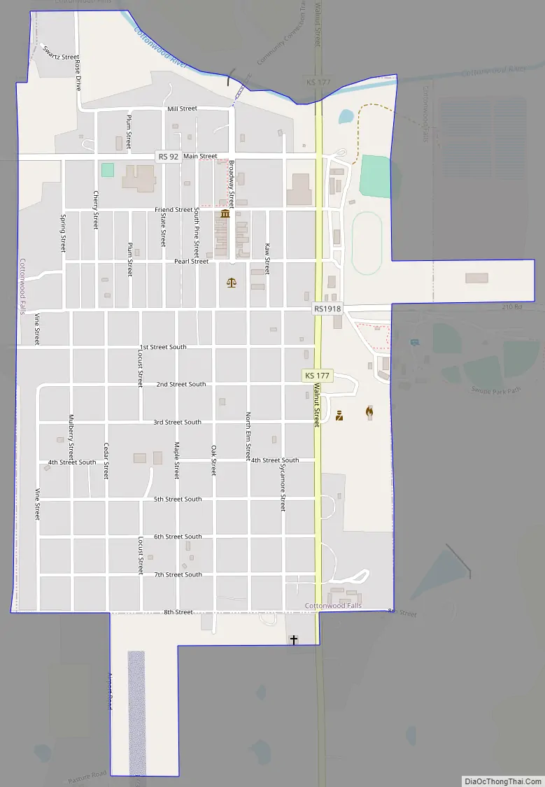
Cottonwood Falls Road Map
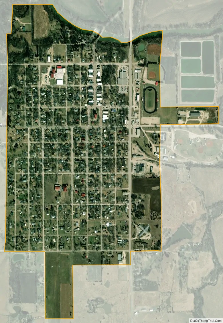
Cottonwood Falls city Satellite Map
Geography
Cottonwood Falls is located at 38°22′5″N 96°32′35″W / 38.36806°N 96.54306°W / 38.36806; -96.54306 (38.368159, -96.542918), in the scenic Flint Hills of the Great Plains. According to the United States Census Bureau, the city has a total area of 0.60 square miles (1.55 km), of which 0.59 square miles (1.53 km) is land and 0.01 square miles (0.03 km) is water.
Climate
The climate in this area is characterized by hot, humid summers and generally mild to cool winters. According to the Köppen Climate Classification system, Cottonwood Falls has a humid subtropical climate, abbreviated “Cfa” on climate maps.
See also
Map of Kansas State and its subdivision:- Allen
- Anderson
- Atchison
- Barber
- Barton
- Bourbon
- Brown
- Butler
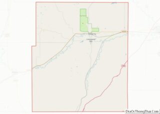
- Chase
- Chautauqua
- Cherokee
- Cheyenne
- Clark
- Clay
- Cloud
- Coffey
- Comanche
- Cowley
- Crawford
- Decatur
- Dickinson
- Doniphan
- Douglas
- Edwards
- Elk
- Ellis
- Ellsworth
- Finney
- Ford
- Franklin
- Geary
- Gove
- Graham
- Grant
- Gray
- Greeley
- Greenwood
- Hamilton
- Harper
- Harvey
- Haskell
- Hodgeman
- Jackson
- Jefferson
- Jewell
- Johnson
- Kearny
- Kingman
- Kiowa
- Labette
- Lane
- Leavenworth
- Lincoln
- Linn
- Logan
- Lyon
- Marion
- Marshall
- McPherson
- Meade
- Miami
- Mitchell
- Montgomery
- Morris
- Morton
- Nemaha
- Neosho
- Ness
- Norton
- Osage
- Osborne
- Ottawa
- Pawnee
- Phillips
- Pottawatomie
- Pratt
- Rawlins
- Reno
- Republic
- Rice
- Riley
- Rooks
- Rush
- Russell
- Saline
- Scott
- Sedgwick
- Seward
- Shawnee
- Sheridan
- Sherman
- Smith
- Stafford
- Stanton
- Stevens
- Sumner
- Thomas
- Trego
- Wabaunsee
- Wallace
- Washington
- Wichita
- Wilson
- Woodson
- Wyandotte
- Alabama
- Alaska
- Arizona
- Arkansas
- California
- Colorado
- Connecticut
- Delaware
- District of Columbia
- Florida
- Georgia
- Hawaii
- Idaho
- Illinois
- Indiana
- Iowa
- Kansas
- Kentucky
- Louisiana
- Maine
- Maryland
- Massachusetts
- Michigan
- Minnesota
- Mississippi
- Missouri
- Montana
- Nebraska
- Nevada
- New Hampshire
- New Jersey
- New Mexico
- New York
- North Carolina
- North Dakota
- Ohio
- Oklahoma
- Oregon
- Pennsylvania
- Rhode Island
- South Carolina
- South Dakota
- Tennessee
- Texas
- Utah
- Vermont
- Virginia
- Washington
- West Virginia
- Wisconsin
- Wyoming