Eudora is a city in Douglas County, Kansas, United States, along the Kansas and Wakarusa rivers. As of the 2020 census, the population of the city was 6,408.
| Name: | Eudora city |
|---|---|
| LSAD Code: | 25 |
| LSAD Description: | city (suffix) |
| State: | Kansas |
| County: | Douglas County |
| Incorporated: | 1859 |
| Elevation: | 840 ft (260 m) |
| Total Area: | 2.98 sq mi (7.73 km²) |
| Land Area: | 2.94 sq mi (7.61 km²) |
| Water Area: | 0.05 sq mi (0.12 km²) |
| Total Population: | 6,408 |
| Population Density: | 2,200/sq mi (830/km²) |
| ZIP code: | 66025 |
| Area code: | 785 |
| FIPS code: | 2021675 |
| Website: | CityOfEudoraks.gov |
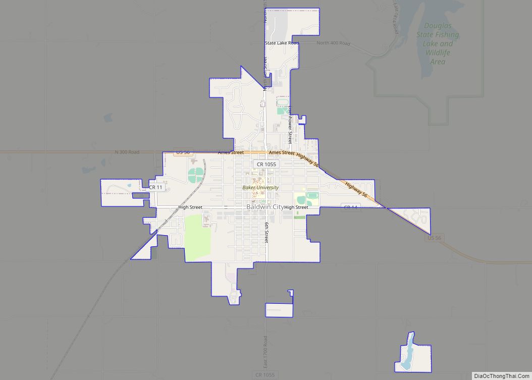
Online Interactive Map
Click on ![]() to view map in "full screen" mode.
to view map in "full screen" mode.
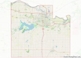
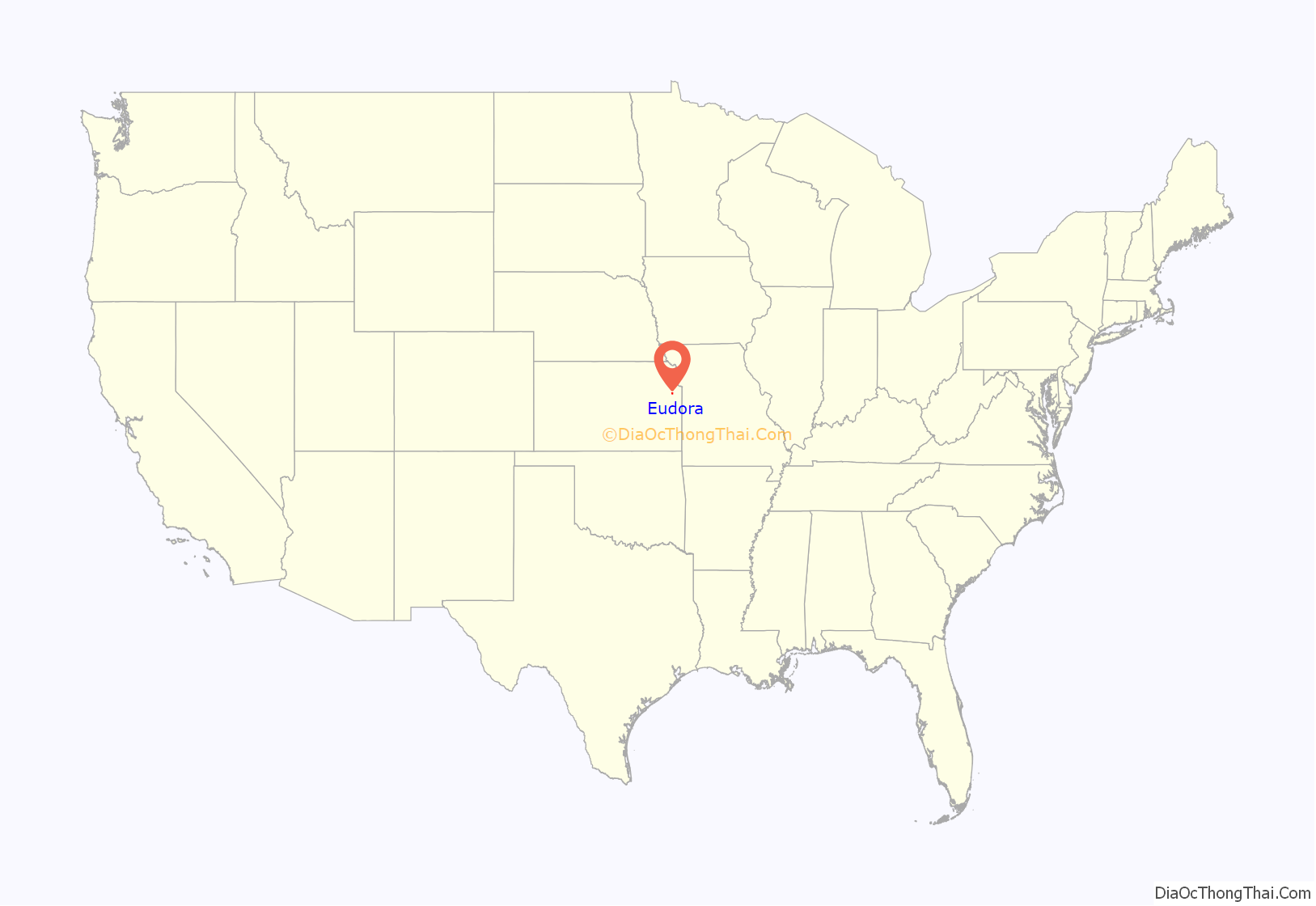
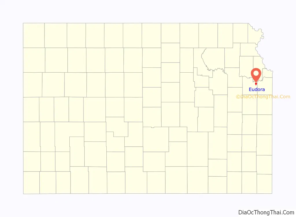
Eudora location map. Where is Eudora city?
History
The Eudora area was home to various Native American tribes for thousands of years. The Kansa tribe lived in the Eudora area from the 1600s to the early 1800s. The Kansa lived along the rivers of this region in villages and practiced agriculture. A Kansa village was located at the site of modern day Eudora in the 1790s. In the 1820s the Kansa were forcibly removed from the region by the U.S. government to make room for the Shawnee tribe. The Oregon Trail and Santa Fe Trail passed through the region, just a few miles south of modern Eudora.
In 1854 the Kansas–Nebraska Act was passed, creating the Kansas Territory and opening the region to settlement by Americans. As a result of the Kansas–Nebraska Act, Americans settlers started to encroach upon Indian lands. In 1856, three members of a German Immigrant Settlement Company (called Deutsche-Neusiedlungsverein) from Chicago, sent out a location committee to choose a town site in the new Kansas Territory. Favoring the Eudora area, they drew up contracts with Shawnee Chief Paschal Fish, the original owner of the town site. The new town was named Eudora in honor of Chief Fish’s daughter. The first post office in Eudora was established in September, 1857. Eudora was incorporated in 1859.
Eudora was the site of conflict during the Bleeding Kansas Era and the American Civil War. Eudora strongly supported the Union during the Civil War, many of its men enlisted to defeat the Confederacy. William Quantrill passed through the Eudora area in 1863 on his way to Lawrence, Kansas to commit his infamous and deadly raid on the unsuspecting town. Several Eudora residents attempted to warn Lawrence of Quantrill’s proximity, but two men were thrown from their horses, one of them dying as a result of his injuries. After the raid, Eudorans were quick to aid the citizens of Lawrence as they started their recovery.
After the Civil War, relative stability finally arrived to the region. Eudora grew rapidly in the late 19th century, In the 1860s, a small Jewish community was based in Eudora. In the late 1800s, a sizeable African American community was based in Eudora, as much as 25% of the Eudora community was Black in 1870. Growth in Eudora leveled in the early 20th century. In the recent decades, Eudora has again grown tremendously as a result of its proximity to Lawrence and Kansas City and its location along Kansas Highway 10.
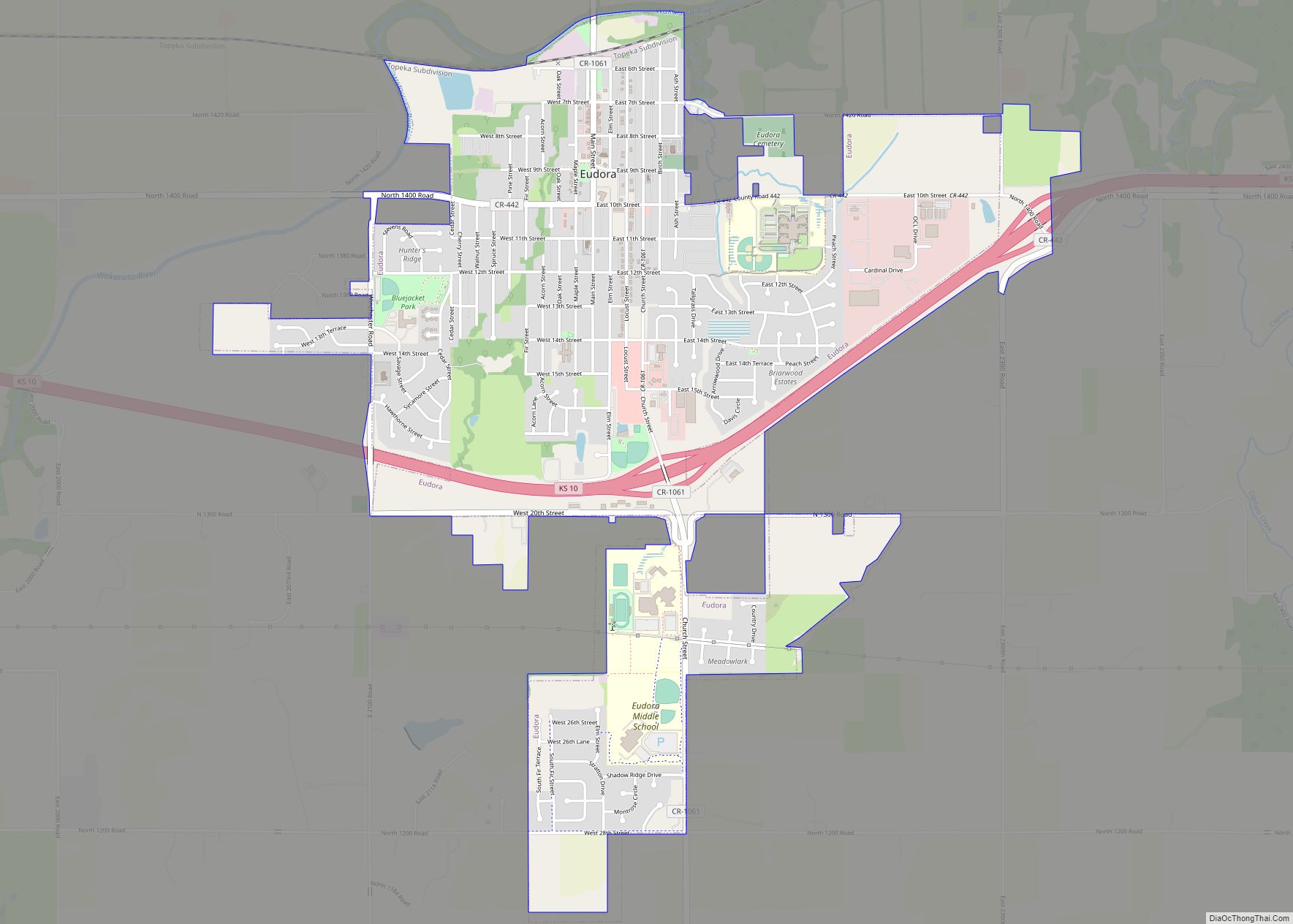
Eudora Road Map
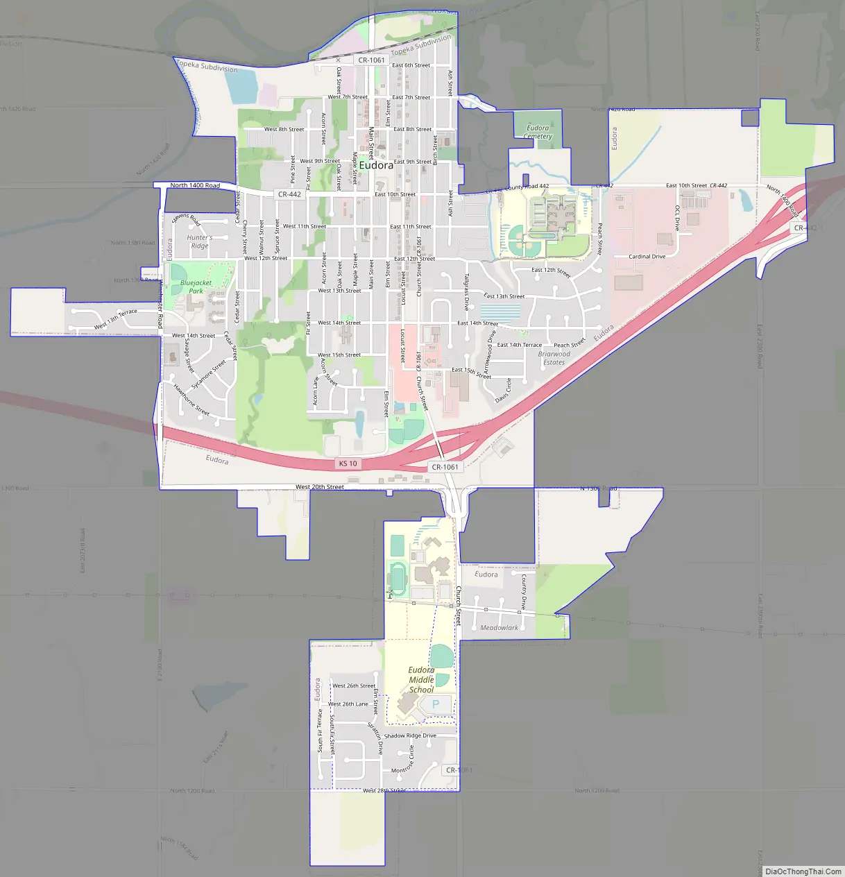
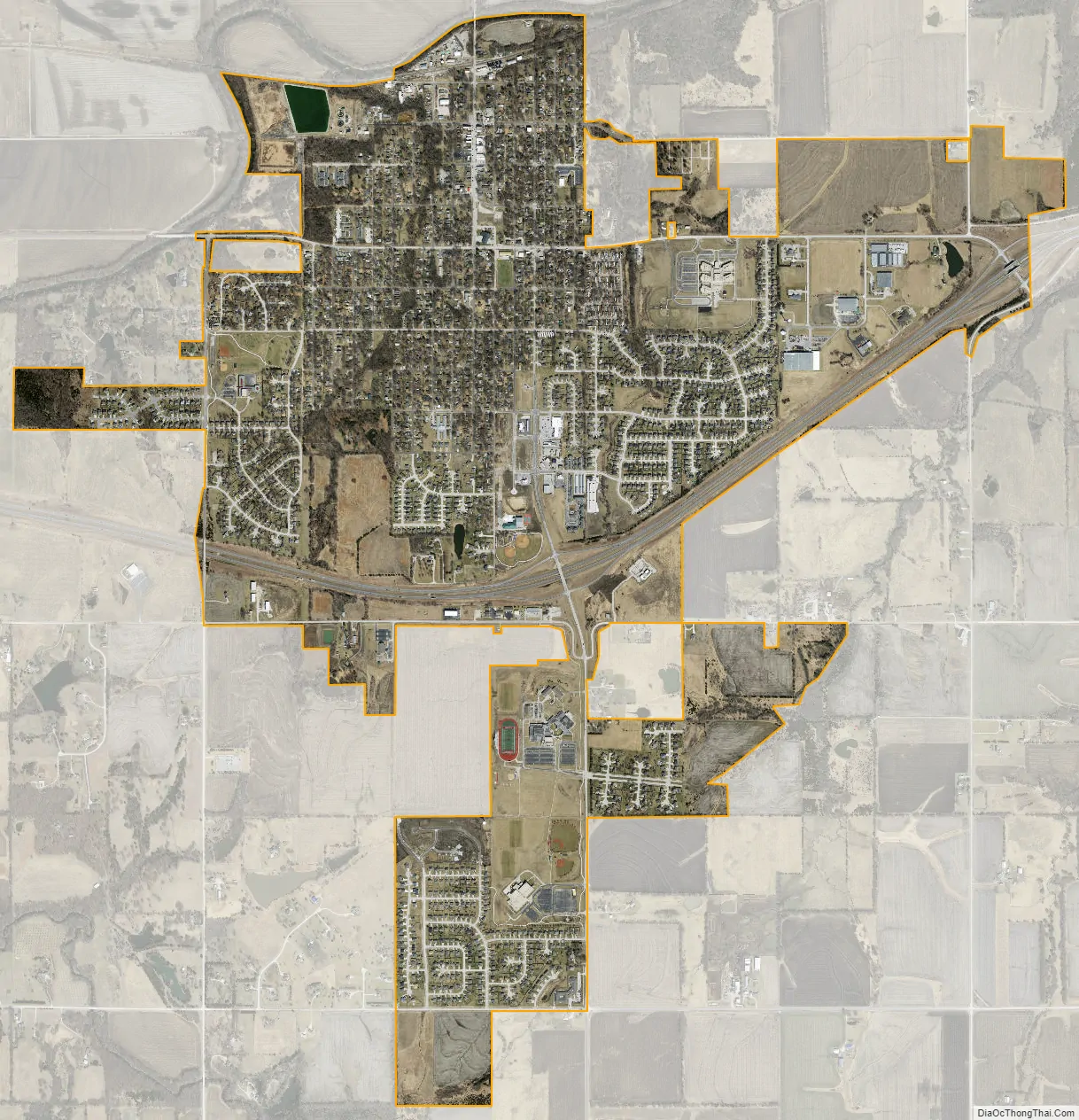
Eudora city Satellite Map
Geography
Eudora is located at 38°56′18″N 95°5′51″W / 38.93833°N 95.09750°W / 38.93833; -95.09750 (38.938213, −95.097417). According to the United States Census Bureau, the city has a total area of 2.94 square miles (7.61 km), of which, 2.89 square miles (7.49 km) is land and 0.05 square miles (0.13 km) is water.
See also
Map of Kansas State and its subdivision:- Allen
- Anderson
- Atchison
- Barber
- Barton
- Bourbon
- Brown
- Butler
- Chase
- Chautauqua
- Cherokee
- Cheyenne
- Clark
- Clay
- Cloud
- Coffey
- Comanche
- Cowley
- Crawford
- Decatur
- Dickinson
- Doniphan
- Douglas
- Edwards
- Elk
- Ellis
- Ellsworth
- Finney
- Ford
- Franklin
- Geary
- Gove
- Graham
- Grant
- Gray
- Greeley
- Greenwood
- Hamilton
- Harper
- Harvey
- Haskell
- Hodgeman
- Jackson
- Jefferson
- Jewell
- Johnson
- Kearny
- Kingman
- Kiowa
- Labette
- Lane
- Leavenworth
- Lincoln
- Linn
- Logan
- Lyon
- Marion
- Marshall
- McPherson
- Meade
- Miami
- Mitchell
- Montgomery
- Morris
- Morton
- Nemaha
- Neosho
- Ness
- Norton
- Osage
- Osborne
- Ottawa
- Pawnee
- Phillips
- Pottawatomie
- Pratt
- Rawlins
- Reno
- Republic
- Rice
- Riley
- Rooks
- Rush
- Russell
- Saline
- Scott
- Sedgwick
- Seward
- Shawnee
- Sheridan
- Sherman
- Smith
- Stafford
- Stanton
- Stevens
- Sumner
- Thomas
- Trego
- Wabaunsee
- Wallace
- Washington
- Wichita
- Wilson
- Woodson
- Wyandotte
- Alabama
- Alaska
- Arizona
- Arkansas
- California
- Colorado
- Connecticut
- Delaware
- District of Columbia
- Florida
- Georgia
- Hawaii
- Idaho
- Illinois
- Indiana
- Iowa
- Kansas
- Kentucky
- Louisiana
- Maine
- Maryland
- Massachusetts
- Michigan
- Minnesota
- Mississippi
- Missouri
- Montana
- Nebraska
- Nevada
- New Hampshire
- New Jersey
- New Mexico
- New York
- North Carolina
- North Dakota
- Ohio
- Oklahoma
- Oregon
- Pennsylvania
- Rhode Island
- South Carolina
- South Dakota
- Tennessee
- Texas
- Utah
- Vermont
- Virginia
- Washington
- West Virginia
- Wisconsin
- Wyoming