Lawrence is the county seat of Douglas County, Kansas, United States, and the sixth-largest city in the state. It is in the northeastern sector of the state, astride Interstate 70, between the Kansas and Wakarusa Rivers. As of the 2020 census, the population of the city was 94,934. Lawrence is a college town and the home to both the University of Kansas and Haskell Indian Nations University.
Lawrence was founded by the New England Emigrant Aid Company (NEEAC) and was named for Amos A. Lawrence, an abolitionist from Massachusetts, who offered financial aid and support for the settlement. Lawrence was central to the “Bleeding Kansas” period (1854–1861), and the site of the Wakarusa War (1855) and the Sacking of Lawrence (1856). During the American Civil War it was also the site of the Lawrence massacre (1863).
Lawrence began as a center of free-state politics. Its economy diversified into many industries, including agriculture, manufacturing, and education, beginning with the founding of the University of Kansas in 1865 and Haskell Indian Nations University in 1884.
| Name: | Lawrence city |
|---|---|
| LSAD Code: | 25 |
| LSAD Description: | city (suffix) |
| State: | Kansas |
| County: | Douglas County |
| Founded: | 1854 |
| Incorporated: | February 20, 1858 |
| Elevation: | 866 ft (264 m) |
| Total Area: | 34.97 sq mi (90.57 km²) |
| Land Area: | 34.14 sq mi (88.42 km²) |
| Water Area: | 0.83 sq mi (2.14 km²) |
| Total Population: | 94,934 |
| Population Density: | 2,700/sq mi (1,000/km²) |
| ZIP code: | 66044-66047, 66049 |
| Area code: | 785 |
| FIPS code: | 2038900 |
| Website: | lawrenceks.org |
Online Interactive Map
Click on ![]() to view map in "full screen" mode.
to view map in "full screen" mode.
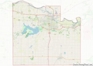
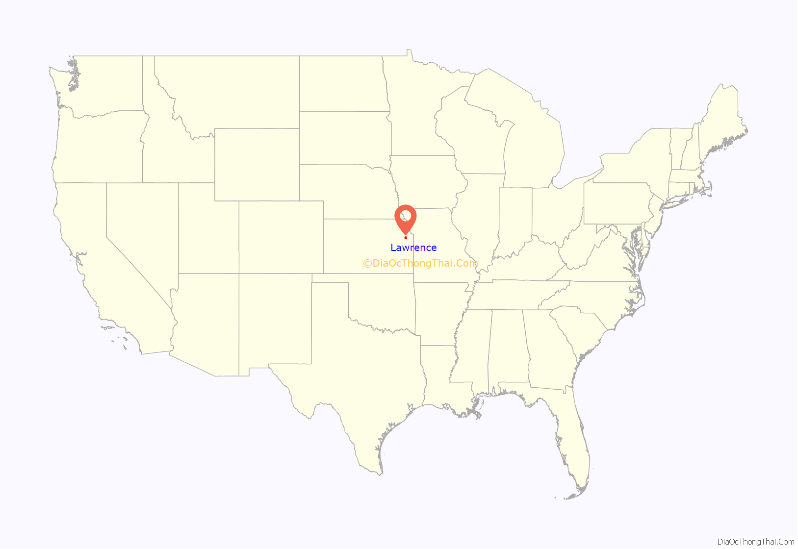
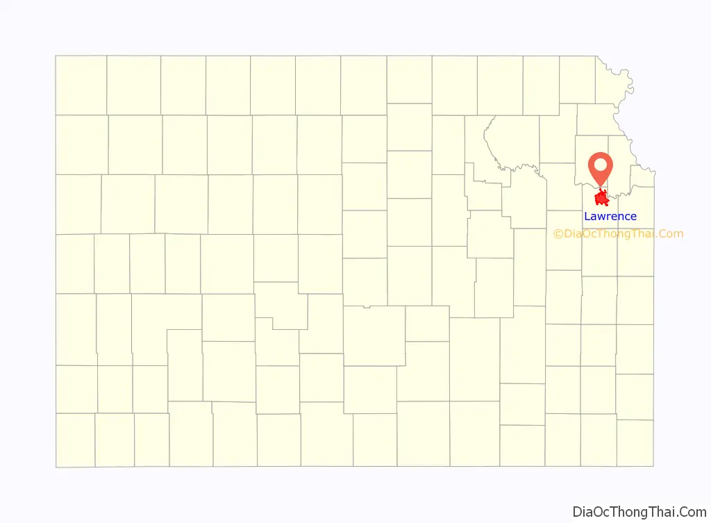
Lawrence location map. Where is Lawrence city?
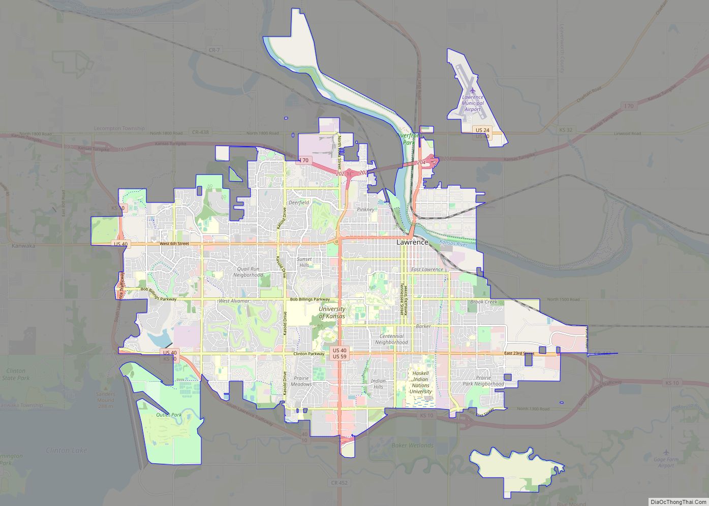
Lawrence Road Map
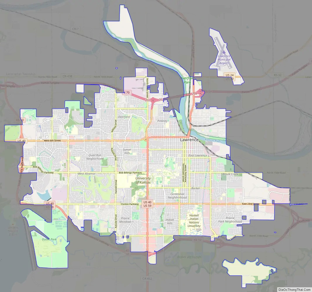
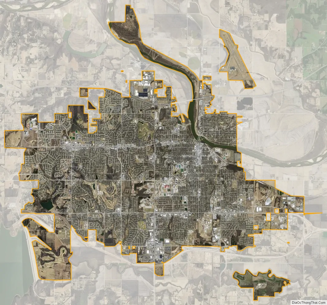
Lawrence city Satellite Map
Geography
Lawrence is located at coordinates 38.9716689, -95.2352501 in the state of Kansas, approximately 25 miles (40 kilometers) east of Topeka, and 35 mi (56 km) west of Kansas City, Kansas. Though Lawrence has a designated elevation of 866 feet (264 m), the highest elevation is Mount Oread on the University of Kansas campus with an elevation of 1,020 feet (310 m).
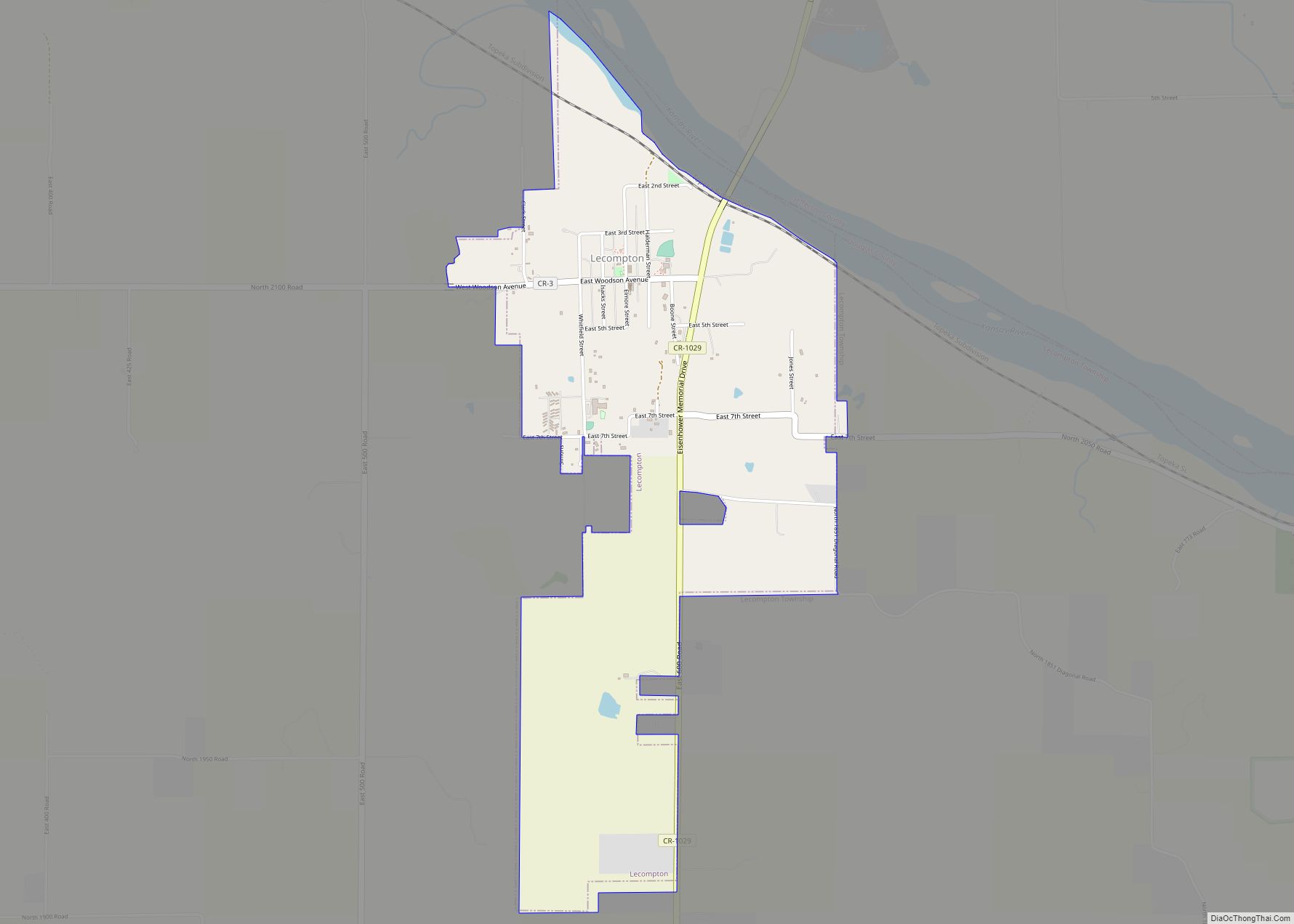
The city lies on the southern edge of the Dissected Till Plains, bordering the Osage Plains to the south. According to the United States Census Bureau, the city has a total area of 34.26 square miles (88.73 km), of which, 33.56 square miles (86.92 km) is land and 0.70 square miles (1.81 km) is water, and is split between Wakarusa Township and Grant Township with small portions in Lecompton, Kanwaka and Clinton Townships.
Lawrence is between the Kansas and Wakarusa Rivers. Several major creeks flow through Lawrence. Burroughs Creek in East Lawrence (named after the writer William S. Burroughs, who retired in East Lawrence) and Baldwin Creek in northwestern Lawrence empty into the Kansas River. Yankee Tank Creek in southwest Lawrence and an unnamed creek that flows through central Lawrence converge with the Wakarusa River south of the city. Yankee Tank Creek is dammed to form Lake Alvamar, which was originally called Yankee Tank Lake. The Wakarusa River was dammed to form Clinton Lake. Potter Lake is on the University of Kansas Campus and Mary’s Lake is in southeastern Lawrence within Prairie Park. The Haskell-Baker Wetlands, maintained by Haskell University and Baker University, is an extensive open space in the southern part of the city that features wetlands, native plants, hiking and biking trails, and interpretative signage about the prairie and wetland ecosystems.
Lawrence has 54 parks which include community and neighborhood parks, trails, cemeteries and nature preserves. A new, multi-use trail system called the Lawrence Loop (“the Loop”) encircles the city and, when fully completed, will create a 22-mile paved recreational trail, a green transportation network, and multiple opportunities for environmental restoration. Community parks include South Park, Buford Watson Park, Broken Arrow Park, Riverfront Park, Holcomb Park, “Dad” Perry Park, Centennial Park and Prairie Park. Cemeteries include Oak Hill, Maple Grove and Memorial Park. The first cemetery in Lawrence, Pioneer Cemetery, is on the University of Kansas campus and is maintained by KU.
Climate
Lawrence has a humid continental climate (Köppen Dfa), typically experiencing hot, humid summers and cold, dry winters. The monthly daily average temperature ranges from 28.4 °F (−2.0 °C) in January to 78.5 °F (25.8 °C) in July. The high temperature reaches or exceeds 90 °F (32 °C) an average of 32 days a year and 100 °F (38 °C) an average of 1.9 days. The minimum temperature falls to or below 0 °F (−18 °C) on an average 4.9 days a year. Extreme temperatures range from 111 °F (44 °C) on July 13 and 14, 1954 down to −21 °F (−29 °C) on December 22, 1989.
Lawrence receives an annual average of 39.9 inches (1,010 mm) of precipitation, most of which occurs in the warmer months, and records 96 days of measurable precipitation. Measurable snowfall occurs an average of 8 days per year with 4.6 days receiving at least 1.0 inch (2.5 cm). Snow depth of at least one inch occurs an average of 15.8 days a year.
See also
Map of Kansas State and its subdivision:- Allen
- Anderson
- Atchison
- Barber
- Barton
- Bourbon
- Brown
- Butler
- Chase
- Chautauqua
- Cherokee
- Cheyenne
- Clark
- Clay
- Cloud
- Coffey
- Comanche
- Cowley
- Crawford
- Decatur
- Dickinson
- Doniphan
- Douglas
- Edwards
- Elk
- Ellis
- Ellsworth
- Finney
- Ford
- Franklin
- Geary
- Gove
- Graham
- Grant
- Gray
- Greeley
- Greenwood
- Hamilton
- Harper
- Harvey
- Haskell
- Hodgeman
- Jackson
- Jefferson
- Jewell
- Johnson
- Kearny
- Kingman
- Kiowa
- Labette
- Lane
- Leavenworth
- Lincoln
- Linn
- Logan
- Lyon
- Marion
- Marshall
- McPherson
- Meade
- Miami
- Mitchell
- Montgomery
- Morris
- Morton
- Nemaha
- Neosho
- Ness
- Norton
- Osage
- Osborne
- Ottawa
- Pawnee
- Phillips
- Pottawatomie
- Pratt
- Rawlins
- Reno
- Republic
- Rice
- Riley
- Rooks
- Rush
- Russell
- Saline
- Scott
- Sedgwick
- Seward
- Shawnee
- Sheridan
- Sherman
- Smith
- Stafford
- Stanton
- Stevens
- Sumner
- Thomas
- Trego
- Wabaunsee
- Wallace
- Washington
- Wichita
- Wilson
- Woodson
- Wyandotte
- Alabama
- Alaska
- Arizona
- Arkansas
- California
- Colorado
- Connecticut
- Delaware
- District of Columbia
- Florida
- Georgia
- Hawaii
- Idaho
- Illinois
- Indiana
- Iowa
- Kansas
- Kentucky
- Louisiana
- Maine
- Maryland
- Massachusetts
- Michigan
- Minnesota
- Mississippi
- Missouri
- Montana
- Nebraska
- Nevada
- New Hampshire
- New Jersey
- New Mexico
- New York
- North Carolina
- North Dakota
- Ohio
- Oklahoma
- Oregon
- Pennsylvania
- Rhode Island
- South Carolina
- South Dakota
- Tennessee
- Texas
- Utah
- Vermont
- Virginia
- Washington
- West Virginia
- Wisconsin
- Wyoming