Frederick is a city in Rice County, Kansas, United States. As of the 2020 census, the population of the city was 8.
| Name: | Frederick city |
|---|---|
| LSAD Code: | 25 |
| LSAD Description: | city (suffix) |
| State: | Kansas |
| County: | Rice County |
| Incorporated: | 1909 |
| Elevation: | 1,759 ft (536 m) |
| Total Area: | 0.19 sq mi (0.50 km²) |
| Land Area: | 0.19 sq mi (0.50 km²) |
| Water Area: | 0.00 sq mi (0.00 km²) |
| Total Population: | 8 |
| Population Density: | 42/sq mi (16/km²) |
| Area code: | 620 |
| FIPS code: | 2024550 |
Online Interactive Map
Click on ![]() to view map in "full screen" mode.
to view map in "full screen" mode.
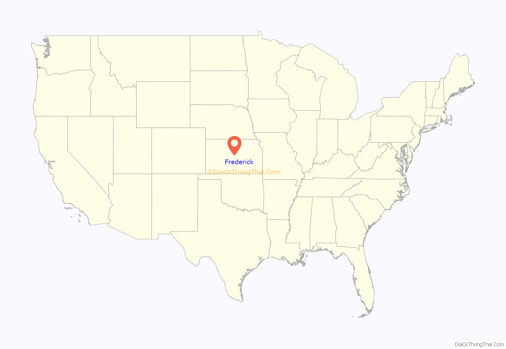
Frederick location map. Where is Frederick city?
History
Frederick was incorporated in 1909. It was a shipping point at the junction of the Missouri Patfic and the St. Louis & San Francisco railroads.
A post office was opened in Frederick (also spelled historically Frederic) in 1887, and remained in operation until it was discontinued in 1954.
In July 2015, Government officials report considering un-incorporating the city. As of August 2015, for the first time in nearly 130 years, the city doesn’t have a city council and no one ran for mayor in April 2015. The future of Frederick is uncertain because Rice County doesn’t have the power to unincorporate the city. According to state law, residents must bring a petition to the city council, then a special election will be called for a vote, but since there isn’t a city council then it can’t happen.
In November 2016, the community voted on whether dissolve Frederick. Election workers at the Eureka Township voting location accidentally made a mistake by giving the wrong ballots to township residents who didn’t actually live in Frederick. 20 people voted, 13 voted to keep the community alive, but currently, only 9 people live in Frederick. The mistake was caught more than a week after the vote was certified, which is after the 5 day window to contest a vote, thus Kansas Law locked the outcome, Frederick is still a city.
In November 2017, another ballot issue was voted on whether to dissolve the city. The vote was 2-2.
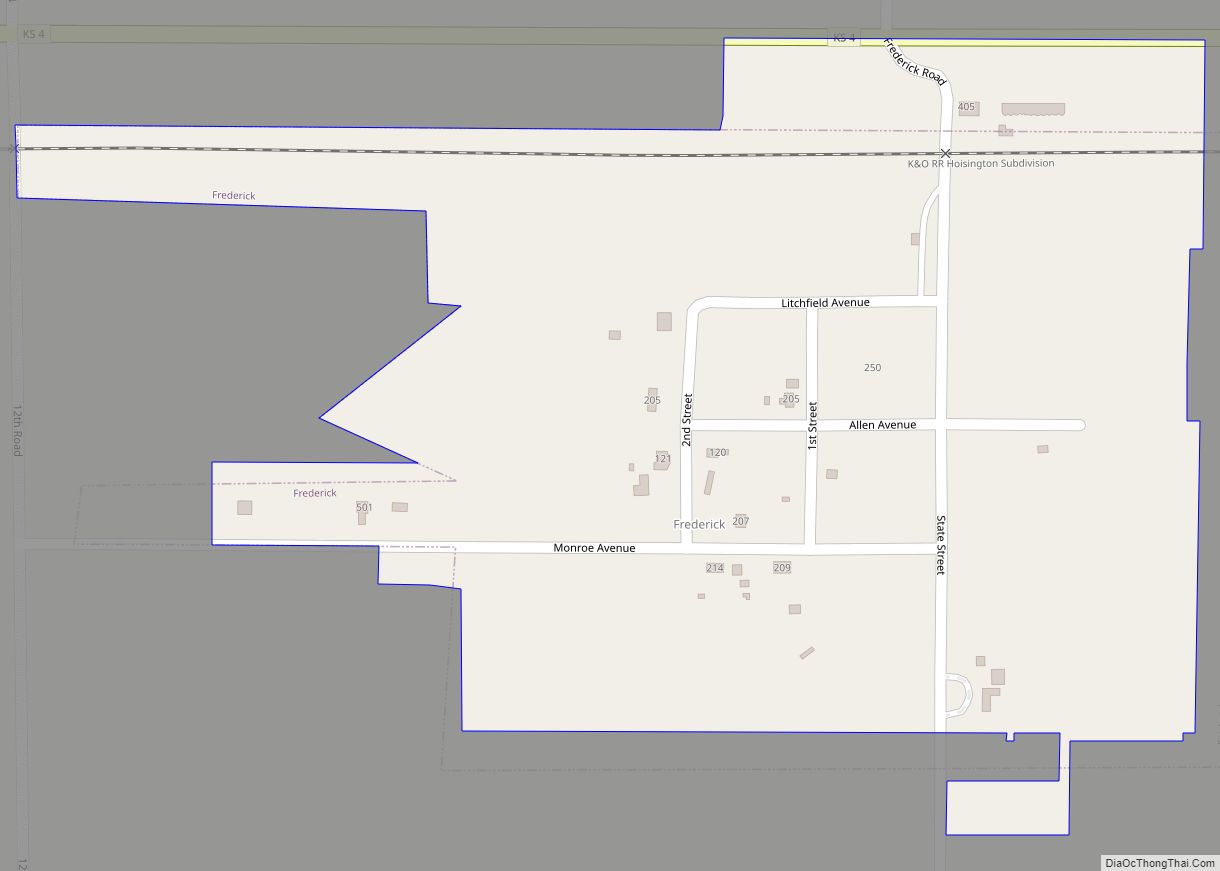
Frederick Road Map
Frederick city Satellite Map
Geography
Frederick is located at 38°30′48″N 98°16′6″W / 38.51333°N 98.26833°W / 38.51333; -98.26833 (38.513108, -98.267756). According to the United States Census Bureau, the city has a total area of 0.19 square miles (0.49 km), all of it land.
See also
Map of Kansas State and its subdivision:- Allen
- Anderson
- Atchison
- Barber
- Barton
- Bourbon
- Brown
- Butler
- Chase
- Chautauqua
- Cherokee
- Cheyenne
- Clark
- Clay
- Cloud
- Coffey
- Comanche
- Cowley
- Crawford
- Decatur
- Dickinson
- Doniphan
- Douglas
- Edwards
- Elk
- Ellis
- Ellsworth
- Finney
- Ford
- Franklin
- Geary
- Gove
- Graham
- Grant
- Gray
- Greeley
- Greenwood
- Hamilton
- Harper
- Harvey
- Haskell
- Hodgeman
- Jackson
- Jefferson
- Jewell
- Johnson
- Kearny
- Kingman
- Kiowa
- Labette
- Lane
- Leavenworth
- Lincoln
- Linn
- Logan
- Lyon
- Marion
- Marshall
- McPherson
- Meade
- Miami
- Mitchell
- Montgomery
- Morris
- Morton
- Nemaha
- Neosho
- Ness
- Norton
- Osage
- Osborne
- Ottawa
- Pawnee
- Phillips
- Pottawatomie
- Pratt
- Rawlins
- Reno
- Republic
- Rice
- Riley
- Rooks
- Rush
- Russell
- Saline
- Scott
- Sedgwick
- Seward
- Shawnee
- Sheridan
- Sherman
- Smith
- Stafford
- Stanton
- Stevens
- Sumner
- Thomas
- Trego
- Wabaunsee
- Wallace
- Washington
- Wichita
- Wilson
- Woodson
- Wyandotte
- Alabama
- Alaska
- Arizona
- Arkansas
- California
- Colorado
- Connecticut
- Delaware
- District of Columbia
- Florida
- Georgia
- Hawaii
- Idaho
- Illinois
- Indiana
- Iowa
- Kansas
- Kentucky
- Louisiana
- Maine
- Maryland
- Massachusetts
- Michigan
- Minnesota
- Mississippi
- Missouri
- Montana
- Nebraska
- Nevada
- New Hampshire
- New Jersey
- New Mexico
- New York
- North Carolina
- North Dakota
- Ohio
- Oklahoma
- Oregon
- Pennsylvania
- Rhode Island
- South Carolina
- South Dakota
- Tennessee
- Texas
- Utah
- Vermont
- Virginia
- Washington
- West Virginia
- Wisconsin
- Wyoming
