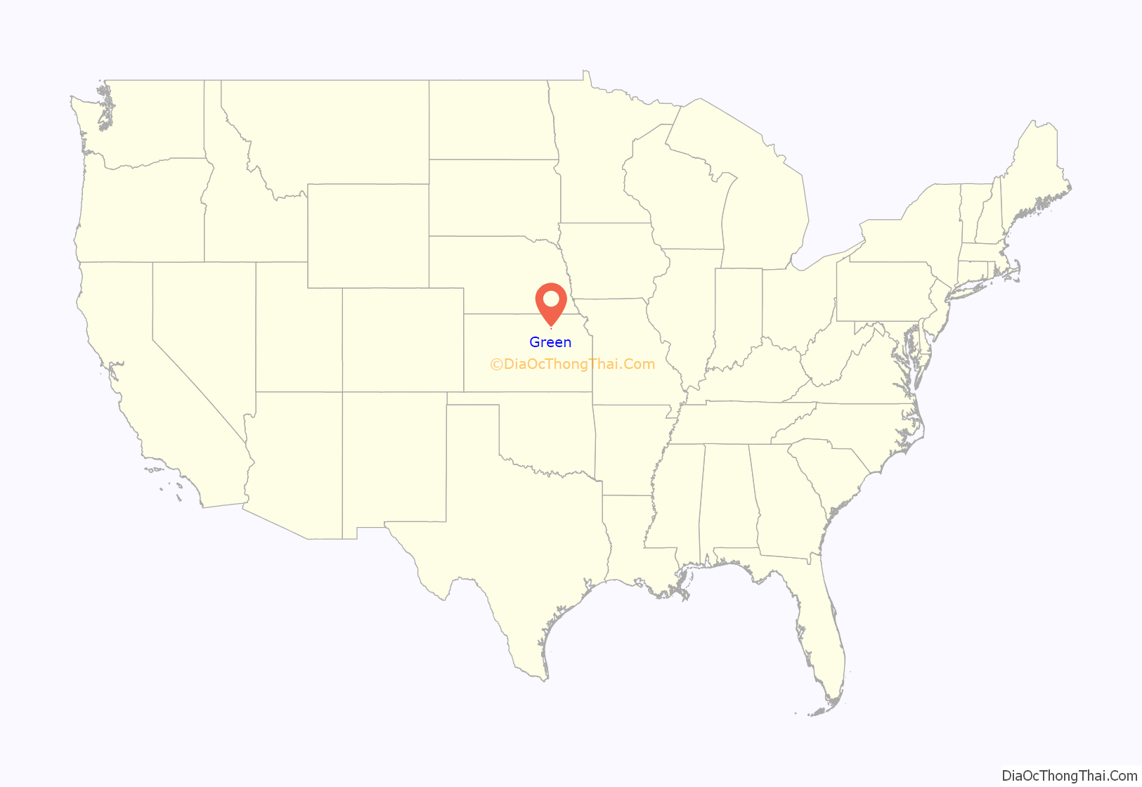
Green is a city in Clay County, Kansas, United States. As of the 2020 census, the population of the city was 95.
| Name: | Green city |
|---|---|
| LSAD Code: | 25 |
| LSAD Description: | city (suffix) |
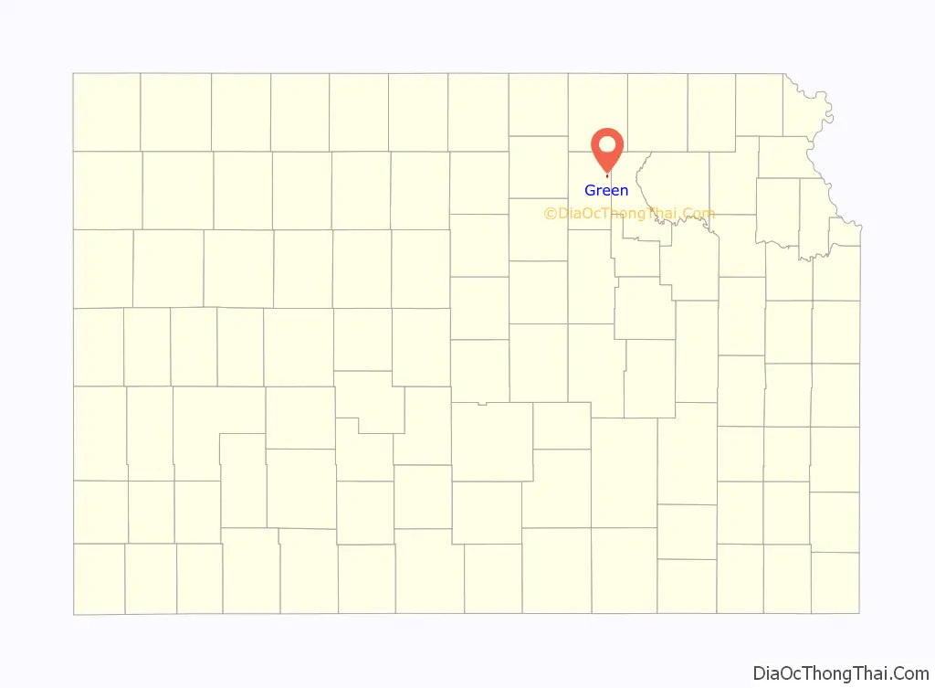
| State: | Kansas |
| County: | Clay County |
| Incorporated: | 1908 |
| Elevation: | 1,381 ft (421 m) |
| Total Area: | 0.20 sq mi (0.51 km²) |
| Land Area: | 0.20 sq mi (0.51 km²) |
| Water Area: | 0.00 sq mi (0.00 km²) |
| Total Population: | 95 |
| Population Density: | 480/sq mi (190/km²) |
| ZIP code: | 67447 |
| Area code: | 785 |
| FIPS code: | 2028425 |
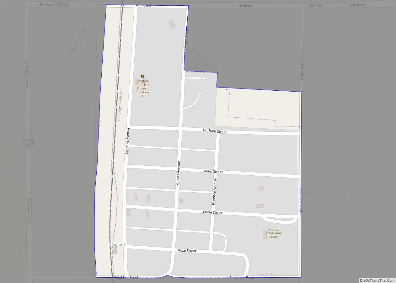
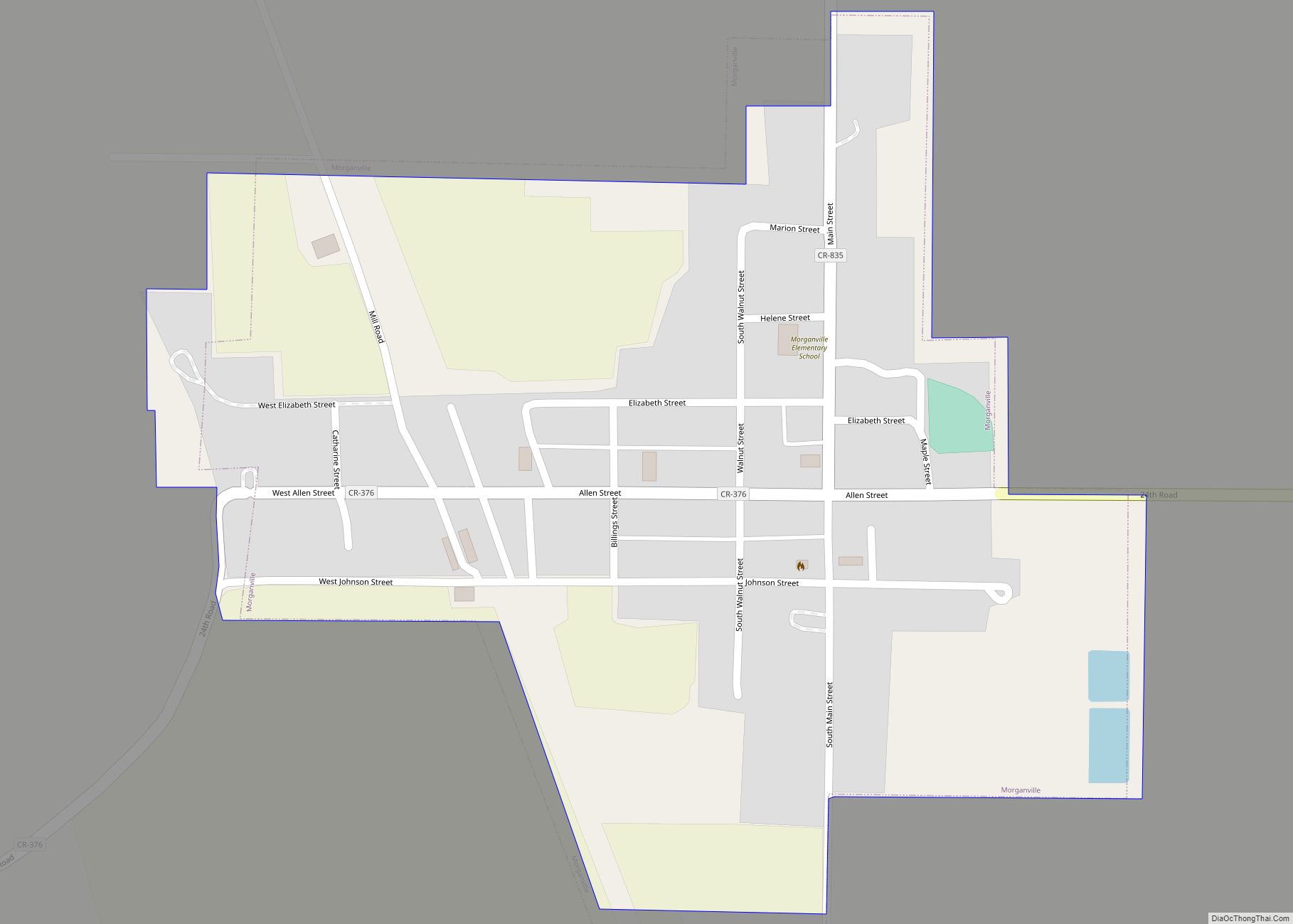
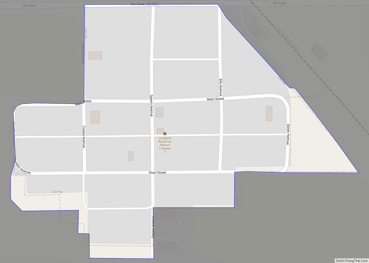
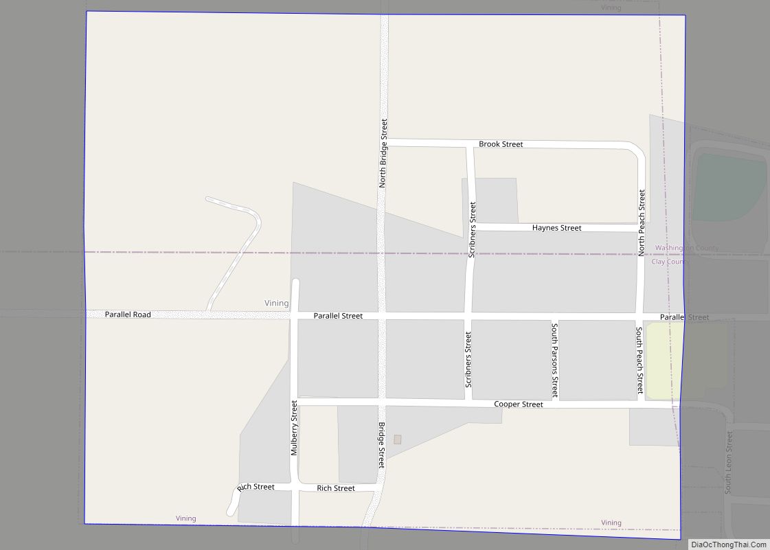
Online Interactive Map
Click on ![]() to view map in "full screen" mode.
to view map in "full screen" mode.
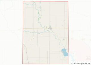
Green location map. Where is Green city?
History
A post office was opened in Powellsburgh (an extinct town) in 1872, but it was moved to Green in 1881.
Green was incorporated in 1908. It is named in honor of the fourth Governor of Kansas, Nehemiah Green, who offered to donate a church bell to the town in exchange for the naming rights.
Green was a shipping point on the Union Pacific Railroad.
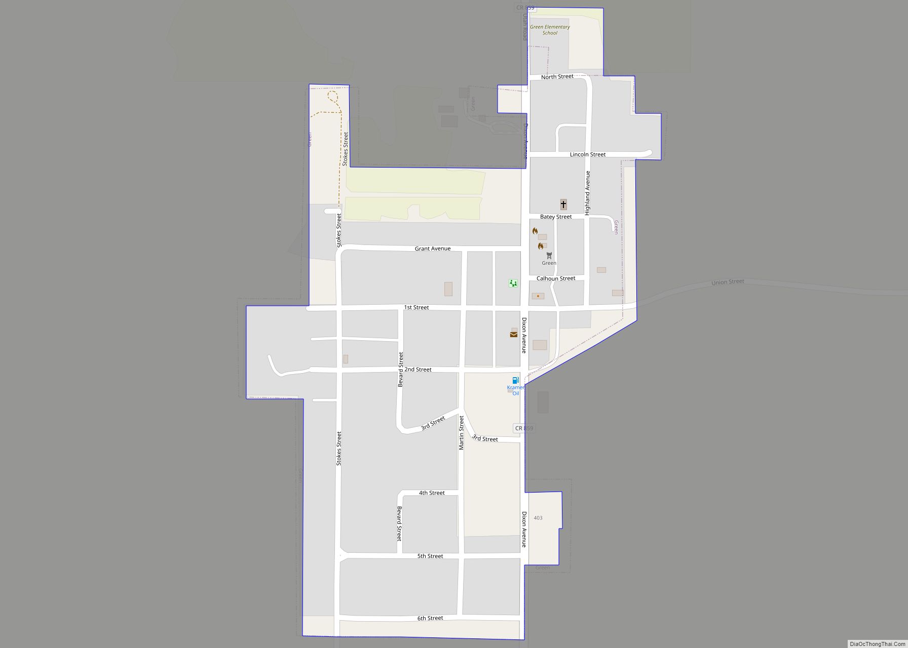
Green Road Map
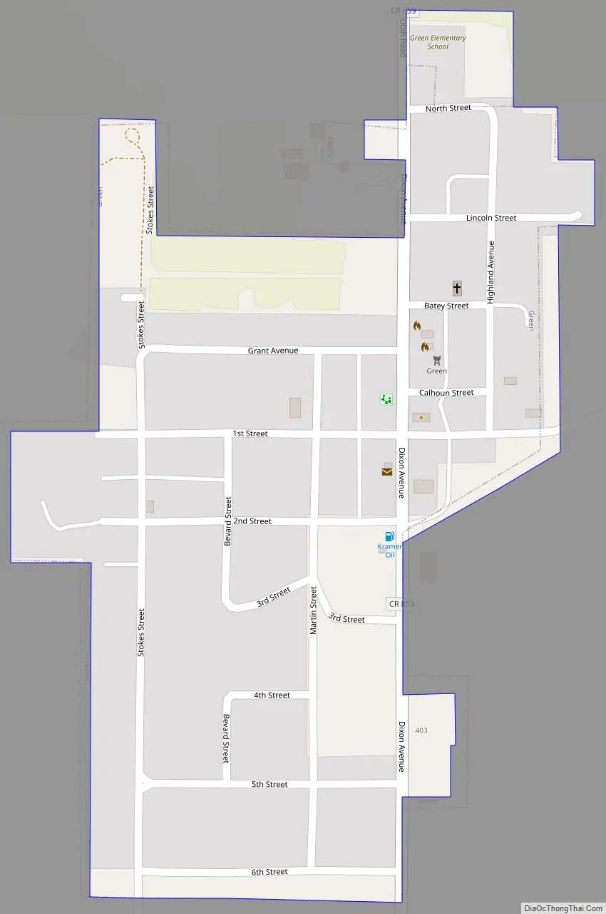
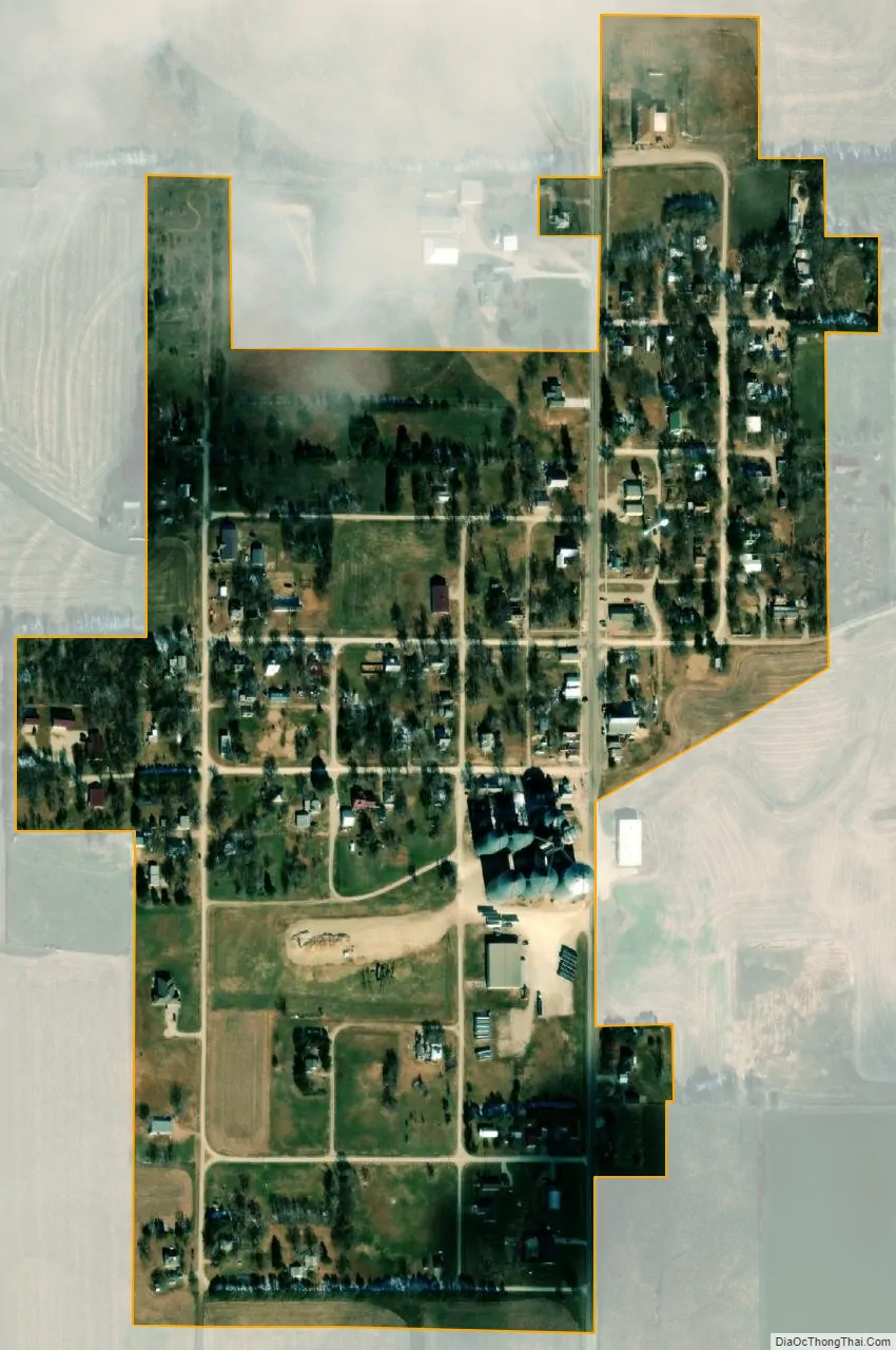
Green city Satellite Map
Geography
Green is located at 39°25′49″N 96°59′57″W / 39.430247°N 96.999195°W / 39.430247; -96.999195 (39.430247, -96.999195). According to the United States Census Bureau, the city has a total area of 0.20 square miles (0.52 km), all of it land.
See also
Map of Kansas State and its subdivision:- Allen
- Anderson
- Atchison
- Barber
- Barton
- Bourbon
- Brown
- Butler
- Chase
- Chautauqua
- Cherokee
- Cheyenne
- Clark
- Clay
- Cloud
- Coffey
- Comanche
- Cowley
- Crawford
- Decatur
- Dickinson
- Doniphan
- Douglas
- Edwards
- Elk
- Ellis
- Ellsworth
- Finney
- Ford
- Franklin
- Geary
- Gove
- Graham
- Grant
- Gray
- Greeley
- Greenwood
- Hamilton
- Harper
- Harvey
- Haskell
- Hodgeman
- Jackson
- Jefferson
- Jewell
- Johnson
- Kearny
- Kingman
- Kiowa
- Labette
- Lane
- Leavenworth
- Lincoln
- Linn
- Logan
- Lyon
- Marion
- Marshall
- McPherson
- Meade
- Miami
- Mitchell
- Montgomery
- Morris
- Morton
- Nemaha
- Neosho
- Ness
- Norton
- Osage
- Osborne
- Ottawa
- Pawnee
- Phillips
- Pottawatomie
- Pratt
- Rawlins
- Reno
- Republic
- Rice
- Riley
- Rooks
- Rush
- Russell
- Saline
- Scott
- Sedgwick
- Seward
- Shawnee
- Sheridan
- Sherman
- Smith
- Stafford
- Stanton
- Stevens
- Sumner
- Thomas
- Trego
- Wabaunsee
- Wallace
- Washington
- Wichita
- Wilson
- Woodson
- Wyandotte
- Alabama
- Alaska
- Arizona
- Arkansas
- California
- Colorado
- Connecticut
- Delaware
- District of Columbia
- Florida
- Georgia
- Hawaii
- Idaho
- Illinois
- Indiana
- Iowa
- Kansas
- Kentucky
- Louisiana
- Maine
- Maryland
- Massachusetts
- Michigan
- Minnesota
- Mississippi
- Missouri
- Montana
- Nebraska
- Nevada
- New Hampshire
- New Jersey
- New Mexico
- New York
- North Carolina
- North Dakota
- Ohio
- Oklahoma
- Oregon
- Pennsylvania
- Rhode Island
- South Carolina
- South Dakota
- Tennessee
- Texas
- Utah
- Vermont
- Virginia
- Washington
- West Virginia
- Wisconsin
- Wyoming