Hardtner is a city in Barber County, Kansas, United States. As of the 2020 census, the population of the city was 167. It is located 1 mile north of the Kansas / Oklahoma state border.
| Name: | Hardtner city |
|---|---|
| LSAD Code: | 25 |
| LSAD Description: | city (suffix) |
| State: | Kansas |
| County: | Barber County |
| Founded: | 1887 |
| Incorporated: | 1911 |
| Elevation: | 1,424 ft (434 m) |
| Total Area: | 0.28 sq mi (0.71 km²) |
| Land Area: | 0.28 sq mi (0.71 km²) |
| Water Area: | 0.00 sq mi (0.00 km²) |
| Total Population: | 167 |
| Population Density: | 600/sq mi (240/km²) |
| ZIP code: | 67057 |
| Area code: | 620 |
| FIPS code: | 2030000 |
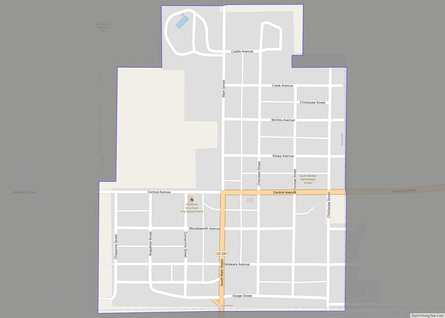
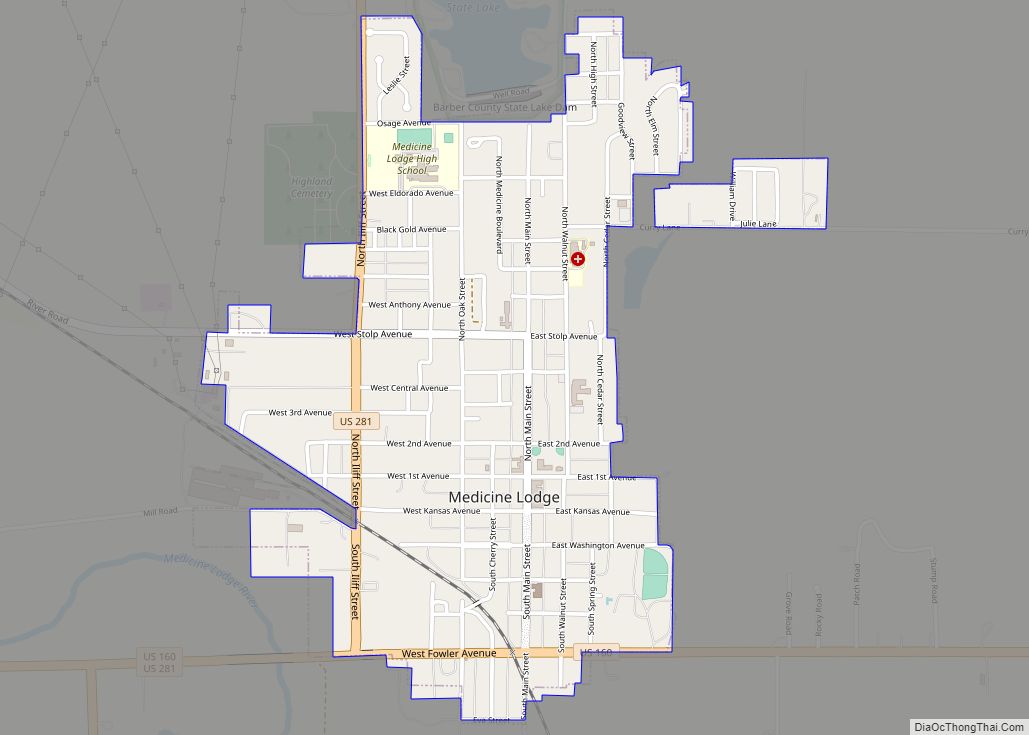
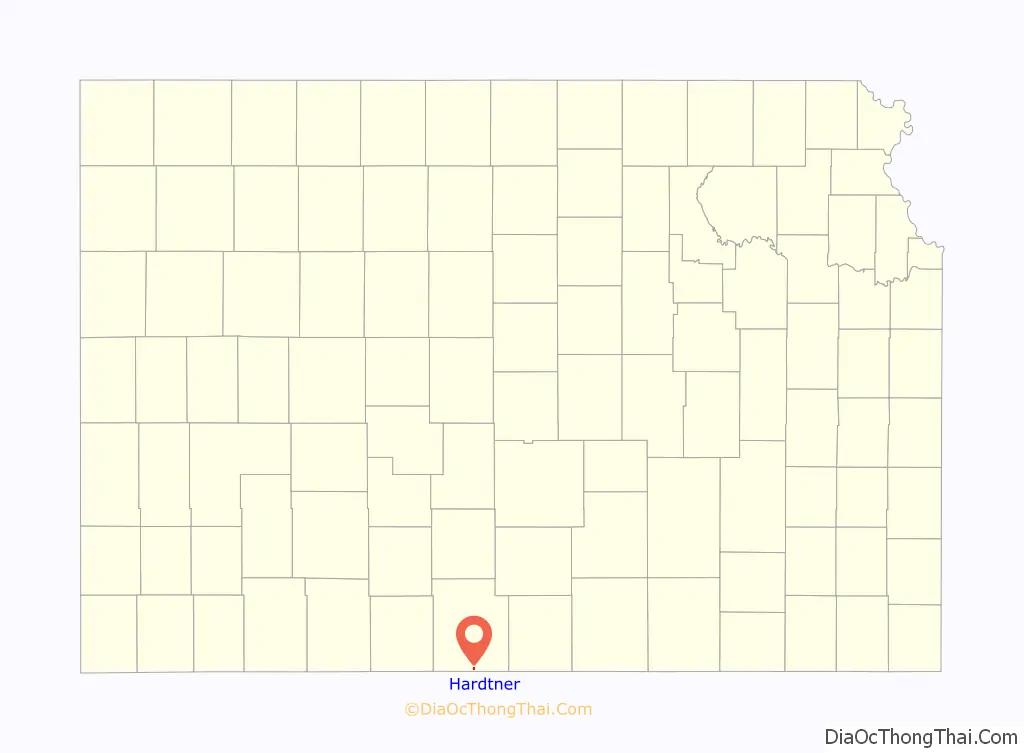
Online Interactive Map
Click on ![]() to view map in "full screen" mode.
to view map in "full screen" mode.
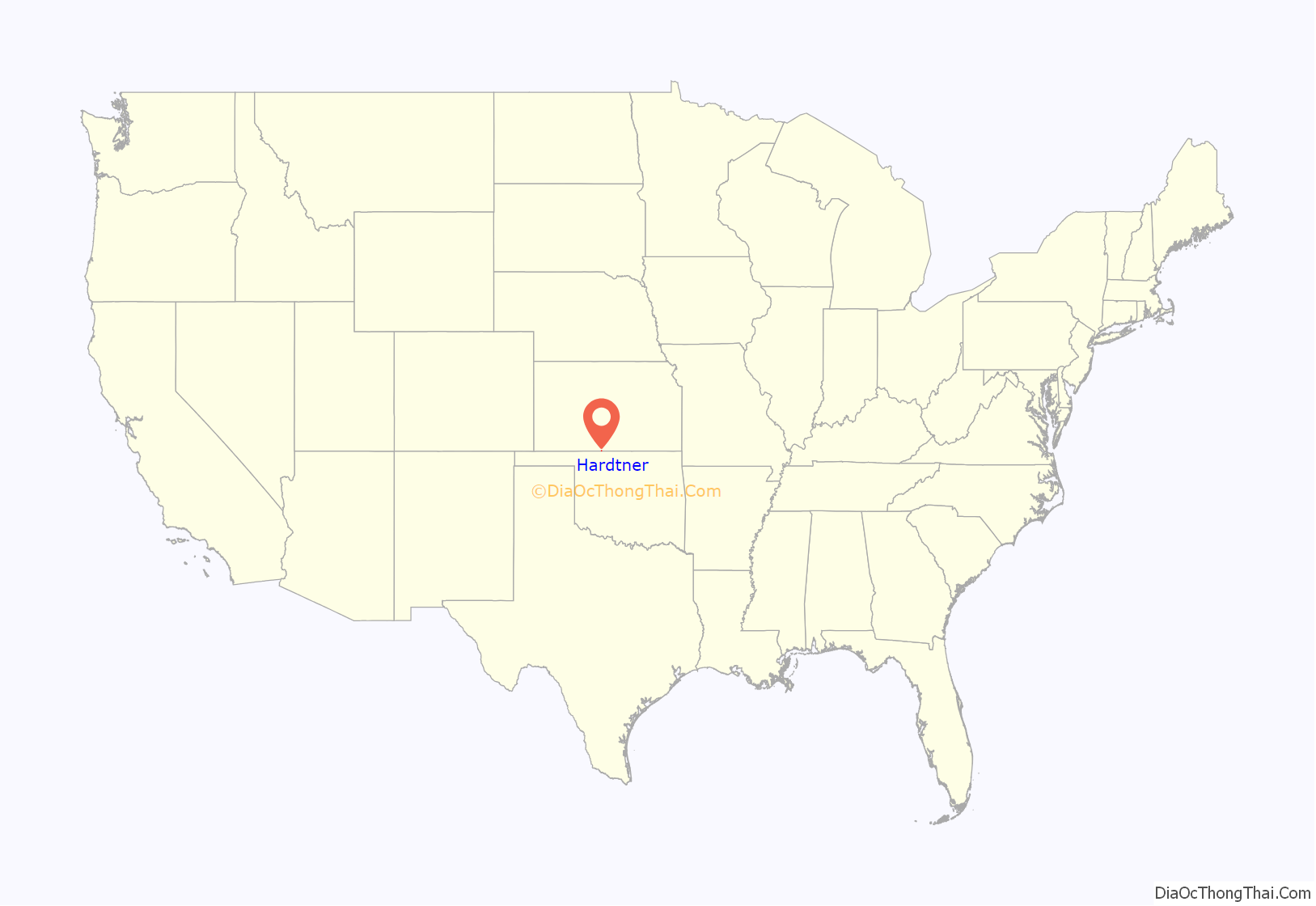
Hardtner location map. Where is Hardtner city?
History
Hardtner was founded in 1887. It was named for Dr. John Hardtner, a landowner.
The first post office in Hardtner was established in July 1887.
By 1908 the townspeople had realized that they would need a railroad line to the outside world in order to survive. The town’s founder Jacob Achenbach, helped set up a company to build a line east to Kiowa. The line would have to cross the Santa Fe’s tracks to link with the Missouri Pacific, the planned connection for Hardtner’s line. The Santa Fe’s Superintendent was not about to stand for that, so he had his private car block the spot where the lines would cross. A local got word to him that the Hardtner people had about 45 cowboys ready to “riddle his car with bullets” The Superintendent moved his car, and the line was completed.
On June 2, 1929, a tornado struck Hardtner, causing minor damage. The tornado was notable since it moved very slowly, yielding some of the highest quality photographs of a tornado to that date.
Hardtner is also known for its yearly Independence Day celebrations. This event attracts people from all around the Kansas/Oklahoma state-line area. Yearly events include a themed parade, medallion hunt, pit beef sandwiches, and a fireworks show.
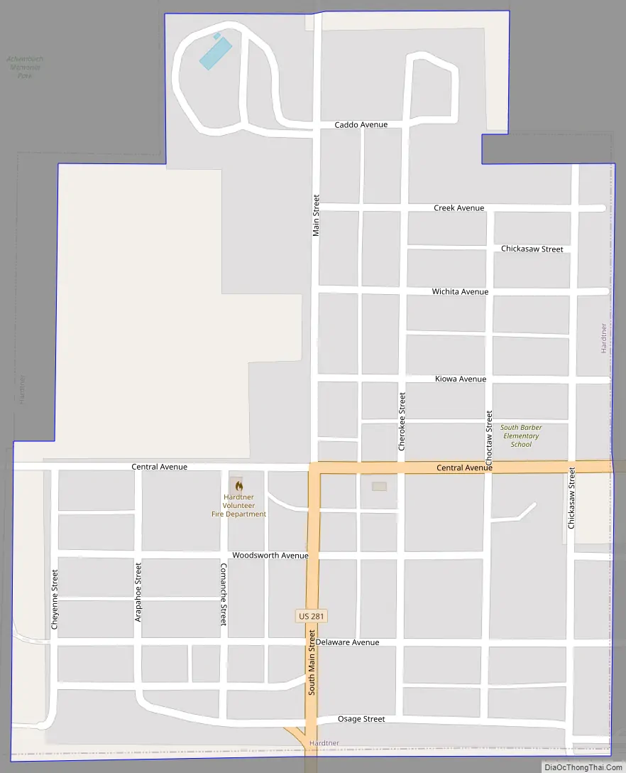
Hardtner Road Map
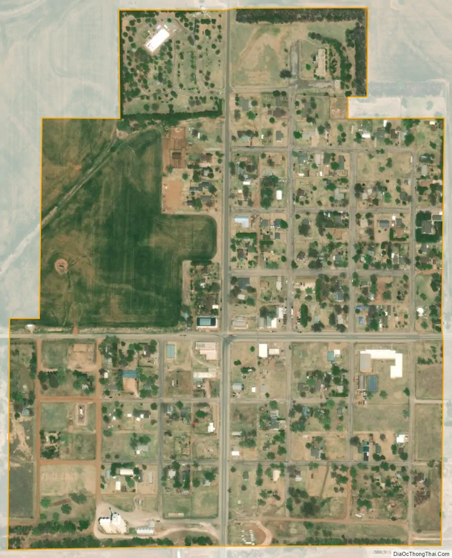
Hardtner city Satellite Map
Geography
Hardtner is located at 37°0′48″N 98°38′56″W / 37.01333°N 98.64889°W / 37.01333; -98.64889 (37.013263, -98.648775). According to the United States Census Bureau, the city has a total area of 0.30 square miles (0.78 km), all of it land.
Climate
The climate in this area is characterized by hot, humid summers and generally mild to cool winters. According to the Köppen Climate Classification system, Hardtner has a humid subtropical climate, abbreviated “Cfa” on climate maps.
See also
Map of Kansas State and its subdivision:- Allen
- Anderson
- Atchison
- Barber
- Barton
- Bourbon
- Brown
- Butler
- Chase
- Chautauqua
- Cherokee
- Cheyenne
- Clark
- Clay
- Cloud
- Coffey
- Comanche
- Cowley
- Crawford
- Decatur
- Dickinson
- Doniphan
- Douglas
- Edwards
- Elk
- Ellis
- Ellsworth
- Finney
- Ford
- Franklin
- Geary
- Gove
- Graham
- Grant
- Gray
- Greeley
- Greenwood
- Hamilton
- Harper
- Harvey
- Haskell
- Hodgeman
- Jackson
- Jefferson
- Jewell
- Johnson
- Kearny
- Kingman
- Kiowa
- Labette
- Lane
- Leavenworth
- Lincoln
- Linn
- Logan
- Lyon
- Marion
- Marshall
- McPherson
- Meade
- Miami
- Mitchell
- Montgomery
- Morris
- Morton
- Nemaha
- Neosho
- Ness
- Norton
- Osage
- Osborne
- Ottawa
- Pawnee
- Phillips
- Pottawatomie
- Pratt
- Rawlins
- Reno
- Republic
- Rice
- Riley
- Rooks
- Rush
- Russell
- Saline
- Scott
- Sedgwick
- Seward
- Shawnee
- Sheridan
- Sherman
- Smith
- Stafford
- Stanton
- Stevens
- Sumner
- Thomas
- Trego
- Wabaunsee
- Wallace
- Washington
- Wichita
- Wilson
- Woodson
- Wyandotte
- Alabama
- Alaska
- Arizona
- Arkansas
- California
- Colorado
- Connecticut
- Delaware
- District of Columbia
- Florida
- Georgia
- Hawaii
- Idaho
- Illinois
- Indiana
- Iowa
- Kansas
- Kentucky
- Louisiana
- Maine
- Maryland
- Massachusetts
- Michigan
- Minnesota
- Mississippi
- Missouri
- Montana
- Nebraska
- Nevada
- New Hampshire
- New Jersey
- New Mexico
- New York
- North Carolina
- North Dakota
- Ohio
- Oklahoma
- Oregon
- Pennsylvania
- Rhode Island
- South Carolina
- South Dakota
- Tennessee
- Texas
- Utah
- Vermont
- Virginia
- Washington
- West Virginia
- Wisconsin
- Wyoming