Medicine Lodge is a city in and the county seat of Barber County, Kansas, United States. As of the 2020 census, the population of the city was 1,781.
| Name: | Medicine Lodge city |
|---|---|
| LSAD Code: | 25 |
| LSAD Description: | city (suffix) |
| State: | Kansas |
| County: | Barber County |
| Founded: | 1873 |
| Incorporated: | 1879 |
| Elevation: | 1,499 ft (457 m) |
| Total Area: | 1.20 sq mi (3.10 km²) |
| Land Area: | 1.20 sq mi (3.10 km²) |
| Water Area: | 0.00 sq mi (0.00 km²) |
| Total Population: | 1,781 |
| Population Density: | 1,500/sq mi (570/km²) |
| ZIP code: | 67104 |
| Area code: | 620 |
| FIPS code: | 2045500 |
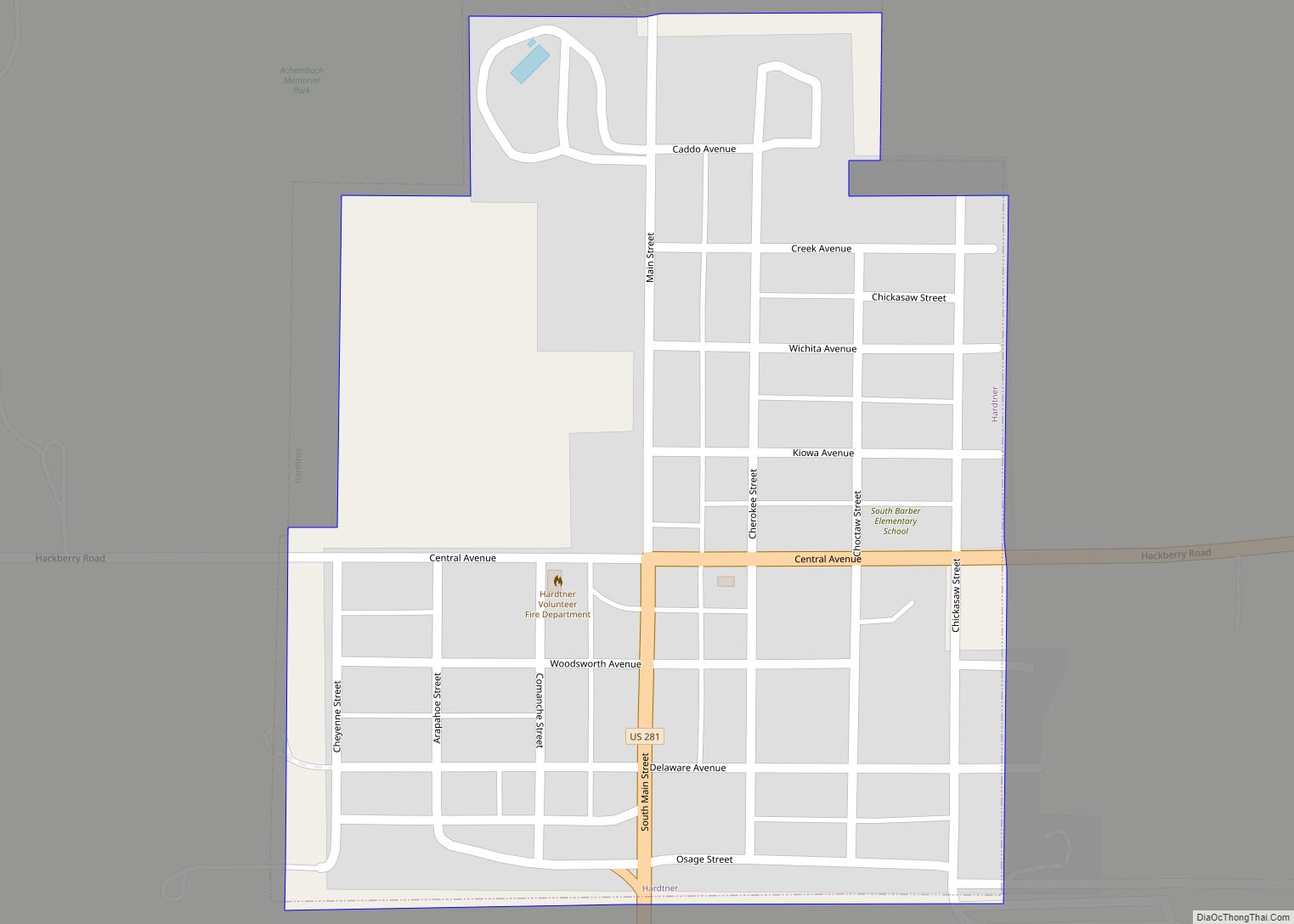
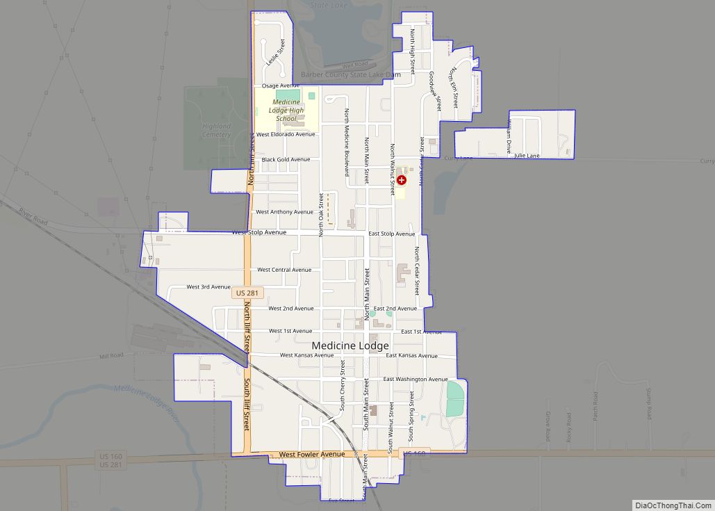
Online Interactive Map
Click on ![]() to view map in "full screen" mode.
to view map in "full screen" mode.
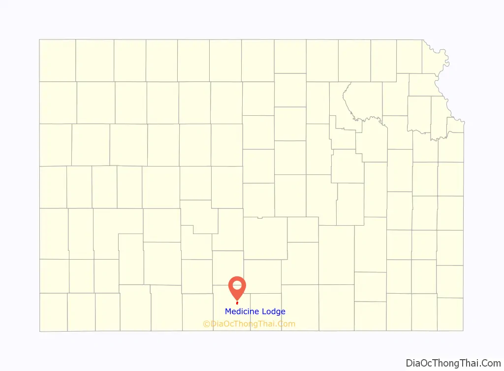
Medicine Lodge location map. Where is Medicine Lodge city?

History
19th century
The particular medicine lodge, mystery house or sacred tabernacle from which the Medicine Lodge River received its name was in reality an arbor-like shelter of tree trunks and leafy branches which was erected by the Kiowa people for the celebration of their annual sun dance in the summer of 1866. It was in the valley of the Medicine Lodge River, several miles below the present town of Medicine Lodge, which is at the mouth of Elm Creek. In their own language, the Kiowa people called this stream A-ya-dalda P’a, meaning “Timber-hill River.” The Kiowa had considered the site sacred due to the high content of Epsom salts in the river.
In October 1867, the Medicine Lodge Treaty was a set of three treaties signed between the United States of America and the Kiowa, Comanche, Plains Apache, Southern Cheyenne, and Southern Arapaho. The site of the Peace Council camp was about three miles above that of the future town and on the same side of the river. A Peace Treaty Pageant, first presented in 1927 in an outdoor amphitheater on a quarter section of Kansas prairie, commemorates this significant event in Western history.
Settlers led by a man named John Hutchinson founded the town of Medicine Lodge north of the confluence of Elm Creek and the Medicine Lodge River in February 1873. The community grew rapidly with a hotel, stores, and a post office established within a year.
In 1874, in response to Native raids in the region, residents and the state militia constructed a stockade. A group of Osage killed three settlers within a few miles of the compound, but no direct attack on the fortifications occurred. Medicine Lodge was incorporated as a city in 1879.
Temperance activist Carrie Nation launched her crusade against the sale of alcohol while living in Medicine Lodge in 1900. Her home and a reproduction of the 1873 stockade are open to the public.
Medicine Lodge Road Map

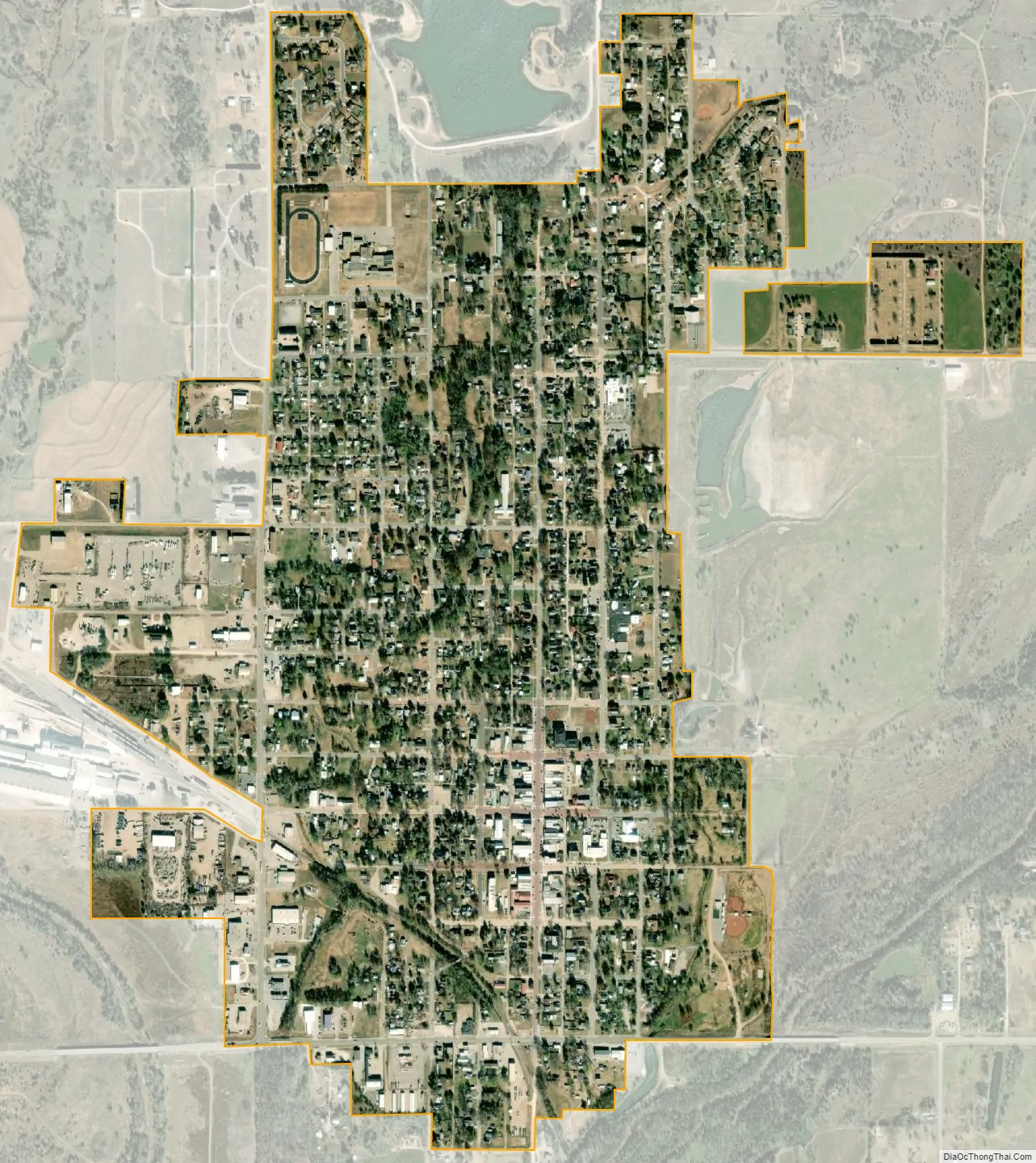
Medicine Lodge city Satellite Map
Geography
Medicine Lodge is located at 37°17′4″N 98°34′52″W / 37.28444°N 98.58111°W / 37.28444; -98.58111 (37.284352, -98.580977) in south-central Kansas in the Red Hills region of the Great Plains. The city sits immediately north of the confluence of the Medicine Lodge River and Elm Creek. The city is on the northeast side of the river. Elm Creek flows south around the eastern and southern sides of the city. A tributary of Elm Creek, which flows south through Medicine Lodge, has been dammed immediately north of the city to form a reservoir, Barber County State Lake.
The city is located at the junction of U.S. Routes 160 and 281.
According to the United States Census Bureau, the city has a total area of 1.21 square miles (3.13 km), all of it land.
Climate
Medicine Lodge has a humid subtropical climate (Köppen Cfa) with hot, humid summers and cold, dry winters. The average temperature in Medicine Lodge is 57.3 °F (14 °C), and the average yearly precipitation is 26.2 inches (660 mm). On average, January is the coolest month, July is the warmest month, and June is the wettest month. The hottest temperature recorded in Medicine Lodge was 118 °F (48 °C) in 1936; the coldest temperature recorded was -22 °F (-30 °C) in 1905.
See also
Map of Kansas State and its subdivision:- Allen
- Anderson
- Atchison
- Barber
- Barton
- Bourbon
- Brown
- Butler
- Chase
- Chautauqua
- Cherokee
- Cheyenne
- Clark
- Clay
- Cloud
- Coffey
- Comanche
- Cowley
- Crawford
- Decatur
- Dickinson
- Doniphan
- Douglas
- Edwards
- Elk
- Ellis
- Ellsworth
- Finney
- Ford
- Franklin
- Geary
- Gove
- Graham
- Grant
- Gray
- Greeley
- Greenwood
- Hamilton
- Harper
- Harvey
- Haskell
- Hodgeman
- Jackson
- Jefferson
- Jewell
- Johnson
- Kearny
- Kingman
- Kiowa
- Labette
- Lane
- Leavenworth
- Lincoln
- Linn
- Logan
- Lyon
- Marion
- Marshall
- McPherson
- Meade
- Miami
- Mitchell
- Montgomery
- Morris
- Morton
- Nemaha
- Neosho
- Ness
- Norton
- Osage
- Osborne
- Ottawa
- Pawnee
- Phillips
- Pottawatomie
- Pratt
- Rawlins
- Reno
- Republic
- Rice
- Riley
- Rooks
- Rush
- Russell
- Saline
- Scott
- Sedgwick
- Seward
- Shawnee
- Sheridan
- Sherman
- Smith
- Stafford
- Stanton
- Stevens
- Sumner
- Thomas
- Trego
- Wabaunsee
- Wallace
- Washington
- Wichita
- Wilson
- Woodson
- Wyandotte
- Alabama
- Alaska
- Arizona
- Arkansas
- California
- Colorado
- Connecticut
- Delaware
- District of Columbia
- Florida
- Georgia
- Hawaii
- Idaho
- Illinois
- Indiana
- Iowa
- Kansas
- Kentucky
- Louisiana
- Maine
- Maryland
- Massachusetts
- Michigan
- Minnesota
- Mississippi
- Missouri
- Montana
- Nebraska
- Nevada
- New Hampshire
- New Jersey
- New Mexico
- New York
- North Carolina
- North Dakota
- Ohio
- Oklahoma
- Oregon
- Pennsylvania
- Rhode Island
- South Carolina
- South Dakota
- Tennessee
- Texas
- Utah
- Vermont
- Virginia
- Washington
- West Virginia
- Wisconsin
- Wyoming