Louisville is a city in Pottawatomie County, Kansas, United States. As of the 2020 census, the population of the city was 131.
| Name: | Louisville city |
|---|---|
| LSAD Code: | 25 |
| LSAD Description: | city (suffix) |
| State: | Kansas |
| County: | Pottawatomie County |
| Founded: | 1857 |
| Incorporated: | 1870 |
| Elevation: | 1,011 ft (308 m) |
| Total Area: | 0.50 sq mi (1.29 km²) |
| Land Area: | 0.50 sq mi (1.29 km²) |
| Water Area: | 0.00 sq mi (0.00 km²) |
| Total Population: | 131 |
| Population Density: | 260/sq mi (100/km²) |
| ZIP code: | 66450 |
| Area code: | 785 |
| FIPS code: | 2042925 |
Online Interactive Map
Click on ![]() to view map in "full screen" mode.
to view map in "full screen" mode.
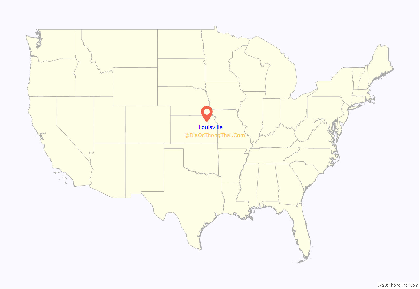
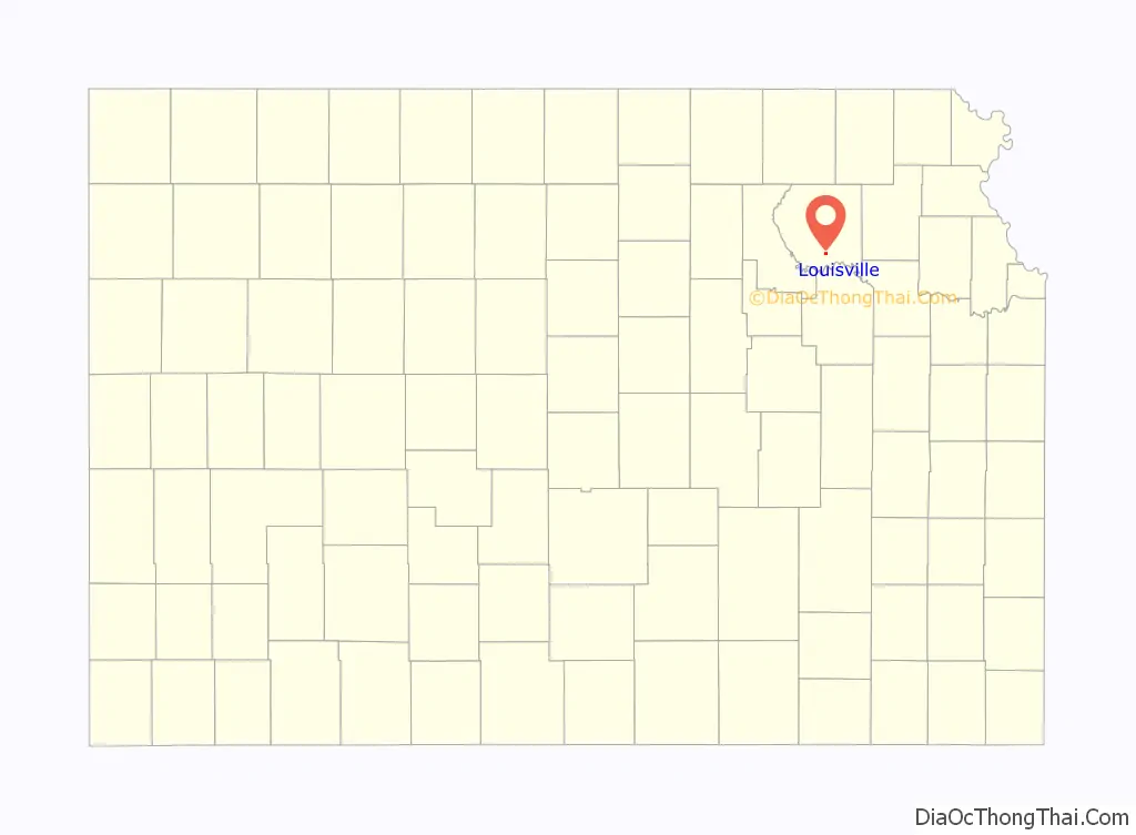
Louisville location map. Where is Louisville city?
History
Founded in 1857 by Robert Wilson as Rock Post. The area was once part of the Potawatomi Hunting grounds and a large majority of the settlers were either associated with the Pottawatomie Indian Reservation or commerce on the Oregon Trail. Louisville was named for Robert Wilson’s son, Louis, and for Louis Vieux, a successful businessman in the area. The town was a contender for county seat of Pottawatomie County but lost to St. George in 1861 and Westmoreland in 1882.
On November 8, 1875, Louisville was struck by an earthquake. In 1882, with the county seat in Westmoreland and the Union Pacific Railroad built through Wamego, the town’s population swiftly declined.
Louis Vieux
Louis Vieux Sr. was a prominent citizen of Louisville who operated a trail crossing across the Vermillion River. He was born in 1809 in Wisconsin to Angelique Roy, a Potawatomi woman, and Jacques Vieux, a Canadian-French trader. Vieux and his wife, Sha-Note, moved first to Cedar Bluffs, Iowa in 1832 until moving to Indianola, Kansas (northwest of Topeka along Soldier Creek) in 1846. Sha-Note died in 1857 and Vieux moved to the Vermillion River near present-day Louisville. Vieux began his trail crossing business and worked as a caller for the U.S. Government working the pay station in St. Mary’s and he also served on the tribal council and made trips to Washington, D.C. on behalf of the Pottawatomies. Vieux also signed the treaty that split the Pottawatomies into two separate tribes-the Prairie Band and Citizen Potawatomi Nation. Vieux died in 1872 and left behind a 200-page will leaving half the town of Louisville, all of Belvue and other personal property to his wife and children.
Oregon Trail crossing
About three miles east of Louisville was the Vermillion Crossing of the Oregon Trail operated by Louis Vieux. Vieux is buried in the Vieux Family Cemetery on top of a hill. Nearby, on the banks of the river, is a cholera cemetery from 1849, which is estimated to contain at least fifty graves, although only two stones — both native sandstones — remain. The Louis Vieux Elm Tree is across the river and is estimated to be over 300 years old. The tree had been afflicted with Dutch elm disease, a lightning strike and vandalism and efforts were taken to protect and shelter the tree’s stump. In August 2011, the stump was destroyed by fire. Near the tree are the graves of seven unknown soldiers.
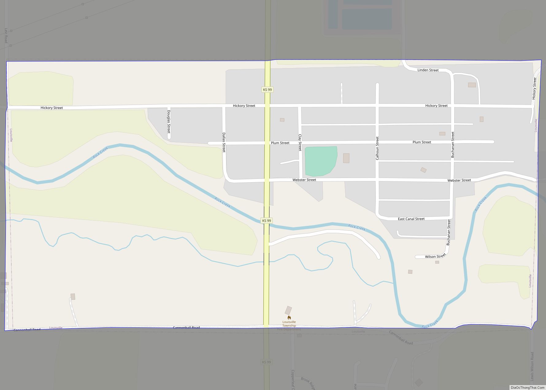
Louisville Road Map
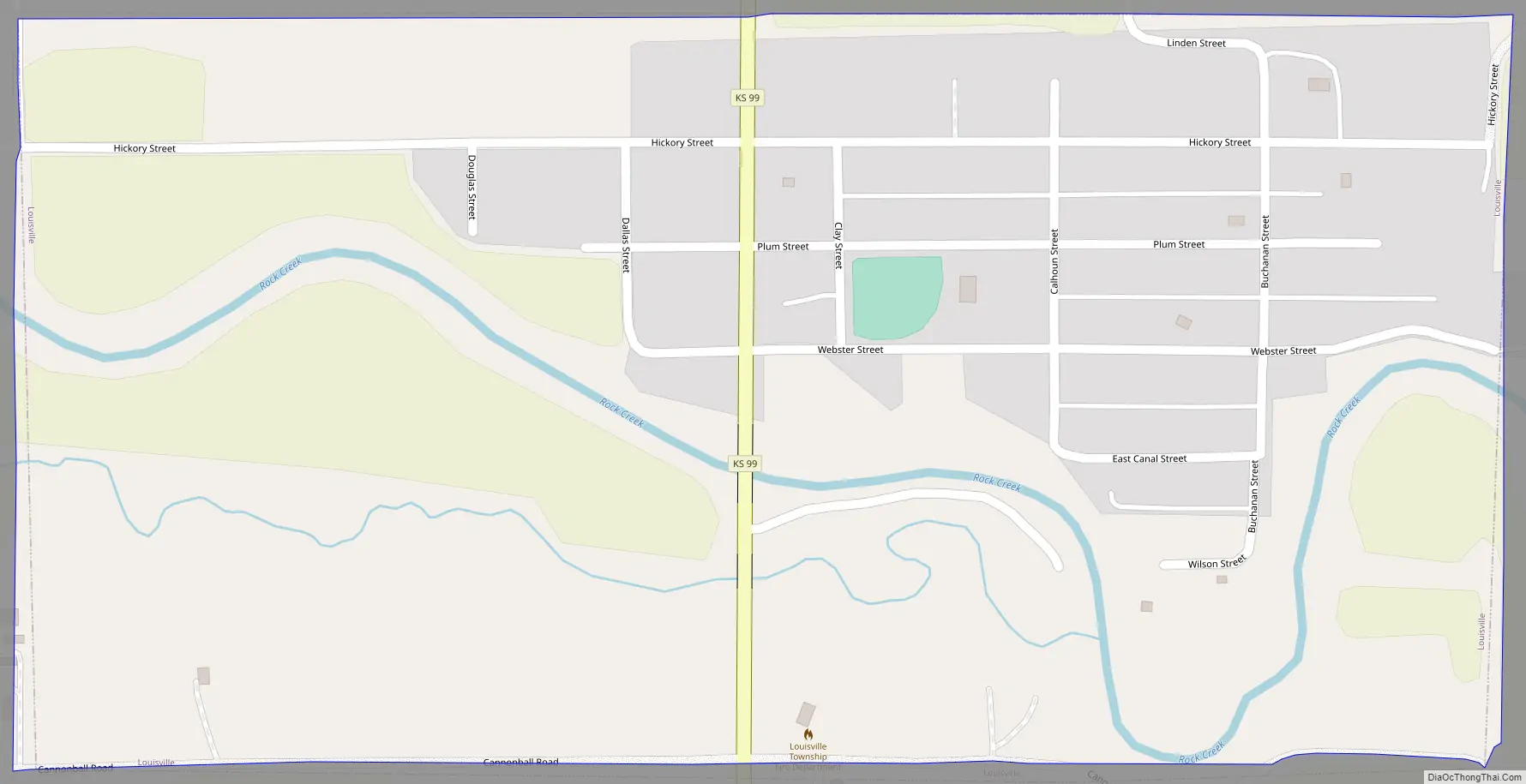
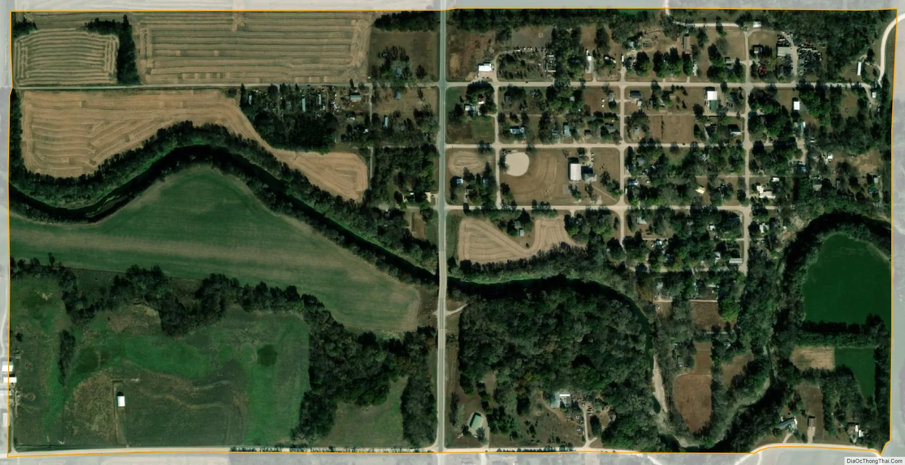
Louisville city Satellite Map
Geography
Louisville is located at 39°15′N 96°19′W / 39.250°N 96.317°W / 39.250; -96.317 (39.251,-96.314), between Wamego and Westmoreland on K-99. According to the United States Census Bureau, the city has a total area of 0.49 square miles (1.27 km), all of it land.
See also
Map of Kansas State and its subdivision:- Allen
- Anderson
- Atchison
- Barber
- Barton
- Bourbon
- Brown
- Butler
- Chase
- Chautauqua
- Cherokee
- Cheyenne
- Clark
- Clay
- Cloud
- Coffey
- Comanche
- Cowley
- Crawford
- Decatur
- Dickinson
- Doniphan
- Douglas
- Edwards
- Elk
- Ellis
- Ellsworth
- Finney
- Ford
- Franklin
- Geary
- Gove
- Graham
- Grant
- Gray
- Greeley
- Greenwood
- Hamilton
- Harper
- Harvey
- Haskell
- Hodgeman
- Jackson
- Jefferson
- Jewell
- Johnson
- Kearny
- Kingman
- Kiowa
- Labette
- Lane
- Leavenworth
- Lincoln
- Linn
- Logan
- Lyon
- Marion
- Marshall
- McPherson
- Meade
- Miami
- Mitchell
- Montgomery
- Morris
- Morton
- Nemaha
- Neosho
- Ness
- Norton
- Osage
- Osborne
- Ottawa
- Pawnee
- Phillips
- Pottawatomie
- Pratt
- Rawlins
- Reno
- Republic
- Rice
- Riley
- Rooks
- Rush
- Russell
- Saline
- Scott
- Sedgwick
- Seward
- Shawnee
- Sheridan
- Sherman
- Smith
- Stafford
- Stanton
- Stevens
- Sumner
- Thomas
- Trego
- Wabaunsee
- Wallace
- Washington
- Wichita
- Wilson
- Woodson
- Wyandotte
- Alabama
- Alaska
- Arizona
- Arkansas
- California
- Colorado
- Connecticut
- Delaware
- District of Columbia
- Florida
- Georgia
- Hawaii
- Idaho
- Illinois
- Indiana
- Iowa
- Kansas
- Kentucky
- Louisiana
- Maine
- Maryland
- Massachusetts
- Michigan
- Minnesota
- Mississippi
- Missouri
- Montana
- Nebraska
- Nevada
- New Hampshire
- New Jersey
- New Mexico
- New York
- North Carolina
- North Dakota
- Ohio
- Oklahoma
- Oregon
- Pennsylvania
- Rhode Island
- South Carolina
- South Dakota
- Tennessee
- Texas
- Utah
- Vermont
- Virginia
- Washington
- West Virginia
- Wisconsin
- Wyoming