Moline is a city in Elk County, Kansas, United States. As of the 2020 census, the population of the city was 345. Moline is located in south central Elk County at the intersection of U.S. Highway 160 and K-99.
Moline is known for being the home of Kansas’ oldest swinging (suspension-type) bridge, built in 1904. The bridge spans over a lower portion of a local stream, Wildcat Creek. Immediately to the west of the famous Swinging Bridge, a limestone water fall formation flows with water through much of the rainy season in late winter and early spring.
| Name: | Moline city |
|---|---|
| LSAD Code: | 25 |
| LSAD Description: | city (suffix) |
| State: | Kansas |
| County: | Elk County |
| Founded: | 1879 |
| Incorporated: | 1886 |
| Elevation: | 1,056 ft (322 m) |
| Total Area: | 0.34 sq mi (0.87 km²) |
| Land Area: | 0.34 sq mi (0.87 km²) |
| Water Area: | 0.00 sq mi (0.00 km²) |
| Total Population: | 345 |
| Population Density: | 1,000/sq mi (400/km²) |
| ZIP code: | 67353 |
| Area code: | 620 |
| FIPS code: | 2047600 |
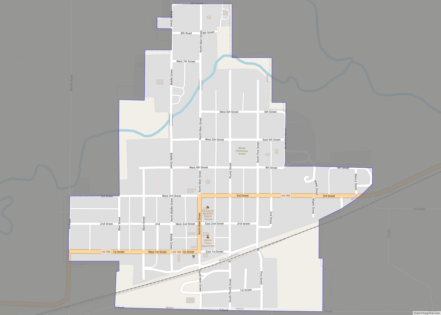
Online Interactive Map
Click on ![]() to view map in "full screen" mode.
to view map in "full screen" mode.
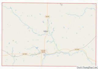
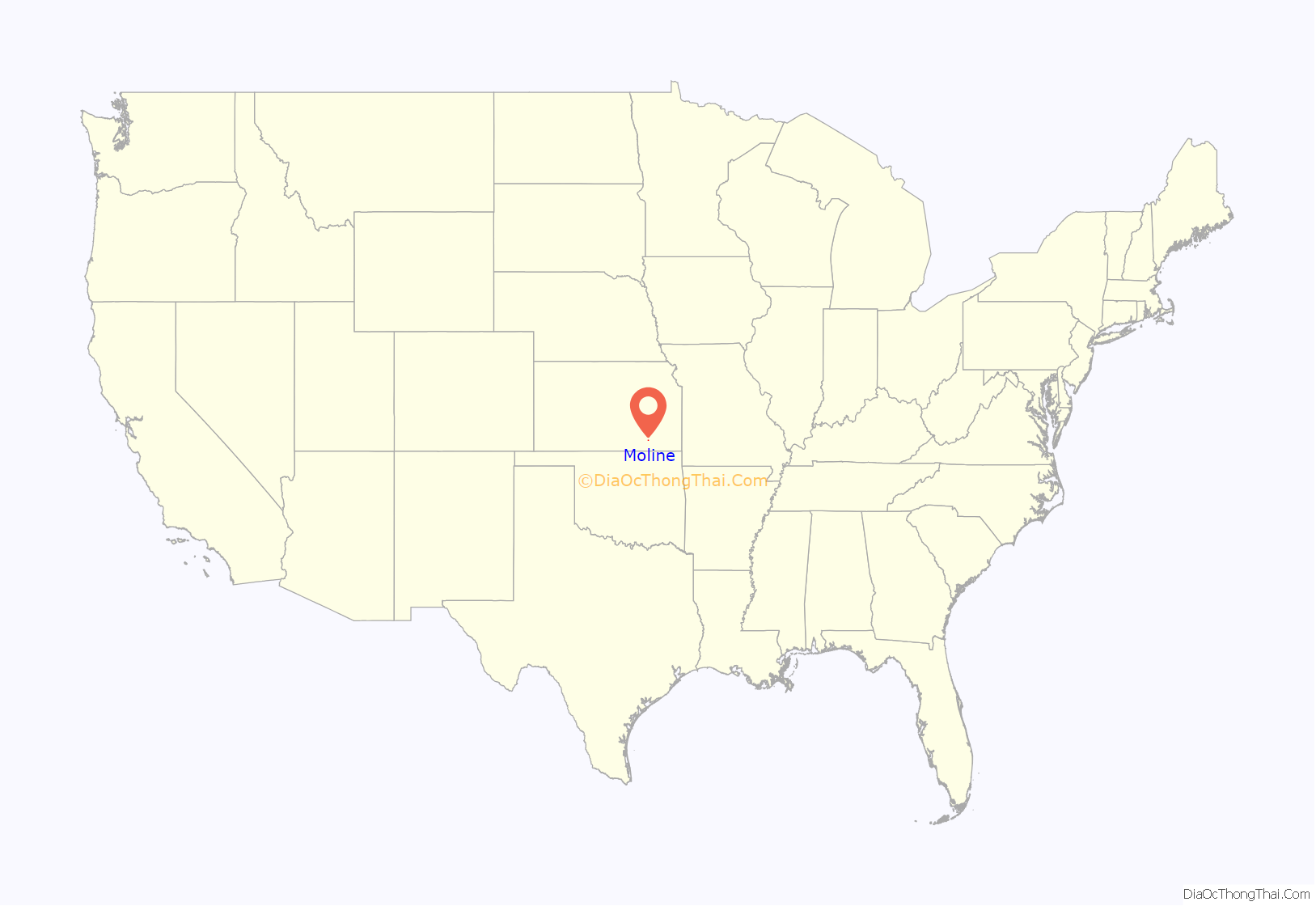
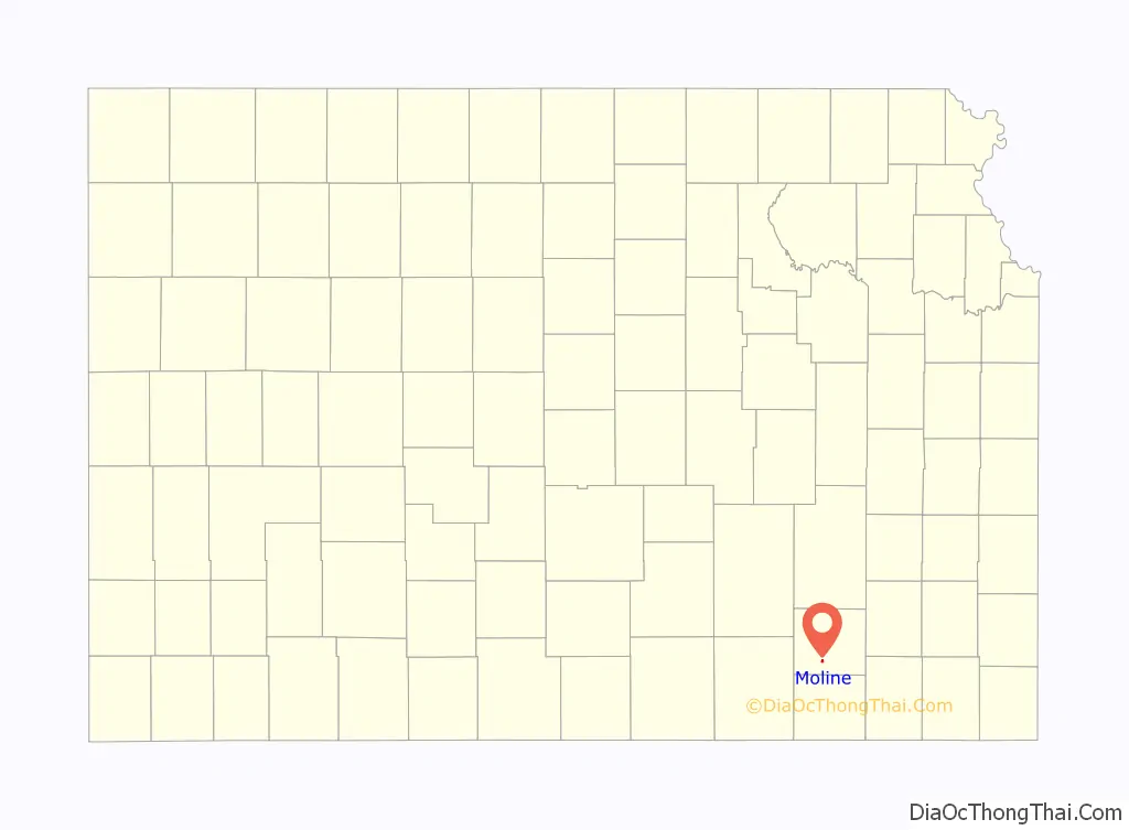
Moline location map. Where is Moline city?
History
Moline is located on a slightly elevated plateau in the valley of Wildcat Creek, named so by the indigenous Native Americans because of the prominent number of wildcats (Bobcats) that lived along the stream. In early 1879 as the Santa Fe Railway extended westward from Independence, Missouri, towns sprung up vigorously along the line. The Land and Town Company chartered the land for the city on July 21, 1879 and laid out the town. The name Moline was decided upon at the suggestion of Mr. J.F. Chapman, of the original town company, who came from the area of Moline, Illinois, and because the farmers in the area largely used the Moline plow.
The first post office in Moline was established in September, 1879.
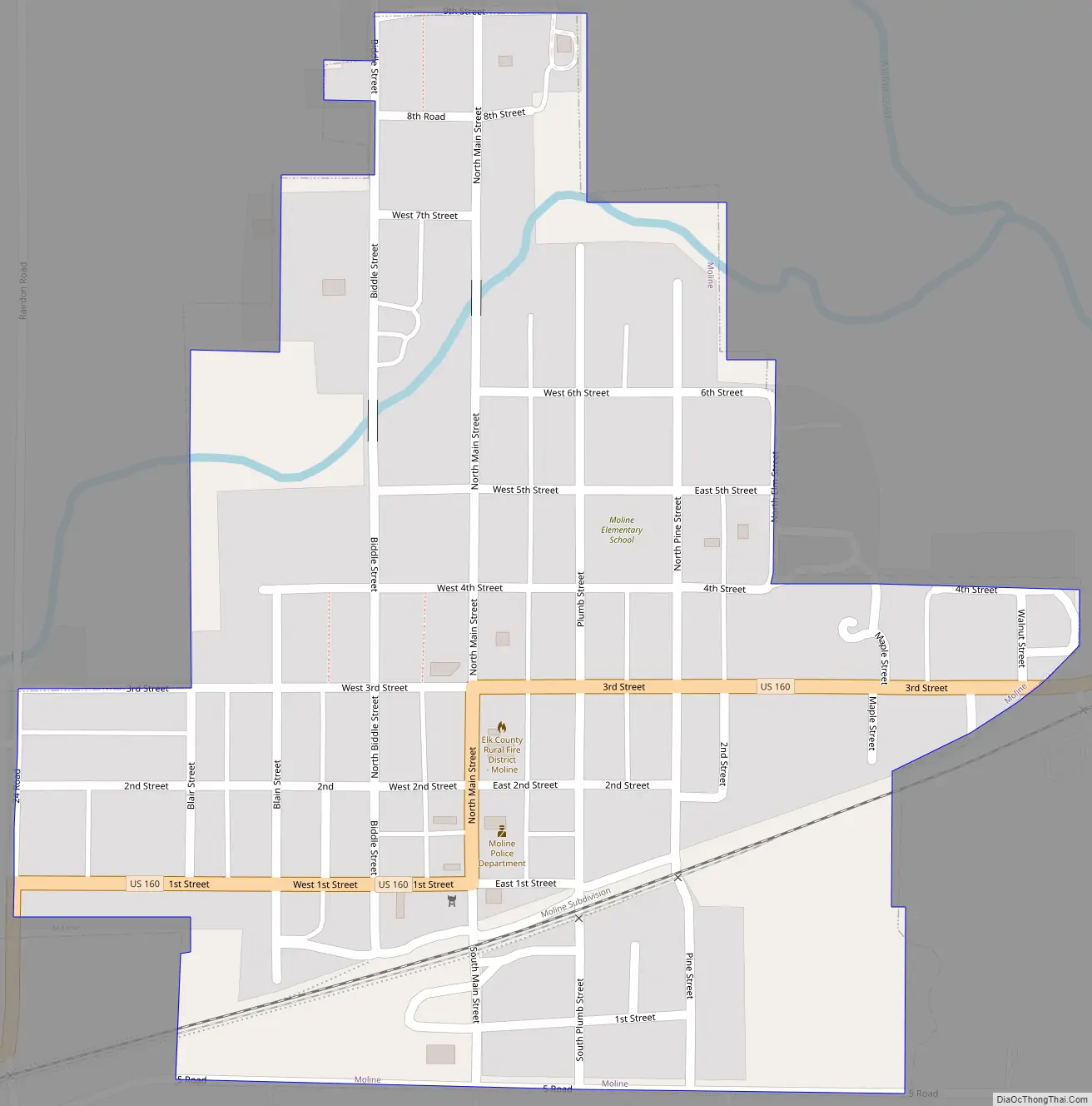
Moline Road Map
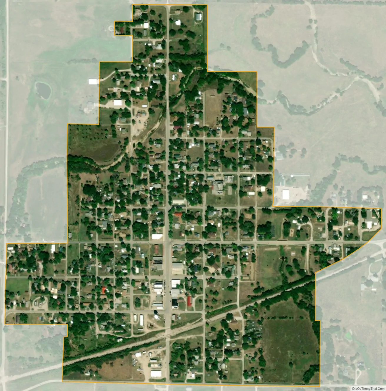
Moline city Satellite Map
Geography
Moline is located at 37°21′50″N 96°18′8″W / 37.36389°N 96.30222°W / 37.36389; -96.30222 (37.363769, -96.302086). According to the United States Census Bureau, the city has a total area of 0.35 square miles (0.91 km), all of it land.
See also
Map of Kansas State and its subdivision:- Allen
- Anderson
- Atchison
- Barber
- Barton
- Bourbon
- Brown
- Butler
- Chase
- Chautauqua
- Cherokee
- Cheyenne
- Clark
- Clay
- Cloud
- Coffey
- Comanche
- Cowley
- Crawford
- Decatur
- Dickinson
- Doniphan
- Douglas
- Edwards
- Elk
- Ellis
- Ellsworth
- Finney
- Ford
- Franklin
- Geary
- Gove
- Graham
- Grant
- Gray
- Greeley
- Greenwood
- Hamilton
- Harper
- Harvey
- Haskell
- Hodgeman
- Jackson
- Jefferson
- Jewell
- Johnson
- Kearny
- Kingman
- Kiowa
- Labette
- Lane
- Leavenworth
- Lincoln
- Linn
- Logan
- Lyon
- Marion
- Marshall
- McPherson
- Meade
- Miami
- Mitchell
- Montgomery
- Morris
- Morton
- Nemaha
- Neosho
- Ness
- Norton
- Osage
- Osborne
- Ottawa
- Pawnee
- Phillips
- Pottawatomie
- Pratt
- Rawlins
- Reno
- Republic
- Rice
- Riley
- Rooks
- Rush
- Russell
- Saline
- Scott
- Sedgwick
- Seward
- Shawnee
- Sheridan
- Sherman
- Smith
- Stafford
- Stanton
- Stevens
- Sumner
- Thomas
- Trego
- Wabaunsee
- Wallace
- Washington
- Wichita
- Wilson
- Woodson
- Wyandotte
- Alabama
- Alaska
- Arizona
- Arkansas
- California
- Colorado
- Connecticut
- Delaware
- District of Columbia
- Florida
- Georgia
- Hawaii
- Idaho
- Illinois
- Indiana
- Iowa
- Kansas
- Kentucky
- Louisiana
- Maine
- Maryland
- Massachusetts
- Michigan
- Minnesota
- Mississippi
- Missouri
- Montana
- Nebraska
- Nevada
- New Hampshire
- New Jersey
- New Mexico
- New York
- North Carolina
- North Dakota
- Ohio
- Oklahoma
- Oregon
- Pennsylvania
- Rhode Island
- South Carolina
- South Dakota
- Tennessee
- Texas
- Utah
- Vermont
- Virginia
- Washington
- West Virginia
- Wisconsin
- Wyoming