Moline (/moʊˈliːn/ moh-LEEN) is a city located in Rock Island County, Illinois, United States. With a population of 42,985 in 2020, it is the largest city in Rock Island County. Moline is one of the Quad Cities, along with neighboring East Moline and Rock Island in Illinois and the cities of Davenport and Bettendorf in Iowa. The Quad Cities have an estimated population of 381,342. The city is the ninth-most populated city in Illinois outside the Chicago Metropolitan Area. The corporate headquarters of Deere & Company is located in Moline, as was Montgomery Elevator, which was founded and headquartered in Moline until 1997, when it was acquired by Kone Elevator, which has its U.S. Division headquartered in Moline. Quad City International Airport, Black Hawk College, and the Quad Cities campus of Western Illinois University-Quad Cities are located in Moline. Moline is a retail hub for the Illinois Quad Cities, as South Park Mall and numerous big-box shopping plazas are located in the city.
In the mid-1990s, the city undertook major efforts to revitalize its central business district, which had declined after suburban growth and retail changes after the 1950s and 1960s. Today, Moline’s downtown again serves as one of the civic and recreational hubs of the Quad Cities; many events take place at the 12,000-seat Vibrant Arena at The MARK (formerly known as The MARK of the Quad Cities, iWireless Center, and TaxSlayer Center) and at John Deere Commons. Downtown Moline features hotels such as Radisson, The Element Moline, The Axis Hotel, and Stoney Creek Inn, along with commercial areas such as Bass Street Landing and the historic 5th Avenue.
Moline acquired its name after it was platted (surveyed and planned) in 1843. The name derives from the French moulin meaning “mill town”.
| Name: | Moline city |
|---|---|
| LSAD Code: | 25 |
| LSAD Description: | city (suffix) |
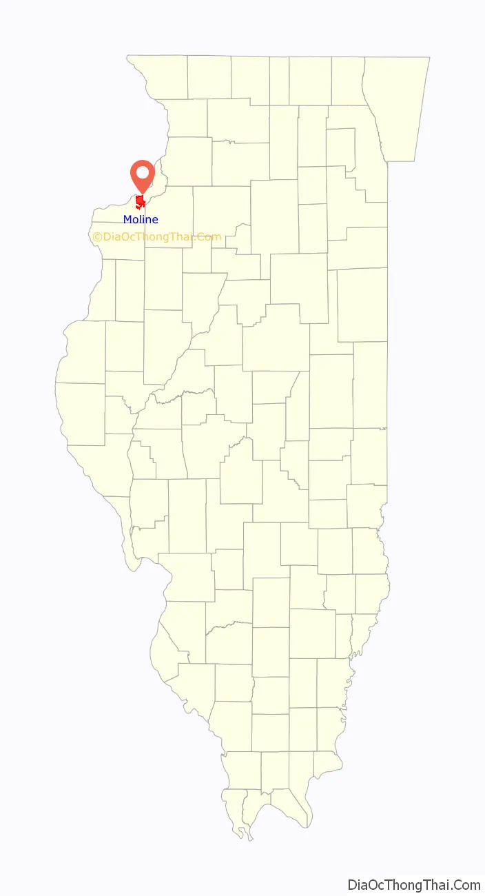
| State: | Illinois |
| County: | Rock Island County |
| Incorporated: | 1848 |
| Land Area: | 16.75 sq mi (43.39 km²) |
| Water Area: | 0.17 sq mi (0.44 km²) |
| Population Density: | 2,565.81/sq mi (990.64/km²) |
| ZIP code: | 61265 |
| Area code: | 309 |
| FIPS code: | 1749867 |
| Website: | www.moline.il.us |
Online Interactive Map
Click on ![]() to view map in "full screen" mode.
to view map in "full screen" mode.
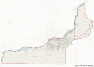
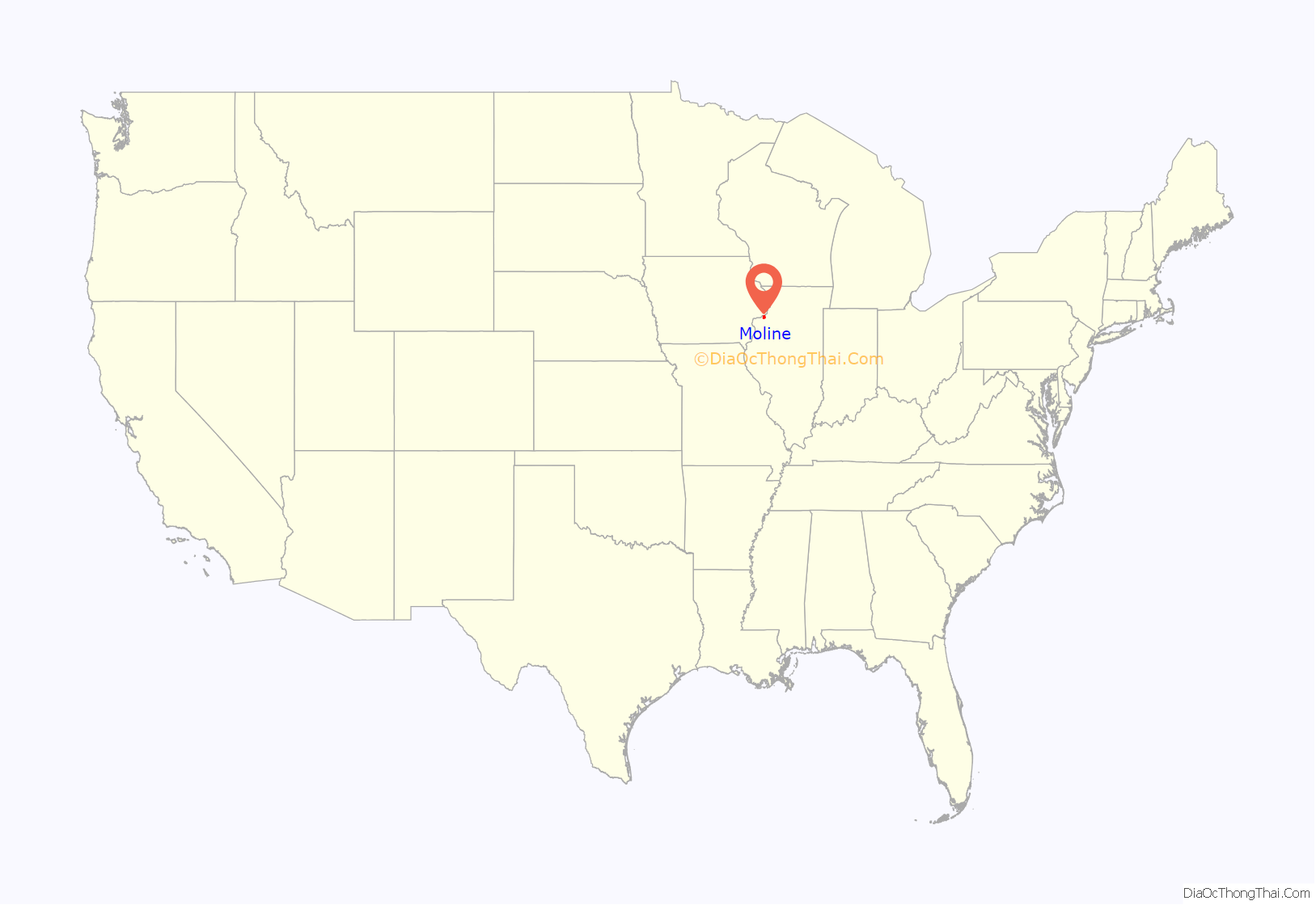
Moline location map. Where is Moline city?
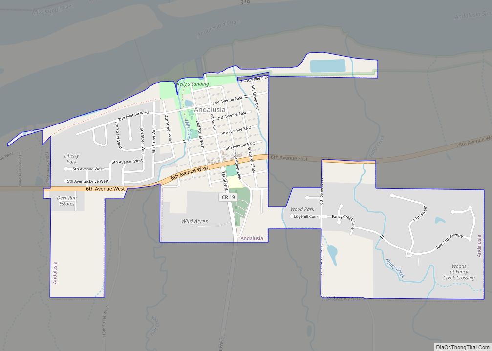
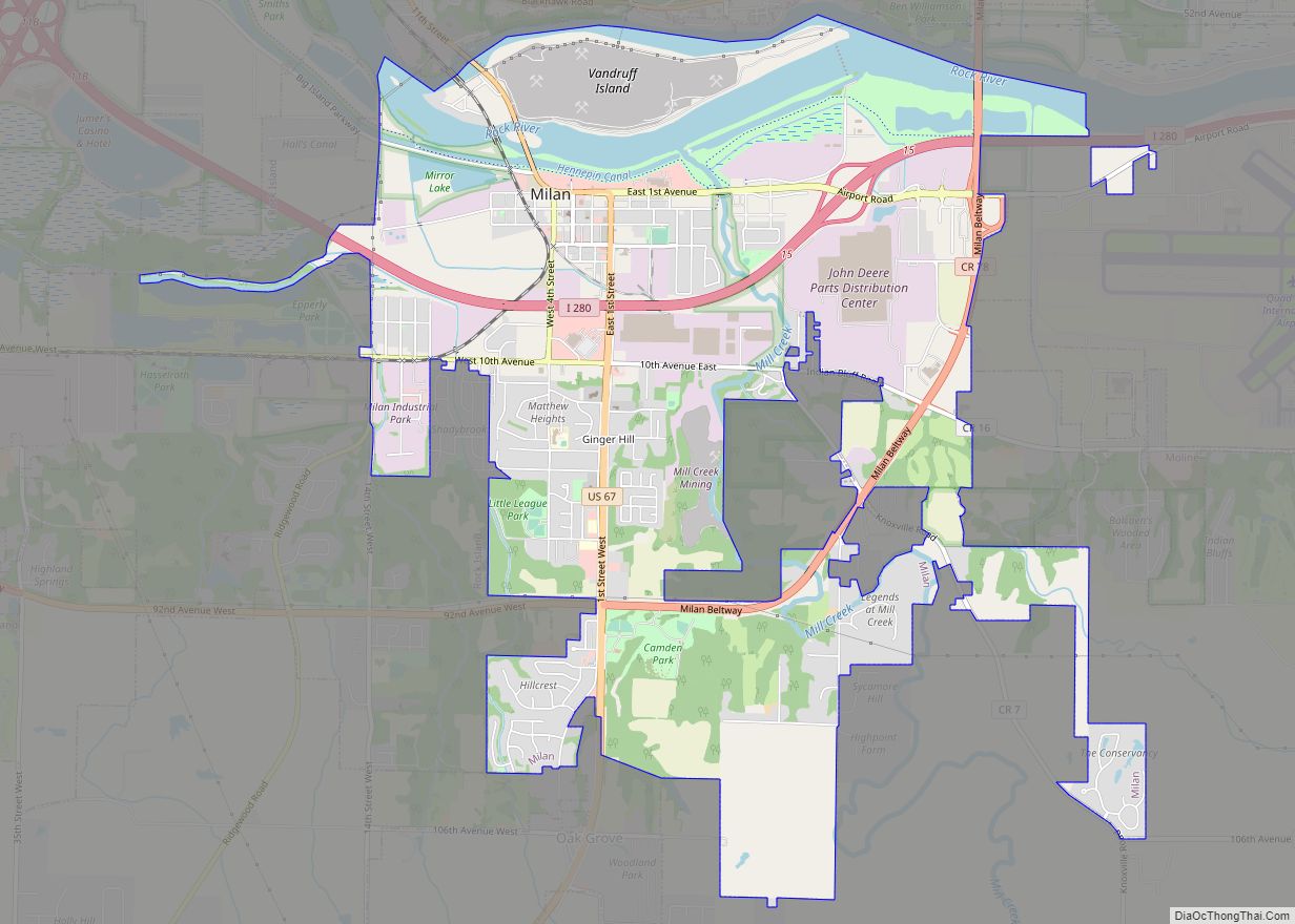
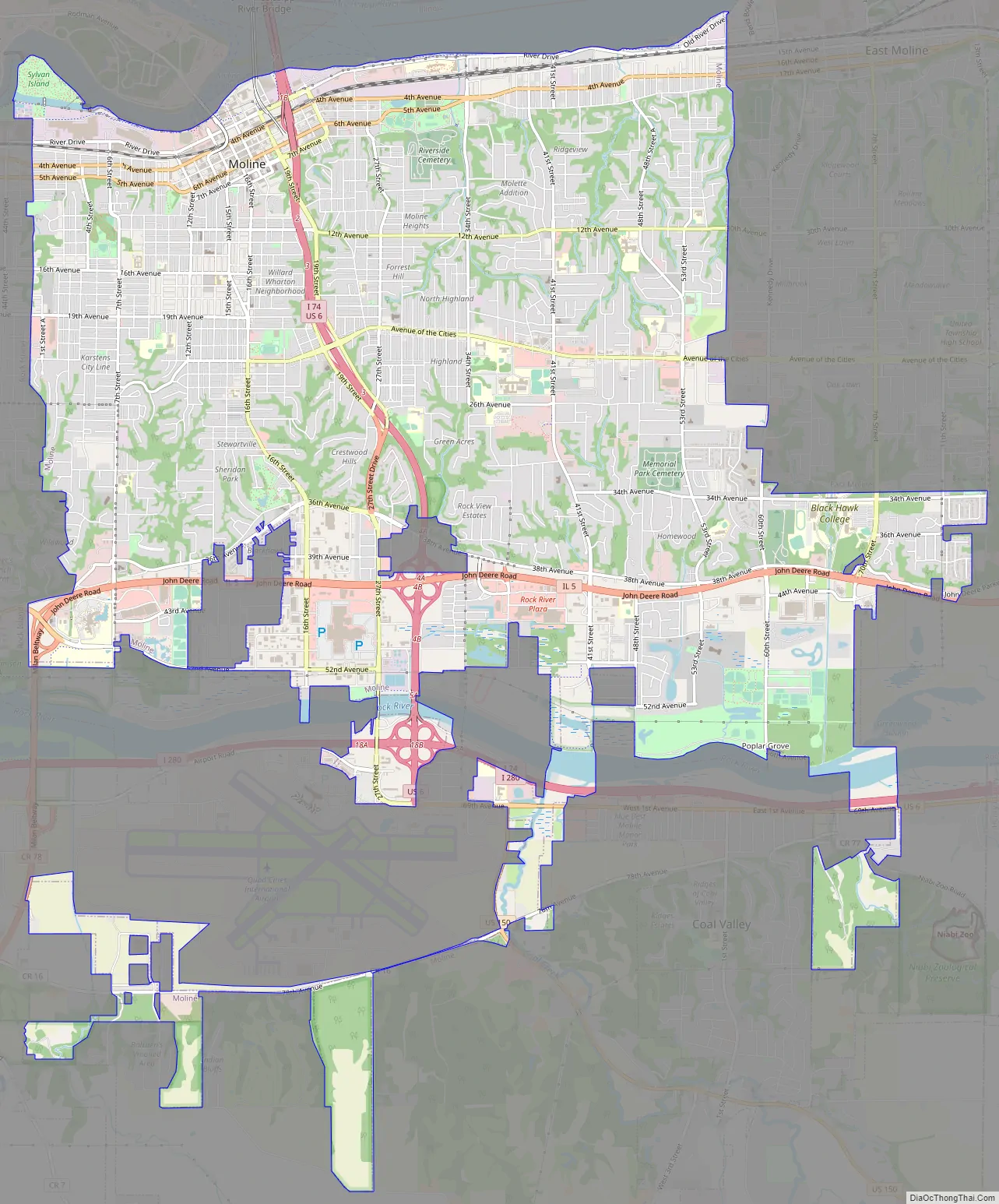
Moline Road Map
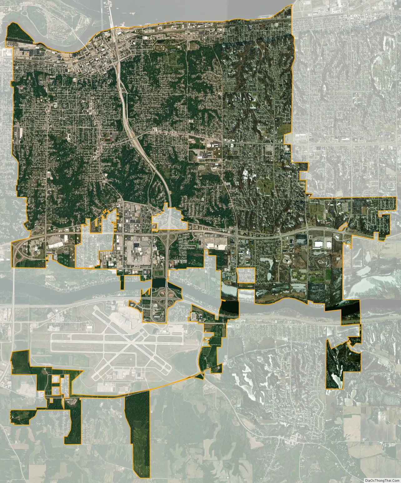
Moline city Satellite Map
Geography
The city of Moline is nestled beside and on a broad bluff situated between the banks of the Mississippi River and Rock River in Rock Island County, Illinois. The city’s highland areas are cut across by many deep ravines that break up the city into natural neighborhoods. The city is bounded to the east by East Moline and to the west by Rock Island.
Moline is located approximately 165 miles (266 km) west of Chicago and approximately 164 miles (264 km) northwest of Springfield, Illinois. Moline and its neighboring communities within the Quad Cities form the largest urban area along the Mississippi River between the Twin Cities (Minneapolis-St. Paul) to the north and St. Louis to the south, and are located approximately halfway between them. The area is served by four interstate highways: Interstate 74 (which runs directly through Moline, bisecting it in roughly equal halves), Interstate 280 (which serves as a ring road around the Quad Cities), Interstate 80 (which crosses the Mississippi River a few miles to the northeast of Moline), and Interstate 88 (which begins on the eastern border of the Quad Cities and ends in Hillside, Illinois, near Chicago).
According to the 2010 census, the city has a total area of 16.66 square miles (43.1 km), of which 16.43 square miles (42.6 km) (or 98.62%) is land and 0.23 square miles (0.60 km) (or 1.38%) is water.
Neighborhoods
Through the Neighborhood Partnership Program, the City of Moline has established nine city-sponsored neighborhood associations and is working to form more. These associations assist their residents by organizing neighborhood clean-up days, participating in the crime watch program, planning social activities, and other activities.
Notable neighborhoods include Moline’s downtown, now known as Moline Centre, which is a historic area bounded approximately by 12th and 34th Streets and the Mississippi River and 6th Avenue. The area is home to Moline’s City Hall, its original, and now vacant, Carnegie-sponsored public library, and other civic institutions.
Other neighborhoods include Floreciente, Olde Towne, Uptown, Overlook, Karsten’s Park, Wharton (home to Wharton Field House which gives the neighborhood its name), Hamilton Heights, Wildwood, Prospect Park, Park Hill, Forest Hill, Highland, Villa Park, Green Acres, Molette, Rockview Estates, Homewood (home to the Playcrafter’s Barn Theater), Heritage Park, Stewartville, Deerview, and Walton Hills.
Climate
Typical of the northern half of Illinois, Moline experiences a humid continental climate (Köppen Dfa) with hot, humid summers and cold, moderately snowy winters; precipitation is distributed throughout the year but is greater in the warmer months. The normal monthly mean temperature ranges from 22.6 °F (−5.2 °C) in January to 75.4 °F (24.1 °C) in July; on average, there are 23 days of 90 °F (32 °C)+ highs, 43 days with a high at or below freezing, and 11 days of sub-0 °F (−18 °C) lows annually. Extremes in temperature have ranged from 111 °F (44 °C), set on July 14, 1936, down to −33 °F (−36 °C), set on January 30, 2019; the record coldest maximum temperature is −12 °F (−24 °C) on January 18, 1994 and January 29, 1966, while the record warmest minimum is 84 °F (29 °C), set the same day of the record high. Temperatures reach 100 °F (38 °C) only several years per decade, and −20 °F (−29 °C) readings are even rarer; the last occurrence of each was July 25, 2012 and January 31, 2019. The average window for freezing temperatures is October 10 thru April 24, allowing a growing season of 168 days.
Snowfall averages 31.6 inches (80 cm) per season, but has ranged as low as 11.1 in (28 cm) in 1901–02 to 69.7 in (177 cm) in 1974–75; on average, measurable (≥0.1 in or 0.25 cm) snow occurs from November 21 to March 26, and rarely in October. Unlike much of the Midwest, measurable snow has never officially occurred in May.
See also
Map of Illinois State and its subdivision:- Adams
- Alexander
- Bond
- Boone
- Brown
- Bureau
- Calhoun
- Carroll
- Cass
- Champaign
- Christian
- Clark
- Clay
- Clinton
- Coles
- Cook
- Crawford
- Cumberland
- De Kalb
- De Witt
- Douglas
- Dupage
- Edgar
- Edwards
- Effingham
- Fayette
- Ford
- Franklin
- Fulton
- Gallatin
- Greene
- Grundy
- Hamilton
- Hancock
- Hardin
- Henderson
- Henry
- Iroquois
- Jackson
- Jasper
- Jefferson
- Jersey
- Jo Daviess
- Johnson
- Kane
- Kankakee
- Kendall
- Knox
- La Salle
- Lake
- Lake Michigan
- Lawrence
- Lee
- Livingston
- Logan
- Macon
- Macoupin
- Madison
- Marion
- Marshall
- Mason
- Massac
- McDonough
- McHenry
- McLean
- Menard
- Mercer
- Monroe
- Montgomery
- Morgan
- Moultrie
- Ogle
- Peoria
- Perry
- Piatt
- Pike
- Pope
- Pulaski
- Putnam
- Randolph
- Richland
- Rock Island
- Saint Clair
- Saline
- Sangamon
- Schuyler
- Scott
- Shelby
- Stark
- Stephenson
- Tazewell
- Union
- Vermilion
- Wabash
- Warren
- Washington
- Wayne
- White
- Whiteside
- Will
- Williamson
- Winnebago
- Woodford
- Alabama
- Alaska
- Arizona
- Arkansas
- California
- Colorado
- Connecticut
- Delaware
- District of Columbia
- Florida
- Georgia
- Hawaii
- Idaho
- Illinois
- Indiana
- Iowa
- Kansas
- Kentucky
- Louisiana
- Maine
- Maryland
- Massachusetts
- Michigan
- Minnesota
- Mississippi
- Missouri
- Montana
- Nebraska
- Nevada
- New Hampshire
- New Jersey
- New Mexico
- New York
- North Carolina
- North Dakota
- Ohio
- Oklahoma
- Oregon
- Pennsylvania
- Rhode Island
- South Carolina
- South Dakota
- Tennessee
- Texas
- Utah
- Vermont
- Virginia
- Washington
- West Virginia
- Wisconsin
- Wyoming