Moscow (/ˈmɒskoʊ/ MOS-koh) is a city in Stevens County, Kansas, United States. As of the 2020 census, the population of the city was 272.
| Name: | Moscow city |
|---|---|
| LSAD Code: | 25 |
| LSAD Description: | city (suffix) |
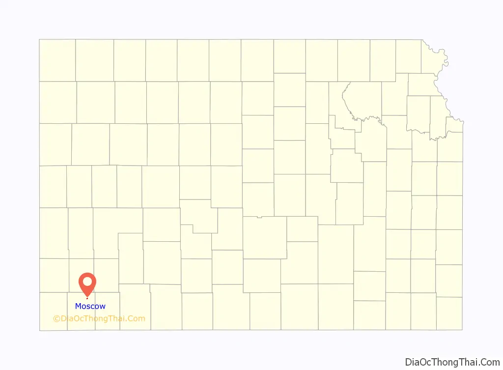
| State: | Kansas |
| County: | Stevens County |
| Founded: | 1887 |
| Incorporated: | 1929 |
| Elevation: | 3,051 ft (930 m) |
| Total Area: | 0.17 sq mi (0.45 km²) |
| Land Area: | 0.17 sq mi (0.45 km²) |
| Water Area: | 0.00 sq mi (0.00 km²) |
| Total Population: | 272 |
| Population Density: | 1,600/sq mi (600/km²) |
| ZIP code: | 67952 |
| Area code: | 620 |
| FIPS code: | 2048600 |
| Website: | moscowkansas.com |
Online Interactive Map
Click on ![]() to view map in "full screen" mode.
to view map in "full screen" mode.
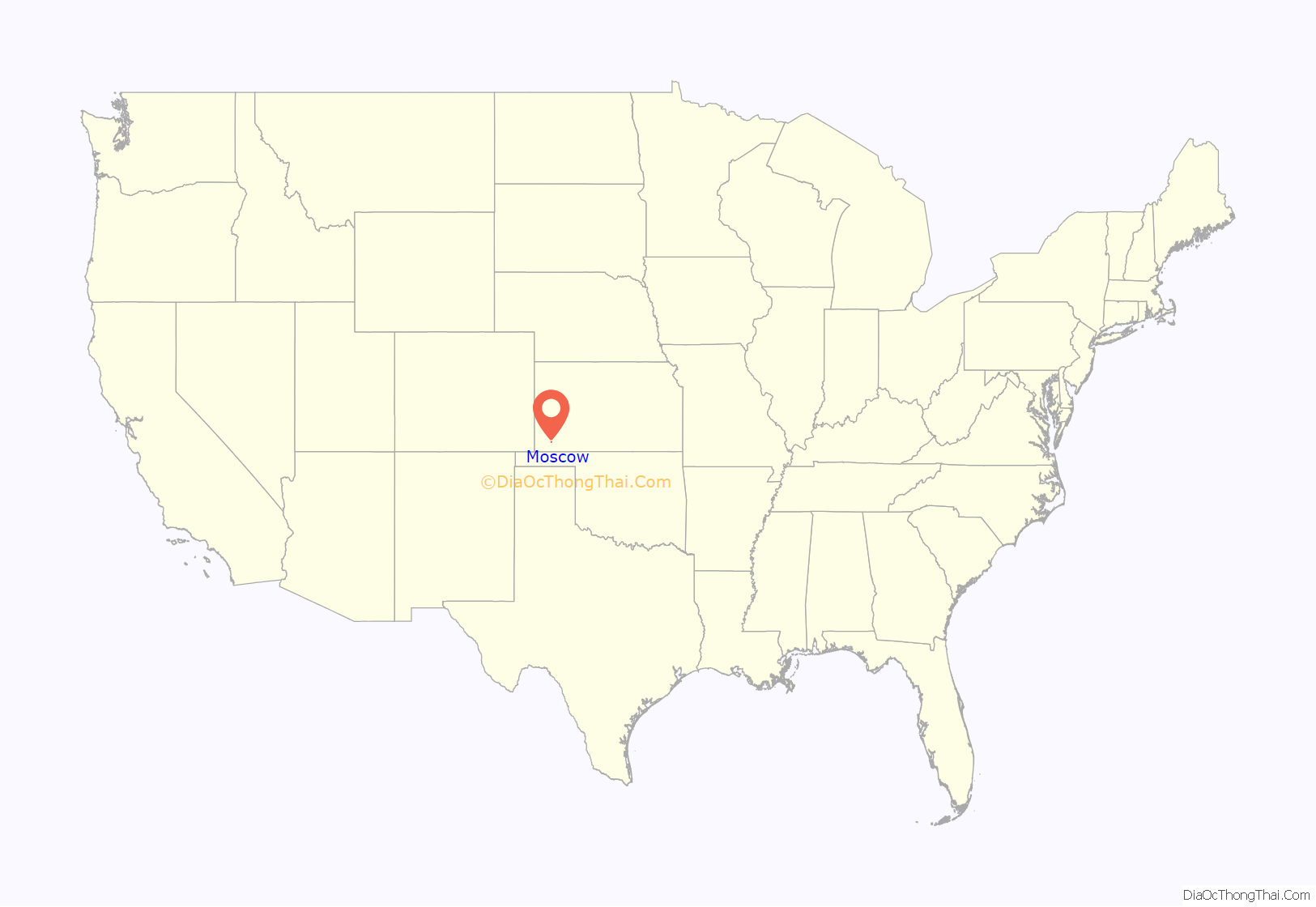
Moscow location map. Where is Moscow city?
History
The settlement of Moscow was established in 1887.
One tradition says, the community was named for a member of de Soto’s expedition, the maestro de campo (field commander) Luis de Moscoso (the source mistakenly indicates Francisco Coronado southwest expedition, but at this time Moscoso was a member of de Soto’s expedition, furthermore he took command of the expedition after de Soto’s death). During the settlement name registration there were a series of mistakes. The residents, in their application for a post office, had shortened it to Mosco. A postal clerk in Washington, upon receipt of their petition, being in a helpful spirit, and thinking the hay-seeds in the west did not know their spelling, added a “w” to the name, changing it to Moscow.
The first post office in Moscow was established on April 28, 1888, when it was moved from Valparaiso (now ghost town), which was located approximately 4 miles (6.4 km) southeast of Moscow.
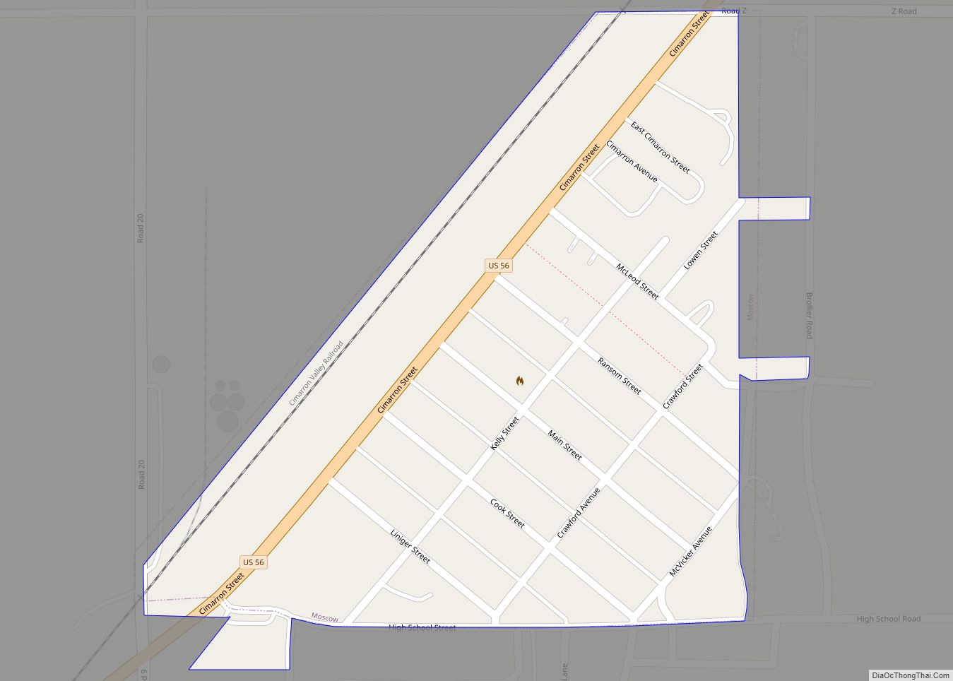
Moscow moved 8 miles to the north in 1913, where in 1912 the CVR railroad was built, so it was also called “New Moscow”.
For the first time in the US Census the placename “Moscow” in Stevens County appeared in 1890, though not as a city but as a township. The Census separated city of Moscow in 1930.
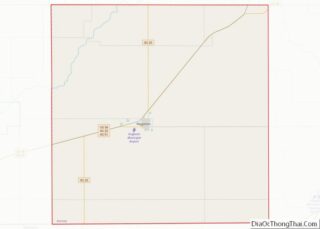
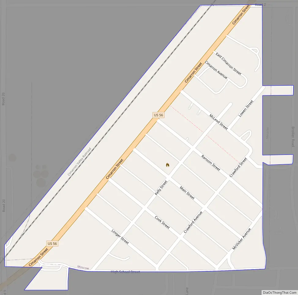
Moscow Road Map
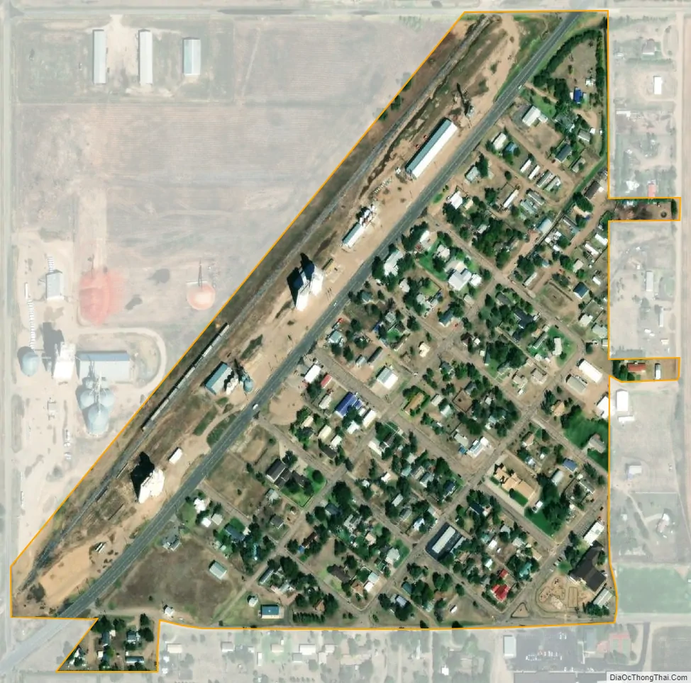
Moscow city Satellite Map
Geography
Moscow is located at 37°19′25″N 101°12′21″W / 37.32361°N 101.20583°W / 37.32361; -101.20583 (37.3236349, -101.2057164). According to the United States Census Bureau, the city has a total area of 0.18 square miles (0.47 km), all of it land.
The town is located in southwest Kansas in the Rolling Cropland and Range region of the Great Plains. The town is in the shape of a right triangle.
The northwest border of the Moscow adjoins U.S. Route 56. The city part of the Route 56 is named Cimarron Avenue, named after the Cimarron River, which is located 7 miles (11 km) north of Moscow.
See also
Map of Kansas State and its subdivision:- Allen
- Anderson
- Atchison
- Barber
- Barton
- Bourbon
- Brown
- Butler
- Chase
- Chautauqua
- Cherokee
- Cheyenne
- Clark
- Clay
- Cloud
- Coffey
- Comanche
- Cowley
- Crawford
- Decatur
- Dickinson
- Doniphan
- Douglas
- Edwards
- Elk
- Ellis
- Ellsworth
- Finney
- Ford
- Franklin
- Geary
- Gove
- Graham
- Grant
- Gray
- Greeley
- Greenwood
- Hamilton
- Harper
- Harvey
- Haskell
- Hodgeman
- Jackson
- Jefferson
- Jewell
- Johnson
- Kearny
- Kingman
- Kiowa
- Labette
- Lane
- Leavenworth
- Lincoln
- Linn
- Logan
- Lyon
- Marion
- Marshall
- McPherson
- Meade
- Miami
- Mitchell
- Montgomery
- Morris
- Morton
- Nemaha
- Neosho
- Ness
- Norton
- Osage
- Osborne
- Ottawa
- Pawnee
- Phillips
- Pottawatomie
- Pratt
- Rawlins
- Reno
- Republic
- Rice
- Riley
- Rooks
- Rush
- Russell
- Saline
- Scott
- Sedgwick
- Seward
- Shawnee
- Sheridan
- Sherman
- Smith
- Stafford
- Stanton
- Stevens
- Sumner
- Thomas
- Trego
- Wabaunsee
- Wallace
- Washington
- Wichita
- Wilson
- Woodson
- Wyandotte
- Alabama
- Alaska
- Arizona
- Arkansas
- California
- Colorado
- Connecticut
- Delaware
- District of Columbia
- Florida
- Georgia
- Hawaii
- Idaho
- Illinois
- Indiana
- Iowa
- Kansas
- Kentucky
- Louisiana
- Maine
- Maryland
- Massachusetts
- Michigan
- Minnesota
- Mississippi
- Missouri
- Montana
- Nebraska
- Nevada
- New Hampshire
- New Jersey
- New Mexico
- New York
- North Carolina
- North Dakota
- Ohio
- Oklahoma
- Oregon
- Pennsylvania
- Rhode Island
- South Carolina
- South Dakota
- Tennessee
- Texas
- Utah
- Vermont
- Virginia
- Washington
- West Virginia
- Wisconsin
- Wyoming