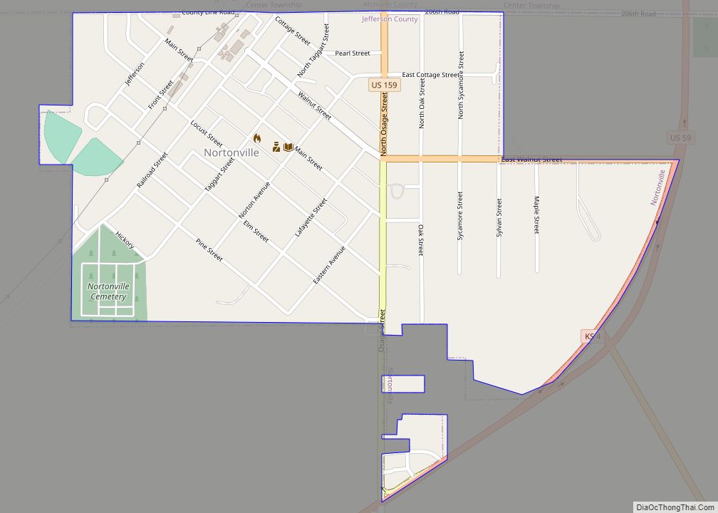
Nortonville is a city in Jefferson County, Kansas, United States. As of the 2020 census, the population of the city was 601.
| Name: | Nortonville city |
|---|---|
| LSAD Code: | 25 |
| LSAD Description: | city (suffix) |
| State: | Kansas |
| County: | Jefferson County |
| Incorporated: | 1884 |
| Elevation: | 1,161 ft (354 m) |
| Total Area: | 0.44 sq mi (1.15 km²) |
| Land Area: | 0.43 sq mi (1.12 km²) |
| Water Area: | 0.01 sq mi (0.03 km²) |
| Total Population: | 601 |
| Population Density: | 1,400/sq mi (520/km²) |
| ZIP code: | 66060 |
| Area code: | 913 |
| FIPS code: | 2051525 |
| Website: | nortonvilleks.com |
Online Interactive Map
Click on ![]() to view map in "full screen" mode.
to view map in "full screen" mode.
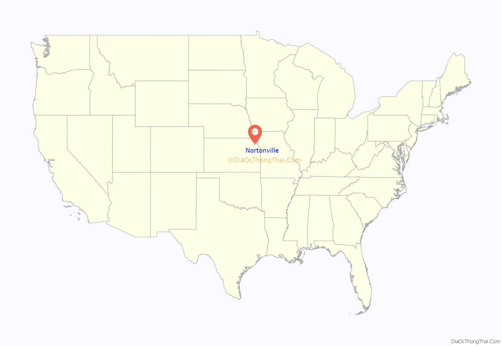
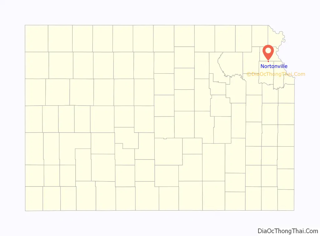
Nortonville location map. Where is Nortonville city?
History
Nortonville was platted in 1873. It was named for L. Norton, Jr., a railroad employee. The first post office in Nortonville was established in May 1873.
In the 1900s, Nortonville was reported to be one of three sundown towns in the state, where African Americans were not allowed to reside.
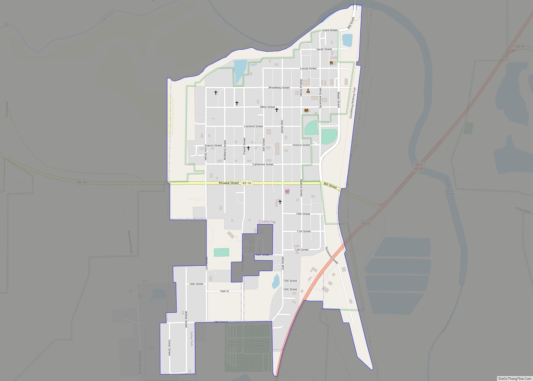
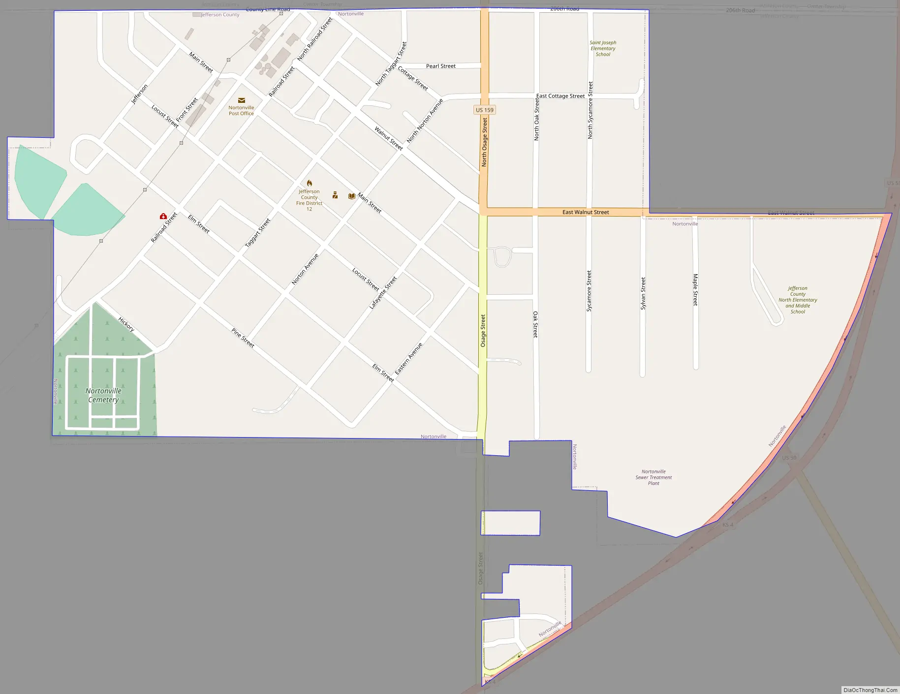
Nortonville Road Map
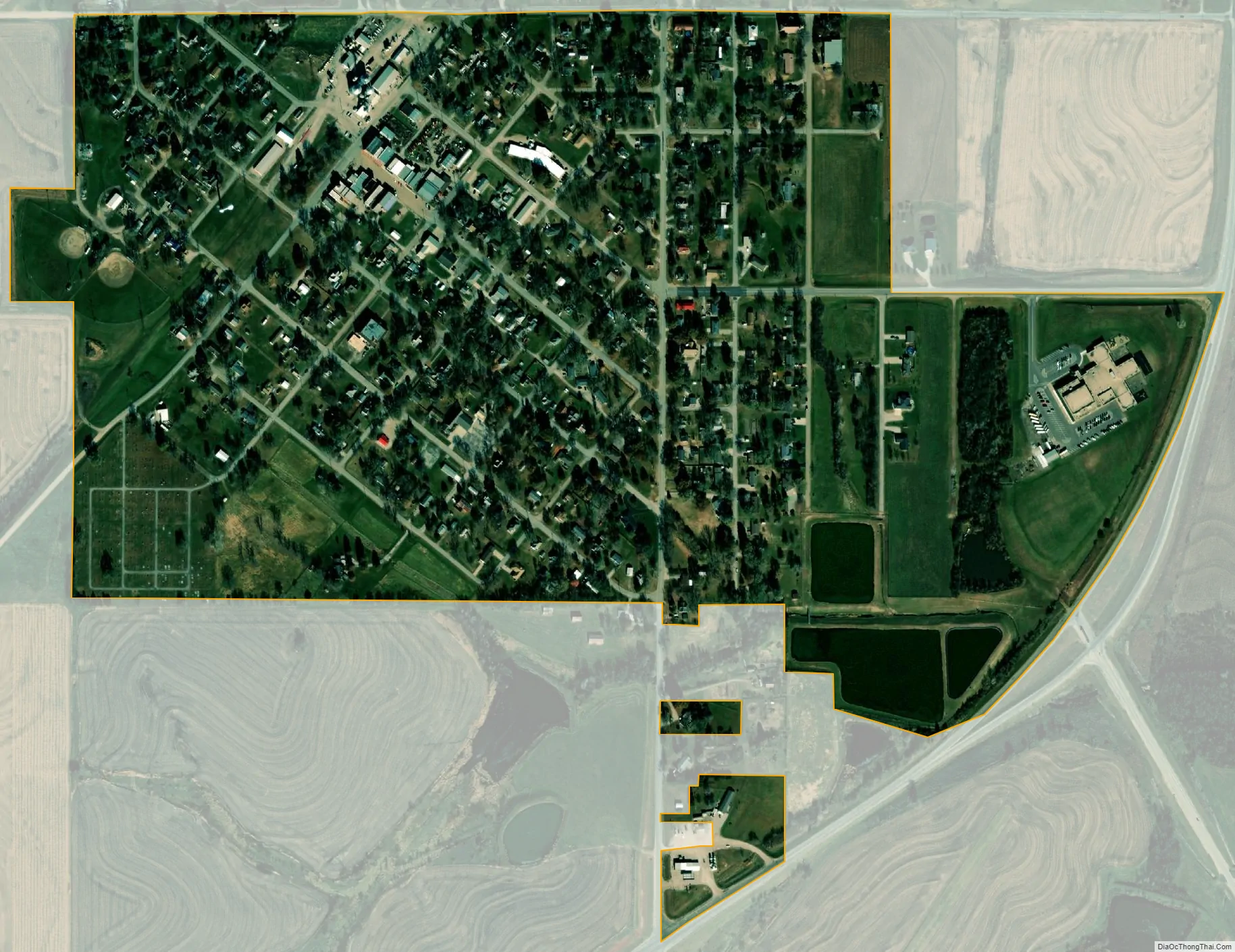
Nortonville city Satellite Map
Geography
Nortonville is located at 39°25′3″N 95°19′54″W / 39.41750°N 95.33167°W / 39.41750; -95.33167 (39.417496, -95.331626). According to the United States Census Bureau, the city has a total area of 0.45 square miles (1.17 km), of which, 0.44 square miles (1.14 km) is land and 0.01 square miles (0.03 km) is water.
See also
Map of Kansas State and its subdivision:- Allen
- Anderson
- Atchison
- Barber
- Barton
- Bourbon
- Brown
- Butler
- Chase
- Chautauqua
- Cherokee
- Cheyenne
- Clark
- Clay
- Cloud
- Coffey
- Comanche
- Cowley
- Crawford
- Decatur
- Dickinson
- Doniphan
- Douglas
- Edwards
- Elk
- Ellis
- Ellsworth
- Finney
- Ford
- Franklin
- Geary
- Gove
- Graham
- Grant
- Gray
- Greeley
- Greenwood
- Hamilton
- Harper
- Harvey
- Haskell
- Hodgeman
- Jackson
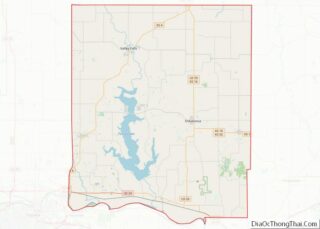
- Jefferson
- Jewell
- Johnson
- Kearny
- Kingman
- Kiowa
- Labette
- Lane
- Leavenworth
- Lincoln
- Linn
- Logan
- Lyon
- Marion
- Marshall
- McPherson
- Meade
- Miami
- Mitchell
- Montgomery
- Morris
- Morton
- Nemaha
- Neosho
- Ness
- Norton
- Osage
- Osborne
- Ottawa
- Pawnee
- Phillips
- Pottawatomie
- Pratt
- Rawlins
- Reno
- Republic
- Rice
- Riley
- Rooks
- Rush
- Russell
- Saline
- Scott
- Sedgwick
- Seward
- Shawnee
- Sheridan
- Sherman
- Smith
- Stafford
- Stanton
- Stevens
- Sumner
- Thomas
- Trego
- Wabaunsee
- Wallace
- Washington
- Wichita
- Wilson
- Woodson
- Wyandotte
- Alabama
- Alaska
- Arizona
- Arkansas
- California
- Colorado
- Connecticut
- Delaware
- District of Columbia
- Florida
- Georgia
- Hawaii
- Idaho
- Illinois
- Indiana
- Iowa
- Kansas
- Kentucky
- Louisiana
- Maine
- Maryland
- Massachusetts
- Michigan
- Minnesota
- Mississippi
- Missouri
- Montana
- Nebraska
- Nevada
- New Hampshire
- New Jersey
- New Mexico
- New York
- North Carolina
- North Dakota
- Ohio
- Oklahoma
- Oregon
- Pennsylvania
- Rhode Island
- South Carolina
- South Dakota
- Tennessee
- Texas
- Utah
- Vermont
- Virginia
- Washington
- West Virginia
- Wisconsin
- Wyoming