Randolph is a city in Riley County, Kansas, United States. As of the 2020 census, the population of the city was 159.
| Name: | Randolph city |
|---|---|
| LSAD Code: | 25 |
| LSAD Description: | city (suffix) |
| State: | Kansas |
| County: | Riley County |
| Founded: | 1850s |
| Incorporated: | 1886 |
| Elevation: | 1,237 ft (377 m) |
| Total Area: | 0.25 sq mi (0.65 km²) |
| Land Area: | 0.25 sq mi (0.65 km²) |
| Water Area: | 0.00 sq mi (0.00 km²) |
| Total Population: | 159 |
| Population Density: | 640/sq mi (240/km²) |
| ZIP code: | 66554 |
| Area code: | 785 |
| FIPS code: | 2058475 |
| Website: | randolphks.com |
Online Interactive Map
Click on ![]() to view map in "full screen" mode.
to view map in "full screen" mode.
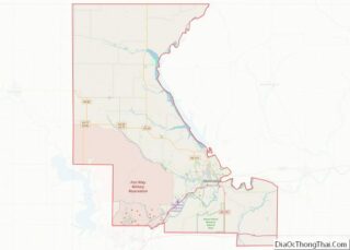
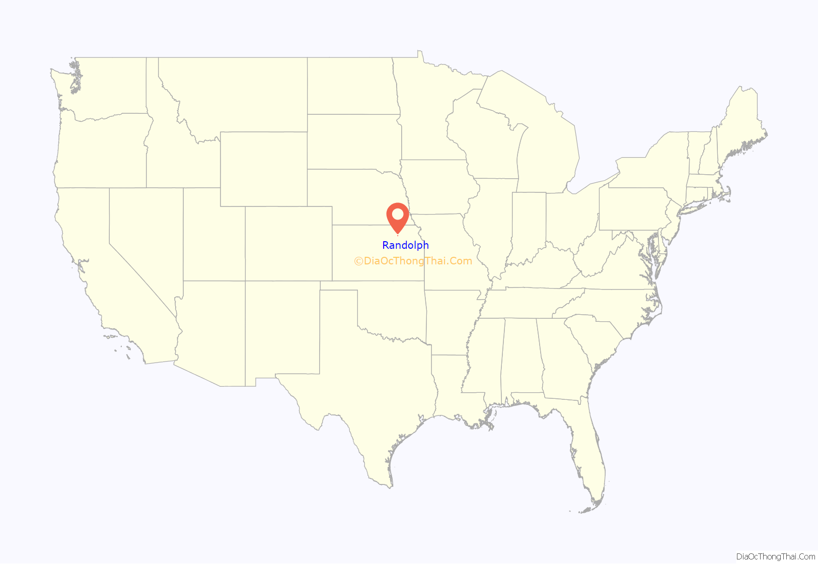
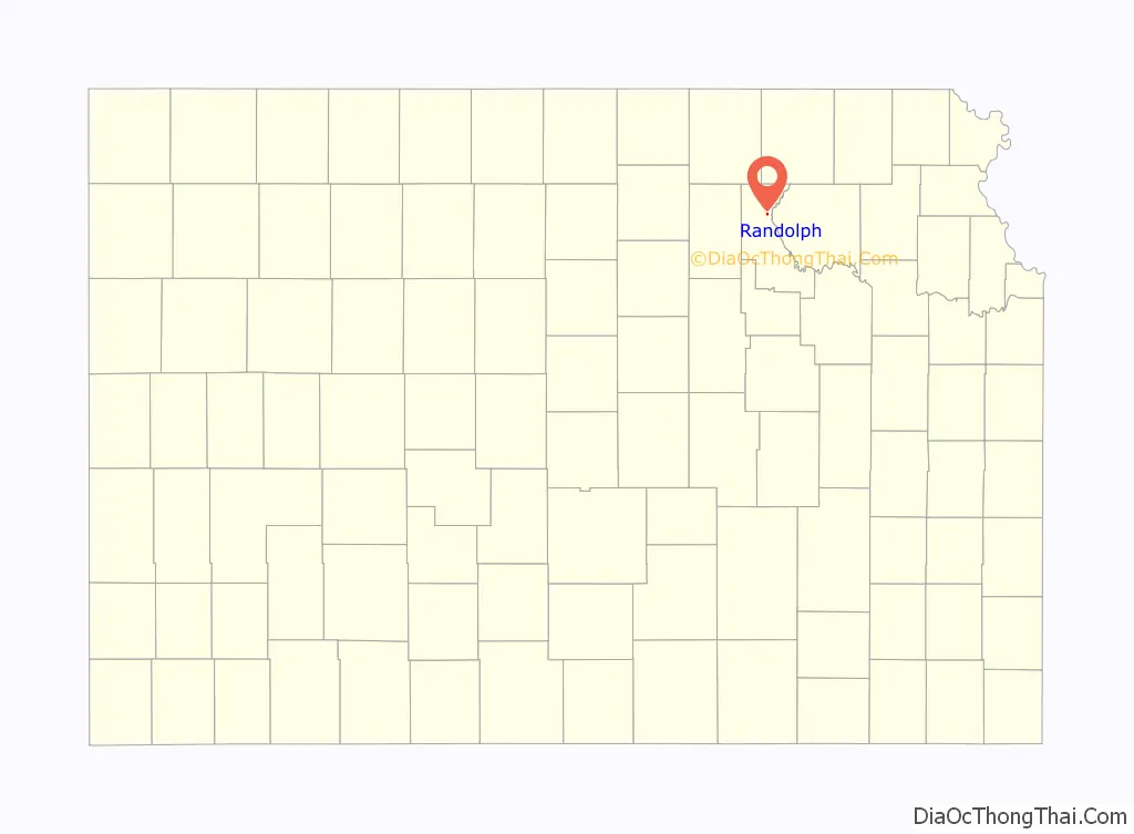
Randolph location map. Where is Randolph city?
History
Randolph was originally called Waterville, and under the latter name was laid out in 1856. It was renamed Randolph in honor Gardner Randolph, a pioneer settler.
Randolph was originally located a mile east of its present location. When the Tuttle Creek reservoir began filling up in 1962, it affected ten towns and entirely submerged four of them (from north to south): Cleburne at 39°31′49″N 96°38′6″W / 39.53028°N 96.63500°W / 39.53028; -96.63500, Randolph, Garrison Cross and Stockdale. The only town to rebuild elsewhere was Randolph, where the streets are named after the submerged towns.
The ruins of the original town are visible on the north side of Kansas Highway 16 as it crosses the lake. The downtown of the original settlement is above the waterline on an island in the marshes at the northern tip of the lake. The island is occasionally accessible by foot when Fancy Creek is low, but the channels of Fancy Creek and the Big Blue River shift frequently making access to the ruins unpredictable. This is locally known as “Old Randolph.”
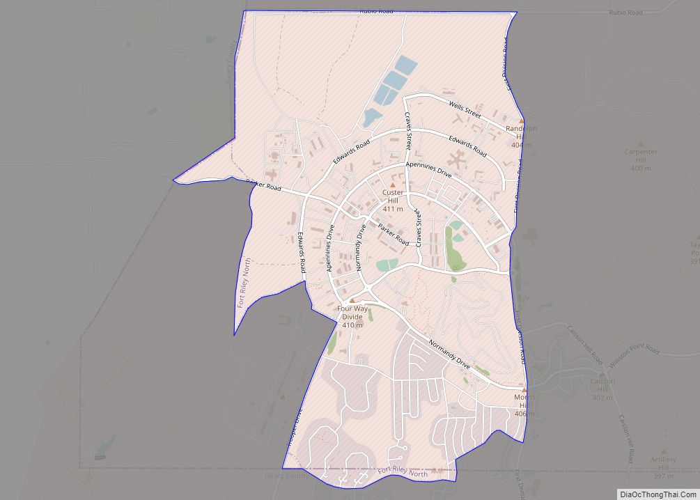
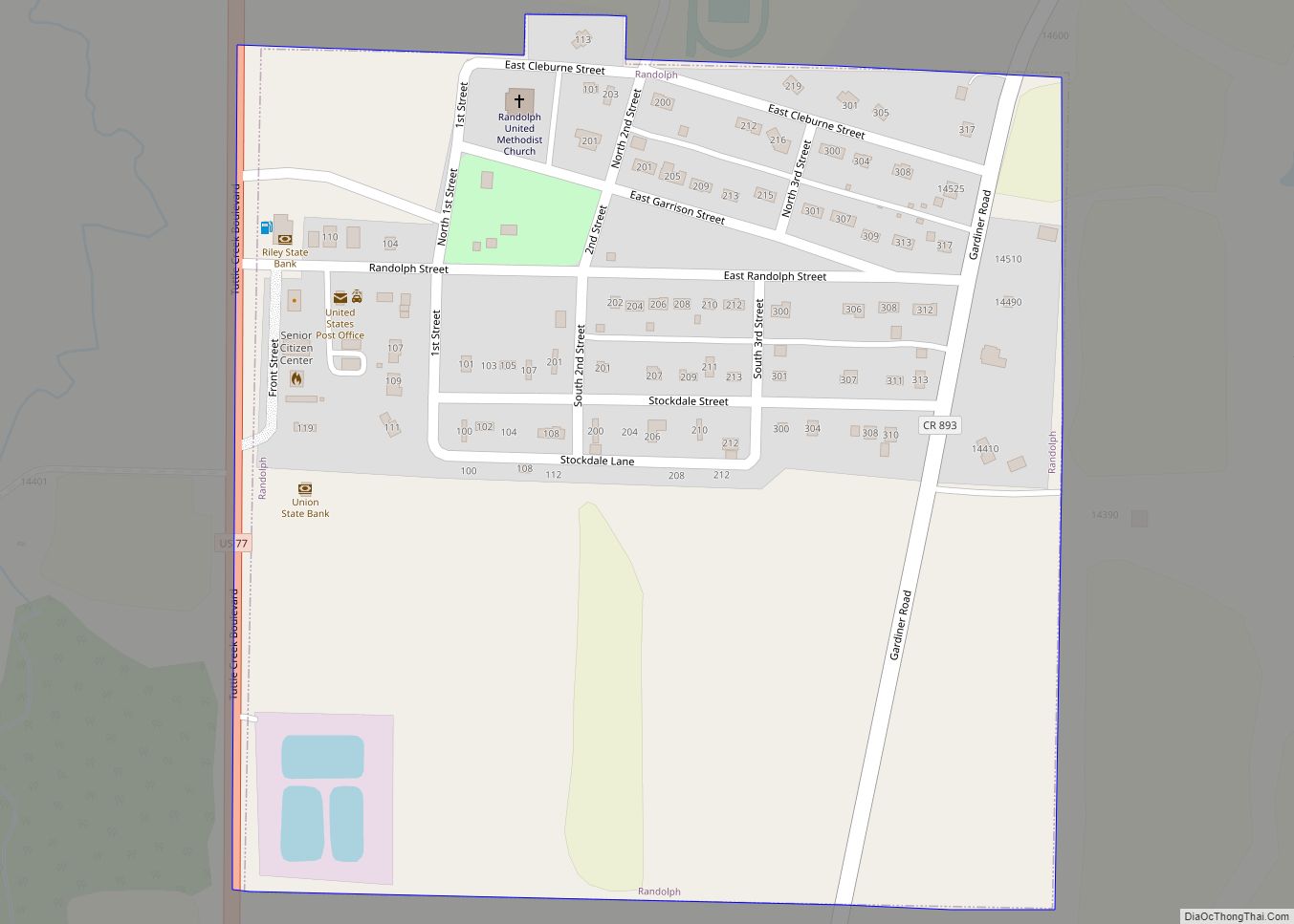
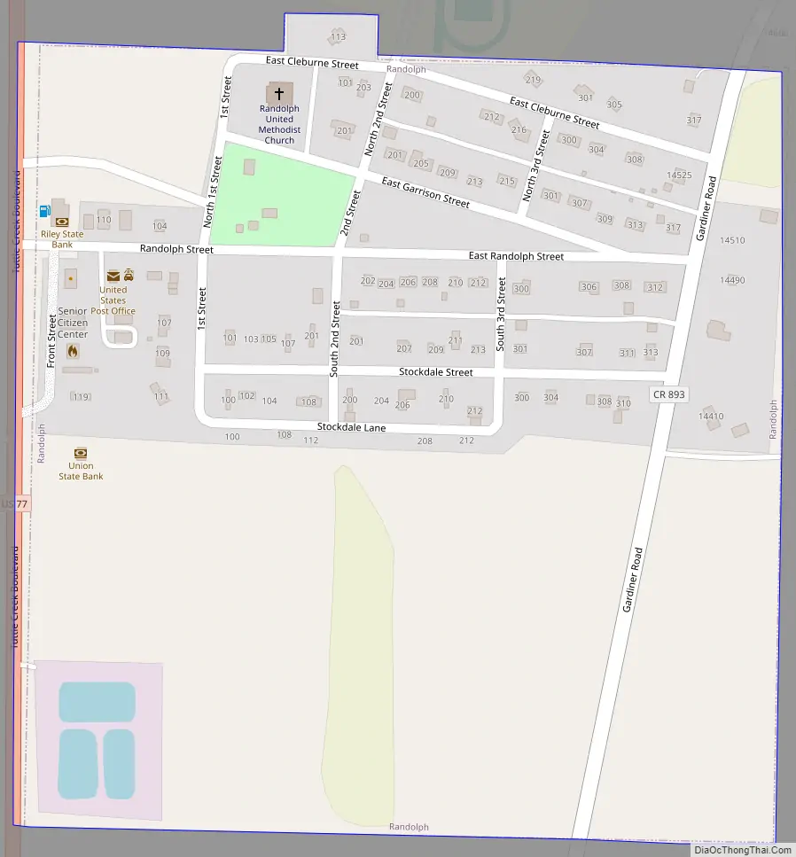
Randolph Road Map
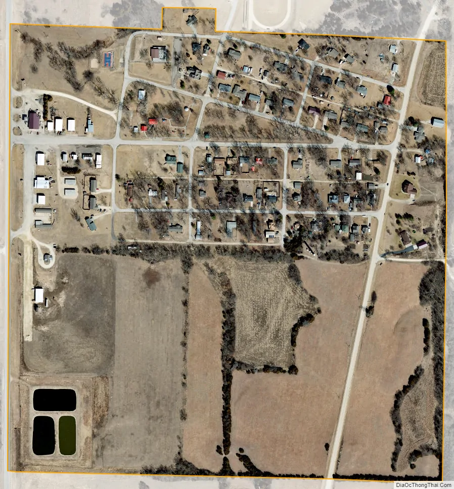
Randolph city Satellite Map
Geography
According to the United States Census Bureau, the city has a total area of 0.25 square miles (0.65 km), all of it land.
Climate
The climate in this area is characterized by hot, humid summers and generally mild to cool winters. According to the Köppen Climate Classification system, Randolph has a humid subtropical climate, abbreviated “Cfa” on climate maps.
See also
Map of Kansas State and its subdivision:- Allen
- Anderson
- Atchison
- Barber
- Barton
- Bourbon
- Brown
- Butler
- Chase
- Chautauqua
- Cherokee
- Cheyenne
- Clark
- Clay
- Cloud
- Coffey
- Comanche
- Cowley
- Crawford
- Decatur
- Dickinson
- Doniphan
- Douglas
- Edwards
- Elk
- Ellis
- Ellsworth
- Finney
- Ford
- Franklin
- Geary
- Gove
- Graham
- Grant
- Gray
- Greeley
- Greenwood
- Hamilton
- Harper
- Harvey
- Haskell
- Hodgeman
- Jackson
- Jefferson
- Jewell
- Johnson
- Kearny
- Kingman
- Kiowa
- Labette
- Lane
- Leavenworth
- Lincoln
- Linn
- Logan
- Lyon
- Marion
- Marshall
- McPherson
- Meade
- Miami
- Mitchell
- Montgomery
- Morris
- Morton
- Nemaha
- Neosho
- Ness
- Norton
- Osage
- Osborne
- Ottawa
- Pawnee
- Phillips
- Pottawatomie
- Pratt
- Rawlins
- Reno
- Republic
- Rice
- Riley
- Rooks
- Rush
- Russell
- Saline
- Scott
- Sedgwick
- Seward
- Shawnee
- Sheridan
- Sherman
- Smith
- Stafford
- Stanton
- Stevens
- Sumner
- Thomas
- Trego
- Wabaunsee
- Wallace
- Washington
- Wichita
- Wilson
- Woodson
- Wyandotte
- Alabama
- Alaska
- Arizona
- Arkansas
- California
- Colorado
- Connecticut
- Delaware
- District of Columbia
- Florida
- Georgia
- Hawaii
- Idaho
- Illinois
- Indiana
- Iowa
- Kansas
- Kentucky
- Louisiana
- Maine
- Maryland
- Massachusetts
- Michigan
- Minnesota
- Mississippi
- Missouri
- Montana
- Nebraska
- Nevada
- New Hampshire
- New Jersey
- New Mexico
- New York
- North Carolina
- North Dakota
- Ohio
- Oklahoma
- Oregon
- Pennsylvania
- Rhode Island
- South Carolina
- South Dakota
- Tennessee
- Texas
- Utah
- Vermont
- Virginia
- Washington
- West Virginia
- Wisconsin
- Wyoming