Raymond is a city in Rice County, Kansas, United States. It is named after Emmons Raymond, former Director of the Atchison, Topeka and Santa Fe Railway. As of the 2020 census, the population of the city was 85.
| Name: | Raymond city |
|---|---|
| LSAD Code: | 25 |
| LSAD Description: | city (suffix) |
| State: | Kansas |
| County: | Rice County |
| Founded: | 1871 |
| Incorporated: | 1954 |
| Elevation: | 1,726 ft (526 m) |
| Total Area: | 0.31 sq mi (0.80 km²) |
| Land Area: | 0.31 sq mi (0.80 km²) |
| Water Area: | 0.00 sq mi (0.00 km²) |
| Total Population: | 85 |
| Population Density: | 270/sq mi (110/km²) |
| ZIP code: | 67573 |
| Area code: | 620 |
| FIPS code: | 2058550 |
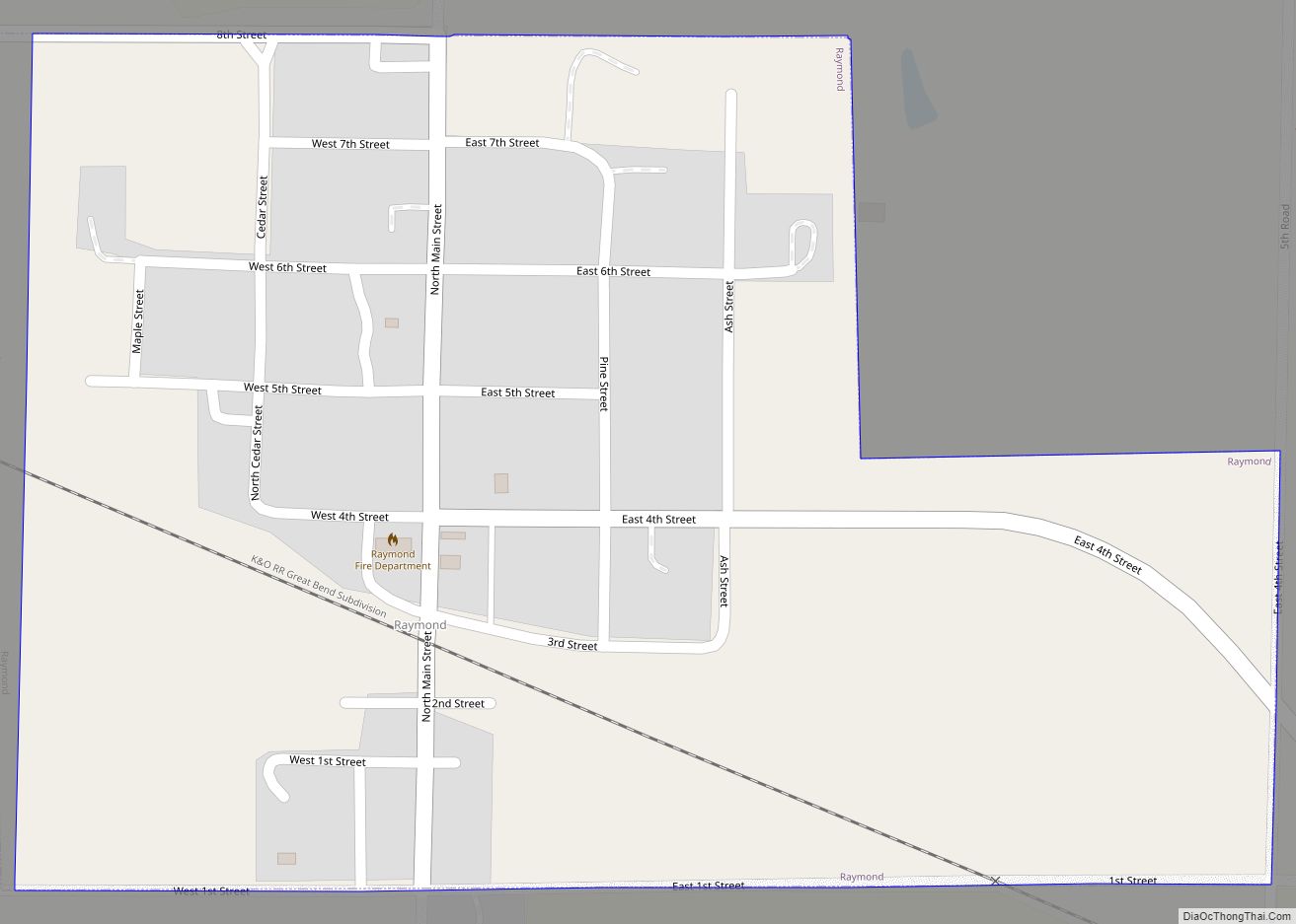
Online Interactive Map
Click on ![]() to view map in "full screen" mode.
to view map in "full screen" mode.
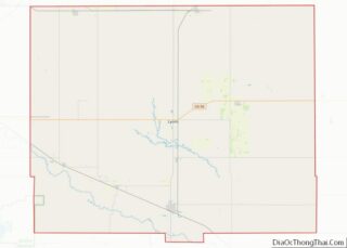
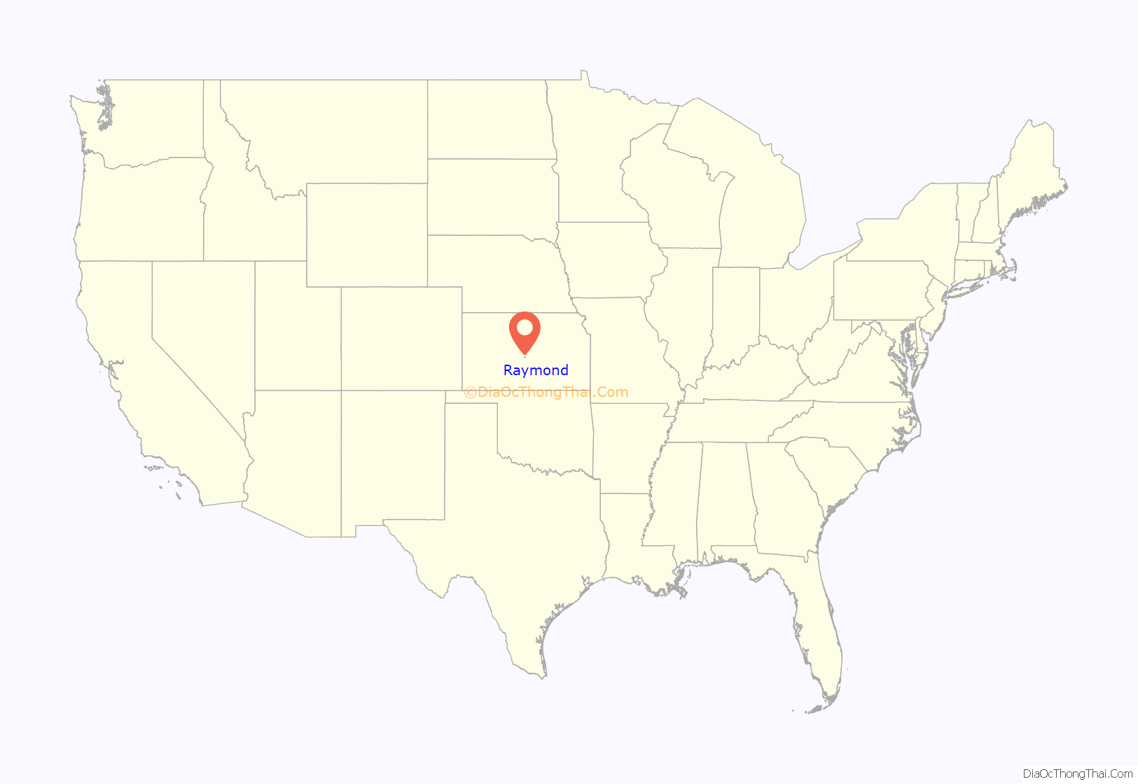
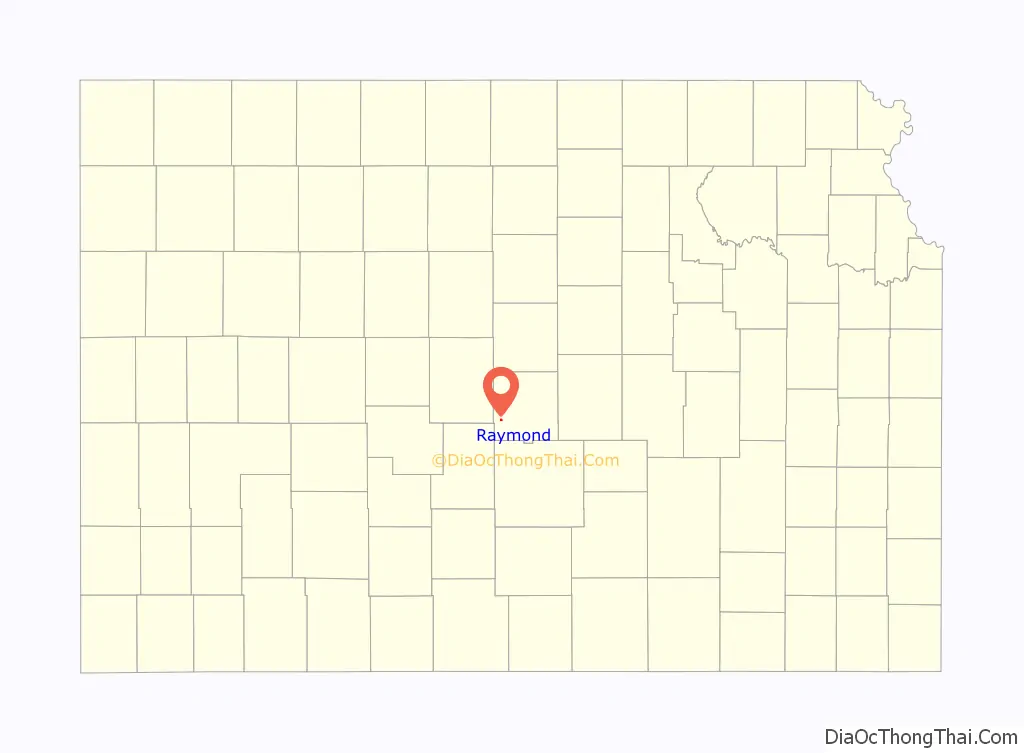
Raymond location map. Where is Raymond city?
History
For millennia, the land now known as Kansas was inhabited by Native Americans. In 1803, most of modern Kansas was secured by the United States as part of the Louisiana Purchase. In 1854, the Kansas Territory was organized, then in 1861 Kansas became the 34th U.S. state. In 1867, Rice County was founded.
Raymond was founded in 1871, making it the oldest town in Rice County. The first post office in Raymond was established in 1872. At one point in its history Raymond was known as a wild “cowtown” and was a stop on the Santa Fe Railroad, but the town has been in decline since the 1950s.
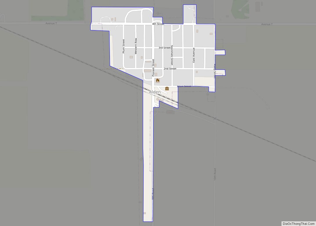
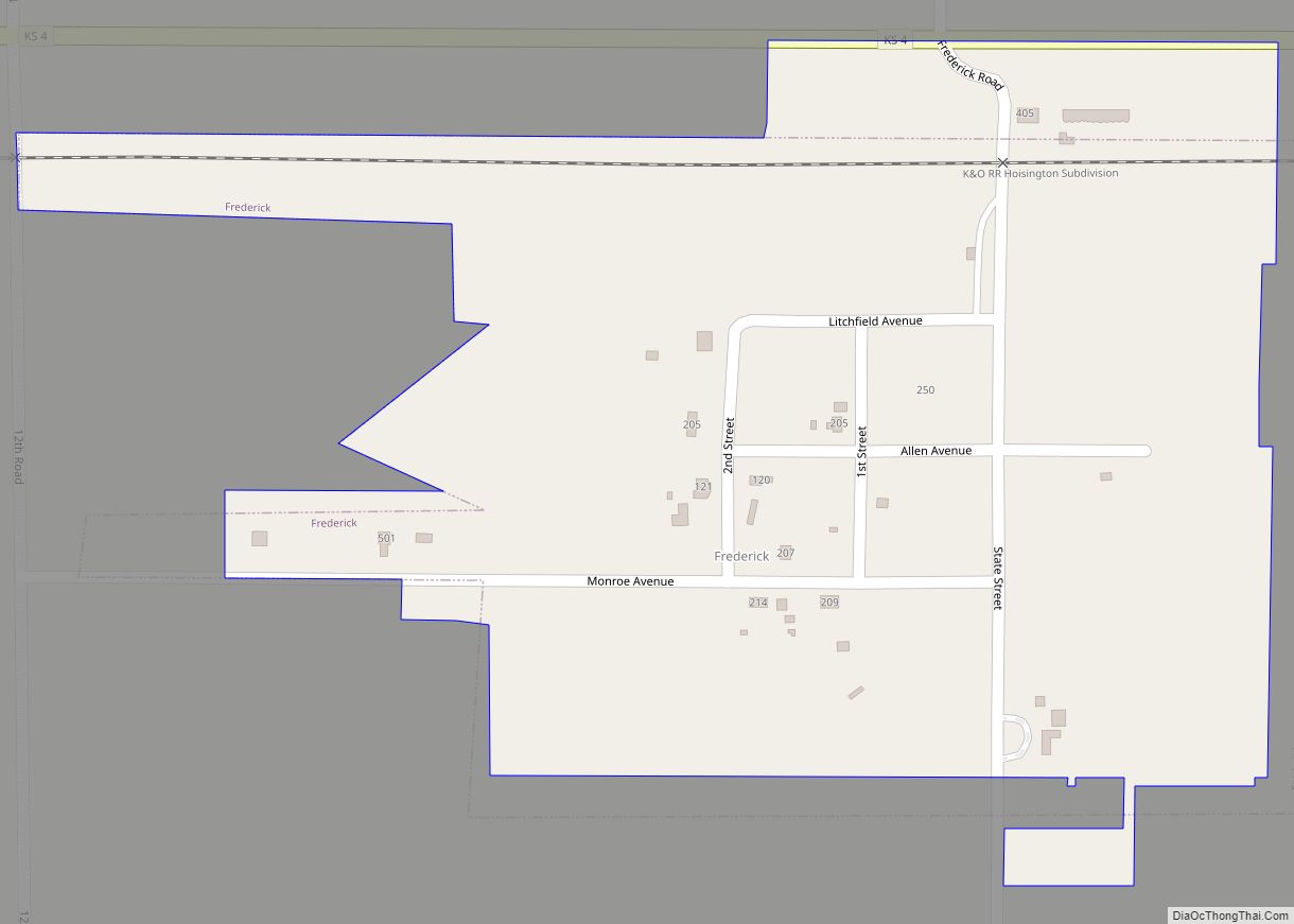
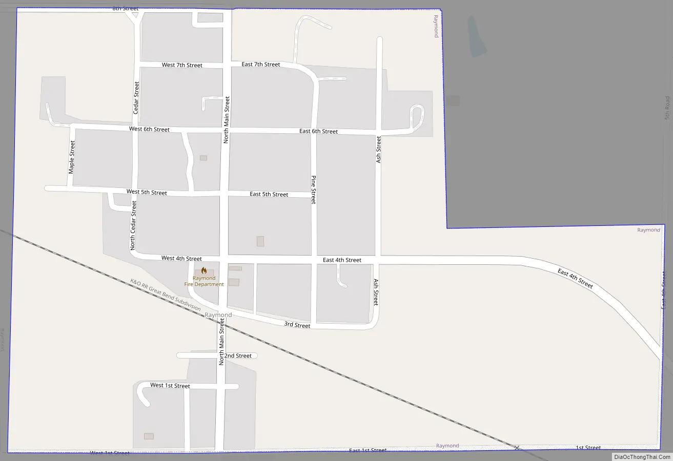
Raymond Road Map
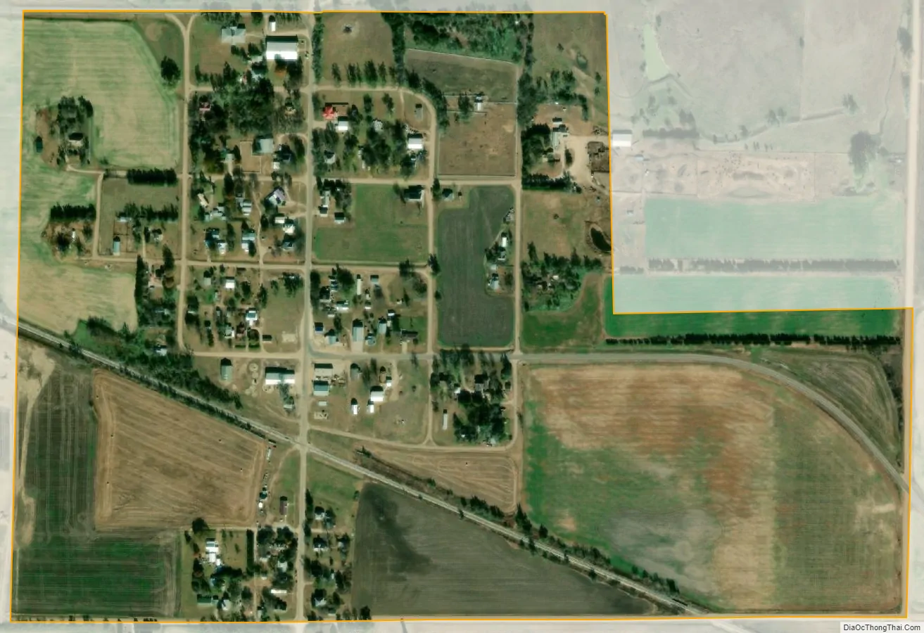
Raymond city Satellite Map
Geography
Raymond is located at 38°16′42″N 98°24′54″W / 38.27833°N 98.41500°W / 38.27833; -98.41500 (38.278464, -98.414878). According to the United States Census Bureau, the city has a total area of 0.32 square miles (0.83 km), all of it land.
See also
Map of Kansas State and its subdivision:- Allen
- Anderson
- Atchison
- Barber
- Barton
- Bourbon
- Brown
- Butler
- Chase
- Chautauqua
- Cherokee
- Cheyenne
- Clark
- Clay
- Cloud
- Coffey
- Comanche
- Cowley
- Crawford
- Decatur
- Dickinson
- Doniphan
- Douglas
- Edwards
- Elk
- Ellis
- Ellsworth
- Finney
- Ford
- Franklin
- Geary
- Gove
- Graham
- Grant
- Gray
- Greeley
- Greenwood
- Hamilton
- Harper
- Harvey
- Haskell
- Hodgeman
- Jackson
- Jefferson
- Jewell
- Johnson
- Kearny
- Kingman
- Kiowa
- Labette
- Lane
- Leavenworth
- Lincoln
- Linn
- Logan
- Lyon
- Marion
- Marshall
- McPherson
- Meade
- Miami
- Mitchell
- Montgomery
- Morris
- Morton
- Nemaha
- Neosho
- Ness
- Norton
- Osage
- Osborne
- Ottawa
- Pawnee
- Phillips
- Pottawatomie
- Pratt
- Rawlins
- Reno
- Republic
- Rice
- Riley
- Rooks
- Rush
- Russell
- Saline
- Scott
- Sedgwick
- Seward
- Shawnee
- Sheridan
- Sherman
- Smith
- Stafford
- Stanton
- Stevens
- Sumner
- Thomas
- Trego
- Wabaunsee
- Wallace
- Washington
- Wichita
- Wilson
- Woodson
- Wyandotte
- Alabama
- Alaska
- Arizona
- Arkansas
- California
- Colorado
- Connecticut
- Delaware
- District of Columbia
- Florida
- Georgia
- Hawaii
- Idaho
- Illinois
- Indiana
- Iowa
- Kansas
- Kentucky
- Louisiana
- Maine
- Maryland
- Massachusetts
- Michigan
- Minnesota
- Mississippi
- Missouri
- Montana
- Nebraska
- Nevada
- New Hampshire
- New Jersey
- New Mexico
- New York
- North Carolina
- North Dakota
- Ohio
- Oklahoma
- Oregon
- Pennsylvania
- Rhode Island
- South Carolina
- South Dakota
- Tennessee
- Texas
- Utah
- Vermont
- Virginia
- Washington
- West Virginia
- Wisconsin
- Wyoming