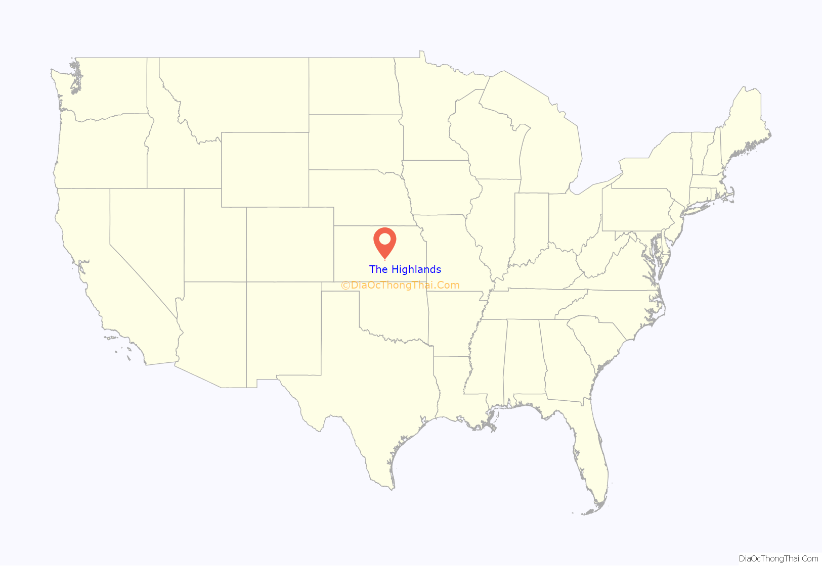
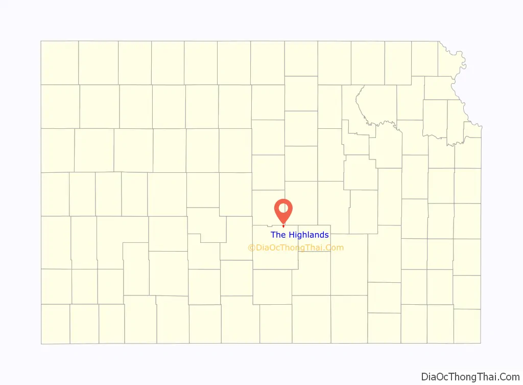
The Highlands is a city in Reno County, Kansas, United States. As of the 2020 census, the population of the city was 349. It is located north of the city of Hutchinson.
| Name: | The Highlands city |
|---|---|
| LSAD Code: | 25 |
| LSAD Description: | city (suffix) |
| State: | Kansas |
| County: | Reno County |
| Incorporated: | July 25, 2017 |
| Elevation: | 1,690 ft (520 m) |
| Total Area: | 1.02 sq mi (2.6 km²) |
| Land Area: | 1.02 sq mi (2.6 km²) |
| Water Area: | 0.00 sq mi (0.0 km²) |
| Total Population: | 349 |
| Population Density: | 340/sq mi (130/km²) |
| Area code: | 620 |
| FIPS code: | 2070357 |
| Website: | thehighlandsgov.net |
Online Interactive Map
Click on ![]() to view map in "full screen" mode.
to view map in "full screen" mode.
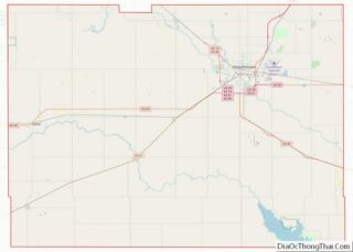
The Highlands location map. Where is The Highlands city?
History
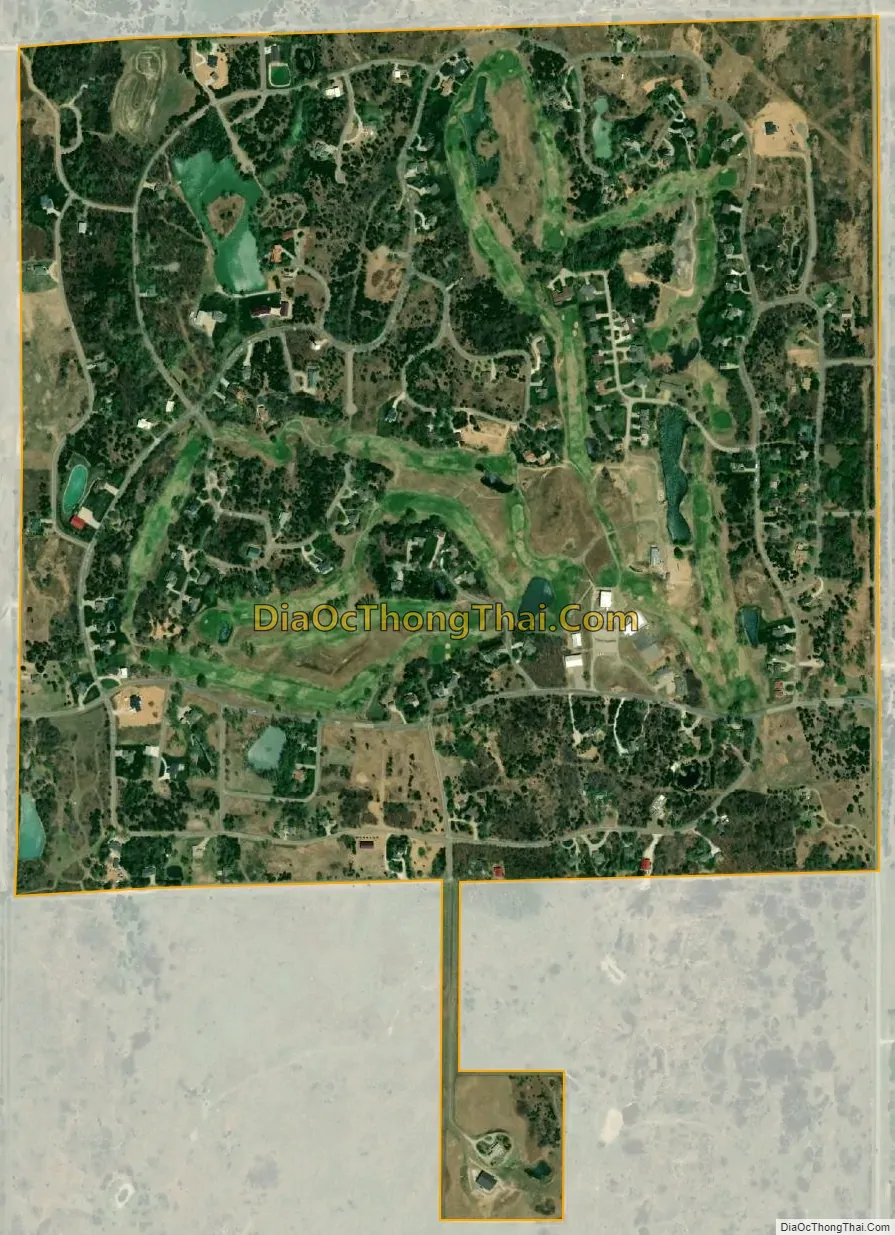
The Highlands was incorporated from 21 subdivisions surrounding the Crazy Horse Golf Club in 2017, in order to provide tax dollars for deteriorating roads. The Highlands was the first new city in Reno County to be incorporated in 65 years since the incorporation of Willowbrook.
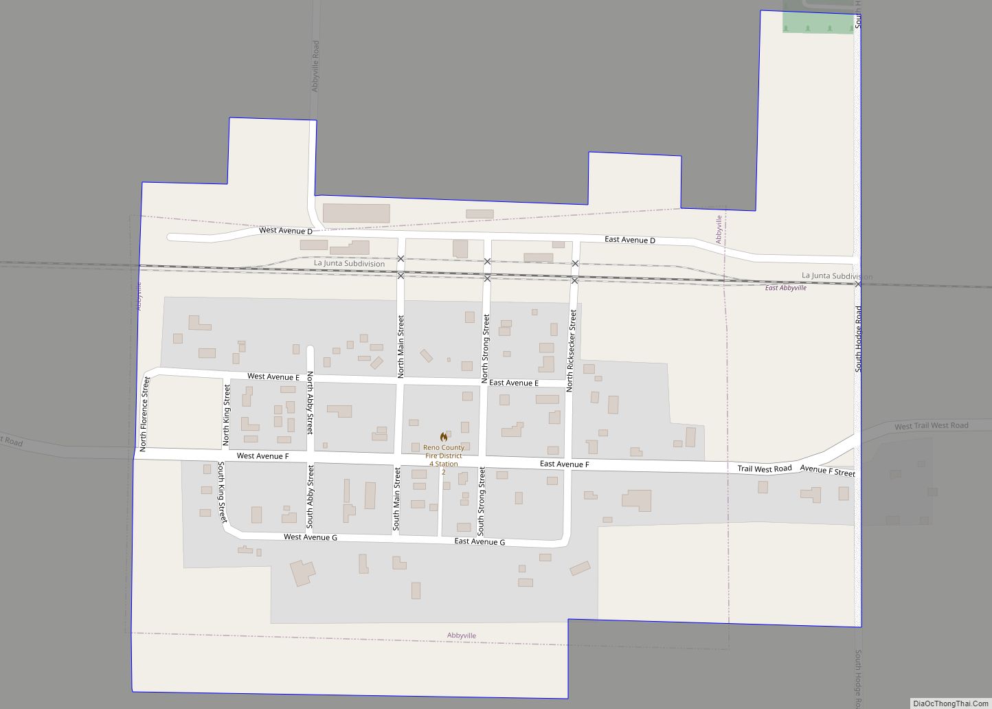
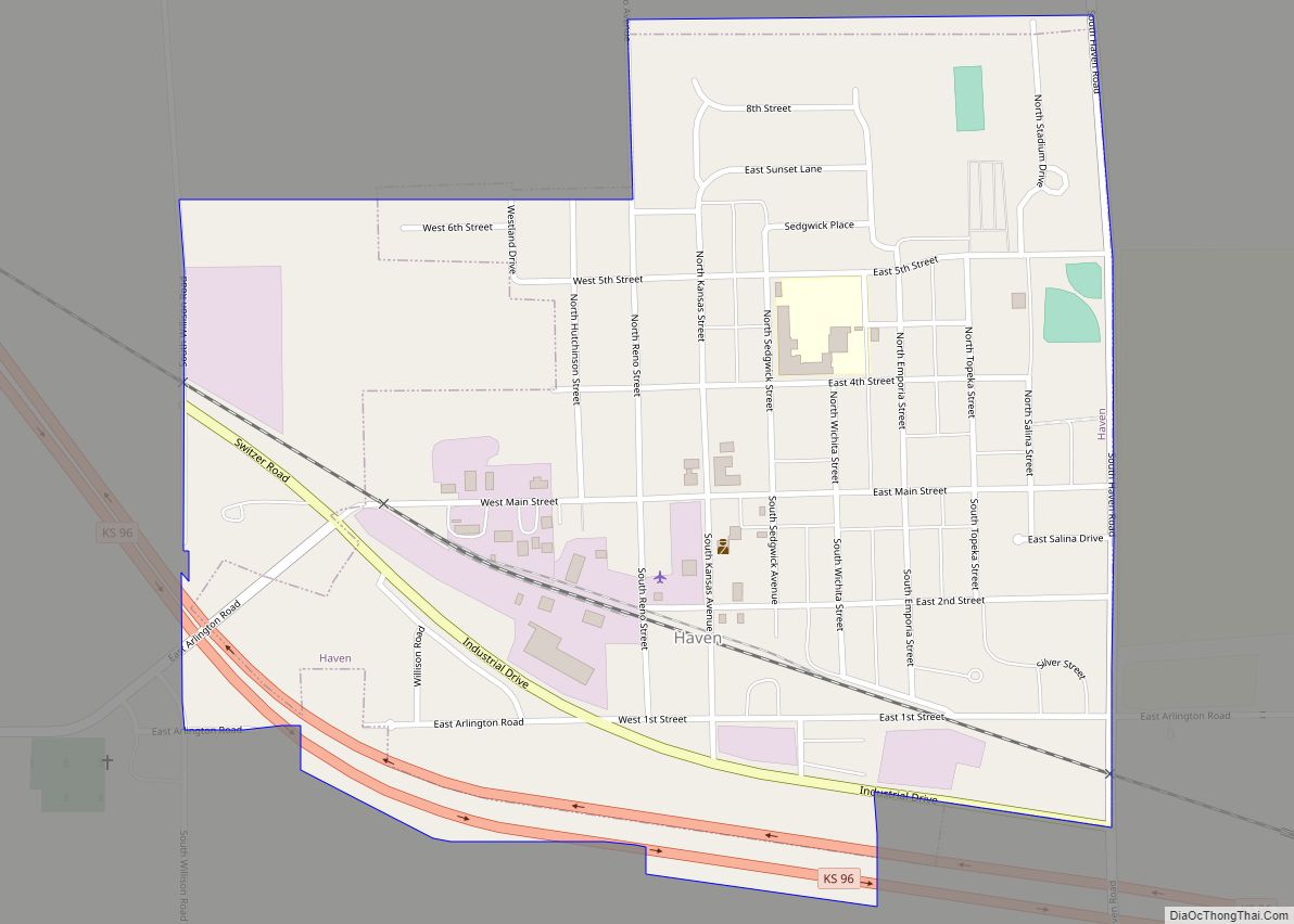
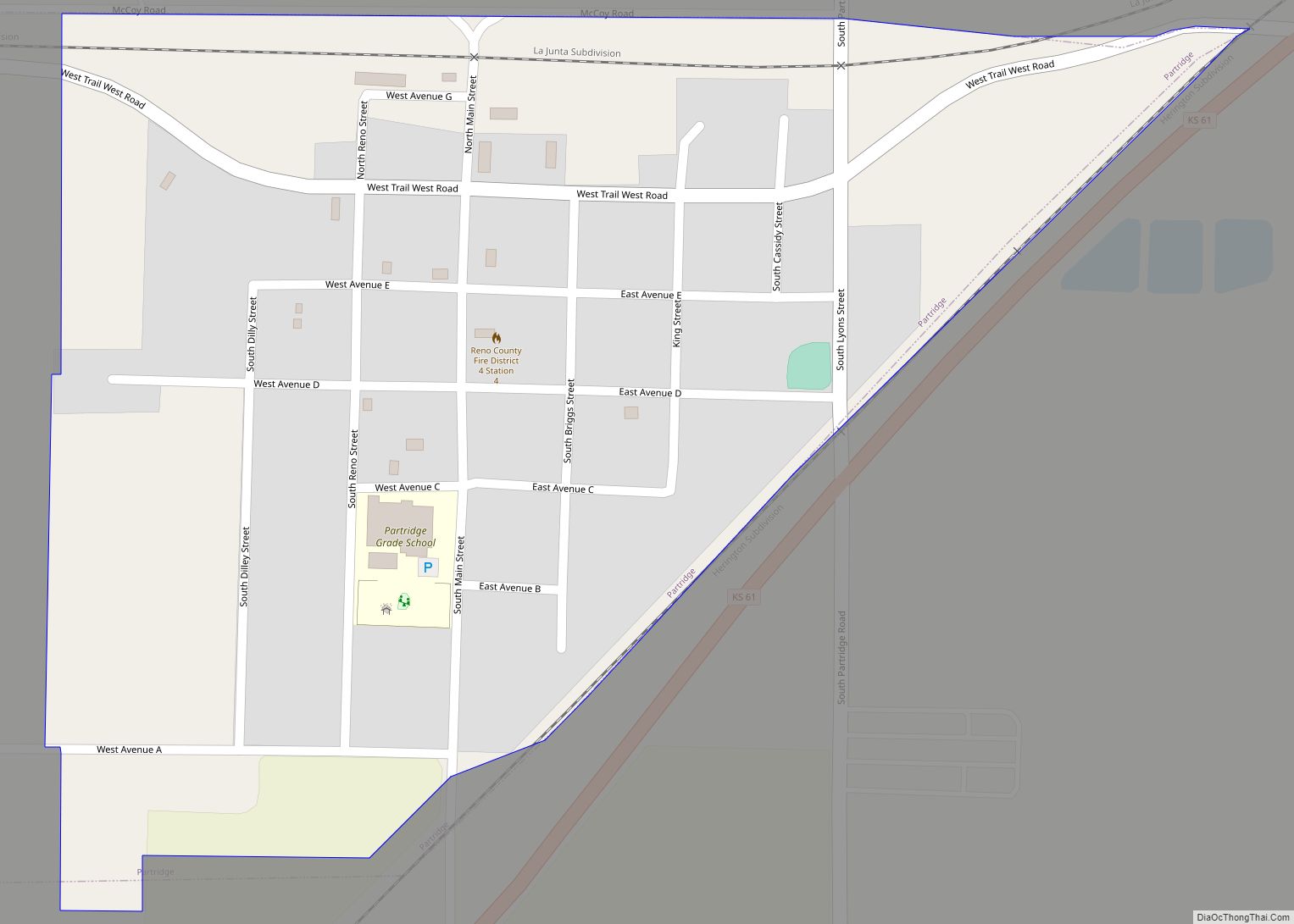
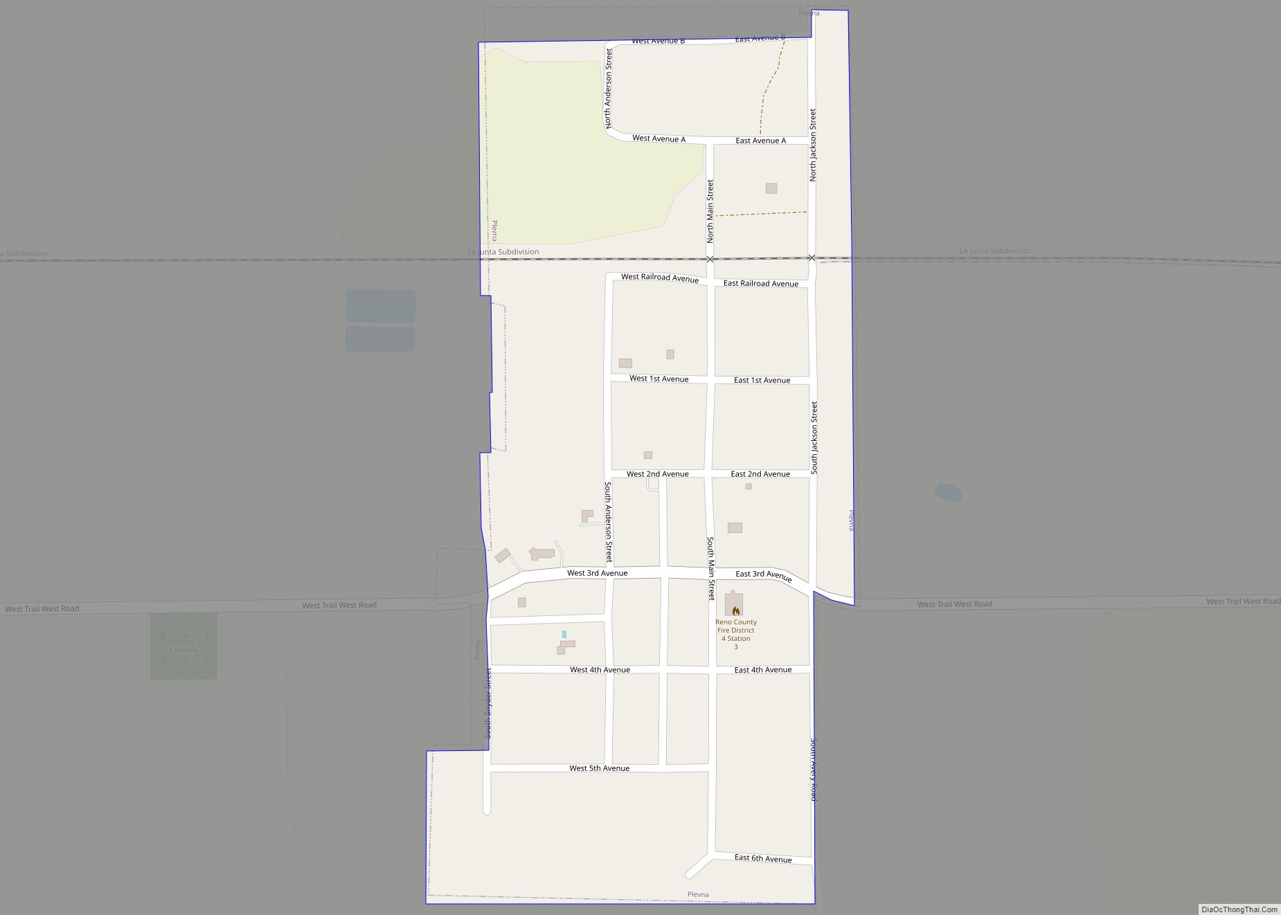
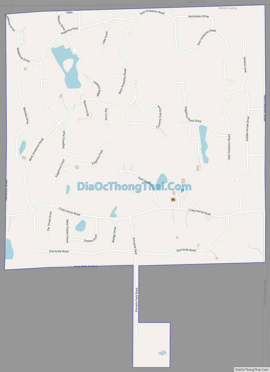
The Highlands Road Map
The Highlands city Satellite Map
Geography
The Highlands is located at 38°09′44″N 97°56′48″W / 38.1622835°N 97.9466114°W / 38.1622835; -97.9466114 (38.1622835, -97.9466114). According to the United States Census Bureau, the city has a total area of 1.025 square miles (2.65 km), all of it land.
See also
Map of Kansas State and its subdivision:- Allen
- Anderson
- Atchison
- Barber
- Barton
- Bourbon
- Brown
- Butler
- Chase
- Chautauqua
- Cherokee
- Cheyenne
- Clark
- Clay
- Cloud
- Coffey
- Comanche
- Cowley
- Crawford
- Decatur
- Dickinson
- Doniphan
- Douglas
- Edwards
- Elk
- Ellis
- Ellsworth
- Finney
- Ford
- Franklin
- Geary
- Gove
- Graham
- Grant
- Gray
- Greeley
- Greenwood
- Hamilton
- Harper
- Harvey
- Haskell
- Hodgeman
- Jackson
- Jefferson
- Jewell
- Johnson
- Kearny
- Kingman
- Kiowa
- Labette
- Lane
- Leavenworth
- Lincoln
- Linn
- Logan
- Lyon
- Marion
- Marshall
- McPherson
- Meade
- Miami
- Mitchell
- Montgomery
- Morris
- Morton
- Nemaha
- Neosho
- Ness
- Norton
- Osage
- Osborne
- Ottawa
- Pawnee
- Phillips
- Pottawatomie
- Pratt
- Rawlins
- Reno
- Republic
- Rice
- Riley
- Rooks
- Rush
- Russell
- Saline
- Scott
- Sedgwick
- Seward
- Shawnee
- Sheridan
- Sherman
- Smith
- Stafford
- Stanton
- Stevens
- Sumner
- Thomas
- Trego
- Wabaunsee
- Wallace
- Washington
- Wichita
- Wilson
- Woodson
- Wyandotte
- Alabama
- Alaska
- Arizona
- Arkansas
- California
- Colorado
- Connecticut
- Delaware
- District of Columbia
- Florida
- Georgia
- Hawaii
- Idaho
- Illinois
- Indiana
- Iowa
- Kansas
- Kentucky
- Louisiana
- Maine
- Maryland
- Massachusetts
- Michigan
- Minnesota
- Mississippi
- Missouri
- Montana
- Nebraska
- Nevada
- New Hampshire
- New Jersey
- New Mexico
- New York
- North Carolina
- North Dakota
- Ohio
- Oklahoma
- Oregon
- Pennsylvania
- Rhode Island
- South Carolina
- South Dakota
- Tennessee
- Texas
- Utah
- Vermont
- Virginia
- Washington
- West Virginia
- Wisconsin
- Wyoming