Hutchinson is the largest city and county seat in Reno County, Kansas, United States, and located on the Arkansas River. It has been home to salt mines since 1887, thus its nickname of “Salt City”, but locals call it “Hutch”. As of the 2020 census, the population of the city was 40,006.
Each year, Hutchinson hosts the Kansas State Fair, and National Junior College Athletic Association (NJCAA) Basketball Tournament. It is the home of the Hutchinson Community College, the Cosmosphere aerospace museum, and Strataca underground salt museum.
| Name: | Hutchinson city |
|---|---|
| LSAD Code: | 25 |
| LSAD Description: | city (suffix) |
| State: | Kansas |
| County: | Reno County |
| Founded: | 1871 |
| Incorporated: | 1872 |
| Elevation: | 1,535 ft (468 m) |
| Total Area: | 24.63 sq mi (63.80 km²) |
| Land Area: | 24.58 sq mi (63.66 km²) |
| Water Area: | 0.05 sq mi (0.14 km²) |
| Total Population: | 40,006 |
| Population Density: | 1,600/sq mi (630/km²) |
| ZIP code: | 67501-67502 |
| Area code: | 620 |
| FIPS code: | 2033625 |
| Website: | hutchgov.com |
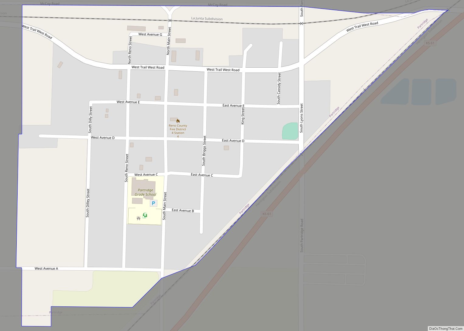
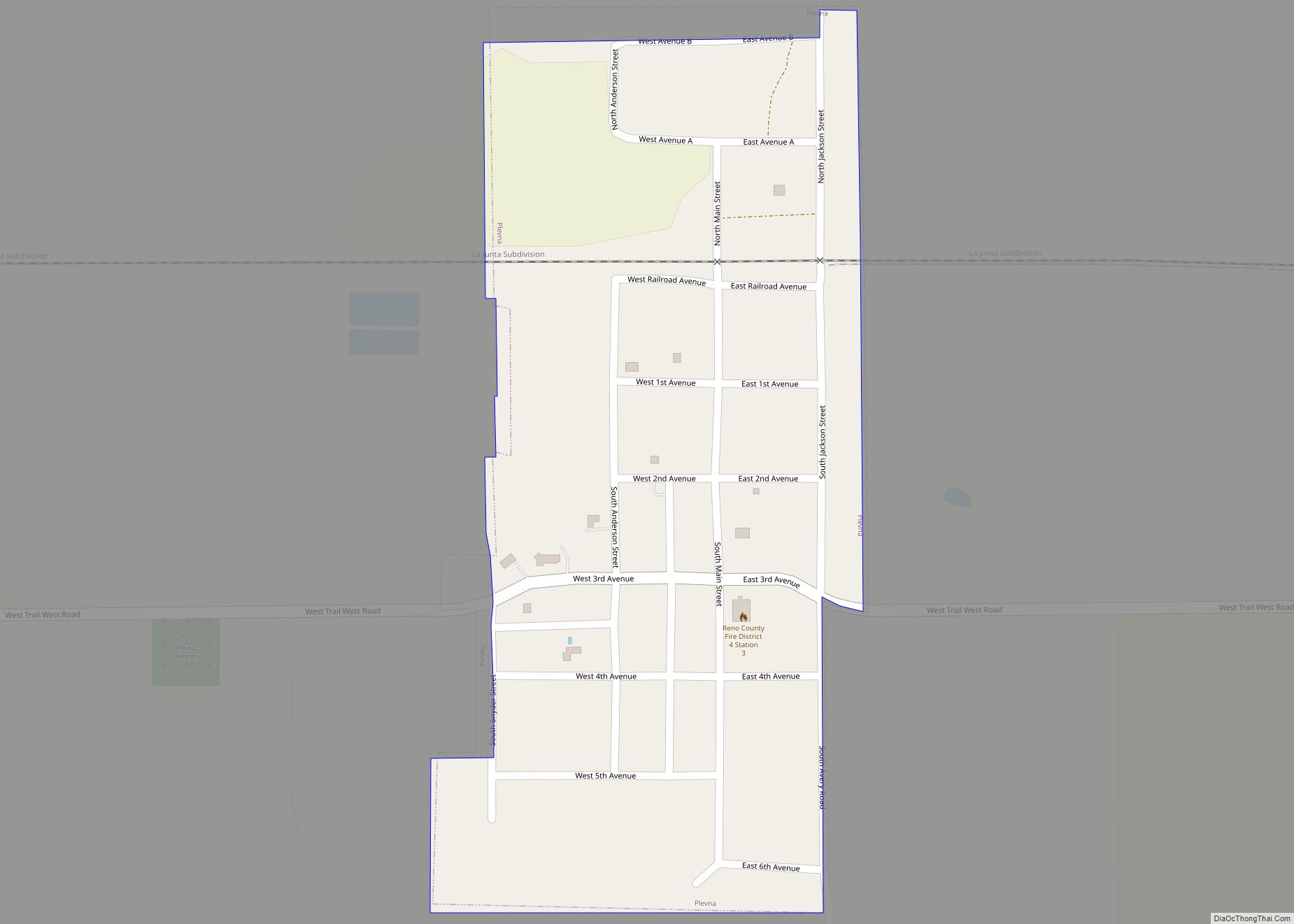
Online Interactive Map
Click on ![]() to view map in "full screen" mode.
to view map in "full screen" mode.
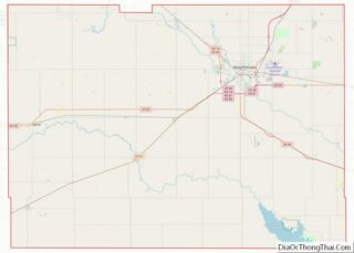
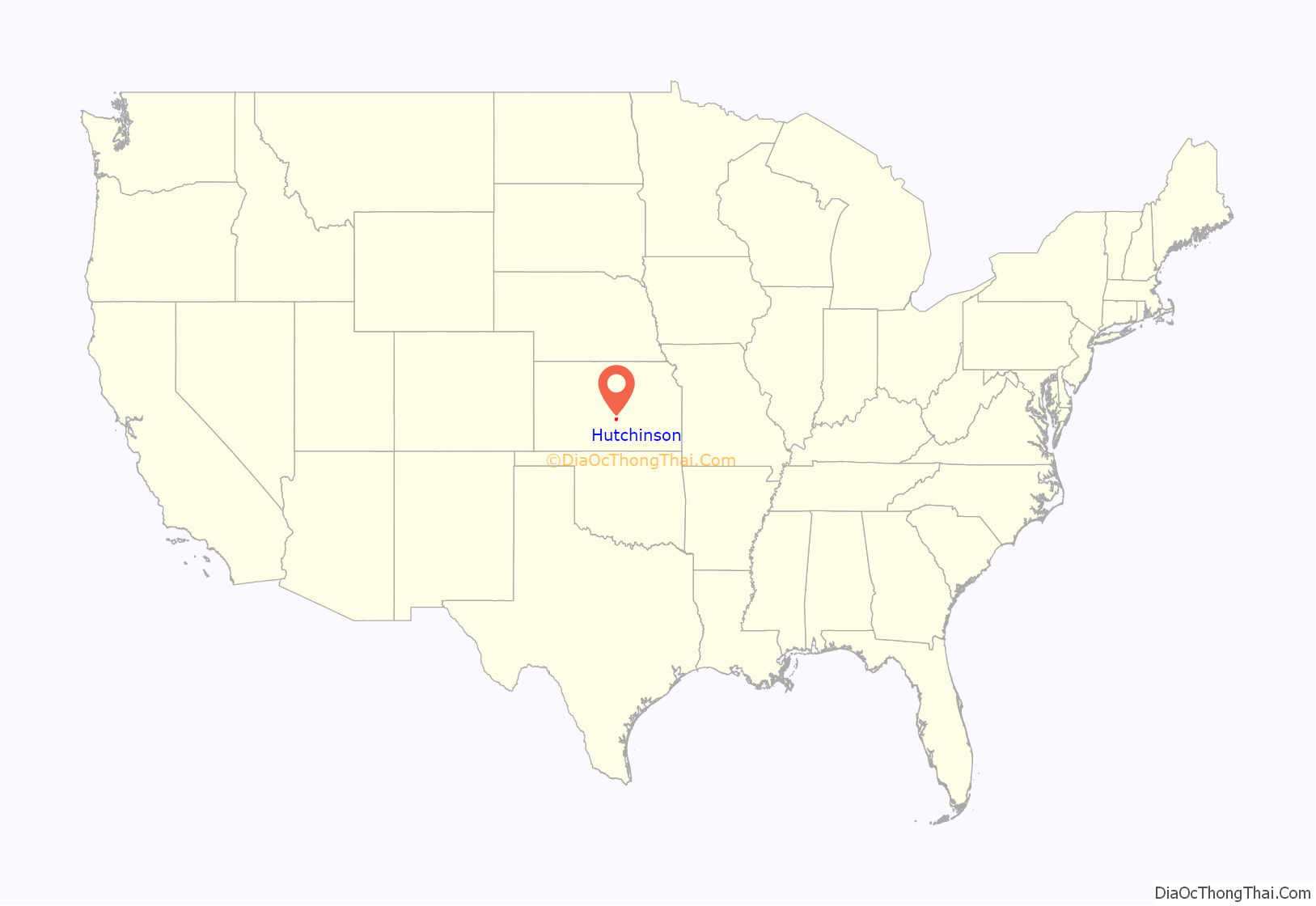
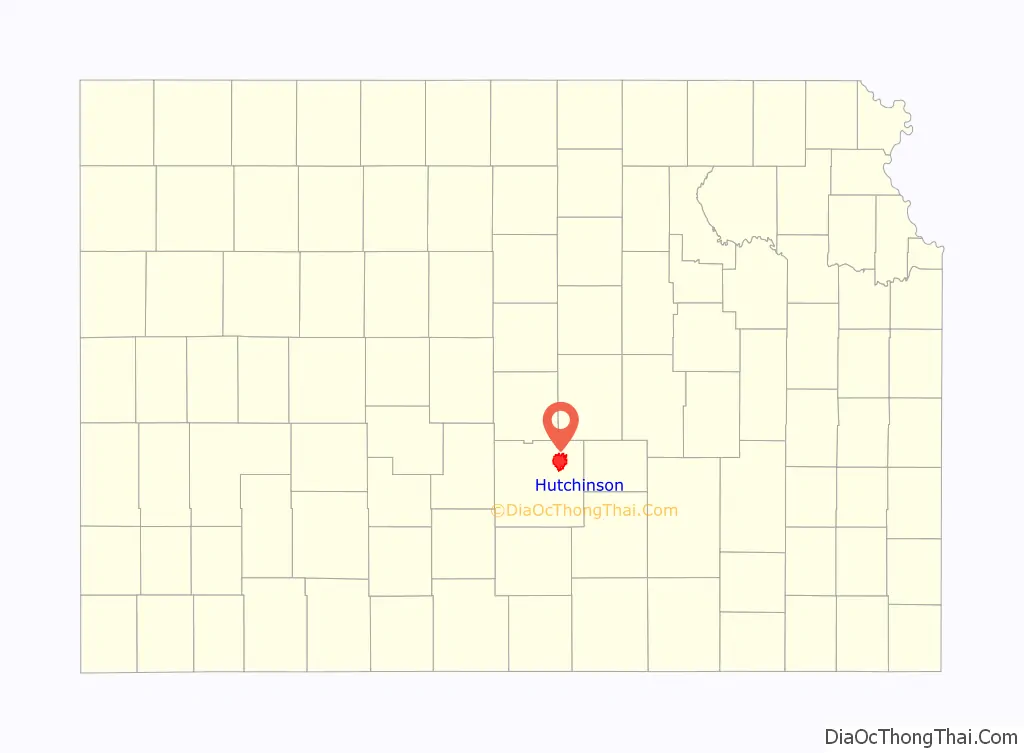
Hutchinson location map. Where is Hutchinson city?
History
The city of Hutchinson was founded in 1871, when frontiersman Clinton “C.C.” Hutchinson contracted with the Santa Fe Railway to make a town at the railroad’s crossing over the Arkansas River. The town actually sprang up about one-half mile north, on the banks of Cow Creek, where a few houses already existed. C.C. Hutchinson later founded the Reno County Bank in 1873, and by 1878 had erected the state’s first water-mill at Hutchinson. The community earned the nickname “Temperance City” due to the prohibition of alcohol set by its founder. Hutchinson was incorporated as a third class city in August 1872.
In 1887, the Chicago, Kansas and Nebraska Railway built a main line from Herington through Hutchinson to Pratt. In 1888, this line was extended to Liberal. Later, it was extended to Tucumcari, New Mexico and El Paso, Texas. It foreclosed in 1891 and was taken over by Chicago, Rock Island and Pacific Railway, which shut down in 1980 and reorganized as Oklahoma, Kansas and Texas Railroad, merged in 1988 with Missouri Pacific Railroad, merged in 1997 with Union Pacific Railroad. Most locals still refer to this railroad as the “Rock Island”.
Also in 1887, local salt deposits were discovered for the first time, when Ben Blanchard, a land speculator who founded South Hutchinson, drilled for oil in the area. Salt mining would become a major industry in Hutchinson, with the city eventually earning the nickname “Salt City”.
Hutchinson had been holding county fairs since 1873. By 1900 many referred to the Hutchinson fair as the Kansas State Fair, even though there was no state supported Kansas State Fair yet. In 1913, after lobbying in the Kansas Legislature, Hutchinson gifted the State of Kansas the land that became the Kansas State Fairgrounds. The official Kansas State Fair has been held in Hutchinson ever since.
In 1943, German and Italian prisoners of World War II were used in Kansas and other Midwest states as a means of solving the labor shortage caused by American men serving in the war effort. Large prisoner-of-war camps were established in Kansas: Camp Concordia, Camp Funston (at Fort Riley), Camp Phillips (at Salina under Fort Riley). Fort Riley established 12 smaller branch camps, including Hutchinson.
On January 17, 2001, 143 million cubic feet (4,000,000 m) of compressed natural gas leaked from the nearby Yaggy storage field. It sank underground, then rose to the surface through old brine or salt wells, making around 15 gas blowholes.
An explosion in the downtown area at 10:45 am destroyed two businesses and damaged 26 others. An explosion the next day in a mobile-home park killed two people. The Kansas National Guard was called in to help evacuate parts of the city because of the gas leaks, and a team of specialists looked over all the city for leaks after the event. These events were broadcast on nationally televised news stations across the country.
On June 21, 2013, following a grassroots campaign in an effort to promote Smallville Con, a comic-book convention hosted at the Kansas State Fair, the mayor of Hutchinson decreed the city’s name would be changed to “Smallville” for one day in honor of Superman’s fictional Kansas hometown of the same name. The tradition has continued every year coinciding with the convention for two days every June.
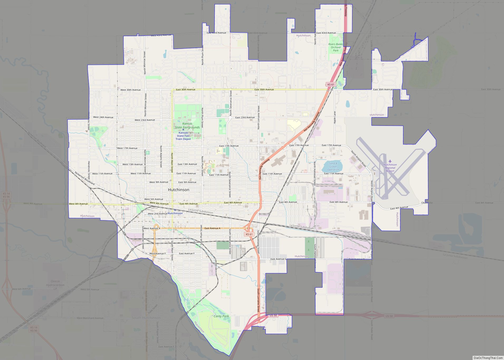
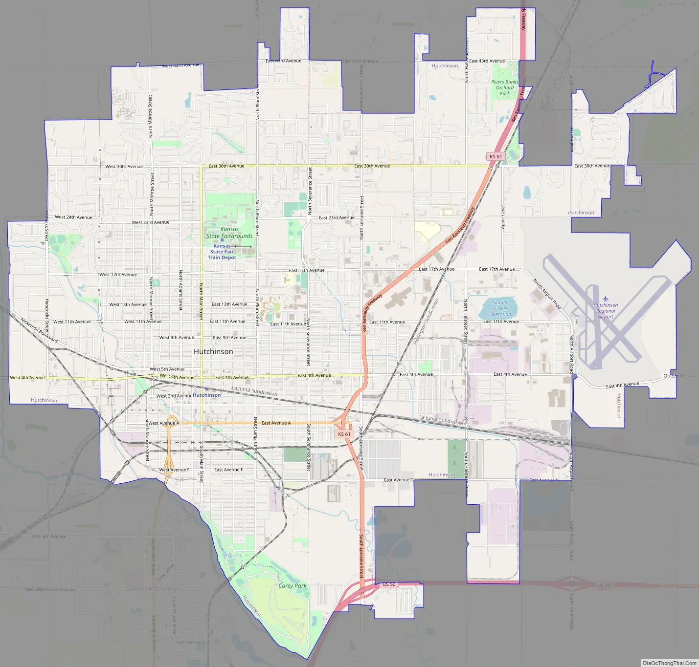
Hutchinson Road Map
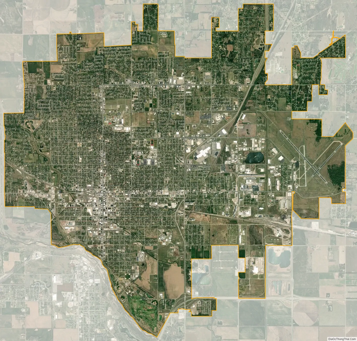
Hutchinson city Satellite Map
Geography
Hutchinson is located at 38°3′39″N 97°55′47″W / 38.06083°N 97.92972°W / 38.06083; -97.92972 (38.0608445, -97.9297743) at an elevation of 1,535 feet (468 m). Located in south-central Kansas at the intersection of U.S. Route 50 and Kansas Highway 96 (K-96), Hutchinson is 39 miles (63 km) northwest of Wichita, 200 mi (320 km) west-southwest of Kansas City, and 395 miles (636 km) east-southeast of Denver.
The city lies on the northeast bank of the Arkansas River in the Great Bend Sand Prairie region of the Great Plains. Cow Creek, a tributary of the Arkansas, runs southeast through the city.
According to the United States Census Bureau, the city has a total area of 22.75 square miles (58.92 km), of which, 22.69 square miles (58.77 km) is land and 0.06 square miles (0.16 km) is water.
Climate
Hutchinson has a humid subtropical climate (Köppen Cfa), with hot, humid summers and cold, dry winters. Temperatures exceed 90 °F or 32.2 °C an average of 63.4 afternoons each year and drop below 32 °F or 0 °C an average of 119.5 mornings each year. Snowfall averages 6.9 inches or 0.18 metres per year. Total precipitation averages 32.93 inches or 836.4 millimetres per year. On average, January is the coolest month, July is the warmest month, and May is the wettest month. The hottest temperature recorded in Hutchinson was 113 °F or 45 °C on July 27, 2011; the coldest temperature recorded was −19 °F (−28.3 °C) on February 16, 2021.
See also
Map of Kansas State and its subdivision:- Allen
- Anderson
- Atchison
- Barber
- Barton
- Bourbon
- Brown
- Butler
- Chase
- Chautauqua
- Cherokee
- Cheyenne
- Clark
- Clay
- Cloud
- Coffey
- Comanche
- Cowley
- Crawford
- Decatur
- Dickinson
- Doniphan
- Douglas
- Edwards
- Elk
- Ellis
- Ellsworth
- Finney
- Ford
- Franklin
- Geary
- Gove
- Graham
- Grant
- Gray
- Greeley
- Greenwood
- Hamilton
- Harper
- Harvey
- Haskell
- Hodgeman
- Jackson
- Jefferson
- Jewell
- Johnson
- Kearny
- Kingman
- Kiowa
- Labette
- Lane
- Leavenworth
- Lincoln
- Linn
- Logan
- Lyon
- Marion
- Marshall
- McPherson
- Meade
- Miami
- Mitchell
- Montgomery
- Morris
- Morton
- Nemaha
- Neosho
- Ness
- Norton
- Osage
- Osborne
- Ottawa
- Pawnee
- Phillips
- Pottawatomie
- Pratt
- Rawlins
- Reno
- Republic
- Rice
- Riley
- Rooks
- Rush
- Russell
- Saline
- Scott
- Sedgwick
- Seward
- Shawnee
- Sheridan
- Sherman
- Smith
- Stafford
- Stanton
- Stevens
- Sumner
- Thomas
- Trego
- Wabaunsee
- Wallace
- Washington
- Wichita
- Wilson
- Woodson
- Wyandotte
- Alabama
- Alaska
- Arizona
- Arkansas
- California
- Colorado
- Connecticut
- Delaware
- District of Columbia
- Florida
- Georgia
- Hawaii
- Idaho
- Illinois
- Indiana
- Iowa
- Kansas
- Kentucky
- Louisiana
- Maine
- Maryland
- Massachusetts
- Michigan
- Minnesota
- Mississippi
- Missouri
- Montana
- Nebraska
- Nevada
- New Hampshire
- New Jersey
- New Mexico
- New York
- North Carolina
- North Dakota
- Ohio
- Oklahoma
- Oregon
- Pennsylvania
- Rhode Island
- South Carolina
- South Dakota
- Tennessee
- Texas
- Utah
- Vermont
- Virginia
- Washington
- West Virginia
- Wisconsin
- Wyoming