Woodbine is a city in Dickinson County, Kansas, United States. As of the 2020 census, the population of the city was 157.
| Name: | Woodbine city |
|---|---|
| LSAD Code: | 25 |
| LSAD Description: | city (suffix) |
| State: | Kansas |
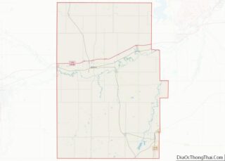
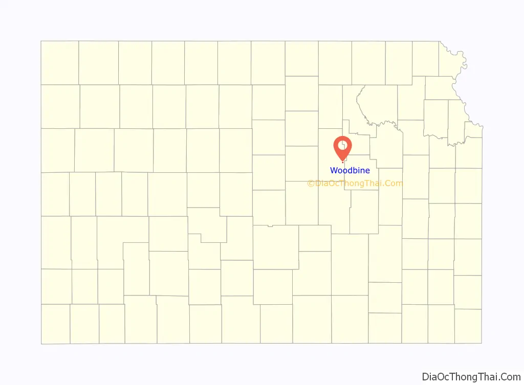
| County: | Dickinson County |
| Founded: | 1871 |
| Elevation: | 1,250 ft (380 m) |
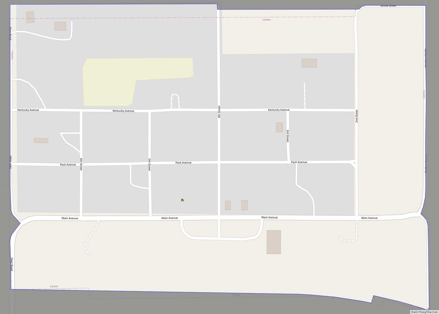
| Total Area: | 0.16 sq mi (0.41 km²) |
| Land Area: | 0.16 sq mi (0.41 km²) |
| Water Area: | 0.00 sq mi (0.00 km²) |
| Total Population: | 157 |
| Population Density: | 980/sq mi (380/km²) |
| ZIP code: | 67492 |
| Area code: | 785 |
| FIPS code: | 2080350 |
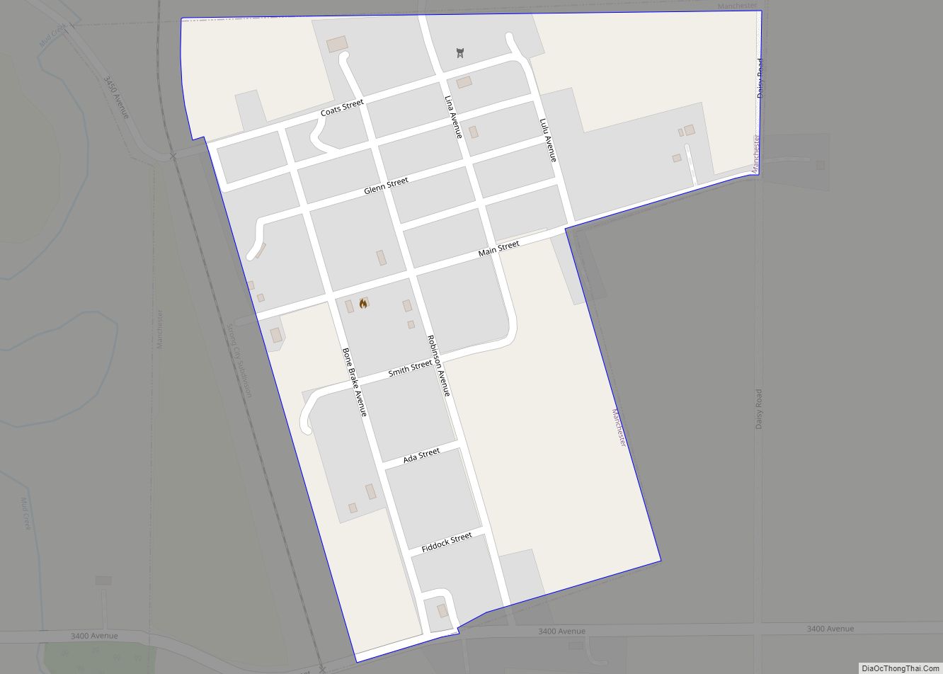
Online Interactive Map
Click on ![]() to view map in "full screen" mode.
to view map in "full screen" mode.
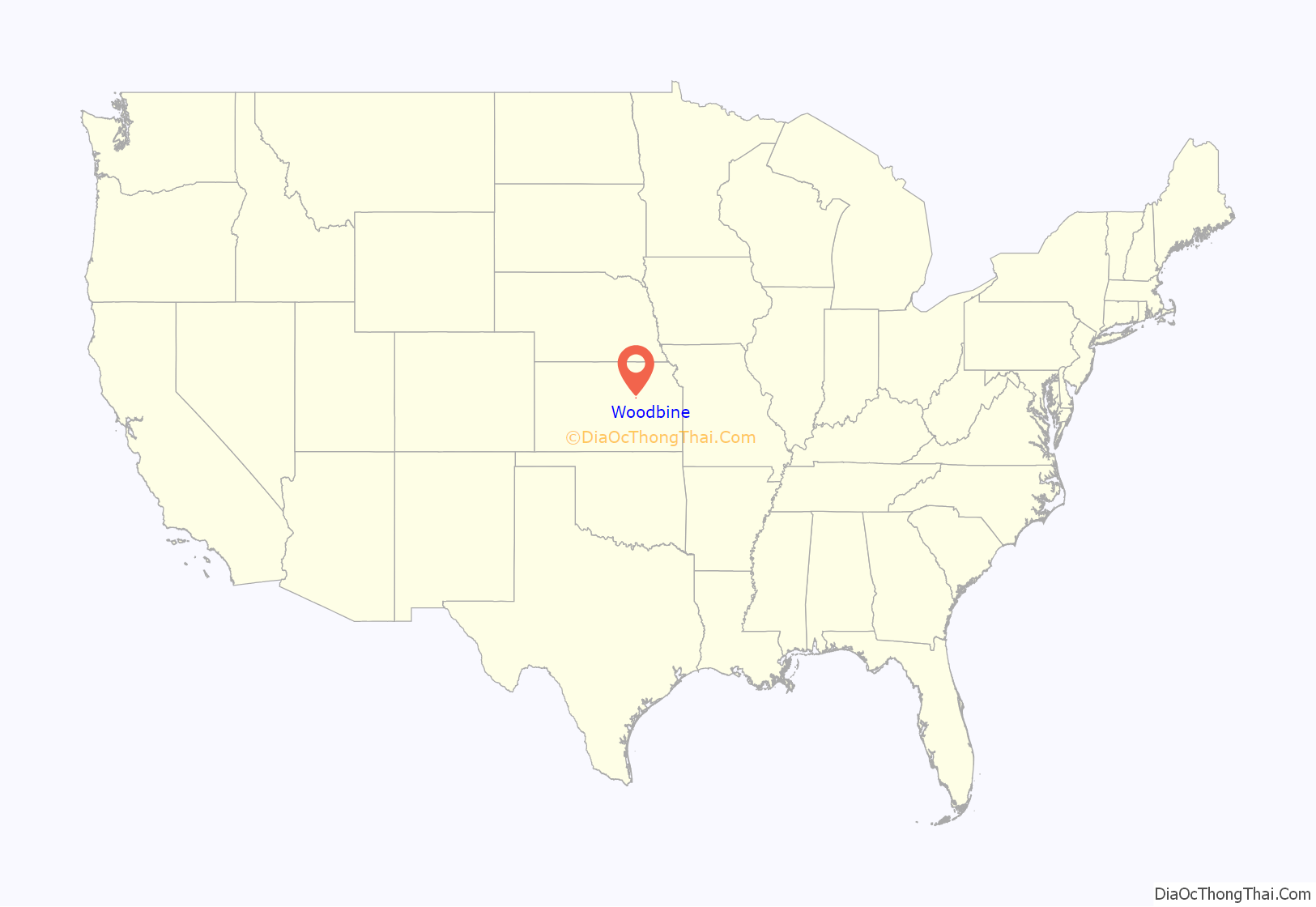
Woodbine location map. Where is Woodbine city?
History
For millennia, the land now known as Kansas was inhabited by Native Americans. In 1803, most of modern Kansas was secured by the United States as part of the Louisiana Purchase. In 1854, the Kansas Territory was organized, then in 1861 Kansas became the 34th U.S. state. In 1857, Dickinson County was founded.
The city was founded as Lyons, named for the nearby creek, in 1871 by James Allen Gillett Sr. The first post office at Woodbine was established in January, 1872. In 1887, the Chicago, Rock Island and Pacific Railroad built through the area and Lyons was remapped as Woodbine on July 16, 1887. Gillett renamed it Woodbine after his former hometown of Woodbine, Illinois.
Along the railroad tracks, Woodbine had a grist mill, grain elevator, depot, and stock yards. Passenger service was offered until 1927 and freight was discontinued in the 1990s. Several bus lines served Woodbine after rail service ended. The town was home to the Woodbine Journal during World War I.
Woodbine at one time had four churches; a Lutheran, a Baptist, and an English and a German Methodist. The school was opened in 1880 with the current building being built in 1909. High school classes began in 1914. Woodbine District #32 became Woodbine Rural High School District #1 (parts of Dickinson and Morris counties) in 1925 and the last graduating class was in 1962. Lower grades continued until 1979. Woodbine is now a part of the Rural Vista school district.
The Rock Island served the area for many years until the company ceased operation in 1980. The track was then used by various rail lines until being abandoned in the mid-1990s. While part of the line was scrapped, the remaining track from Abilene to Woodbine has been purchased by the Abilene and Smoky Valley Railroad.
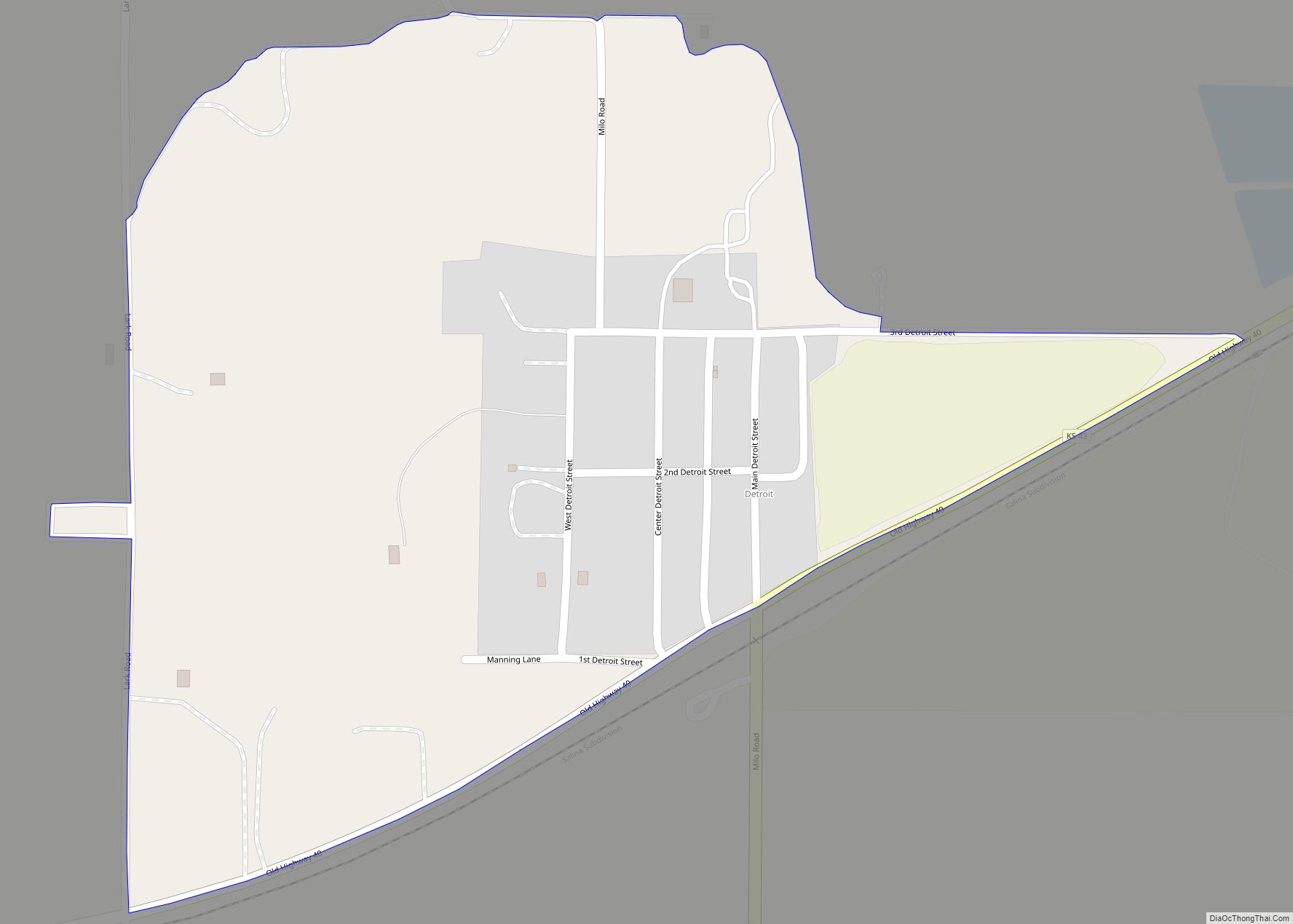
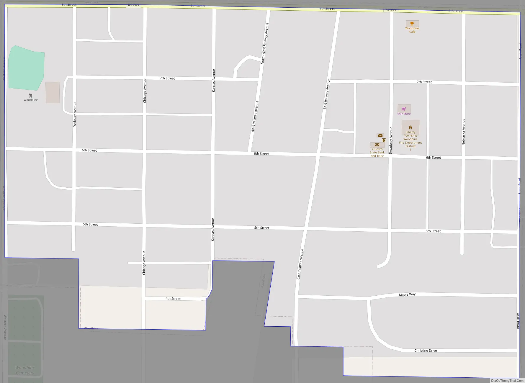
Woodbine Road Map
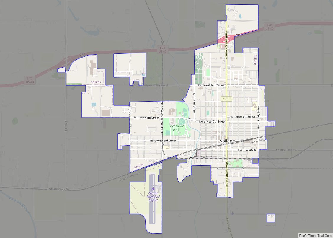
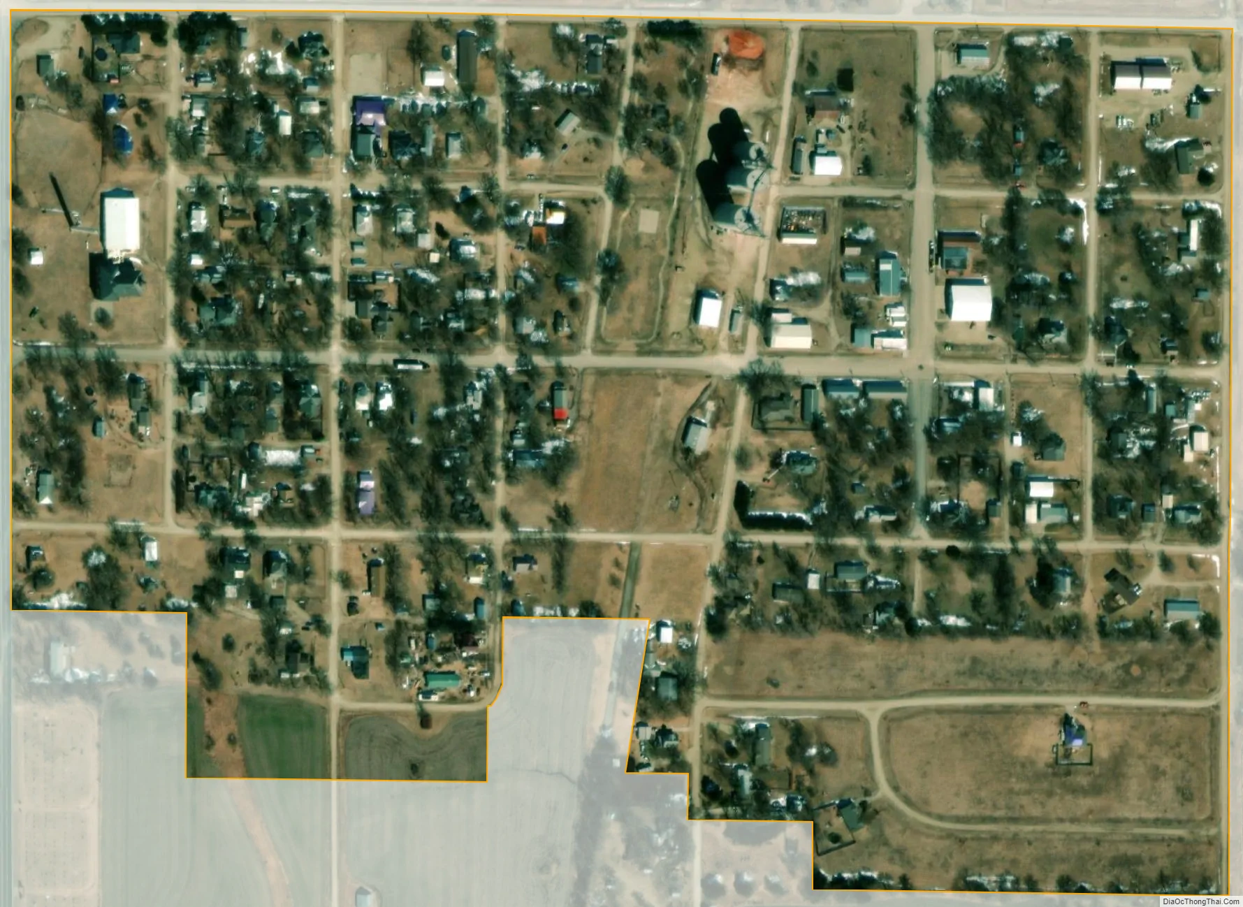
Woodbine city Satellite Map
Geography
Woodbine is located at 38°47′44″N 96°57′36″W / 38.79556°N 96.96000°W / 38.79556; -96.96000 (38.795442, -96.960002). According to the United States Census Bureau, the city has a total area of 0.16 square miles (0.41 km), all of it land.
See also
Map of Kansas State and its subdivision:- Allen
- Anderson
- Atchison
- Barber
- Barton
- Bourbon
- Brown
- Butler
- Chase
- Chautauqua
- Cherokee
- Cheyenne
- Clark
- Clay
- Cloud
- Coffey
- Comanche
- Cowley
- Crawford
- Decatur
- Dickinson
- Doniphan
- Douglas
- Edwards
- Elk
- Ellis
- Ellsworth
- Finney
- Ford
- Franklin
- Geary
- Gove
- Graham
- Grant
- Gray
- Greeley
- Greenwood
- Hamilton
- Harper
- Harvey
- Haskell
- Hodgeman
- Jackson
- Jefferson
- Jewell
- Johnson
- Kearny
- Kingman
- Kiowa
- Labette
- Lane
- Leavenworth
- Lincoln
- Linn
- Logan
- Lyon
- Marion
- Marshall
- McPherson
- Meade
- Miami
- Mitchell
- Montgomery
- Morris
- Morton
- Nemaha
- Neosho
- Ness
- Norton
- Osage
- Osborne
- Ottawa
- Pawnee
- Phillips
- Pottawatomie
- Pratt
- Rawlins
- Reno
- Republic
- Rice
- Riley
- Rooks
- Rush
- Russell
- Saline
- Scott
- Sedgwick
- Seward
- Shawnee
- Sheridan
- Sherman
- Smith
- Stafford
- Stanton
- Stevens
- Sumner
- Thomas
- Trego
- Wabaunsee
- Wallace
- Washington
- Wichita
- Wilson
- Woodson
- Wyandotte
- Alabama
- Alaska
- Arizona
- Arkansas
- California
- Colorado
- Connecticut
- Delaware
- District of Columbia
- Florida
- Georgia
- Hawaii
- Idaho
- Illinois
- Indiana
- Iowa
- Kansas
- Kentucky
- Louisiana
- Maine
- Maryland
- Massachusetts
- Michigan
- Minnesota
- Mississippi
- Missouri
- Montana
- Nebraska
- Nevada
- New Hampshire
- New Jersey
- New Mexico
- New York
- North Carolina
- North Dakota
- Ohio
- Oklahoma
- Oregon
- Pennsylvania
- Rhode Island
- South Carolina
- South Dakota
- Tennessee
- Texas
- Utah
- Vermont
- Virginia
- Washington
- West Virginia
- Wisconsin
- Wyoming