Marcellus is a village in Cass County in the U.S. state of Michigan. The population was 1,198 at the 2010 census. The village is located within Marcellus Township. It is part of the South Bend–Mishawaka, IN-MI, Metropolitan Statistical Area.
| Name: | Marcellus village |
|---|---|
| LSAD Code: | 47 |
| LSAD Description: | village (suffix) |
| State: | Michigan |
| County: | Cass County |
| Elevation: | 896 ft (273 m) |
| Total Area: | 0.68 sq mi (1.77 km²) |
| Land Area: | 0.68 sq mi (1.77 km²) |
| Water Area: | 0.00 sq mi (0.01 km²) |
| Total Population: | 1,074 |
| Population Density: | 1,574.78/sq mi (608.14/km²) |
| Area code: | 269 |
| FIPS code: | 2651460 |
| GNISfeature ID: | 0631539 |
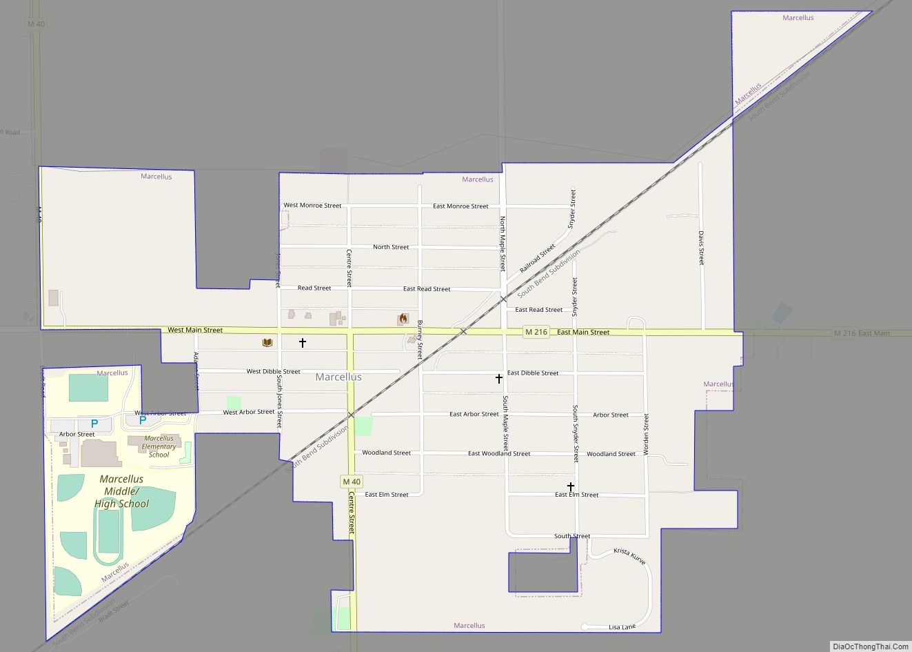
Online Interactive Map
Click on ![]() to view map in "full screen" mode.
to view map in "full screen" mode.
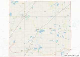
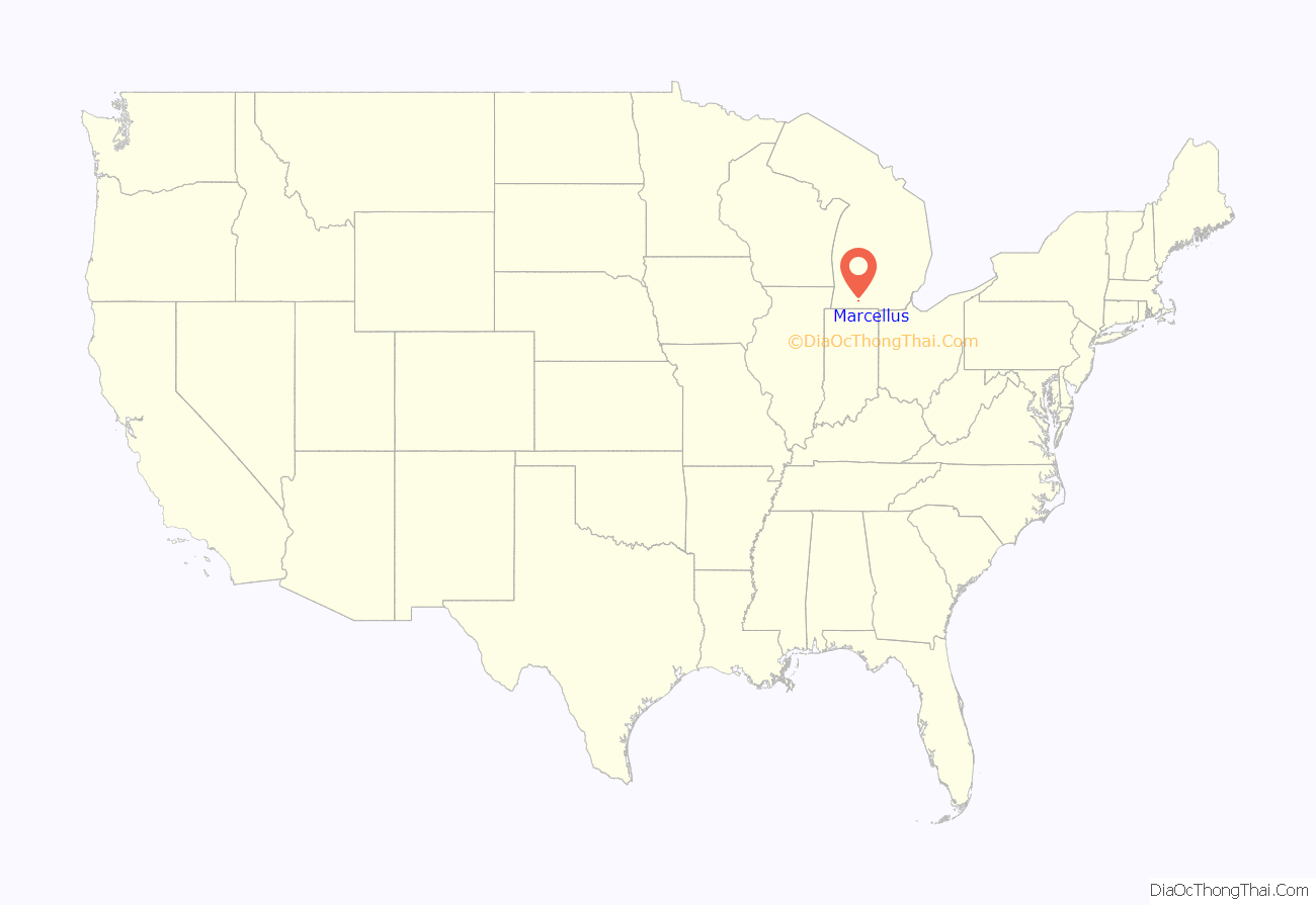
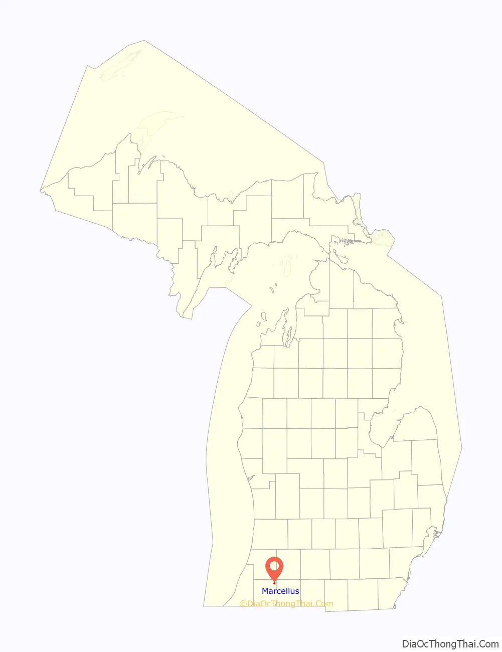
Marcellus location map. Where is Marcellus village?
History
The first settler in the Marcellus area was John Bair, who came in October 1832. He was followed almost a year later by Daniel Driskel, in 1833. In 1835, 11 other families settled in Marcellus, and by 1836, 28 families had settled there.
At the time of the organization of the township the citizens wanted to call it Cambria; however, since there was already a township by that name in Michigan, their Representative at that time, Judge Littlejohn of Allegan, proposed they name it after Roman Emperor Flavius Marcellus. As a result, on June 16, 1843, the township was officially named Marcellus. Elections were held on the same night and Daniel G. Rouse was elected Township Supervisor, Guerdor R. Beebee was elected Treasurer, and Ephraim Huyatt was elected Clerk.
In the winter of 1870–71 the Peninsular Railroad came through Marcellus, infusing life into the small township. The depot was originally on the east side of town; however, because the business district was far from the depot, the depot was moved in 1898. After this move, business began rapidly expanding and an addition was added to the station to meet the increased traffic demands. By 1911, ten passenger trains stopped at the depot every day.
Marcellus became an official village in 1879, with over 500 residents. Three years later it had grown and included 2 churches, 3 dry goods stores, 3 groceries, 3 millinery shops, 2 drug stores, 2 meat markets, 2 hotels, 2 tin shops, a bank, 2 stave factories, 2 harness shops, a hardware store, a furniture store, a restaurant, a printing business, a tailor shop, a cooper shop, a steam saw mill, a sash and blind manufacturer, 4 doctors, 2 lawyers, 2 justices of the peace, and a newspaper.
During its height, Marcellus was also home to two theaters, a bowling alley, and a pool hall. Each year it hosts the National Bluegill Frolic, and previously hosted a parade, fishing tournament, and beauty pageant which attracted thousands each year.
Marcellus is the home town of the Head Strength and Conditioning Coach for the San Francisco 49ers, Dustin Perry. Perry attended Marcellus High School before leaving to attend college at Western Michigan and beginning his coaching career.
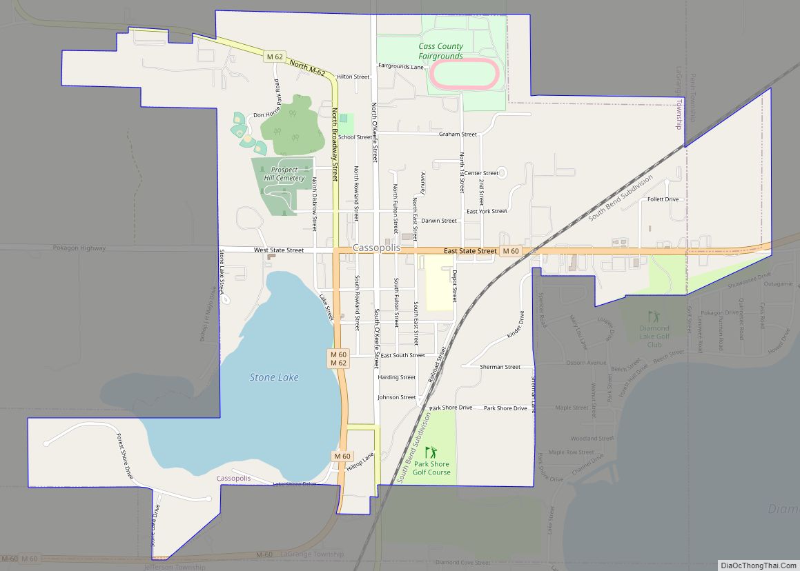
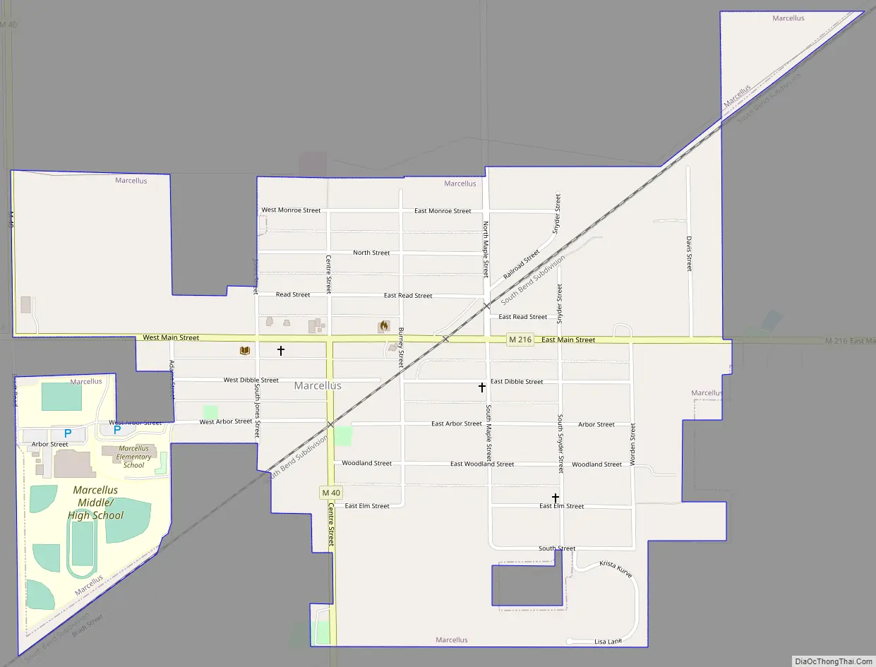
Marcellus Road Map
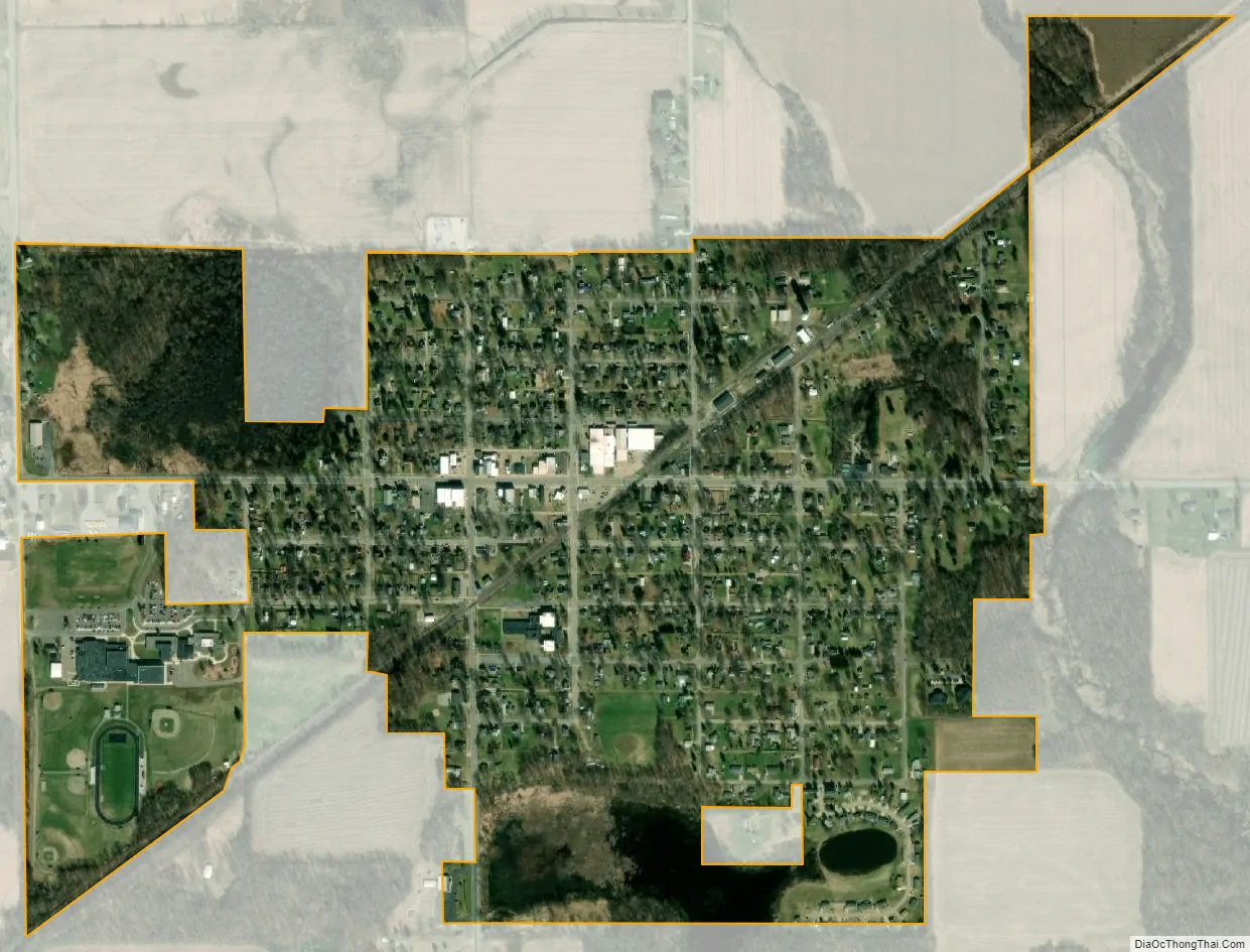
Marcellus city Satellite Map
Geography
According to the United States Census Bureau, the village has a total area of 0.59 square miles (1.53 km), of which 0.58 square miles (1.50 km) is land and 0.01 square miles (0.03 km) is water.
See also
Map of Michigan State and its subdivision:- Alcona
- Alger
- Allegan
- Alpena
- Antrim
- Arenac
- Baraga
- Barry
- Bay
- Benzie
- Berrien
- Branch
- Calhoun
- Cass
- Charlevoix
- Cheboygan
- Chippewa
- Clare
- Clinton
- Crawford
- Delta
- Dickinson
- Eaton
- Emmet
- Genesee
- Gladwin
- Gogebic
- Grand Traverse
- Gratiot
- Hillsdale
- Houghton
- Huron
- Ingham
- Ionia
- Iosco
- Iron
- Isabella
- Jackson
- Kalamazoo
- Kalkaska
- Kent
- Keweenaw
- Lake
- Lake Hurron
- Lake Michigan
- Lake St. Clair
- Lake Superior
- Lapeer
- Leelanau
- Lenawee
- Livingston
- Luce
- Mackinac
- Macomb
- Manistee
- Marquette
- Mason
- Mecosta
- Menominee
- Midland
- Missaukee
- Monroe
- Montcalm
- Montmorency
- Muskegon
- Newaygo
- Oakland
- Oceana
- Ogemaw
- Ontonagon
- Osceola
- Oscoda
- Otsego
- Ottawa
- Presque Isle
- Roscommon
- Saginaw
- Saint Clair
- Saint Joseph
- Sanilac
- Schoolcraft
- Shiawassee
- Tuscola
- Van Buren
- Washtenaw
- Wayne
- Wexford
- Alabama
- Alaska
- Arizona
- Arkansas
- California
- Colorado
- Connecticut
- Delaware
- District of Columbia
- Florida
- Georgia
- Hawaii
- Idaho
- Illinois
- Indiana
- Iowa
- Kansas
- Kentucky
- Louisiana
- Maine
- Maryland
- Massachusetts
- Michigan
- Minnesota
- Mississippi
- Missouri
- Montana
- Nebraska
- Nevada
- New Hampshire
- New Jersey
- New Mexico
- New York
- North Carolina
- North Dakota
- Ohio
- Oklahoma
- Oregon
- Pennsylvania
- Rhode Island
- South Carolina
- South Dakota
- Tennessee
- Texas
- Utah
- Vermont
- Virginia
- Washington
- West Virginia
- Wisconsin
- Wyoming