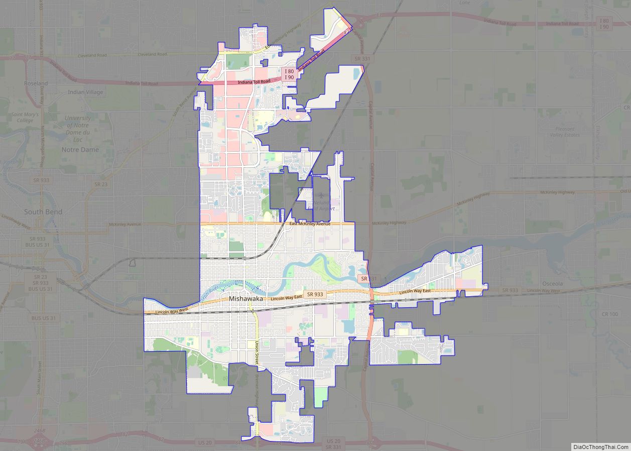
Mishawaka /ˌmɪʃəˈwɑːkə/ is a city on the St. Joseph River, in Penn Township, St. Joseph County, in the U.S. state of Indiana. The population was 51,063 as of the 2020 census. Its nickname is “the Princess City”. Mishawaka is a principal city of the South Bend–Mishawaka, IN-MI, Metropolitan Statistical Area.
| Name: | Mishawaka city |
|---|---|
| LSAD Code: | 25 |
| LSAD Description: | city (suffix) |
| State: | Indiana |
| County: | St. Joseph County |
| Elevation: | 719 ft (219 m) |
| Total Area: | 18.25 sq mi (47.26 km²) |
| Land Area: | 17.90 sq mi (46.35 km²) |
| Water Area: | 0.35 sq mi (0.90 km²) |
| Total Population: | 51,063 |
| Population Density: | 2,853.16/sq mi (1,101.61/km²) |
| ZIP code: | 46544-46546 |
| Area code: | 574 |
| FIPS code: | 1849932 |
| GNISfeature ID: | 452691 |
| Website: | http://www.mishawaka.in.gov |
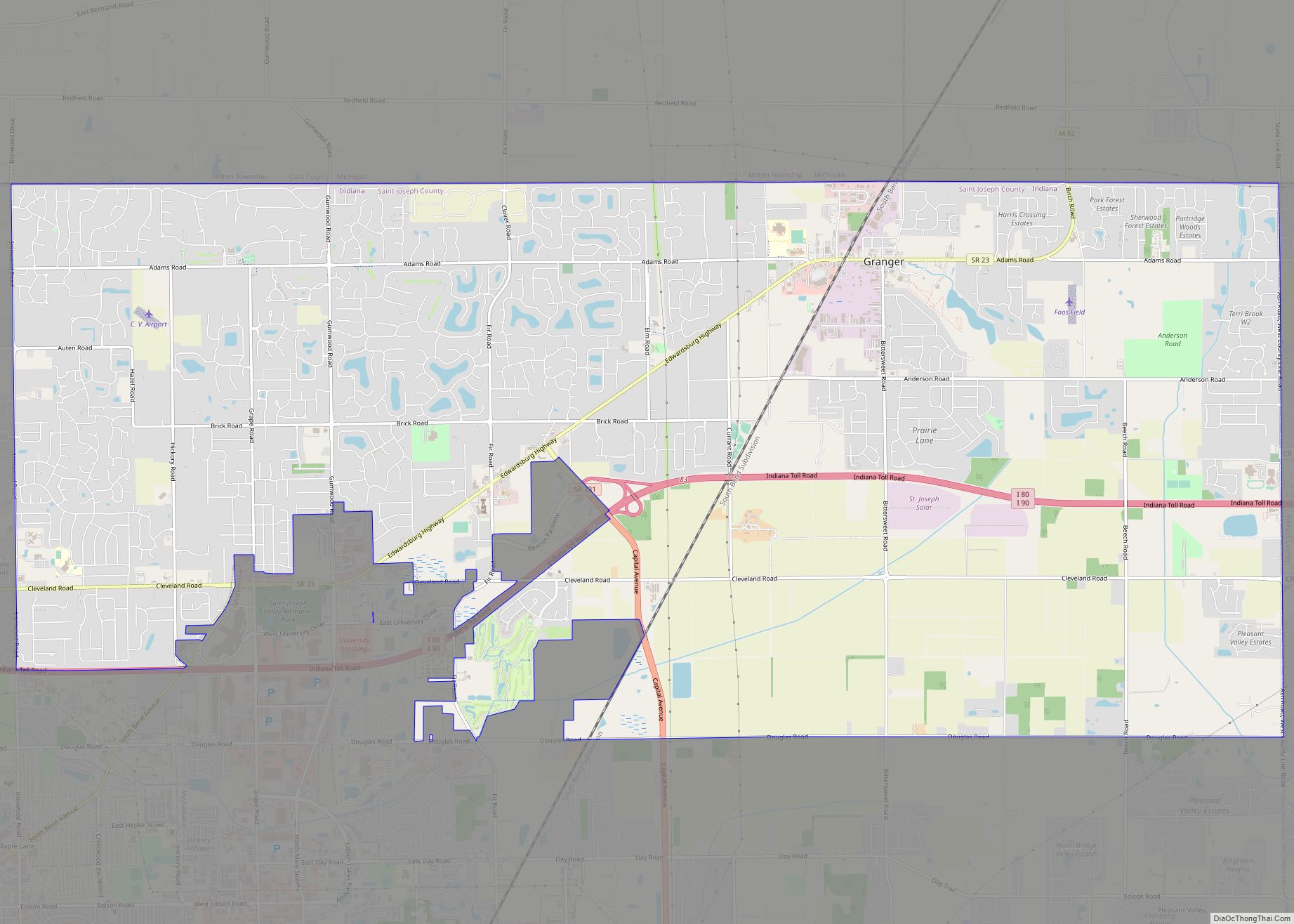
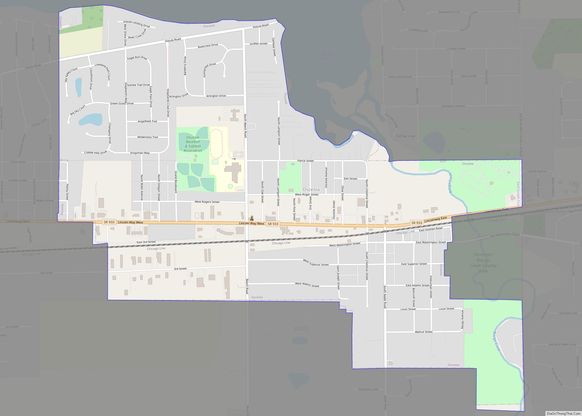
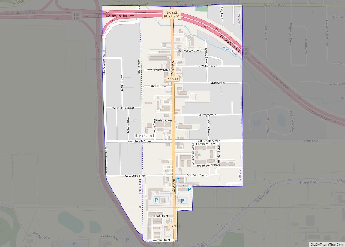
Online Interactive Map
Click on ![]() to view map in "full screen" mode.
to view map in "full screen" mode.
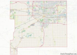
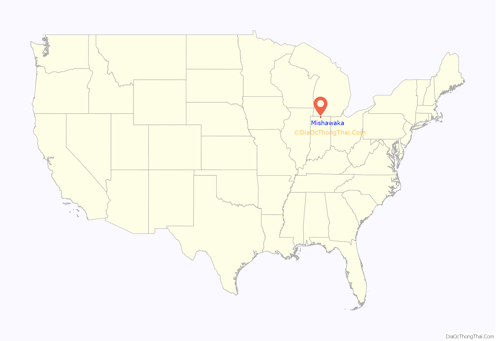
Mishawaka location map. Where is Mishawaka city?
History
Mishawaka’s recorded history began with the discovery of bog iron deposits at the beginning of the 1830s. Settlers arriving to mine the deposits founded the town of St. Joseph Iron Works in 1831. Within a few years, the town had a blast furnace, a general store, a tavern, and about 200 residents. Business prospered, and in 1833 St. Joseph Iron Works, Indiana City, and two other adjacent small towns were incorporated to form the city of Mishawaka.
The Mishawaka post office has been in operation since 1833.
In September 1872, a fire destroyed three quarters of Mishawaka’s business district. However, the citizens rebuilt and attracted new industry. The Dodge Manufacturing Company, Perkins Windmills and the Mishawaka Woolen and Rubber Company (later Ball Band, then Uniroyal) all helped the town to prosper. Mishawaka grew through both industry and agriculture. In the late 19th century, Mishawaka became known as the “Peppermint Capital of the World”, since the area’s rich black loam produced great quantities of mint.
From 1906 to 1915, Mishawaka was the manufacturing home of the luxurious American Simplex motor car. Ball Band made rubber garments and was hit by a major strike in 1931. It flourished in the 1940s, finally closing in 1997 in the face of cheaper imports. Manufacturing in Mishawaka peaked in the 1940s and began a slow decline due to industrial restructuring. The economic base shifted to retail services and small industry.
In 1979, University Park Mall opened in the far northern portion of Mishawaka. In 1990, AM General began producing the Hummer in its Mishawaka plant. The MV-1 is a purpose-built taxicab and replaces the planned Standard Taxi; it was developed in collaboration with AM General. The car is built in Mishawaka at an AM General plant. AM General will begin making Mercedes vehicles at this plant in 2015.
Names
The name Mishawaka derives from the name of a Potawatomi village at the junction of the Elkhart and St. Joseph rivers, where there were many dead trees. The village’s exact name in the Potawatomi language may have been *mšwakig (“at the firewood-tree land”). In the Miami-Illinois language, which historically was also spoken in the area, the corresponding placename is mihswaahkwahkiki (“it is firewood-tree land”).
The nickname “Princess City”, however, derives from a different account of the name’s origin. According to this story, “Mishawaka” or something similar was the name of the daughter of a Shawnee chief named “Elkhart”. A love triangle between Mishawaka, a white trader named “Dead Shot”, and a Shawnee warrior named “Grey Wolf” led to various adventures. This story originated with Flavius J. Littlejohn, a Michigan politician and judge, who published a collection of such stories in 1875; in Littlejohn’s account, the woman’s name was “Mishawaha”.
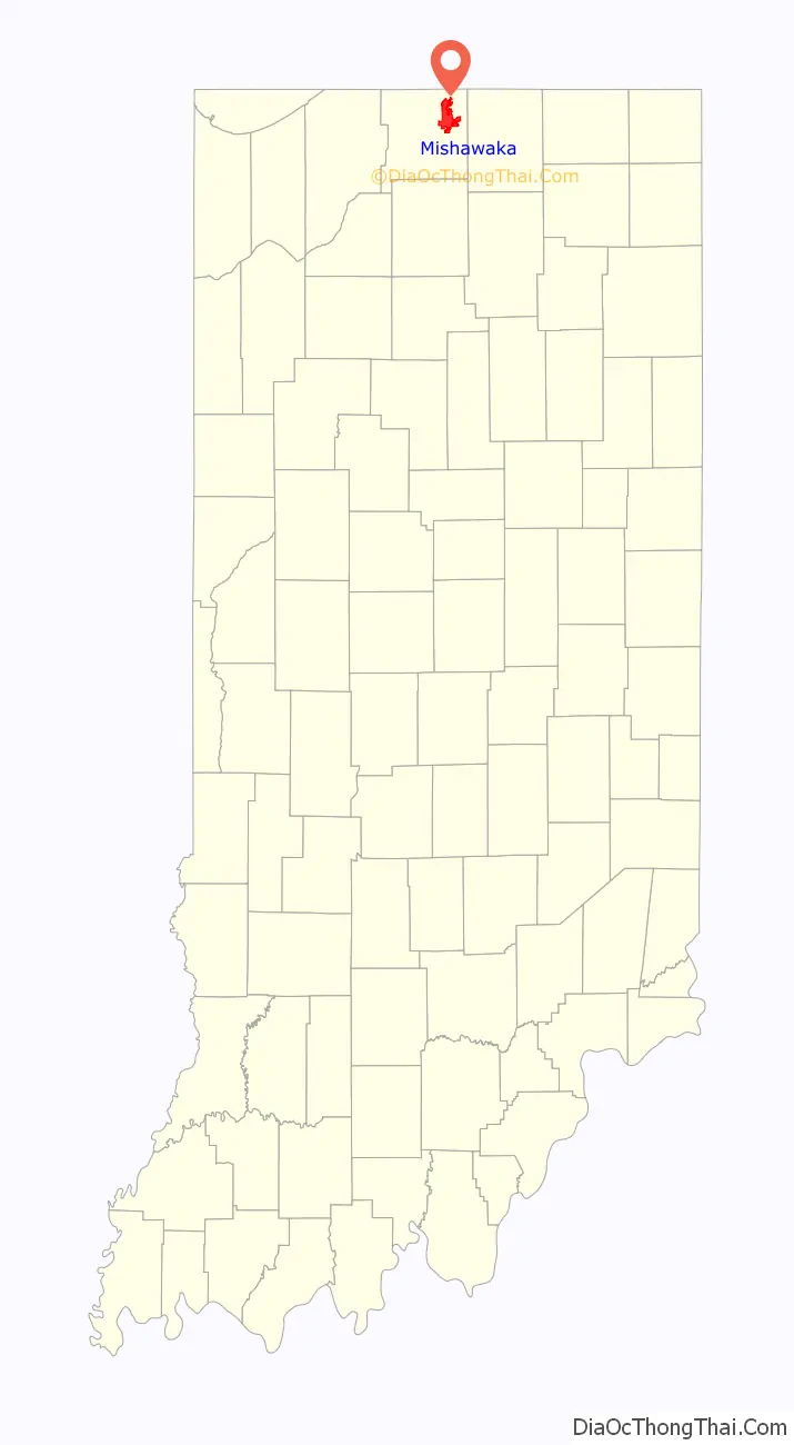
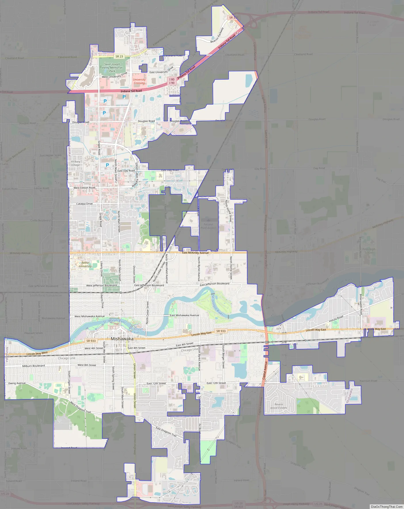
Mishawaka Road Map
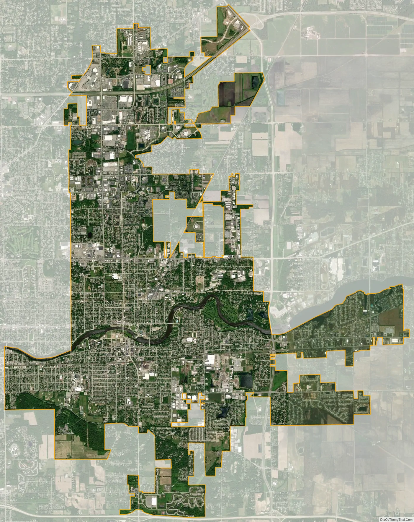
Mishawaka city Satellite Map
Geography
According to the 2010 census, Mishawaka has a total area of 17.348 square miles (44.93 km), of which 17 square miles (44.03 km) (or 97.99%) is land and 0.348 square miles (0.90 km) (or 2.01%) is water.
See also
Map of Indiana State and its subdivision:- Adams
- Allen
- Bartholomew
- Benton
- Blackford
- Boone
- Brown
- Carroll
- Cass
- Clark
- Clay
- Clinton
- Crawford
- Daviess
- De Kalb
- Dearborn
- Decatur
- Delaware
- Dubois
- Elkhart
- Fayette
- Floyd
- Fountain
- Franklin
- Fulton
- Gibson
- Grant
- Greene
- Hamilton
- Hancock
- Harrison
- Hendricks
- Henry
- Howard
- Huntington
- Jackson
- Jasper
- Jay
- Jefferson
- Jennings
- Johnson
- Knox
- Kosciusko
- LaGrange
- Lake
- Lake Michigan
- LaPorte
- Lawrence
- Madison
- Marion
- Marshall
- Martin
- Miami
- Monroe
- Montgomery
- Morgan
- Newton
- Noble
- Ohio
- Orange
- Owen
- Parke
- Perry
- Pike
- Porter
- Posey
- Pulaski
- Putnam
- Randolph
- Ripley
- Rush
- Saint Joseph
- Scott
- Shelby
- Spencer
- Starke
- Steuben
- Sullivan
- Switzerland
- Tippecanoe
- Tipton
- Union
- Vanderburgh
- Vermillion
- Vigo
- Wabash
- Warren
- Warrick
- Washington
- Wayne
- Wells
- White
- Whitley
- Alabama
- Alaska
- Arizona
- Arkansas
- California
- Colorado
- Connecticut
- Delaware
- District of Columbia
- Florida
- Georgia
- Hawaii
- Idaho
- Illinois
- Indiana
- Iowa
- Kansas
- Kentucky
- Louisiana
- Maine
- Maryland
- Massachusetts
- Michigan
- Minnesota
- Mississippi
- Missouri
- Montana
- Nebraska
- Nevada
- New Hampshire
- New Jersey
- New Mexico
- New York
- North Carolina
- North Dakota
- Ohio
- Oklahoma
- Oregon
- Pennsylvania
- Rhode Island
- South Carolina
- South Dakota
- Tennessee
- Texas
- Utah
- Vermont
- Virginia
- Washington
- West Virginia
- Wisconsin
- Wyoming