Canby is a city in Yellow Medicine County, Minnesota, United States. The population was 1,795 at the 2010 census.
| Name: | Canby city |
|---|---|
| LSAD Code: | 25 |
| LSAD Description: | city (suffix) |
| State: | Minnesota |
| County: | Yellow Medicine County |
| Elevation: | 1,240 ft (380 m) |
| Total Area: | 2.25 sq mi (5.82 km²) |
| Land Area: | 2.24 sq mi (5.80 km²) |
| Water Area: | 0.01 sq mi (0.02 km²) |
| Total Population: | 1,695 |
| Population Density: | 757.03/sq mi (292.33/km²) |
| ZIP code: | 56220 |
| Area code: | 507 |
| FIPS code: | 2709604 |
| GNISfeature ID: | 0640861 |
| Website: | www.canby.govoffice.com |
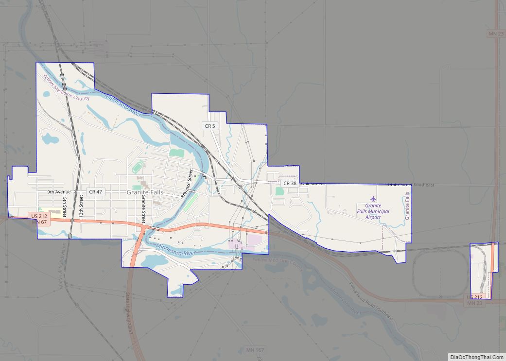
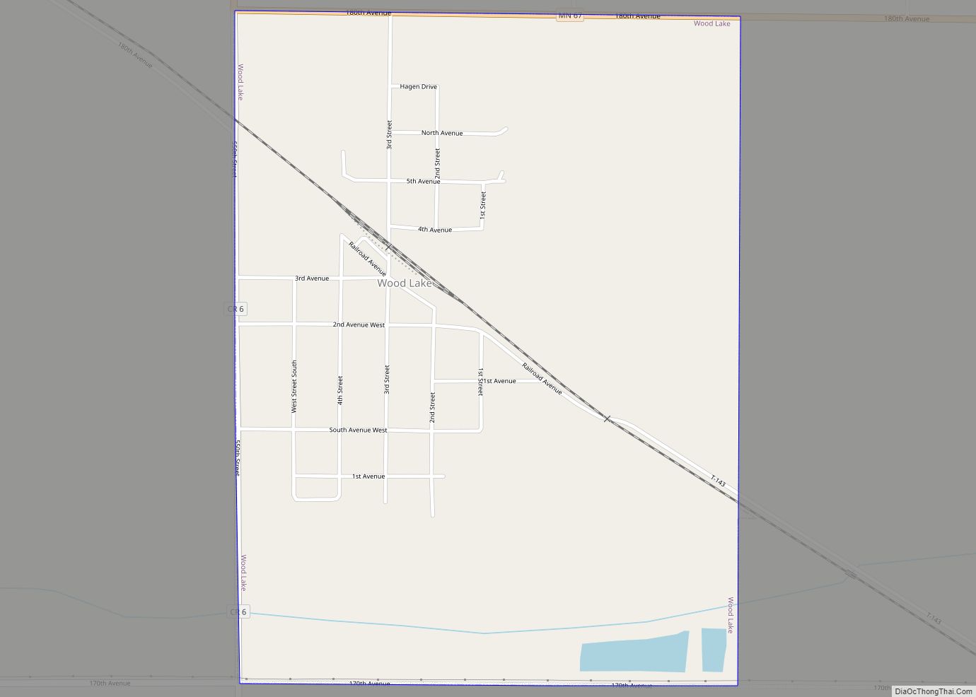
Online Interactive Map
Click on ![]() to view map in "full screen" mode.
to view map in "full screen" mode.
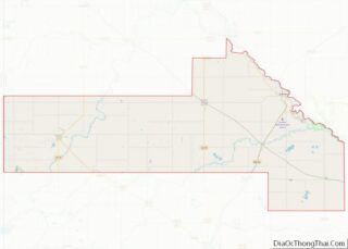
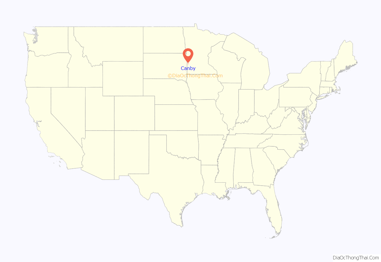
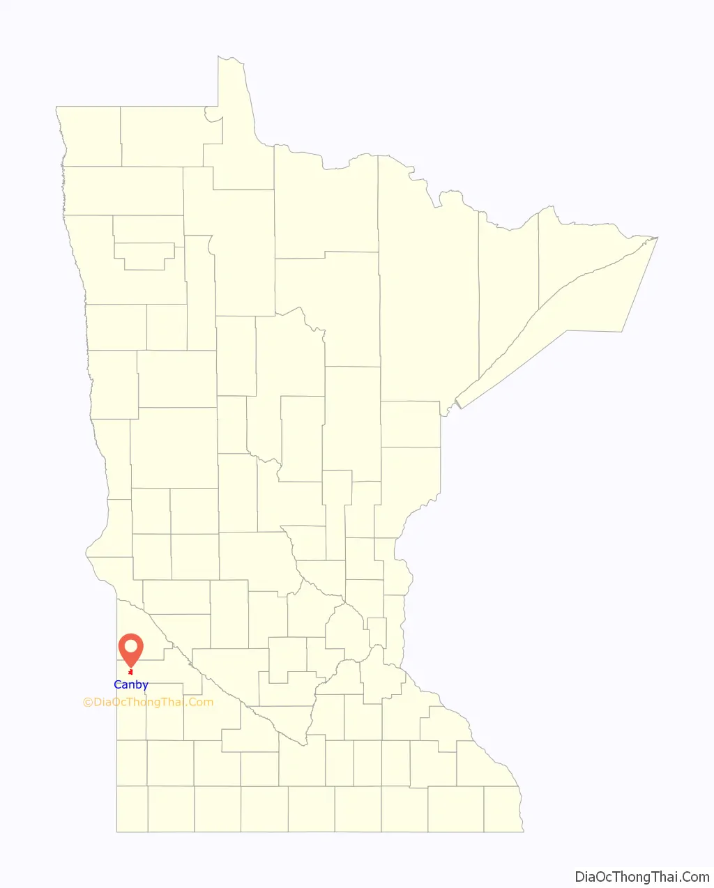
Canby location map. Where is Canby city?
History
John Swenson, who secured a homestead on section 4 of Norman Township where now stands the City of Canby, was one of the early European settlers in the area. After erecting a claim shanty, for the convenience of his neighbors, he opened a little store in his cabin. In November 1874, he secured the establishment of a post office in that store. At Swenson’s suggestion, the post office was named Canby, in honor of Civil War and career officer General Edward Canby of the United States Army. (General Canby had been assassinated the prior year during peace negotiations with the Modoc Tribe of Northern California.)
However, in 1876 the surrounding country was receiving new settlers and the railway company deemed it time to begin the operation of train service over the western part of the line. Canby Station was established and on August 24, 1876, and the city platted by the Winona & St. Peter Railroad Company soon after the railroad was extended to that point. Because of its location on the rail line, Canby grew quickly and was incorporated as a village in 1879 and as a city in 1905.
Lots were sold by the railroad with the provision that they must be built upon within six months. Swenson was the first to buy, and he selected the corner of Front and Main for his first store building.
Grasshoppers, natives, and prairie fires were a big concern for Canby residents at this time. 1875 was the summer of the first bad grasshopper plague. The settlers tried everything they could think of to make them go away but the grasshoppers devoured every blade of grass, the leaves on the trees and even clustered on buildings.
Natives were on everyone’s mind because of General Custer’s campaign in Wyoming. On June 25, 1876, 3,000 braves circled and killed Custer and his 277 troops. Not long after the battle, a band of about 100 natives camped along the railroad track in Canby to trade furs for merchandise. The group soon left without incident.
Firebreaks were plowed around the town and each farmstead because settlers were ever alert to prairie fires. In 1893 it wasn’t a prairie fire but a common daily task that started a fire in town. It began with filling a kerosene lamp from a tin measure. Fate and the wind were against Canby that night. After the flames had demolished every Main street store between the Swenson building and the bank, the wind switched and blew the heat and sparks across Main street to Block 3 where every structure went except for one.
A loss of $150,000 was reported but Canby built right up again and the structures were replaced with brick or stone construction. Because of the uniquely preserved architecture of these buildings the downtown area has been designated as a nationally registered historic district. The corner piece of this district as well as the oldest building, which was not destroyed in the fire, is located on the corner of Highway 75 and 2nd Street.
The first sermon was preached in Canby in 1876, however, in 1879 the first regular religious service in the English language was held. The first school was started in 1877 and located on the second floor of a home. The Canby News was founded in September 1878; it was the westernmost newspaper on the railroad. The cost of Canby’s government in 1888-1889 was $5,898.12.
The new century saw a lot of change in Canby and all over the world. Businesses changed hands and many new ones were established. It was a time of amazing growth in Canby. In 1915, 50 new homes were built. It was a pre-war boom. Post-war also saw a lot of changes. In 1930 motorized power and electrical power were taking place. A count of businesses in 1940 found 157 business places in Canby.
In 1946, after World War II, there was again a shortage of housing in Canby. In 1947, 55 building permits were issued. The following years were all “building years” and showed a lot of growth for Canby.
The population of Canby showed its largest growth in the 1930s and reached its peak in 1950.
Farmers have cultivated the area around Canby since the first settlers arrived in the middle of the 19th century. Farms and agriculture related businesses – both large and small, provide opportunities for various types of employment. Canby, realizing the importance of “farming,” continues to create new ways to promote the area’s farming industry to insure the community’s sustainability in the future. (City of Canby Information Booklet, September 1, 2001)
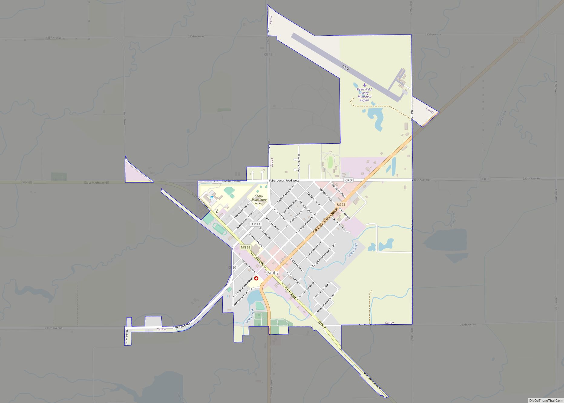
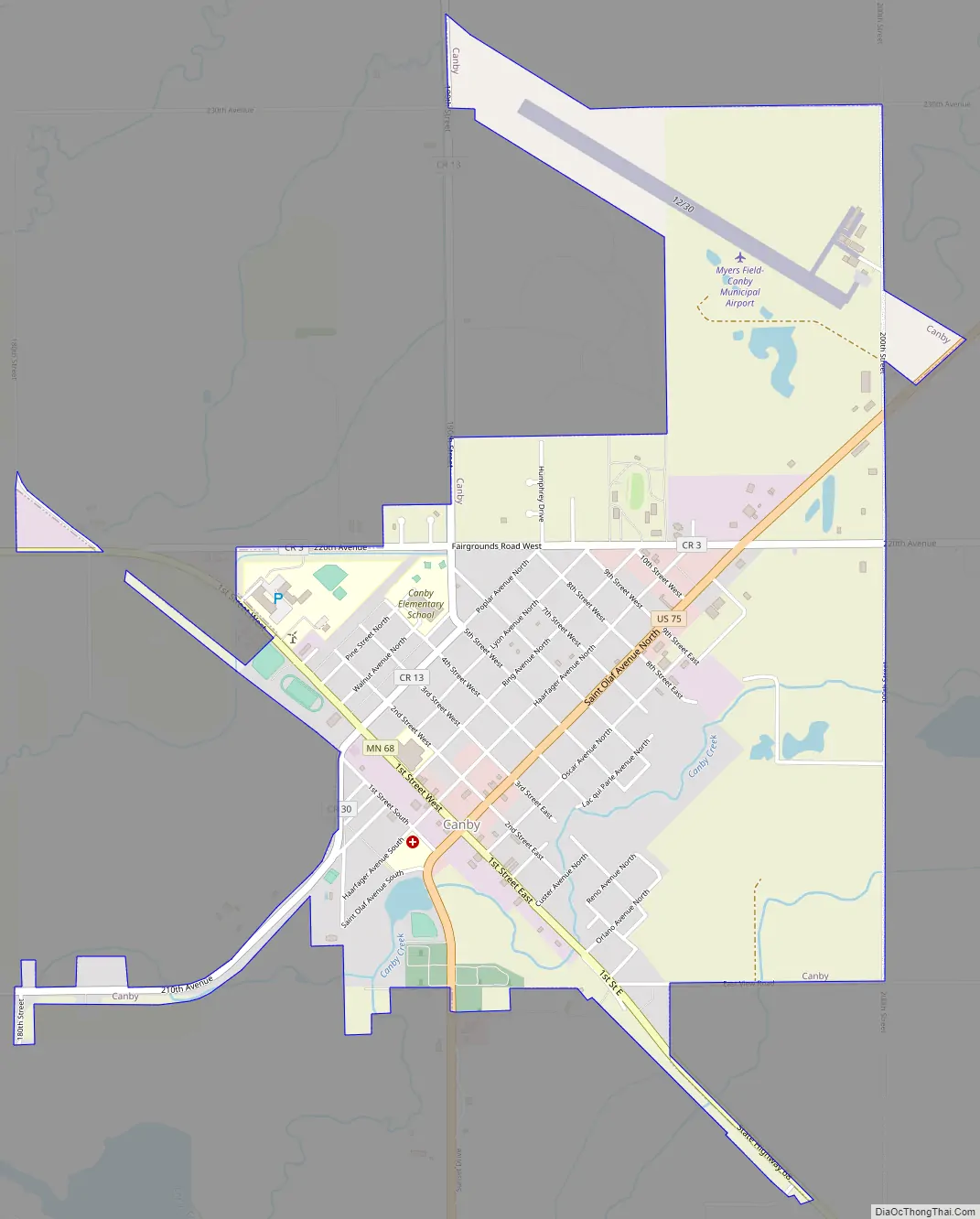
Canby Road Map
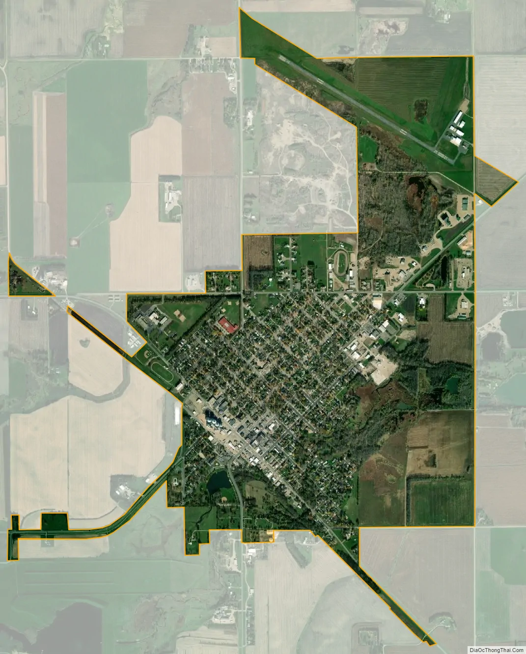
Canby city Satellite Map
Geography
Canby is located mainly in Sections 3 & 4 of Norman Township (T114N R45W). According to the United States Census Bureau, the city has a total area of 2.20 square miles (5.70 km); 2.19 square miles (5.67 km) is land and 0.01 square miles (0.03 km) is water.
Canby Creek, a tributary of the Lac qui Parle River, flows through the city.
U.S. Highway 75 and Minnesota State Highway 68 are two of the main routes in the city. Minnesota State Highway 67 is in close proximity to the city.
Climate
See also
Map of Minnesota State and its subdivision:- Aitkin
- Anoka
- Becker
- Beltrami
- Benton
- Big Stone
- Blue Earth
- Brown
- Carlton
- Carver
- Cass
- Chippewa
- Chisago
- Clay
- Clearwater
- Cook
- Cottonwood
- Crow Wing
- Dakota
- Dodge
- Douglas
- Faribault
- Fillmore
- Freeborn
- Goodhue
- Grant
- Hennepin
- Houston
- Hubbard
- Isanti
- Itasca
- Jackson
- Kanabec
- Kandiyohi
- Kittson
- Koochiching
- Lac qui Parle
- Lake
- Lake of the Woods
- Lake Superior
- Le Sueur
- Lincoln
- Lyon
- Mahnomen
- Marshall
- Martin
- McLeod
- Meeker
- Mille Lacs
- Morrison
- Mower
- Murray
- Nicollet
- Nobles
- Norman
- Olmsted
- Otter Tail
- Pennington
- Pine
- Pipestone
- Polk
- Pope
- Ramsey
- Red Lake
- Redwood
- Renville
- Rice
- Rock
- Roseau
- Saint Louis
- Scott
- Sherburne
- Sibley
- Stearns
- Steele
- Stevens
- Swift
- Todd
- Traverse
- Wabasha
- Wadena
- Waseca
- Washington
- Watonwan
- Wilkin
- Winona
- Wright
- Yellow Medicine
- Alabama
- Alaska
- Arizona
- Arkansas
- California
- Colorado
- Connecticut
- Delaware
- District of Columbia
- Florida
- Georgia
- Hawaii
- Idaho
- Illinois
- Indiana
- Iowa
- Kansas
- Kentucky
- Louisiana
- Maine
- Maryland
- Massachusetts
- Michigan
- Minnesota
- Mississippi
- Missouri
- Montana
- Nebraska
- Nevada
- New Hampshire
- New Jersey
- New Mexico
- New York
- North Carolina
- North Dakota
- Ohio
- Oklahoma
- Oregon
- Pennsylvania
- Rhode Island
- South Carolina
- South Dakota
- Tennessee
- Texas
- Utah
- Vermont
- Virginia
- Washington
- West Virginia
- Wisconsin
- Wyoming