Hendricks is a city in Lincoln County, Minnesota, United States. The population was 713 at the 2010 census.
| Name: | Hendricks city |
|---|---|
| LSAD Code: | 25 |
| LSAD Description: | city (suffix) |
| State: | Minnesota |
| County: | Lincoln County |
| Elevation: | 1,788 ft (545 m) |
| Total Area: | 0.97 sq mi (2.51 km²) |
| Land Area: | 0.97 sq mi (2.51 km²) |
| Water Area: | 0.00 sq mi (0.00 km²) |
| Total Population: | 616 |
| Population Density: | 635.05/sq mi (245.18/km²) |
| ZIP code: | 56136 |
| Area code: | 507 |
| FIPS code: | 2728430 |
| GNISfeature ID: | 0644865 |
| Website: | www.hendricksmn.net |
Online Interactive Map
Click on ![]() to view map in "full screen" mode.
to view map in "full screen" mode.
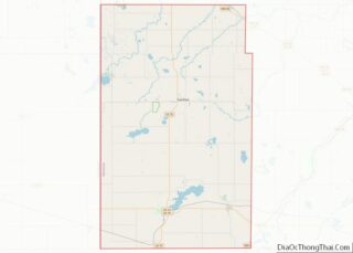
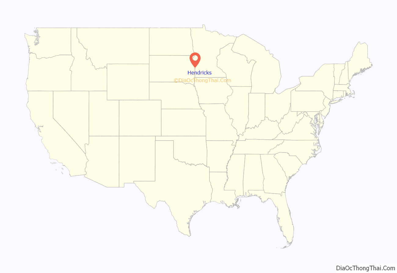
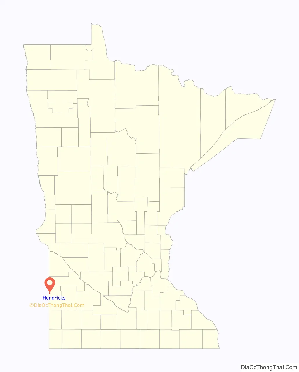
Hendricks location map. Where is Hendricks city?
History
A post office called Hendricks has been in operation since 1884. The city was named for Thomas A. Hendricks, elected 21st Vice President of the United States in 1884.
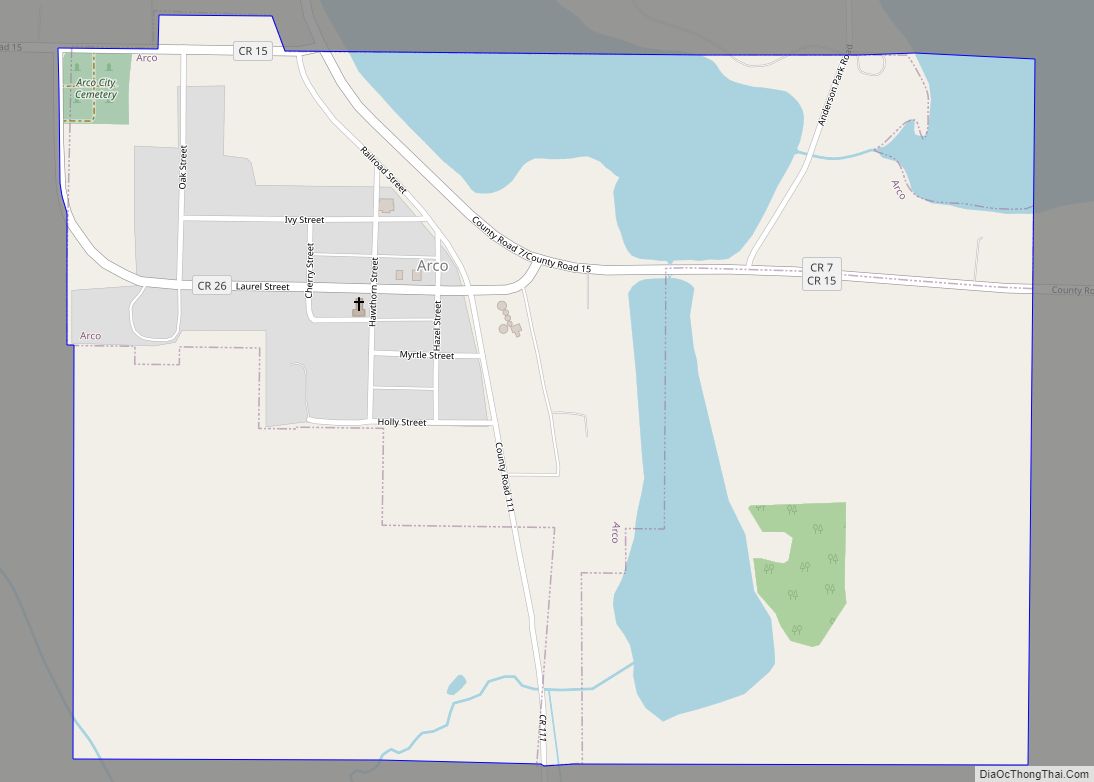
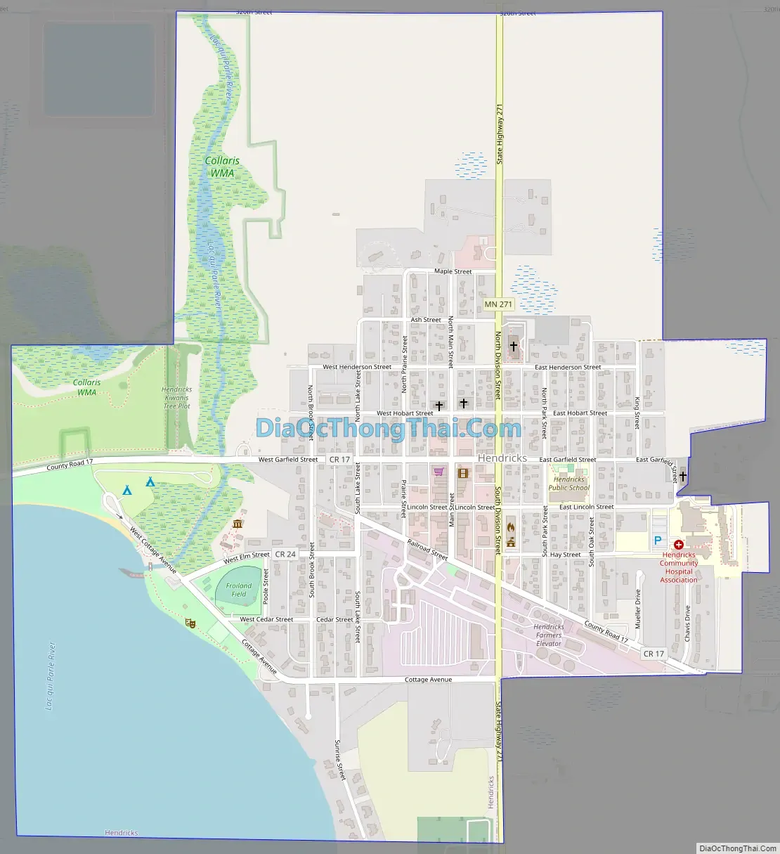
Hendricks Road Map
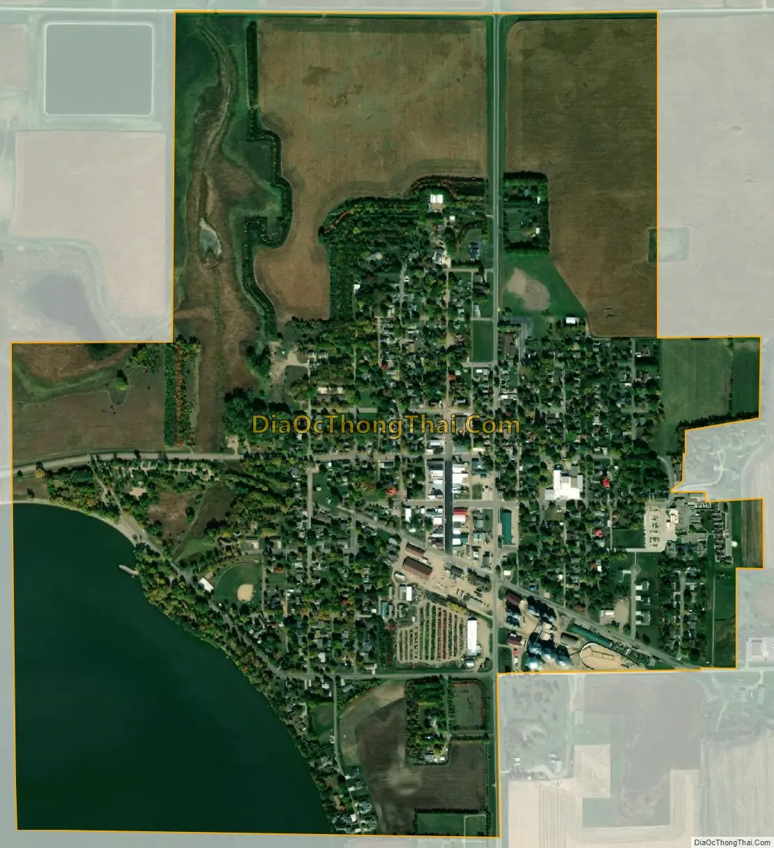
Hendricks city Satellite Map
Geography
According to the United States Census Bureau, the city has a total area of 0.98 square miles (2.54 km), of which 0.96 square miles (2.49 km) is land and 0.02 square miles (0.05 km) is water. The city is located in Sections 17 and 18 of Hendricks Township (T112N R46W), along the northeast shore of Lake Hendricks, the source of the Lac qui Parle River.
Main routes include Minnesota State Highway 271, Division Street, Main Street, Garfield Street, Railroad Street, and Lincoln County Road 17. Minnesota State Highway 19 is nearby.
See also
Map of Minnesota State and its subdivision:- Aitkin
- Anoka
- Becker
- Beltrami
- Benton
- Big Stone
- Blue Earth
- Brown
- Carlton
- Carver
- Cass
- Chippewa
- Chisago
- Clay
- Clearwater
- Cook
- Cottonwood
- Crow Wing
- Dakota
- Dodge
- Douglas
- Faribault
- Fillmore
- Freeborn
- Goodhue
- Grant
- Hennepin
- Houston
- Hubbard
- Isanti
- Itasca
- Jackson
- Kanabec
- Kandiyohi
- Kittson
- Koochiching
- Lac qui Parle
- Lake
- Lake of the Woods
- Lake Superior
- Le Sueur
- Lincoln
- Lyon
- Mahnomen
- Marshall
- Martin
- McLeod
- Meeker
- Mille Lacs
- Morrison
- Mower
- Murray
- Nicollet
- Nobles
- Norman
- Olmsted
- Otter Tail
- Pennington
- Pine
- Pipestone
- Polk
- Pope
- Ramsey
- Red Lake
- Redwood
- Renville
- Rice
- Rock
- Roseau
- Saint Louis
- Scott
- Sherburne
- Sibley
- Stearns
- Steele
- Stevens
- Swift
- Todd
- Traverse
- Wabasha
- Wadena
- Waseca
- Washington
- Watonwan
- Wilkin
- Winona
- Wright
- Yellow Medicine
- Alabama
- Alaska
- Arizona
- Arkansas
- California
- Colorado
- Connecticut
- Delaware
- District of Columbia
- Florida
- Georgia
- Hawaii
- Idaho
- Illinois
- Indiana
- Iowa
- Kansas
- Kentucky
- Louisiana
- Maine
- Maryland
- Massachusetts
- Michigan
- Minnesota
- Mississippi
- Missouri
- Montana
- Nebraska
- Nevada
- New Hampshire
- New Jersey
- New Mexico
- New York
- North Carolina
- North Dakota
- Ohio
- Oklahoma
- Oregon
- Pennsylvania
- Rhode Island
- South Carolina
- South Dakota
- Tennessee
- Texas
- Utah
- Vermont
- Virginia
- Washington
- West Virginia
- Wisconsin
- Wyoming