Lake Benton is a city in Lincoln County, Minnesota, United States. The population was 683 at the 2010 census.
Lake Benton is also the name of the approximately seven-mile-long (11 km) lake adjacent to the city of Lake Benton. The town is on the Buffalo Ridge, and is the site for the radio tower of KKCK-FM in Marshall.
The area is the site of Exelon Wind’s Norgaard Wind Project.
| Name: | Lake Benton city |
|---|---|
| LSAD Code: | 25 |
| LSAD Description: | city (suffix) |
| State: | Minnesota |
| County: | Lincoln County |
| Elevation: | 1,762 ft (537 m) |
| Total Area: | 4.05 sq mi (10.50 km²) |
| Land Area: | 3.21 sq mi (8.30 km²) |
| Water Area: | 0.85 sq mi (2.19 km²) |
| Total Population: | 687 |
| Population Density: | 214.29/sq mi (82.74/km²) |
| ZIP code: | 56149 |
| Area code: | 507 |
| FIPS code: | 2734100 |
| GNISfeature ID: | 0646331 |
| Website: | www.lakebentonminnesota.com |
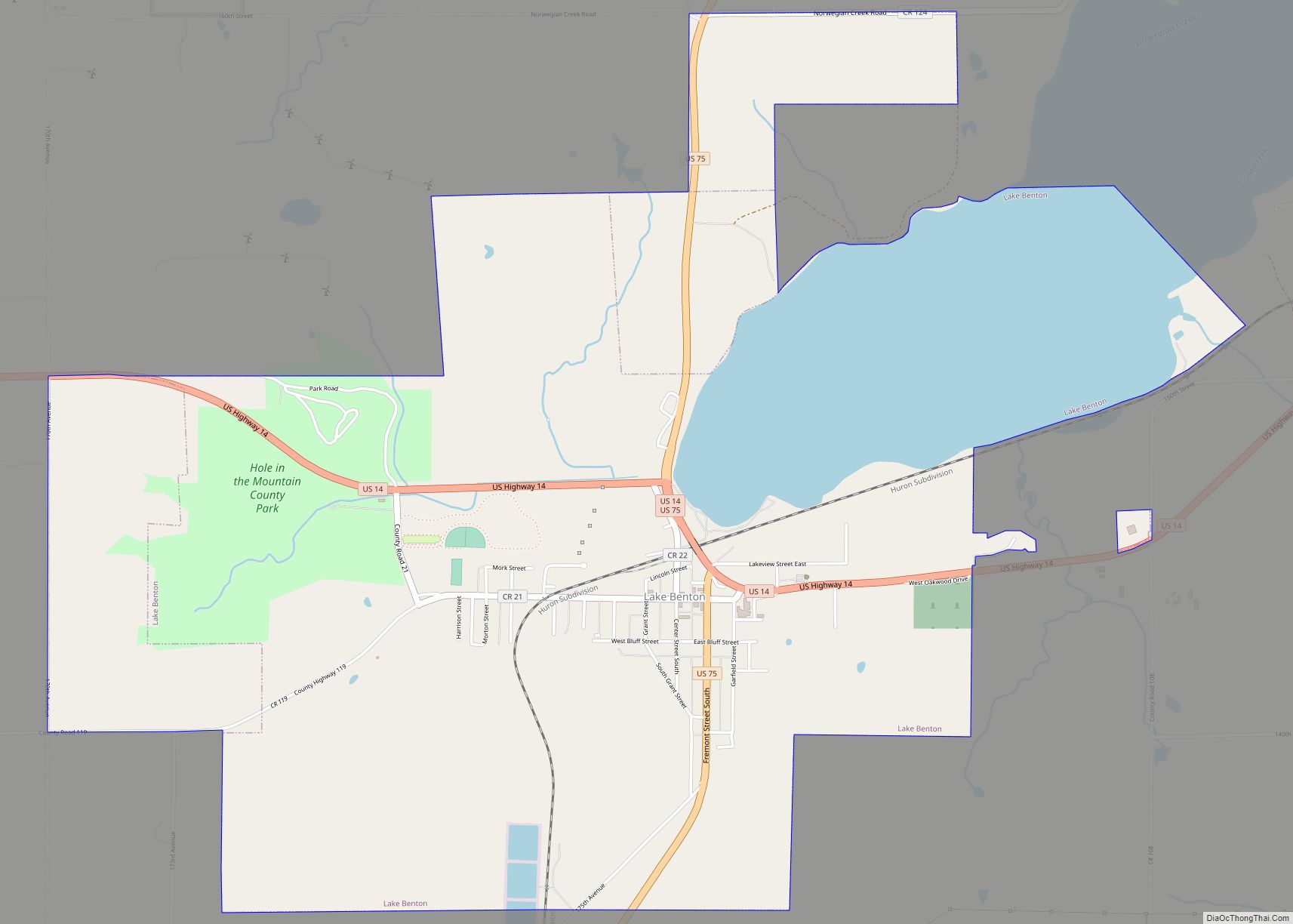
Online Interactive Map
Click on ![]() to view map in "full screen" mode.
to view map in "full screen" mode.
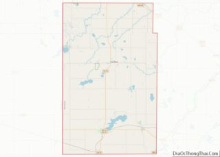
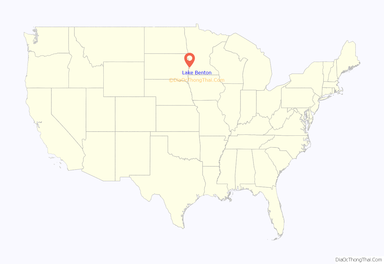
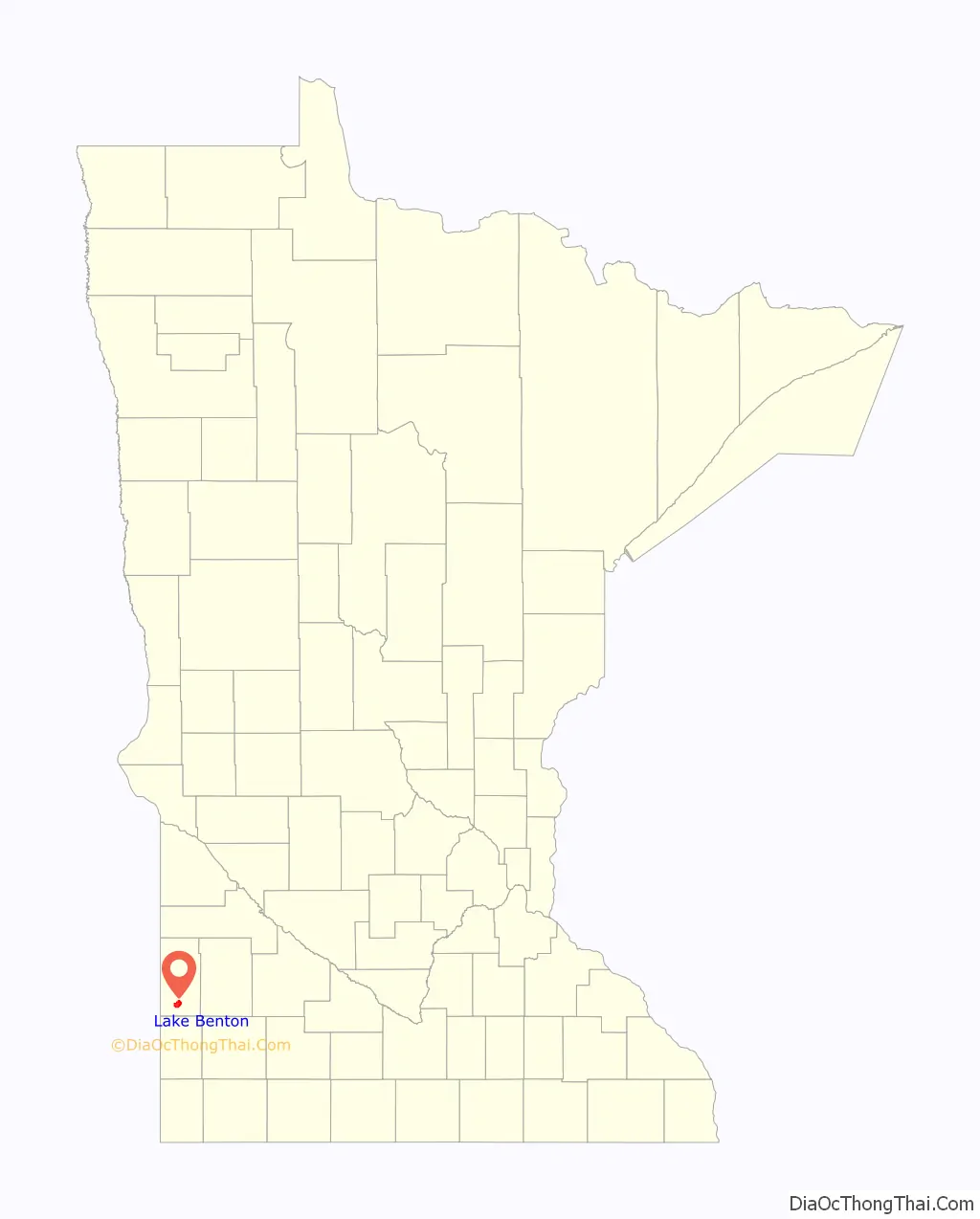
Lake Benton location map. Where is Lake Benton city?
History
A post office called Lake Benton has been in operation since 1873. Lake Benton was platted in 1879. The city took its name from nearby Lake Benton. The county seat was located at Lake Benton from 1882 until 1902.
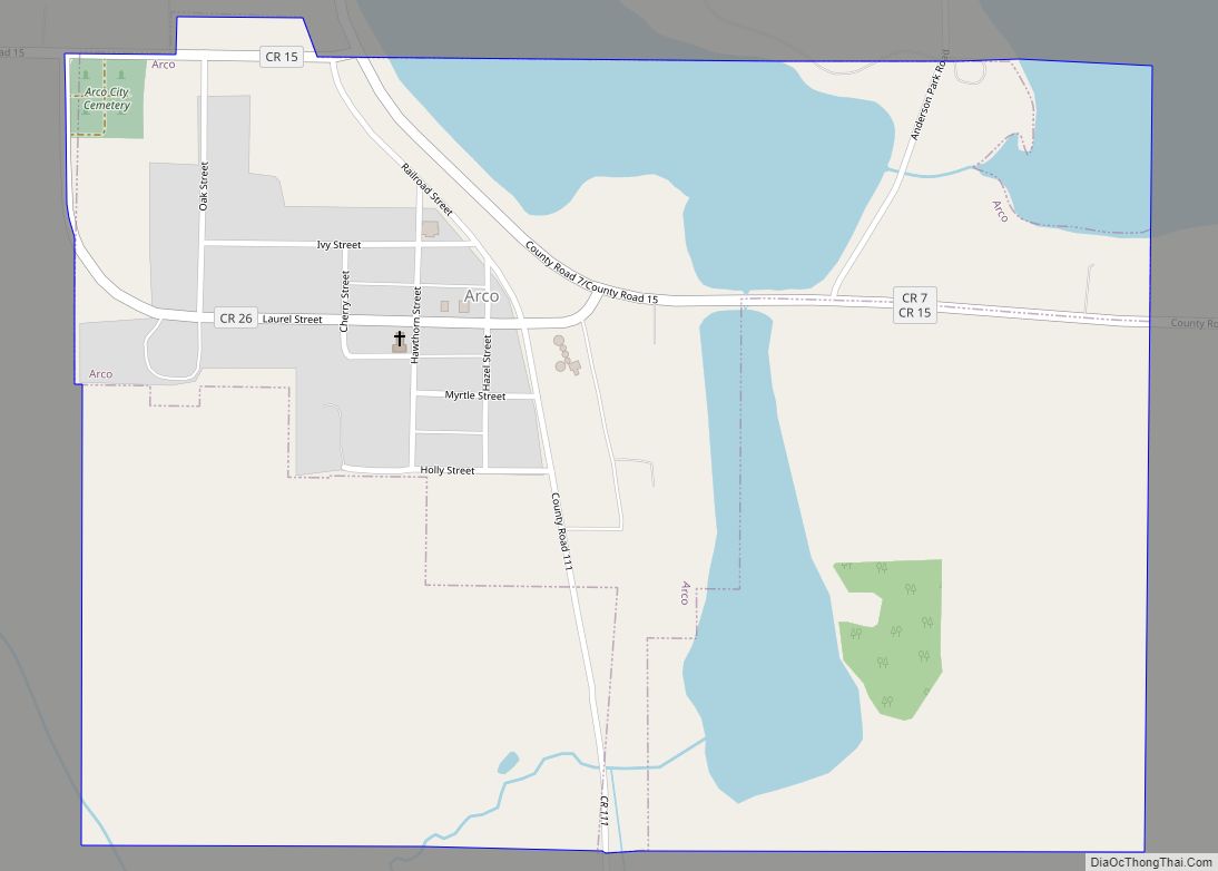
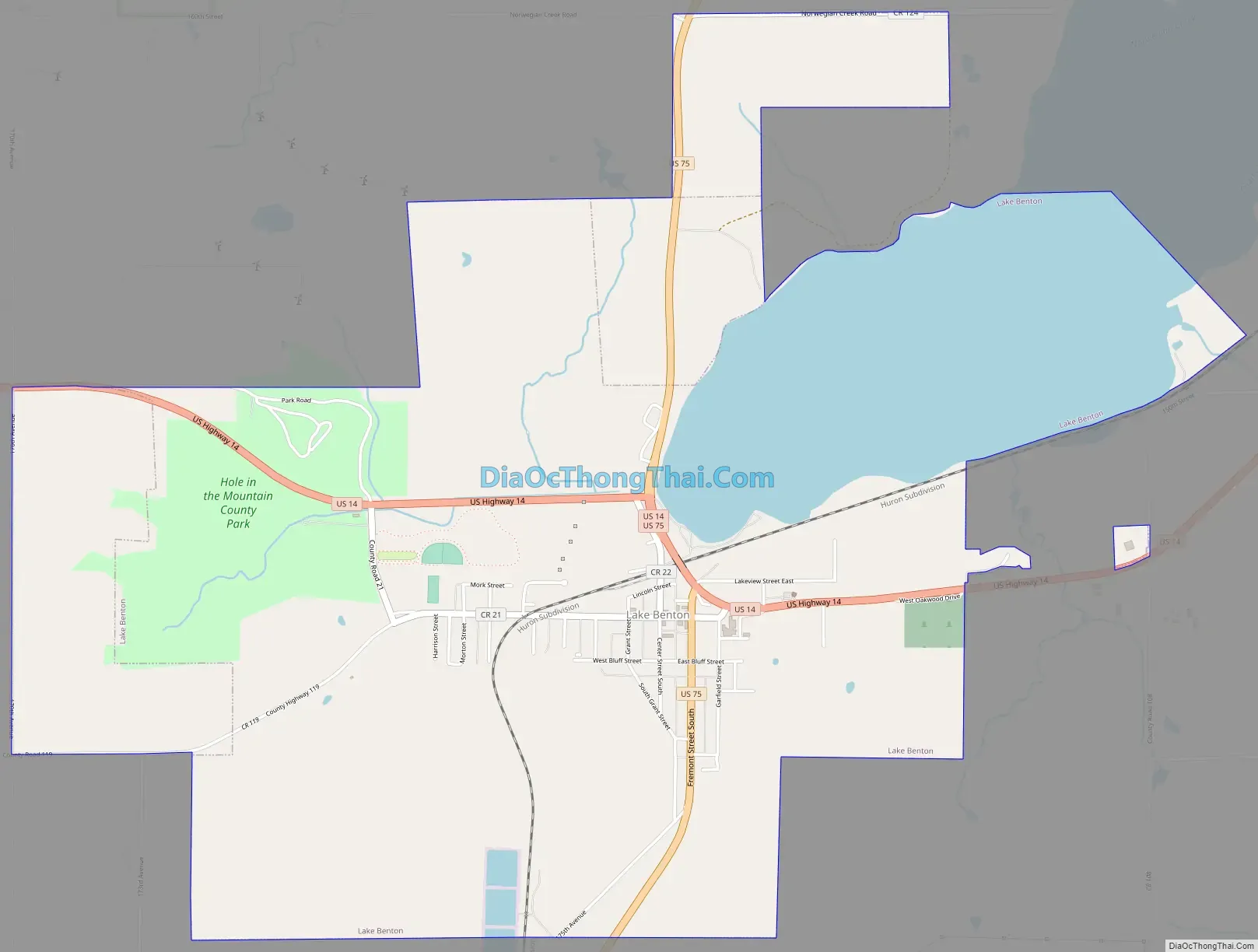
Lake Benton Road Map
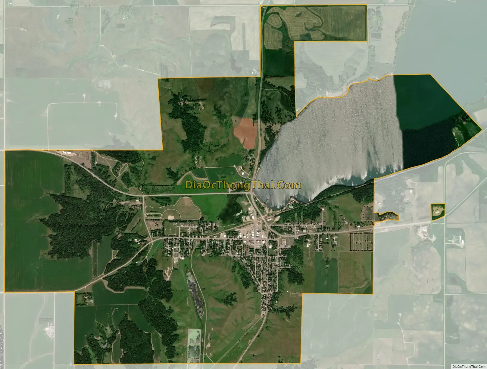
Lake Benton city Satellite Map
Geography
According to the United States Census Bureau, the city has a total area of 4.62 square miles (11.97 km), of which 3.78 square miles (9.79 km) is land and 0.84 square miles (2.18 km) is water.
U.S. Highways 14 and 75 are two of the main routes in the community.
See also
Map of Minnesota State and its subdivision:- Aitkin
- Anoka
- Becker
- Beltrami
- Benton
- Big Stone
- Blue Earth
- Brown
- Carlton
- Carver
- Cass
- Chippewa
- Chisago
- Clay
- Clearwater
- Cook
- Cottonwood
- Crow Wing
- Dakota
- Dodge
- Douglas
- Faribault
- Fillmore
- Freeborn
- Goodhue
- Grant
- Hennepin
- Houston
- Hubbard
- Isanti
- Itasca
- Jackson
- Kanabec
- Kandiyohi
- Kittson
- Koochiching
- Lac qui Parle
- Lake
- Lake of the Woods
- Lake Superior
- Le Sueur
- Lincoln
- Lyon
- Mahnomen
- Marshall
- Martin
- McLeod
- Meeker
- Mille Lacs
- Morrison
- Mower
- Murray
- Nicollet
- Nobles
- Norman
- Olmsted
- Otter Tail
- Pennington
- Pine
- Pipestone
- Polk
- Pope
- Ramsey
- Red Lake
- Redwood
- Renville
- Rice
- Rock
- Roseau
- Saint Louis
- Scott
- Sherburne
- Sibley
- Stearns
- Steele
- Stevens
- Swift
- Todd
- Traverse
- Wabasha
- Wadena
- Waseca
- Washington
- Watonwan
- Wilkin
- Winona
- Wright
- Yellow Medicine
- Alabama
- Alaska
- Arizona
- Arkansas
- California
- Colorado
- Connecticut
- Delaware
- District of Columbia
- Florida
- Georgia
- Hawaii
- Idaho
- Illinois
- Indiana
- Iowa
- Kansas
- Kentucky
- Louisiana
- Maine
- Maryland
- Massachusetts
- Michigan
- Minnesota
- Mississippi
- Missouri
- Montana
- Nebraska
- Nevada
- New Hampshire
- New Jersey
- New Mexico
- New York
- North Carolina
- North Dakota
- Ohio
- Oklahoma
- Oregon
- Pennsylvania
- Rhode Island
- South Carolina
- South Dakota
- Tennessee
- Texas
- Utah
- Vermont
- Virginia
- Washington
- West Virginia
- Wisconsin
- Wyoming