Norcross is a city in Grant County, Minnesota, United States, along the Mustinka River. The population was 70 at the 2010 census.
| Name: | Norcross city |
|---|---|
| LSAD Code: | 25 |
| LSAD Description: | city (suffix) |
| State: | Minnesota |
| County: | Grant County |
| Elevation: | 1,040 ft (317 m) |
| Total Area: | 1.56 sq mi (4.03 km²) |
| Land Area: | 1.56 sq mi (4.03 km²) |
| Water Area: | 0.00 sq mi (0.00 km²) |
| Total Population: | 52 |
| Population Density: | 33.38/sq mi (12.89/km²) |
| ZIP code: | 56274 |
| Area code: | 320 |
| FIPS code: | 2746492 |
| GNISfeature ID: | 0648581 |
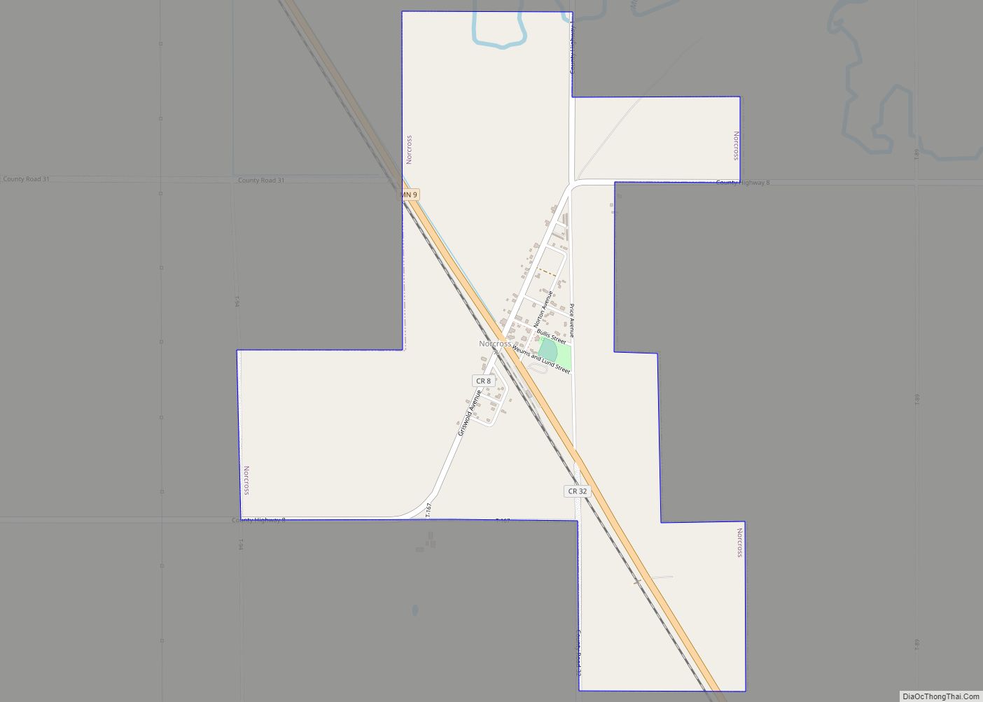
Online Interactive Map
Click on ![]() to view map in "full screen" mode.
to view map in "full screen" mode.
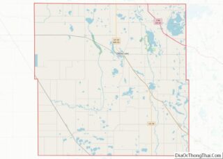
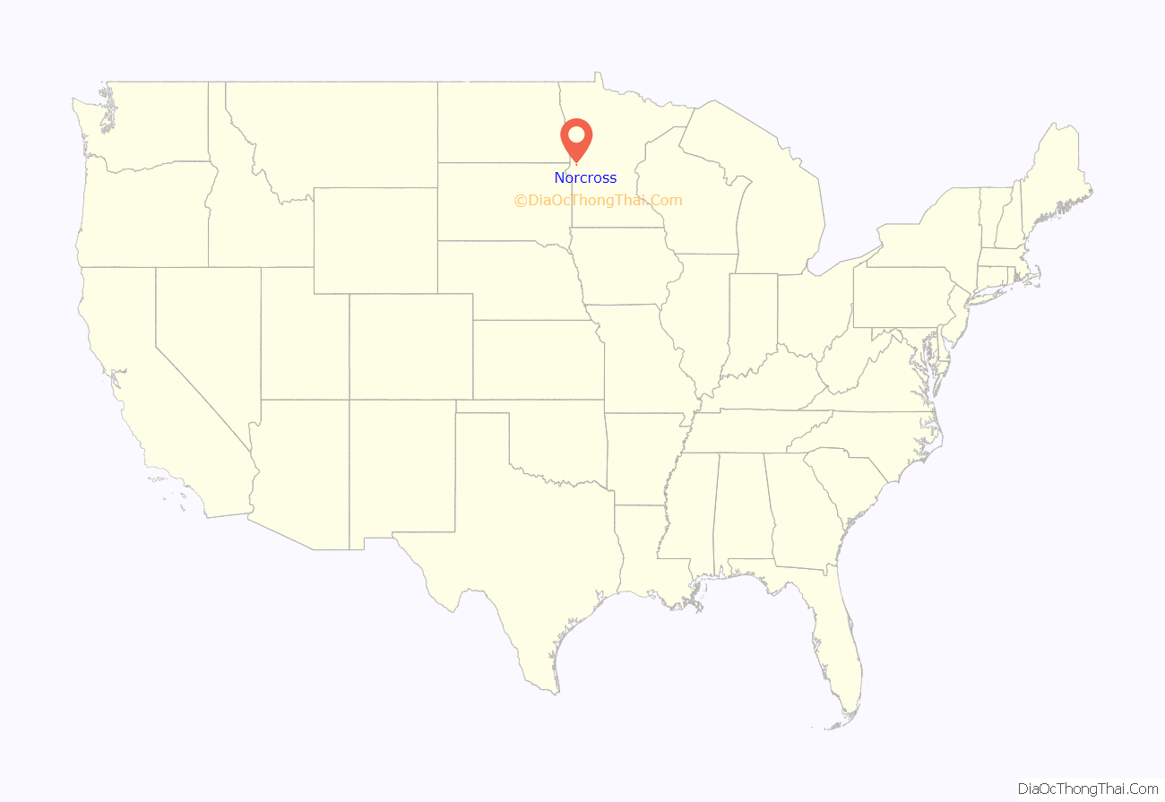
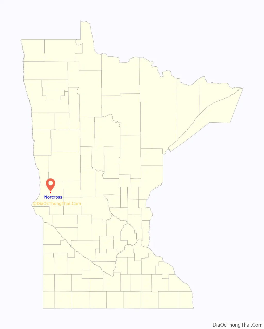
Norcross location map. Where is Norcross city?
History
Norcross was platted in 1881. In 1882, Norcross began as a large grain ranch owned by N.F. Griswold and Captain J.N. Cross. They convinced the Great Northern Railway to build the depot at their ranch rather than two miles north at the planned town of Gorton. The train regularly stopped at the ranch to pick up wheat, and the railroad officials agreed to build the depot and grain elevators there. Why the name Norcross instead of Griscross? The two gentlemen and an old army career man, called Norton, donated the land for the town. Norton and Cross teamed up for the city name, Norcross, and Griswold settled for main street, known as “Griswold Ave.” The city’s name is an amalgamation of Henry Allyn Norton and Judson Newell Cross, the founders.
The town incorporated in 1913 with 140 people. Lund and Sellseth started a bank in 1909, which closed in 1931, a victim of the Depression. The first school, named “New School,” opened in 1903, and later was home to the Norwegian Lutheran Church when a newer school was built. In 1928, a great fire destroyed all the buildings on the south side of town. Refusing to give in to the forces of nature, the citizens opened a creamery, the town hall, and a liquor store, which later was converted to a pool hall during Prohibition. George Houps for Iowa bought the stockyards and started a general store.
At one time Norcross had three churches. Our Savior’s Lutheran Church celebrated their 75th anniversary in 1976 and their 90th anniversary in 1991, and is now a beautiful private home. Before the church was built, early pioneers walked 17 miles to a church northeast of Norcross in order to be confirmed. St. Mary’s Catholic Church opened in 1905 and closed in 1923. The Faith United Methodist Church began services in the Amundson School in 1919, erected a church in 1952, and closed in 2007.
American Legion Hillestad-Borgeson Post #410, based in Norcross, established a veterans’ memorial in Norcross Park on Highway 9. The monument erected by the post is dedicated “In memory of all the men and women who have served their country in all wars.” A National Guardsman and 2005 veteran of the war in Iraq, Norcross native Jacob Veldhouse’s name is inscribed there, as is the name of his uncle, Dennis.
The Norcross Town Hall, built in the late ’20s, was the place to be when growing up in Norcross. People danced, roller skated, attended funerals and wedding receptions, hosted church fundraiser dinners, and even basketball games. The brick building fell into disrepair and was dismantled in 1997. Bricks were offered free to the public.
A post office started operation at Norcross since 1881. The United States Postal Service suspended the post office to be relocated to the post office in Herman in October of 2019.
The Norcross school building is a worthy candidate for the National Register of Historic Places. Built in 1938 by the WPA, the building is made entirely of poured concrete, a fine example of Art Deco architecture. For over thirty years, students from first through seventh grade were educated in the three-room school. The school consolidated with Herman in 1971, and now the building is privately owned.
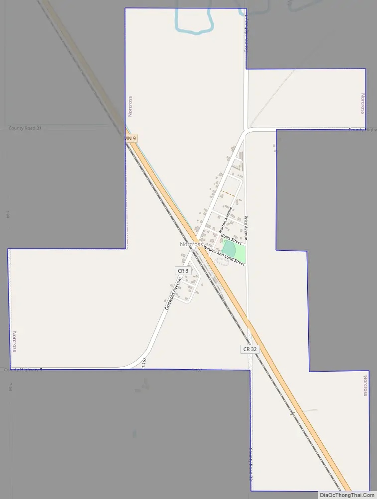
Norcross Road Map
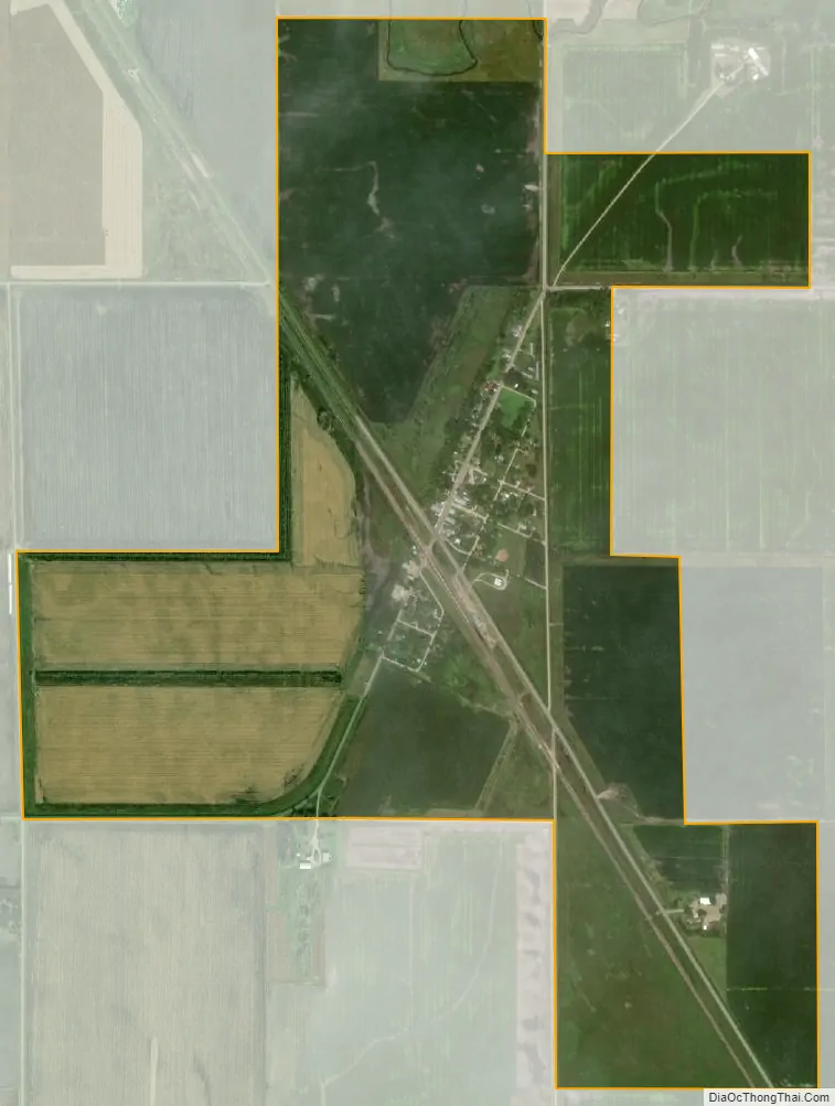
Norcross city Satellite Map
Geography
According to the United States Census Bureau, the city has a total area of 1.56 square miles (4.04 km), all land.
Minnesota State Highway 9 serves as a main route in the community.
See also
Map of Minnesota State and its subdivision:- Aitkin
- Anoka
- Becker
- Beltrami
- Benton
- Big Stone
- Blue Earth
- Brown
- Carlton
- Carver
- Cass
- Chippewa
- Chisago
- Clay
- Clearwater
- Cook
- Cottonwood
- Crow Wing
- Dakota
- Dodge
- Douglas
- Faribault
- Fillmore
- Freeborn
- Goodhue
- Grant
- Hennepin
- Houston
- Hubbard
- Isanti
- Itasca
- Jackson
- Kanabec
- Kandiyohi
- Kittson
- Koochiching
- Lac qui Parle
- Lake
- Lake of the Woods
- Lake Superior
- Le Sueur
- Lincoln
- Lyon
- Mahnomen
- Marshall
- Martin
- McLeod
- Meeker
- Mille Lacs
- Morrison
- Mower
- Murray
- Nicollet
- Nobles
- Norman
- Olmsted
- Otter Tail
- Pennington
- Pine
- Pipestone
- Polk
- Pope
- Ramsey
- Red Lake
- Redwood
- Renville
- Rice
- Rock
- Roseau
- Saint Louis
- Scott
- Sherburne
- Sibley
- Stearns
- Steele
- Stevens
- Swift
- Todd
- Traverse
- Wabasha
- Wadena
- Waseca
- Washington
- Watonwan
- Wilkin
- Winona
- Wright
- Yellow Medicine
- Alabama
- Alaska
- Arizona
- Arkansas
- California
- Colorado
- Connecticut
- Delaware
- District of Columbia
- Florida
- Georgia
- Hawaii
- Idaho
- Illinois
- Indiana
- Iowa
- Kansas
- Kentucky
- Louisiana
- Maine
- Maryland
- Massachusetts
- Michigan
- Minnesota
- Mississippi
- Missouri
- Montana
- Nebraska
- Nevada
- New Hampshire
- New Jersey
- New Mexico
- New York
- North Carolina
- North Dakota
- Ohio
- Oklahoma
- Oregon
- Pennsylvania
- Rhode Island
- South Carolina
- South Dakota
- Tennessee
- Texas
- Utah
- Vermont
- Virginia
- Washington
- West Virginia
- Wisconsin
- Wyoming