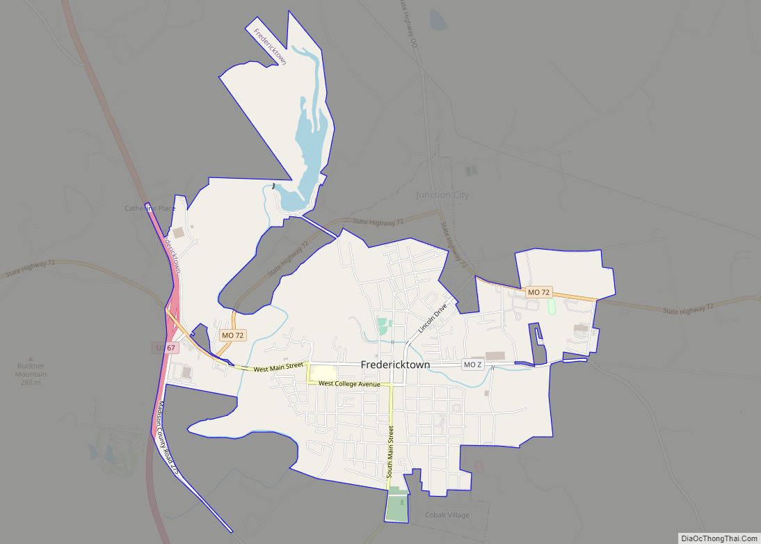
Fredericktown is a city in and the county seat of Madison County, Missouri, United States, in the northeastern foothills of the St. Francois Mountains. The population was 4,429 at the 2020 census. The city is surrounded on three sides (east, west, and south) by the easternmost parcel of the Mark Twain National Forest.
| Name: | Fredericktown city |
|---|---|
| LSAD Code: | 25 |
| LSAD Description: | city (suffix) |
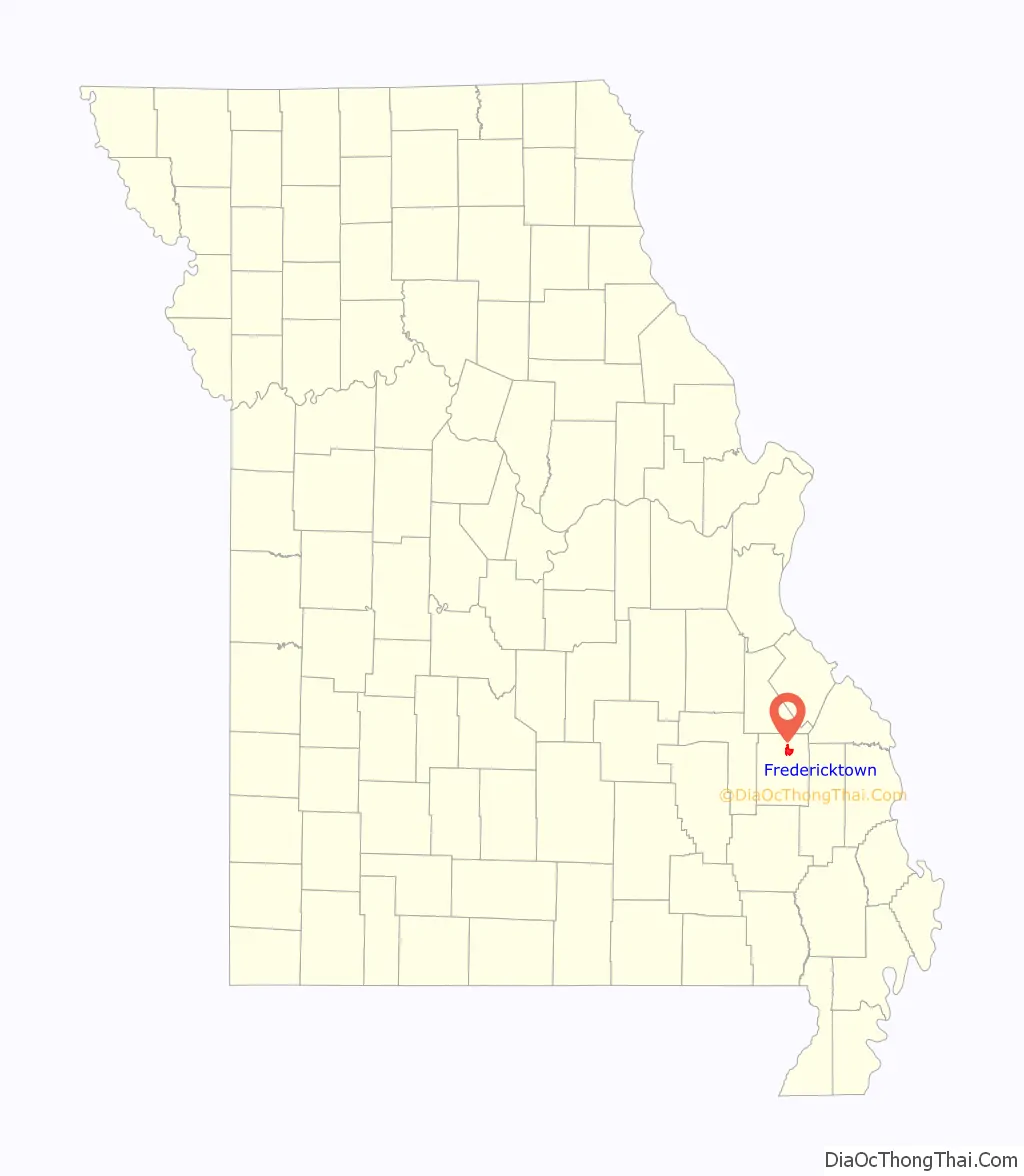
| State: | Missouri |
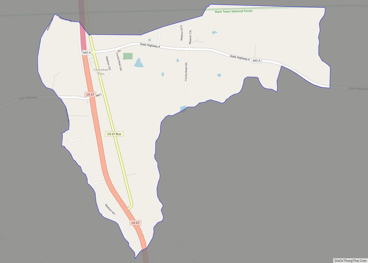
| County: | Madison County |
| Elevation: | 699 ft (213 m) |
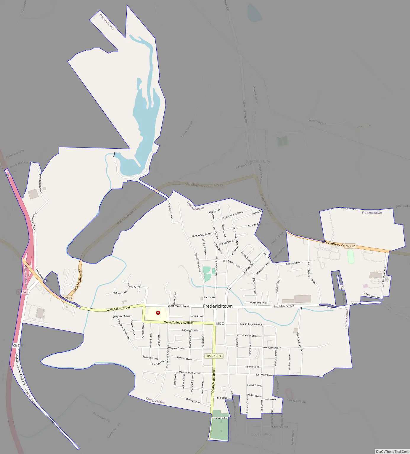
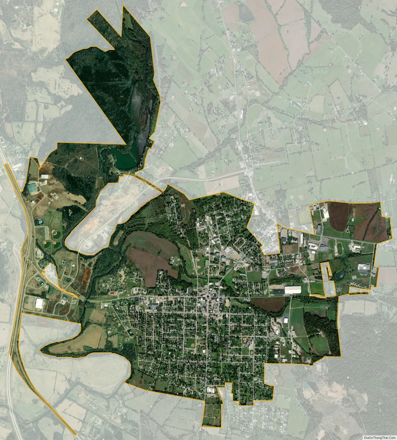
| Total Area: | 4.50 sq mi (11.64 km²) |
| Land Area: | 4.33 sq mi (11.20 km²) |
| Water Area: | 0.17 sq mi (0.44 km²) |
| Total Population: | 4,429 |
| Population Density: | 1,024.05/sq mi (395.36/km²) |
| ZIP code: | 63645 |
| Area code: | 573 |
| FIPS code: | 2925768 |
| GNISfeature ID: | 2394816 |
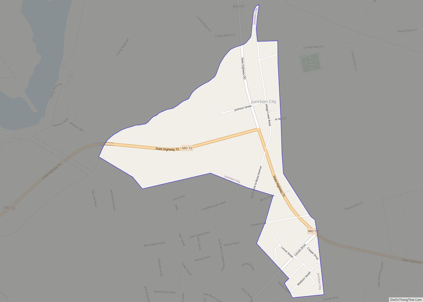
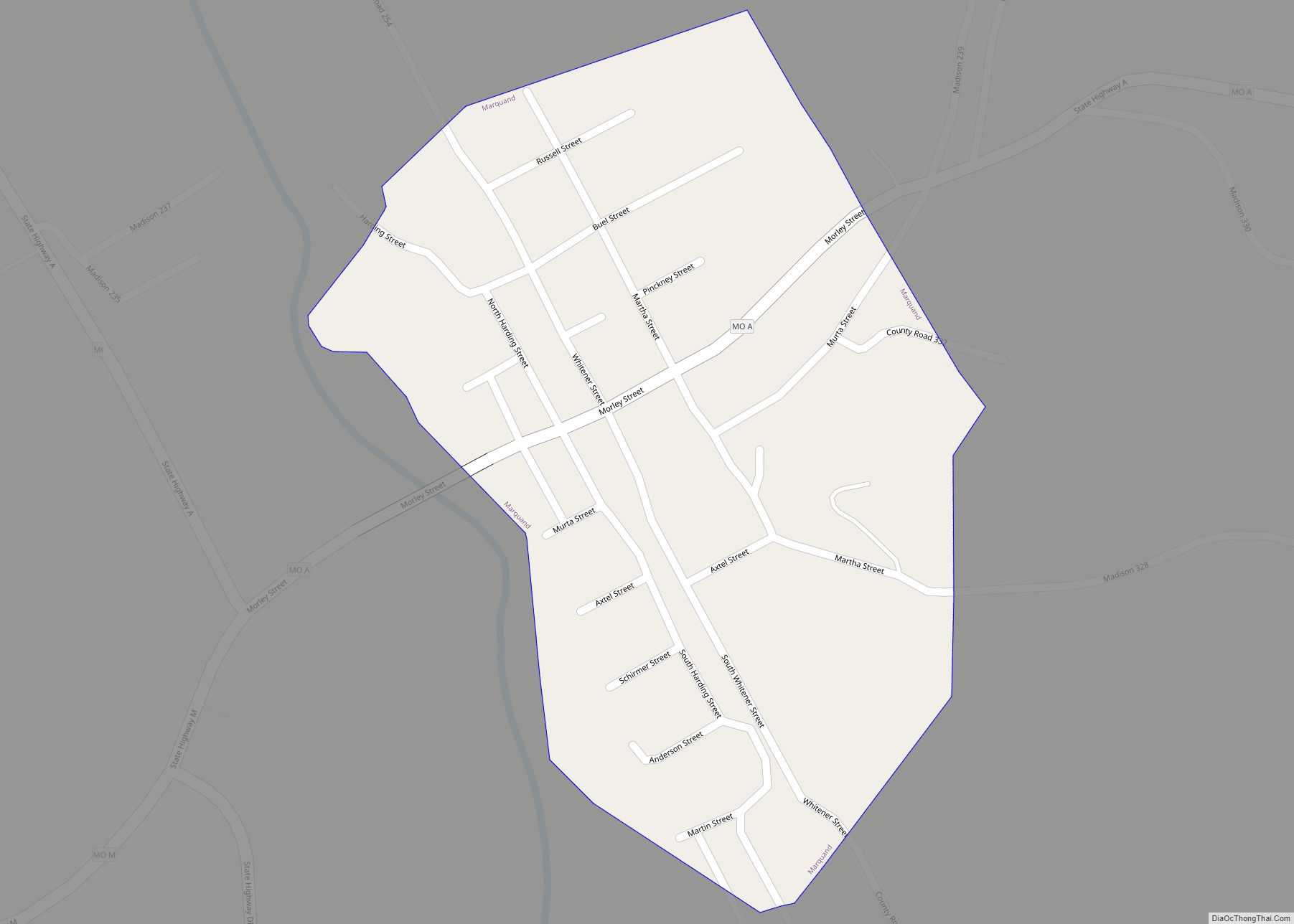
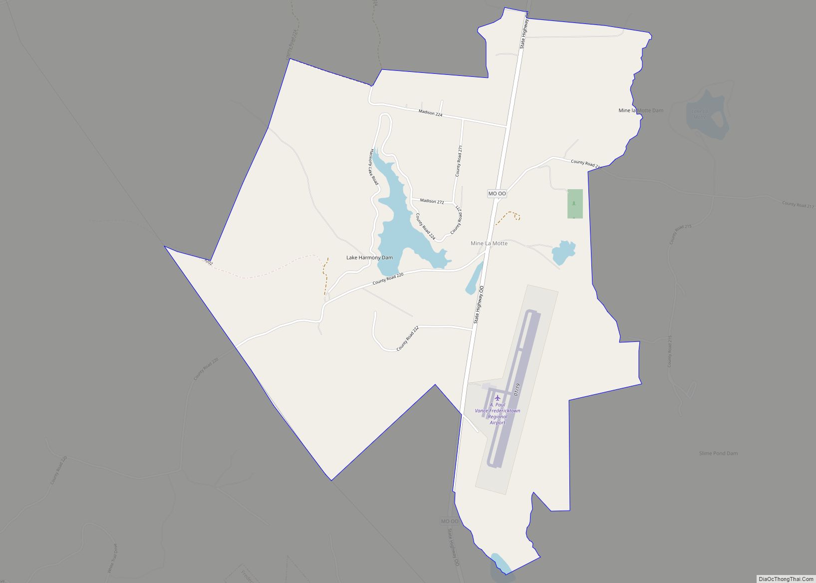
Online Interactive Map
Click on ![]() to view map in "full screen" mode.
to view map in "full screen" mode.
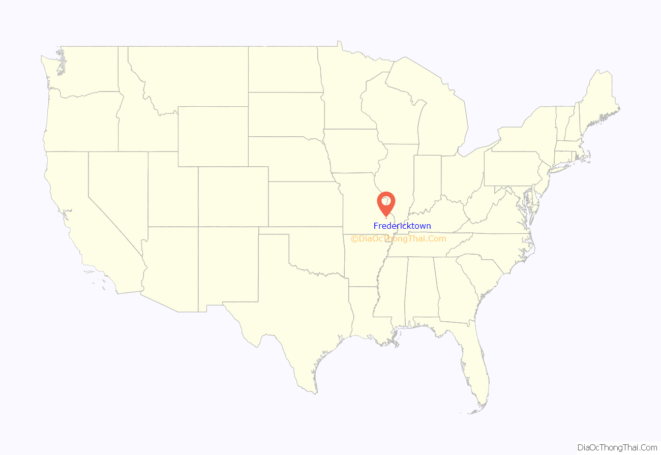
Fredericktown location map. Where is Fredericktown city?
History
The Fredericktown Courthouse Square Historic District, Fredericktown Missouri Pacific Railroad Depot, Fredericktown United States Post Office, Madison County Courthouse, and St. Louis, Iron Mountain and Southern Railroad Depot are listed on the National Register of Historic Places.
Exploration
The history of Fredericktown revolves around the history of lead mining. The earliest beginnings of Fredericktown occurred around 1715 when local Indians guided French explorers to the area which at that time was part of the Upper Louisiana in order to show them sources of lead which the French had hoped would also contain silver.
The French Governor of French Louisiana Sieur Antoine de la Mothe Cadillac, failed to find silver, but succeeded in recruiting other French investors in The Company of the West, organized in 1717, to exploit the mineral resources of Louisiana.
Early settlement
The earliest European settlement in the area near what is now Fredericktown was Mine La Motte, a small community about six miles (10 km) to the north. Mine La Motte was first settled by Europeans to mine a large vein of galena lead ore distributed in dolomite that reached the surface there. The need for a local source of lead for ammunition made Mine La Motte one of the earliest European settlements in the interior of the North American continent. Another earlier settlement was the French Catholic community of Saint Michel, Missouri, which is located just north of the current Fredericktown site on the other side of Saline Creek. After the Louisiana Purchase in 1803, the Americanization of the area began in earnest with an influx of second and third generation German Reformed Church settlers from the next county eastward, Bollinger County. Other American settlers were drawn to the area as well, including Moses Austin, founder of the American settlement in Texas, who mined for lead between 1800 and 1820 before going on to Texas. In 1818, the area was organized to form Madison County. The name was chosen to honor James Madison, who had been the two-term President of the United States up until two years earlier (from 1809 to 1817), and who had handled the Louisiana Purchase as Secretary of State for Thomas Jefferson. At the time that Madison County was organized, the land south of Saline Creek was owned by Col. Nathaniel Cook. A new town was laid out on Col. Cook’s higher, less flood-prone land, and named Fredericktown in honor of Col. Cook’s close friend from Bollinger County, Col. George Frederick Bollinger.
2021 Tornado
On October 24, 2021 the city was impacted by a destructive EF3 tornado.
Fredericktown Road Map
Fredericktown city Satellite Map
Geography
According to the United States Census Bureau, the city has a total area of 4.50 square miles (11.65 km), of which 4.33 square miles (11.21 km) is land and 0.17 square miles (0.44 km) is water.
Climate
See also
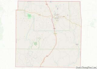
Map of Missouri State and its subdivision:- Adair
- Andrew
- Atchison
- Audrain
- Barry
- Barton
- Bates
- Benton
- Bollinger
- Boone
- Buchanan
- Butler
- Caldwell
- Callaway
- Camden
- Cape Girardeau
- Carroll
- Carter
- Cass
- Cedar
- Chariton
- Christian
- Clark
- Clay
- Clinton
- Cole
- Cooper
- Crawford
- Dade
- Dallas
- Daviess
- De Kalb
- Dent
- Douglas
- Dunklin
- Franklin
- Gasconade
- Gentry
- Greene
- Grundy
- Harrison
- Henry
- Hickory
- Holt
- Howard
- Howell
- Iron
- Jackson
- Jasper
- Jefferson
- Johnson
- Knox
- Laclede
- Lafayette
- Lawrence
- Lewis
- Lincoln
- Linn
- Livingston
- Macon
- Madison
- Maries
- Marion
- McDonald
- Mercer
- Miller
- Mississippi
- Moniteau
- Monroe
- Montgomery
- Morgan
- New Madrid
- Newton
- Nodaway
- Oregon
- Osage
- Ozark
- Pemiscot
- Perry
- Pettis
- Phelps
- Pike
- Platte
- Polk
- Pulaski
- Putnam
- Ralls
- Randolph
- Ray
- Reynolds
- Ripley
- Saint Charles
- Saint Clair
- Saint Francois
- Saint Louis
- Sainte Genevieve
- Saline
- Schuyler
- Scotland
- Scott
- Shannon
- Shelby
- Stoddard
- Stone
- Sullivan
- Taney
- Texas
- Vernon
- Warren
- Washington
- Wayne
- Webster
- Worth
- Wright
- Alabama
- Alaska
- Arizona
- Arkansas
- California
- Colorado
- Connecticut
- Delaware
- District of Columbia
- Florida
- Georgia
- Hawaii
- Idaho
- Illinois
- Indiana
- Iowa
- Kansas
- Kentucky
- Louisiana
- Maine
- Maryland
- Massachusetts
- Michigan
- Minnesota
- Mississippi
- Missouri
- Montana
- Nebraska
- Nevada
- New Hampshire
- New Jersey
- New Mexico
- New York
- North Carolina
- North Dakota
- Ohio
- Oklahoma
- Oregon
- Pennsylvania
- Rhode Island
- South Carolina
- South Dakota
- Tennessee
- Texas
- Utah
- Vermont
- Virginia
- Washington
- West Virginia
- Wisconsin
- Wyoming