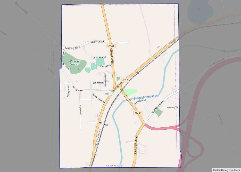
Afton is a village in Chenango County, New York, United States. The population was 822 at the 2010 census. The village is named after the poem “Sweet Afton” by Scottish poet Robert Burns, referring to the River Afton in Ayrshire, Scotland.
The village of Afton is located in the town of Afton and is northeast of Binghamton.
| Name: | Afton village |
|---|---|
| LSAD Code: | 47 |
| LSAD Description: | village (suffix) |
| State: | New York |
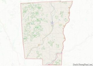
| County: | Chenango County |
| Elevation: | 1,001 ft (305 m) |
| Total Area: | 1.60 sq mi (4.14 km²) |
| Land Area: | 1.53 sq mi (3.95 km²) |
| Water Area: | 0.07 sq mi (0.19 km²) |
| Total Population: | 794 |
| Population Density: | 519.97/sq mi (200.82/km²) |
| ZIP code: | 13730 |
| Area code: | 607 |
| FIPS code: | 3600342 |
| GNISfeature ID: | 2391501 |
| Website: | http://villageofaftonny.com |
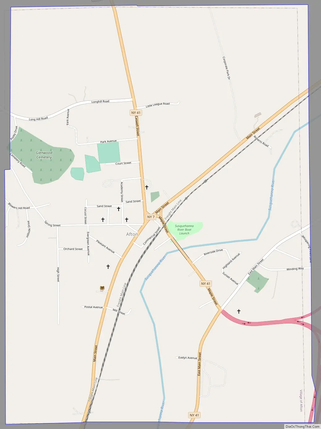
Online Interactive Map
Click on ![]() to view map in "full screen" mode.
to view map in "full screen" mode.
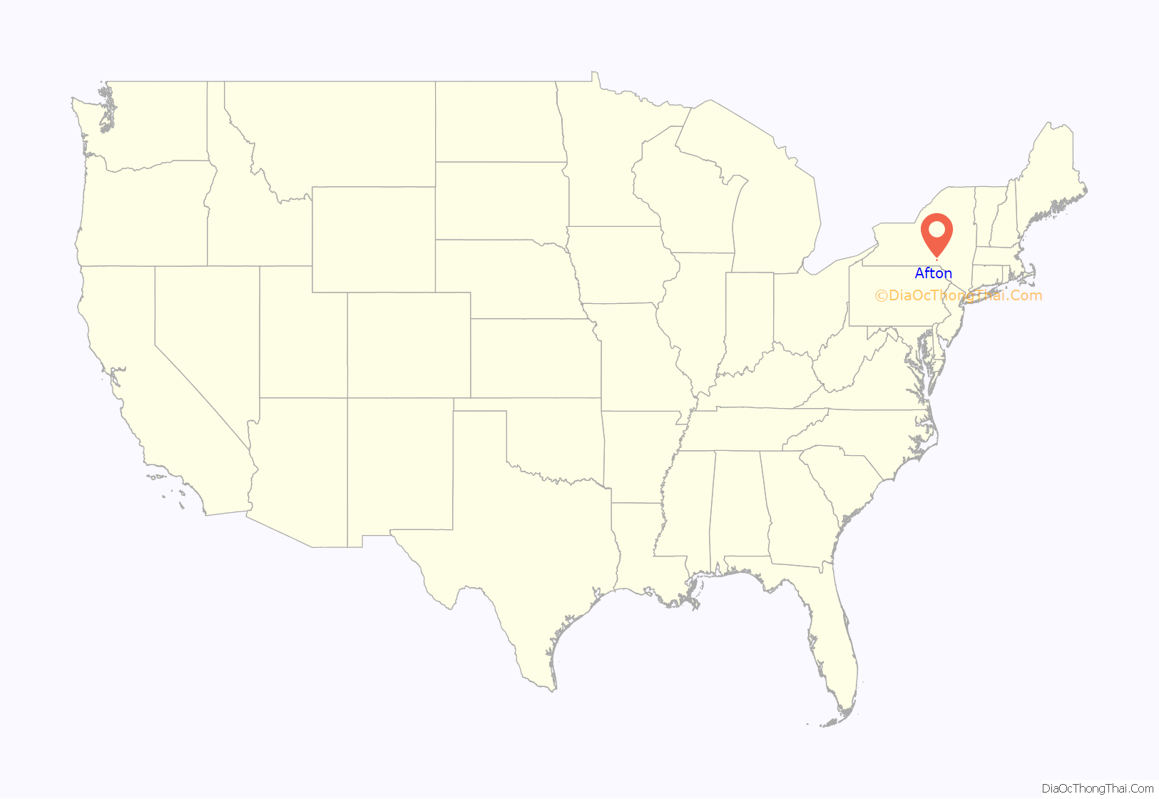
Afton location map. Where is Afton village?
History
The first settlement in the town, around 1786, was near the site of the present village. Ebenezer Landers built a home on the east side of the Susquehanna River. The home was later acquired by Dr. Carlton J. H. Hayes, professor of history at Columbia University and the United States ambassador to Spain during World War II. Hayes added the Pillard Porticho to the Landers home, and the structure continues to stand and is known as the Jericho Farm today. In 1983, the Main Street Historic District was listed on the National Register of Historic Places.
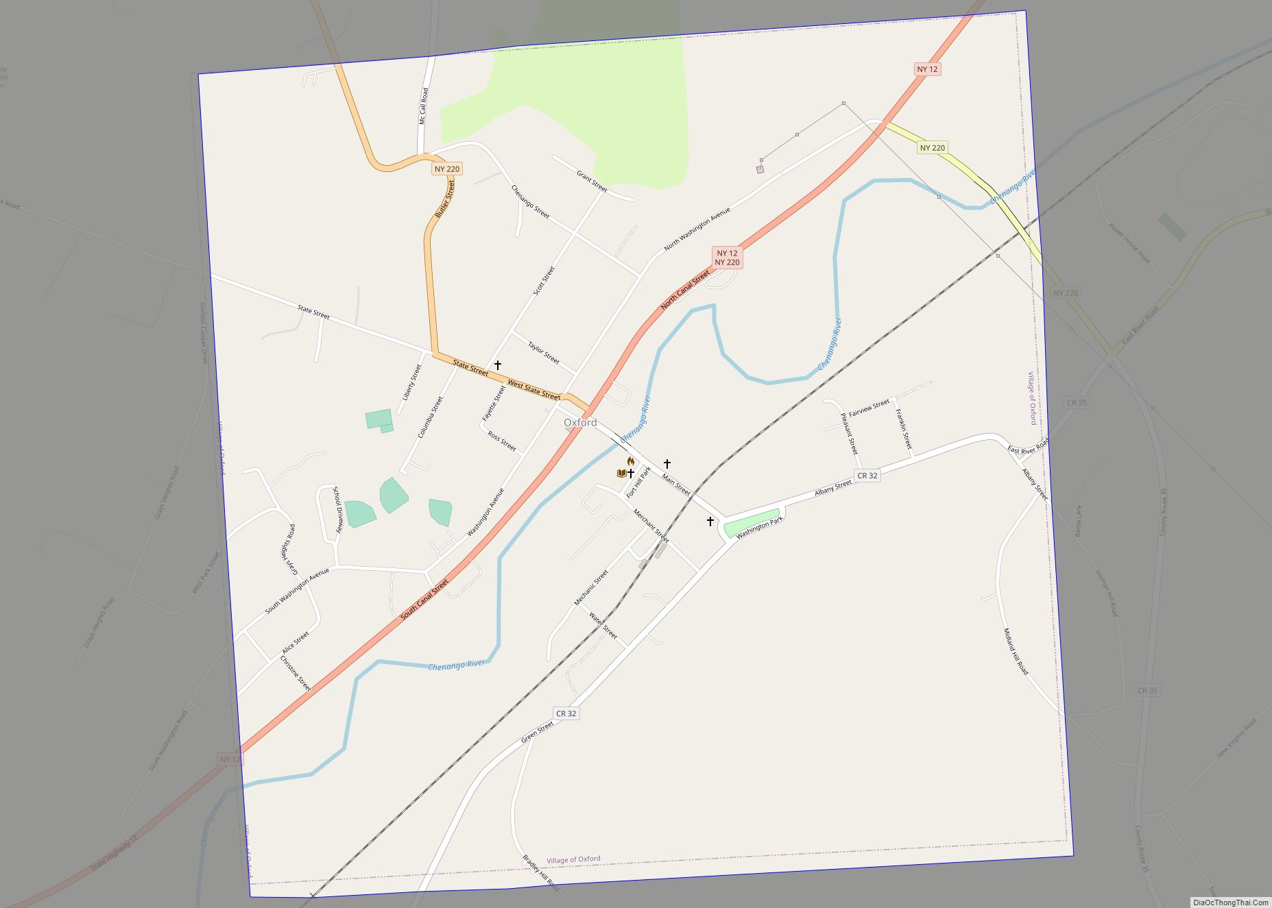
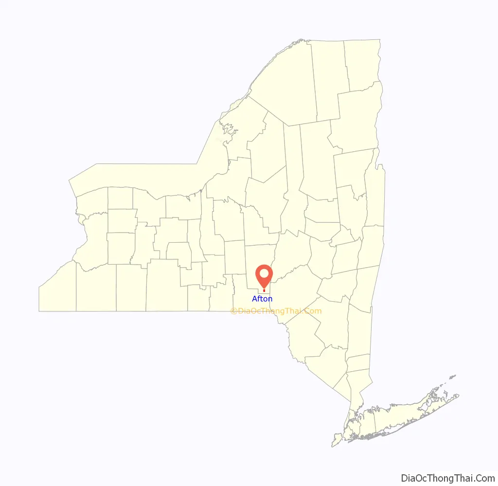
Afton Road Map
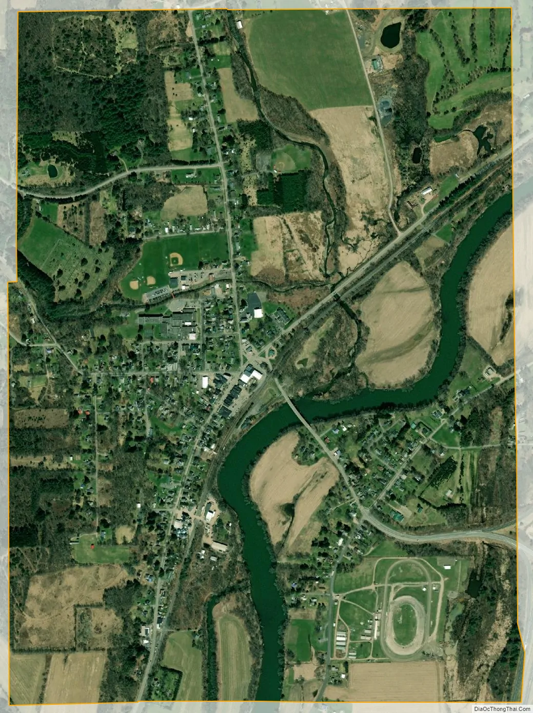
Afton city Satellite Map
Geography
Afton village is located at the geographic center of the town of Afton at 42°13′45″N 75°31′29″W / 42.22917°N 75.52472°W / 42.22917; -75.52472 (42.22918, -75.524781), in southern Chenango County.
According to the United States Census Bureau, the village has a total area of 1.6 square miles (4.1 km), of which 1.5 square miles (4.0 km) is land and 0.08 square miles (0.2 km), or 4.57%, is water. The Susquehanna River flows through the village.
Interstate 88 passes just east of the village limits, with access from Exit 7. The center of Afton is at the junction of NY Route 7 and NY Route 41. Binghamton is 26 miles (42 km) to the southwest, and Oneonta is 33 miles (53 km) to the northeast. County Road 30 also intersects NY-41 in the village.
See also
Map of New York State and its subdivision:- Albany
- Allegany
- Bronx
- Broome
- Cattaraugus
- Cayuga
- Chautauqua
- Chemung
- Chenango
- Clinton
- Columbia
- Cortland
- Delaware
- Dutchess
- Erie
- Essex
- Franklin
- Fulton
- Genesee
- Greene
- Hamilton
- Herkimer
- Jefferson
- Kings
- Lake Ontario
- Lewis
- Livingston
- Madison
- Monroe
- Montgomery
- Nassau
- New York
- Niagara
- Oneida
- Onondaga
- Ontario
- Orange
- Orleans
- Oswego
- Otsego
- Putnam
- Queens
- Rensselaer
- Richmond
- Rockland
- Saint Lawrence
- Saratoga
- Schenectady
- Schoharie
- Schuyler
- Seneca
- Steuben
- Suffolk
- Sullivan
- Tioga
- Tompkins
- Ulster
- Warren
- Washington
- Wayne
- Westchester
- Wyoming
- Yates
- Alabama
- Alaska
- Arizona
- Arkansas
- California
- Colorado
- Connecticut
- Delaware
- District of Columbia
- Florida
- Georgia
- Hawaii
- Idaho
- Illinois
- Indiana
- Iowa
- Kansas
- Kentucky
- Louisiana
- Maine
- Maryland
- Massachusetts
- Michigan
- Minnesota
- Mississippi
- Missouri
- Montana
- Nebraska
- Nevada
- New Hampshire
- New Jersey
- New Mexico
- New York
- North Carolina
- North Dakota
- Ohio
- Oklahoma
- Oregon
- Pennsylvania
- Rhode Island
- South Carolina
- South Dakota
- Tennessee
- Texas
- Utah
- Vermont
- Virginia
- Washington
- West Virginia
- Wisconsin
- Wyoming