Briarcliff Manor (/ˈbraɪ.ərklɪf/) is a suburban village in Westchester County, New York, 30 miles (50 km) north of New York City. It is on 5.9 square miles (15 km) of land on the east bank of the Hudson River, geographically shared by the towns of Mount Pleasant and Ossining. Briarcliff Manor includes the communities of Scarborough and Chilmark, and is served by the Scarborough station of the Metro-North Railroad’s Hudson Line. A section of the village, including buildings and homes covering 376 acres (152 ha), is part of the Scarborough Historic District and was listed on the National Register of Historic Places in 1984. The village motto is “A village between two rivers”, reflecting Briarcliff Manor’s location between the Hudson and Pocantico Rivers. Although the Pocantico is the primary boundary between Mount Pleasant and Ossining, since its incorporation the village has spread into Mount Pleasant.
In the precolonial era, the village’s area was inhabited by a band of the Wappinger tribes of Native Americans. In the early 19th century, the area was known as Whitson’s Corners. Walter William Law moved to the area and purchased lands during the 1890s. Law developed the village, establishing schools, churches, parks, and the Briarcliff Lodge. Briarcliff Manor was incorporated as a village in 1902, and celebrated its centennial on November 21, 2002. The village has grown from 331 people when established to 7,867 in the 2010 census.
Briarcliff Manor was historically known for its wealthy estate-owning families, including the Vanderbilts, Astors, and Rockefellers. It still remains primarily residential and its population is still considered affluent by U.S. standards. It has about 180 acres (70 ha) of recreational facilities and parks, all accessible to the public. The village has seven Christian churches for various denominations and two synagogues. The oldest church is Saint Mary’s Episcopal Church, built in 1851. Briarcliff Manor has an elected local government, with departments including police, fire, recreation, and public works. It has a low crime rate: a 2012 study found it had the second-lowest in the state. In the New York State Legislature it is split between the New York State Assembly’s 95th and 92nd districts, and the New York Senate’s 38th and 40th districts. In Congress the village is in New York’s 17th District.
| Name: | Briarcliff Manor village |
|---|---|
| LSAD Code: | 47 |
| LSAD Description: | village (suffix) |
| State: | New York |
| County: | Westchester County |
| Elevation: | 351 ft (107 m) |
| Total Area: | 6.83 sq mi (17.70 km²) |
| Land Area: | 6.00 sq mi (15.53 km²) |
| Water Area: | 0.84 sq mi (2.17 km²) |
| Total Population: | 7,569 |
| Population Density: | 1,262.55/sq mi (487.44/km²) |
| ZIP code: | 10510 |
| Area code: | 914 |
| FIPS code: | 3608103 |
| GNISfeature ID: | 969912 |
| Website: | www.briarcliffmanor.org |
Online Interactive Map
Click on ![]() to view map in "full screen" mode.
to view map in "full screen" mode.
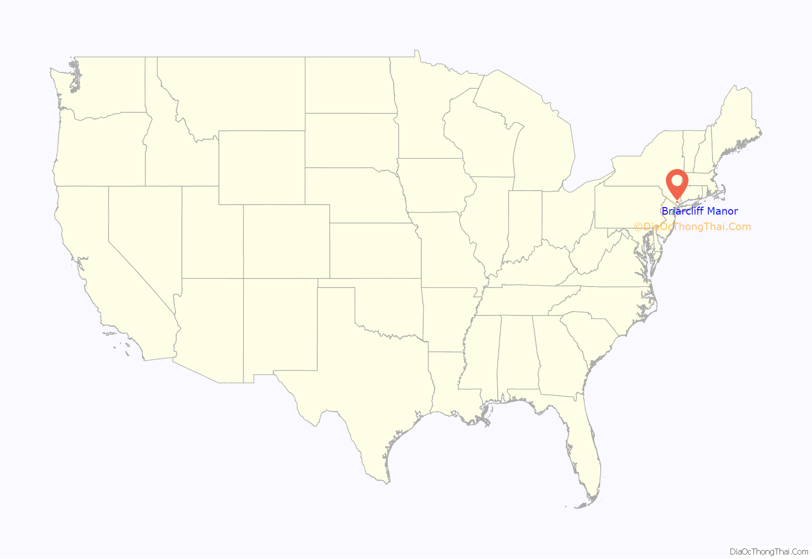
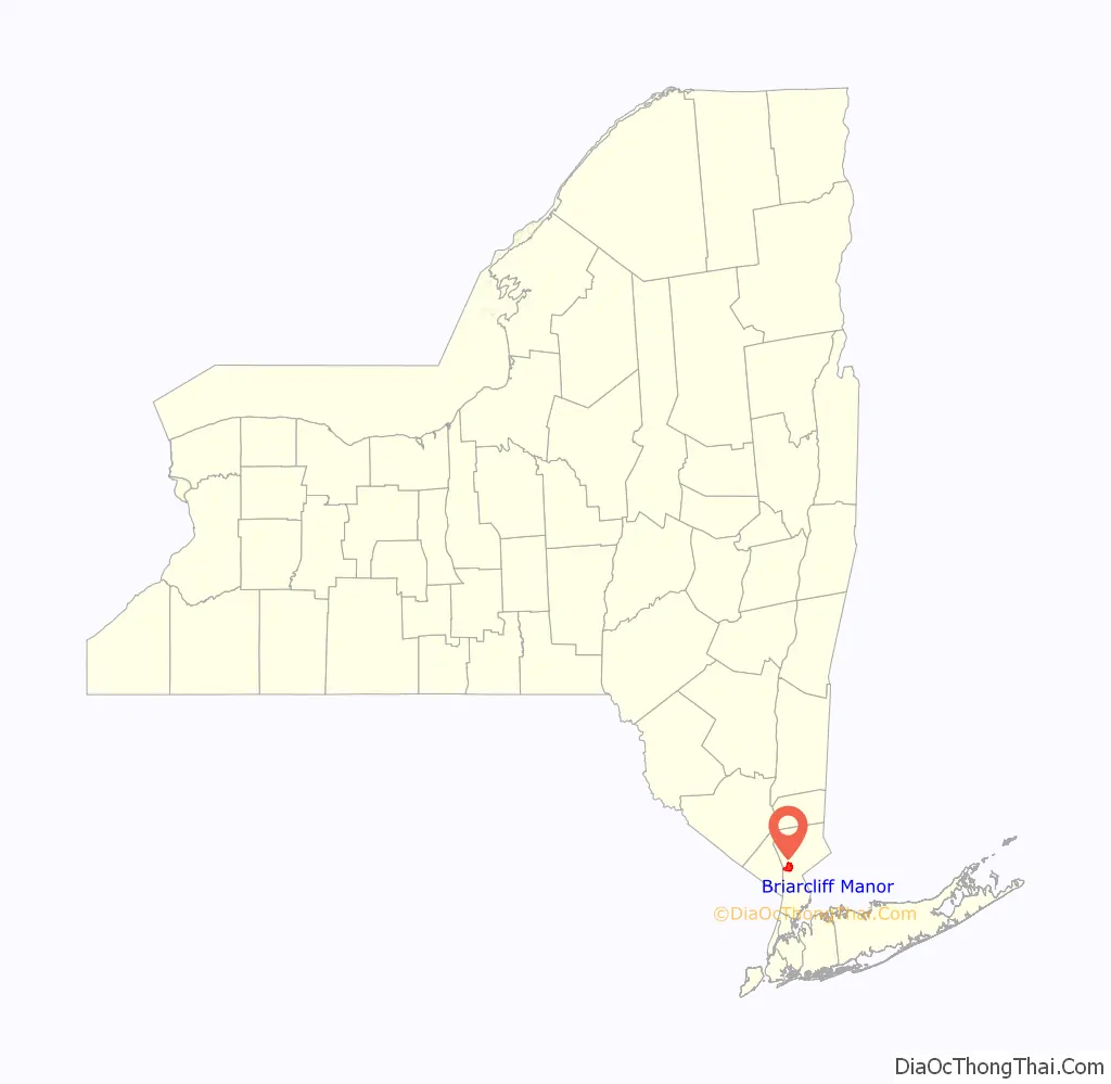
Briarcliff Manor location map. Where is Briarcliff Manor village?
History
Names
Part of modern-day Briarcliff Manor was once known as Whitson’s Corners for brothers John H., Richard, and Reuben Whitson, who owned adjoining farms in the area totaling 400 acres (160 ha). Whitson’s Corners was named after the corner of Pleasantville and South State Roads, where John H. Whitson’s house, the Crossways, stood from 1820 until the 1940s. The Briarcliff Congregational Church’s parish house currently stands at its former location. The neighboring community of Scarborough was known as Weskora until it was renamed in 1864, after resident William Kemey’s ancestral hometown in Yorkshire. After the community was incorporated into Briarcliff Manor in 1906, the New York Central and Hudson River Railroad put up a sign reading “Briarcliff West” at the village’s Scarborough station. Soon afterward, attributed to the neighborhood’s pride over their name, that sign was thrown into the Hudson River and replaced with the original Scarborough sign.
Briarcliff Manor derives from “Brier Cliff”, a compound of the English words “brier” and “cliff”. The name originated in Ireland as that of the family home of John David Ogilby, a professor of ecclesiastical history at the General Theological Seminary. Ogilby had named his New York summer home Brier Cliff after his family home in Ireland. In 1890, Walter Law bought James Stillman’s 236-acre (96 ha) Briarcliff Farm and further developed it, later using the name Briarcliff for all his property. Law’s friend, Andrew Carnegie, called him “The Laird of Briarcliff Manor”; since the title appealed to all concerned, the village was named “Briarcliff Manor”. By 1897, the village post office and railroad station bore the name Briarcliff Manor. The village (and its name) were approved by its residents in a September 12, 1902 referendum; the name prevailed over other suggestions, including “Sing Sing East”. On November 21, 1902, the village of Briarcliff Manor was established.
The village is also known by several other names. It is conversationally called “Briarcliff”, and often erroneously written as “Briar Cliff Manor” (although historically there has been little distinction). The village has been called “Briarcliff on the Hudson” by Mark Twain and Aileen Riggin; it is also known as “the Village of Briarcliff Manor”. The name Briarcliff has also been applied to other municipalities, including the 470-person town of Briarcliffe Acres in South Carolina; in naming it, the town’s founder had drawn inspiration from Briarcliff Manor’s name. One of the village’s mottos, “A village between two rivers”, can also refer to the municipality; another official motto is a Walter Law quote, “Only the best is good enough”.
Precolonial and colonial eras
The history of Briarcliff Manor can be traced back to the founding of a settlement between the Hudson and Pocantico Rivers in the 19th century. The area now known as Briarcliff Manor had seen human occupation since at least the Archaic period, but significant growth in the settlements that are now incorporated into the village did not occur until the Industrial Revolution.
In the precolonial era, the area of present-day Briarcliff Manor was inhabited by a band of the Wappinger tribes of Native Americans, known as Sint Sincks (or “Sing Sings”). They owned territory as far north as the Croton River. In the 1680s, Frederick Philipse purchased about 156,000 acres (631 km) from the Sint Sincks, and named it Philipsburg Manor. The Philipses lost their claim to the land because of the American Revolutionary War; the family, which was Loyalist, had its property confiscated in 1779. The area remained largely unsettled by colonists until after the war; in 1693, fewer than twenty families lived in the 50,000-acre (202 km) area of Westchester which included Briarcliff Manor.
Progressive era to present day
After retiring as vice president of W. & J. Sloane, Walter Law moved with his family to the present Briarcliff Manor. He bought his first 236 acres (96 ha) in 1890, and then quickly expanded his property, buying about forty parcels in less than ten years; by 1900, he owned more than 5,000 acres (7.8 sq mi) of Westchester County. Law developed the village, establishing schools, churches, parks, and the Briarcliff Lodge. His employees at Briarcliff Farms moved into the village, and the population grew enough to encourage Law to establish the area as a village. A proposition was presented to the supervisors of Mount Pleasant and Ossining on October 8, 1902, that the area of 640 acres with a population of 331 be incorporated as the Village of Briarcliff Manor, and the village was incorporated on November 21.
The Tudor Revival-style Briarcliff Lodge was opened in 1902 as a premier resort hotel. It was surrounded by Walter Law’s dairy barns and greenhouses, and hosted numerous distinguished guests, including Franklin and Eleanor Roosevelt. The lodge held the Edgewood Park School (1936–1954) and The King’s College (1955–1994) before it burned to the ground on September 20, 2003.
The Briarcliff Manor Fire Department was founded on February 10, 1903, from Briarcliff Manor’s first fire company, the 1901 Briarcliff Steamer Company No. 1. Scarborough was incorporated into Briarcliff Manor in 1906, and the Police Department was organized two years later. The Village Municipal Building was built in 1913 and was opened on July 4, 1914. The high school opened in 1928, and in 1946, the People’s Caucus party, an organization which calls out interested residents for candidacy, was created. Briarcliff Manor celebrated its semicentennial celebration from October 10–12, 1952, publishing a book about the village and its history; that year, the Crossroads neighborhood of 84 houses was completed.
In 1953, Todd Elementary School opened to free space at the Law Park grade school. The Putnam Division of the New York Central Railroad was discontinued in 1958, and the following year the Briarcliff Manor Public Library opened in the former Briarcliff Manor train station. The village’s first corporate facility (part of Philips Research) opened in 1960. In 1964 the new Village Hall opened, replacing the Municipal Building. The present high school opened in 1971 to ease the large enrollment at the grade-school building. In 1980, Pace University began leasing the middle-school building, and the middle school was moved to a portion of the new high-school building. The grade-school building was demolished in 1996, and a retirement home was built on its site the following year. The village celebrated its centennial in 2002, which involved celebratory events. A two-story addition to the village library was built in 2009, and the original portion was renovated to become the village’s community center in 2016.
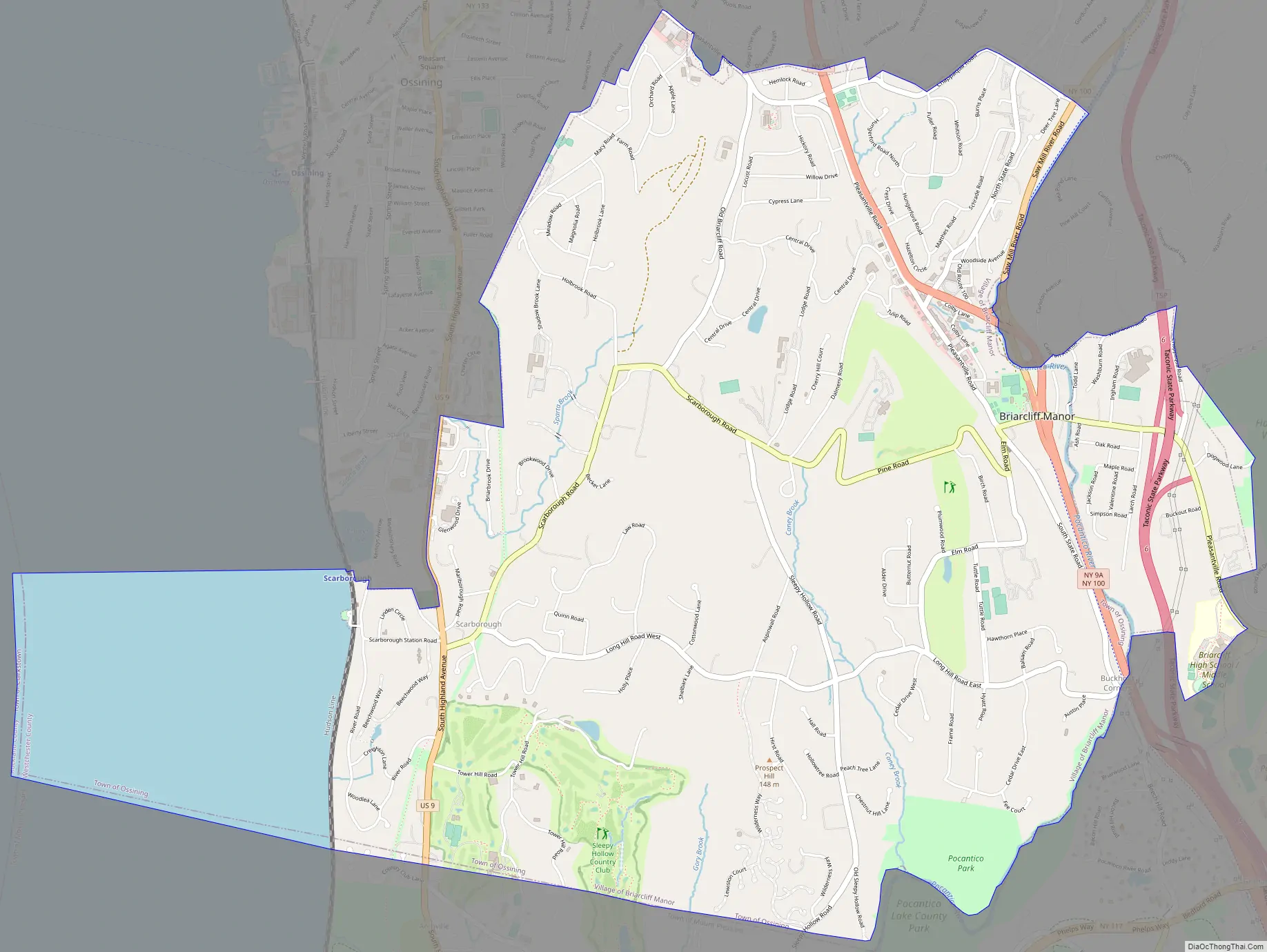
Briarcliff Manor Road Map
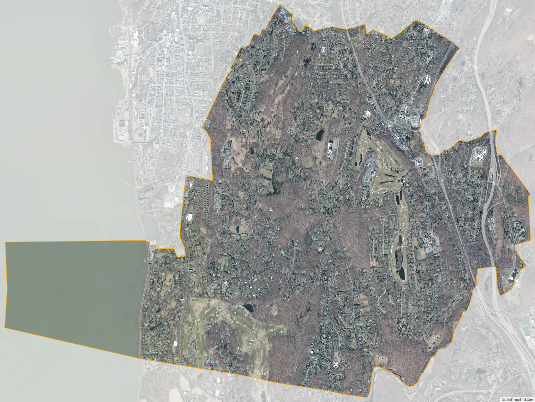
Briarcliff Manor city Satellite Map
Geography
Briarcliff Manor is around 30 miles (48 km) north of Manhattan. It is part of Westchester County and so part of the New York metropolitan area and the New York–Jersey City–White Plains, NY–NJ Metropolitan Division. It is on the Hudson River, just north of the Tappan Zee Bridge and south of Croton Point (near the widest part of the river) and just northwest of the county’s center. According to the 2010 United States Census Briarcliff Manor covers an area of 6.7 square miles (17 km), of which 5.9 square miles (15 km) is land and 0.8 square miles (2.1 km) is water.
The village is a part of the Pocantico and Saw Mill River Basin and the Lower Hudson River Drainage Basin, which leads to the Hudson west-southwest of the village. Major streams running through Briarcliff Manor include the centrally-located Caney Brook, the Pocantico River, and Sparta Brook. Abundant rock outcroppings include dolomite, granite, gneiss, and mica schist. Copper and silver were once mined near Scarborough, and Briarcliff Manor’s geographical area has large boulders, deposited in the last glacial period. Elevations within the village range from less than 100 feet (30 meters) above mean sea level near the Hudson River to approximately 500 feet (150 meters) above mean sea level around the center and eastern areas. The highest natural point in Briarcliff Manor is 1,200 feet (370 m) southwest of NGS station mark LX4016, off Farm Road, at 533 feet (162 m) above sea level. The village, which covered one square mile when incorporated in 1902, has expanded primarily through annexation: of Scarborough in 1906 and acreage from the town of Mount Pleasant in 1927. It is in telephone area code 914 and the postal ZIP code area 10510. Briarcliff Manor’s Ossining portion takes up nearly half of the village land area, about 93 percent of its population, and 85 percent of its land parcels.
Climate
The village is in a humid continental climate zone (Köppen climate classification: Dfa), with cold, snowy winters and hot, humid summers and four distinct seasons. The United States Department of Agriculture places Briarcliff Manor in plant hardiness zone 7a. Summer high temperatures average in the lower 80s Fahrenheit (upper 20s Celsius), with lows averaging in the lower 60s F (upper 10s C). Its highest recorded temperature was 100 °F (38 °C) in 1995, and its lowest was −10 °F (−23 °C) in 1979.
Neighborhoods
The village is home to neighborhoods and business and residential areas, including the central business district, the hamlets of Scarborough and Chilmark, and residential areas Central Briarcliff West, the Tree Streets and the Crossroads.
Scarborough, often called Scarborough-on-Hudson because it borders the Hudson River, is an 0.45-square-mile (1.2 km) unincorporated district divided between Briarcliff Manor and the village of Ossining, with most of the area within Briarcliff Manor and a few streets in the village of Ossining. Briarcliff Manor’s portion of Scarborough was annexed into the village in 1906. The boundary between Scarborough and the rest of the village is roughly along Old Briarcliff and Sleepy Hollow Roads. The area was settled prior to the Revolutionary War. Around that time, the area included a tavern and inn at corner of Albany Post Road and Scarborough Station Road and a blacksmith shop where the Scarborough Presbyterian Church stands today. Scarborough was named after early settler William Kemey’s town in England. A cove in Scarborough is named after him.
Scarborough is largely residential, and has some of the most expensive houses in the village, due in part to its proximity to the Hudson. Condominium complexes within Scarborough include Kemeys Cove, built in 1974, and Scarborough Manor, a 7-story, 205-unit complex built in the 1960s. The hamlet has a post office and a station on the Metro-North Hudson Line within walking distance of most houses in the hamlet. Unlike most of Briarcliff Manor, Scarborough is within the Ossining Union Free School District. During the 17th century, Scarborough became one of the first trading posts for the Dutch on the Hudson. During the early 20th century, the Astor, Rockefeller, and Vanderbilt families entertained guests on their river-view country estates in the Scarborough area. The Scarborough Historic District, including the Scarborough Presbyterian Church, is on the National Register of Historic Places. Across the street from the church is Sparta Cemetery, containing graves of local Revolutionary War veterans and the Leatherman. A notable building on the register is Beechwood, built in 1780 and considered one of the finest examples of Federal architecture in Westchester County. Beechwood was later purchased by Frank A. Vanderlip, who constructed the Scarborough School on the estate. The school was founded in 1913, and closed in 1978. Holly Hill is a notable house nearby. Hubert Rogers, a New York City attorney, had the house designed around 1927 by William Adams Delano; Rogers named it Weskora. After his death Brooke Astor purchased the estate, renaming it Holly Hill for its holly trees. Directly across from Holly Hill is the site used for the U.S. headquarters of Philips Research from 1965 to 2015, built on part of Waldheim, the former 130-acre (53 ha) estate of James Speyer.
Chilmark (also known as Chilmark Park) is an unincorporated residential community of about 300 acres (120 ha), established in 1930, in northern Briarcliff Manor. The neighborhood was designed with Underhill Road as its main thoroughfare, running north–south. It was named after the village of Chilmark, England, the birthplace and early home of Thomas Macy (an ancestor of Valentine Everit Macy), who arrived in the colonies in 1635. The area is culturally significant for its association with the Macy family, whose members were active in New York and Westchester County during the 19th and early 20th centuries. Valentine Everit Macy and his wife, Edith Carpenter Macy, founded the community and aided in its development; Macy purchased several small family farms in present Chilmark in 1897. In 1925, Macy donated 265 acres (107 ha) on Old Chappaqua Road for the first national Girl Scout camp, which later became the Edith Macy Conference Center, a conference and training facility owned and operated by the Girl Scouts of the USA. The Briarcliff Recreation Center was formerly the private Chilmark Club until the 1970s, when the village purchased the land for a recreation center and adjoining park. Macy’s residence in the area was the Chilmark estate, a Tudor-style stone and stucco mansion built in 1896 with a nine-hole golf course. The neighborhood hosts Briarcliff Manor’s Conservative temple Congregation Sons of Israel.
Chilmark features landscaped, winding roads designed to blend with the topography, access to transportation (including a commuter rail line and a highway and homes built in revival styles echoing Tudor and Gothic architecture; it is architecturally significant as an example of early-20th-century suburban design. During the 1920s Macy’s son, V.E. Macy Jr., founded the Chilmark Park Realty Corporation to sell land parcels. When he began marketing the area, he renovated or demolished existing homes to lend an air of development and built a private 8.3-acre (3.4 ha) country club for use by Chilmark residents. The village of Briarcliff Manor later purchased the site, and operates it as Chilmark Park. To denote its development as an exclusive neighborhood, Macy planted distinctive shade trees along Underhill Road. Since its founding, additional homes have been built in Chilmark, most between 1955 and 1960. The developments expanded the area beyond its original 300 acres; it presently comprises Underhill Road and the streets immediately adjacent to it.
The central business district, also known as the Village Center, is located on Briarcliff Manor’s main street on Pleasantville Road and continues on North State Road. The area has numerous businesses lining Pleasantville Road, a large expansion from the three stores that existed there in 1906. The business district is home to the village hall and a pocket park, and has brick sidewalks, period street lighting, and free parking. Farther south along the road is the Walter W. Law Memorial Park, and further east along the road are the three schools of the Briarcliff Manor Union Free School District. The Village Center contains a number of pre-Revolutionary War houses, including the Whitson House, built during the 1770s and the former home of Richard Whitson (one of the Whitson brothers, after whom Whitson’s Corners was named); Buckhout House, also dating to the 1770s and named for the family who lived there for over a century and the oldest, Century Homestead, dating to about 1767 and first owned by Reuben Whitson. The Washburn House, another pre-Revolutionary house, was sold by the New York State Commission on Forfeiture to Joseph Washburn in 1775.
Central Briarcliff West is a neighborhood which has a number of mansions built by 20th-century millionaires who stayed at the Briarcliff Lodge and later built estates in the area. The lodge stood in the area and on the highest point of Walter Law’s estate from its construction in 1902 until it burned down in 2003. Other historic estates in the neighborhood include the Law family homes (built in 1902 for Walter Law’s children) and Law’s estate, the Manor House, all on Scarborough Road. The three estates for his children are Six Gables, Mt. Vernon, and Hillcrest. The Modernist Julian Street Jr. residence, designed by Wallace Harrison for Julian and Narcissa Vanderlip Street, was one of the first contemporary-style homes in Westchester. Ashridge, a large Greek Revival estate, was built around 1825.
The Tree Streets is a network of streets in the Mount Pleasant portion of the village. Several of the streets are named after regional trees, including Satinwood Lane, Larch Road, Elm Road, and Oak Road. Walter Law had rows of trees planted on streets named for the varieties, though many of these trees no longer adorn their streets. The first major development of the area occurred around 1902, though many houses in the neighborhood were constructed during a 1930s building boom, circling Jackson Road Park and near Todd Elementary School.
The Crossroads is a group of 84 houses on streets named after local World War II veterans, including Schrade Road, Hazelton Circle, Matthes Road, and Dunn Lane. It was constructed at the end of World War II to provide affordable housing to returning veterans, and was completed in 1952.
See also
Map of New York State and its subdivision:- Albany
- Allegany
- Bronx
- Broome
- Cattaraugus
- Cayuga
- Chautauqua
- Chemung
- Chenango
- Clinton
- Columbia
- Cortland
- Delaware
- Dutchess
- Erie
- Essex
- Franklin
- Fulton
- Genesee
- Greene
- Hamilton
- Herkimer
- Jefferson
- Kings
- Lake Ontario
- Lewis
- Livingston
- Madison
- Monroe
- Montgomery
- Nassau
- New York
- Niagara
- Oneida
- Onondaga
- Ontario
- Orange
- Orleans
- Oswego
- Otsego
- Putnam
- Queens
- Rensselaer
- Richmond
- Rockland
- Saint Lawrence
- Saratoga
- Schenectady
- Schoharie
- Schuyler
- Seneca
- Steuben
- Suffolk
- Sullivan
- Tioga
- Tompkins
- Ulster
- Warren
- Washington
- Wayne
- Westchester
- Wyoming
- Yates
- Alabama
- Alaska
- Arizona
- Arkansas
- California
- Colorado
- Connecticut
- Delaware
- District of Columbia
- Florida
- Georgia
- Hawaii
- Idaho
- Illinois
- Indiana
- Iowa
- Kansas
- Kentucky
- Louisiana
- Maine
- Maryland
- Massachusetts
- Michigan
- Minnesota
- Mississippi
- Missouri
- Montana
- Nebraska
- Nevada
- New Hampshire
- New Jersey
- New Mexico
- New York
- North Carolina
- North Dakota
- Ohio
- Oklahoma
- Oregon
- Pennsylvania
- Rhode Island
- South Carolina
- South Dakota
- Tennessee
- Texas
- Utah
- Vermont
- Virginia
- Washington
- West Virginia
- Wisconsin
- Wyoming


