Bronxville is a village in Westchester County, New York, United States, located approximately 15 miles (24 km) north of Midtown Manhattan. It is part of the town of Eastchester. The village comprises one square mile (2.5 km) of land in its entirety, approximately 20% of the town of Eastchester. As of the 2020 U.S. census, Bronxville had a population of 6,656. In 2016, Bronxville was rated by CNBC as the most expensive suburb of any of the U.S. ten largest cities, with a median home value of $2.33 million. It was ranked eighth in Bloomberg’s “America’s 100 Richest Places” in 2017 and 2018 and ninth in 2019 and is the second-richest town in the state of New York behind Scarsdale.
| Name: | Bronxville village |
|---|---|
| LSAD Code: | 47 |
| LSAD Description: | village (suffix) |
| State: | New York |
| County: | Westchester County |
| Incorporated: | 1898 |
| Elevation: | 92 ft (28 m) |
| Total Area: | 0.97 sq mi (2.52 km²) |
| Land Area: | 0.97 sq mi (2.52 km²) |
| Water Area: | 0.00 sq mi (0.00 km²) |
| Total Population: | 6,656 |
| Population Density: | 6,847.74/sq mi (2,642.69/km²) |
| ZIP code: | 10708 |
| Area code: | 914 |
| FIPS code: | 3608532 |
| GNISfeature ID: | 0944824 |
| Website: | villageofbronxville.com |
Online Interactive Map
Click on ![]() to view map in "full screen" mode.
to view map in "full screen" mode.
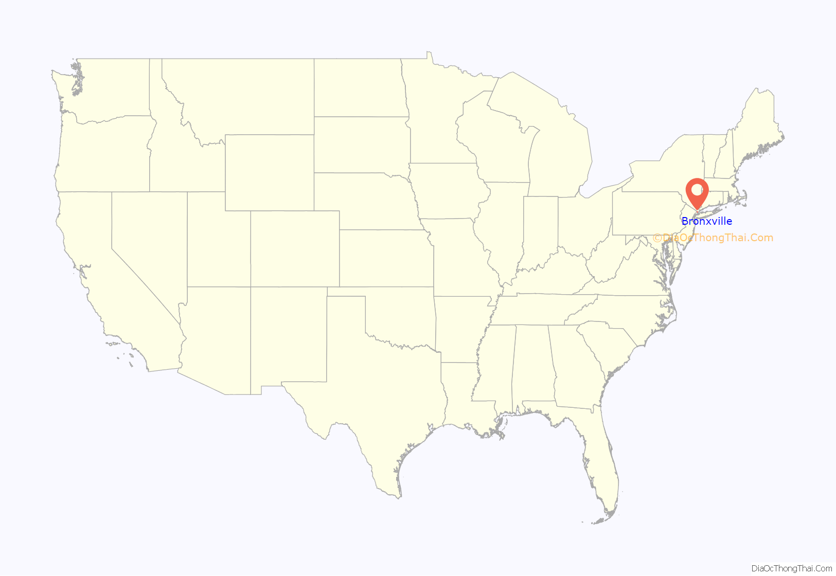
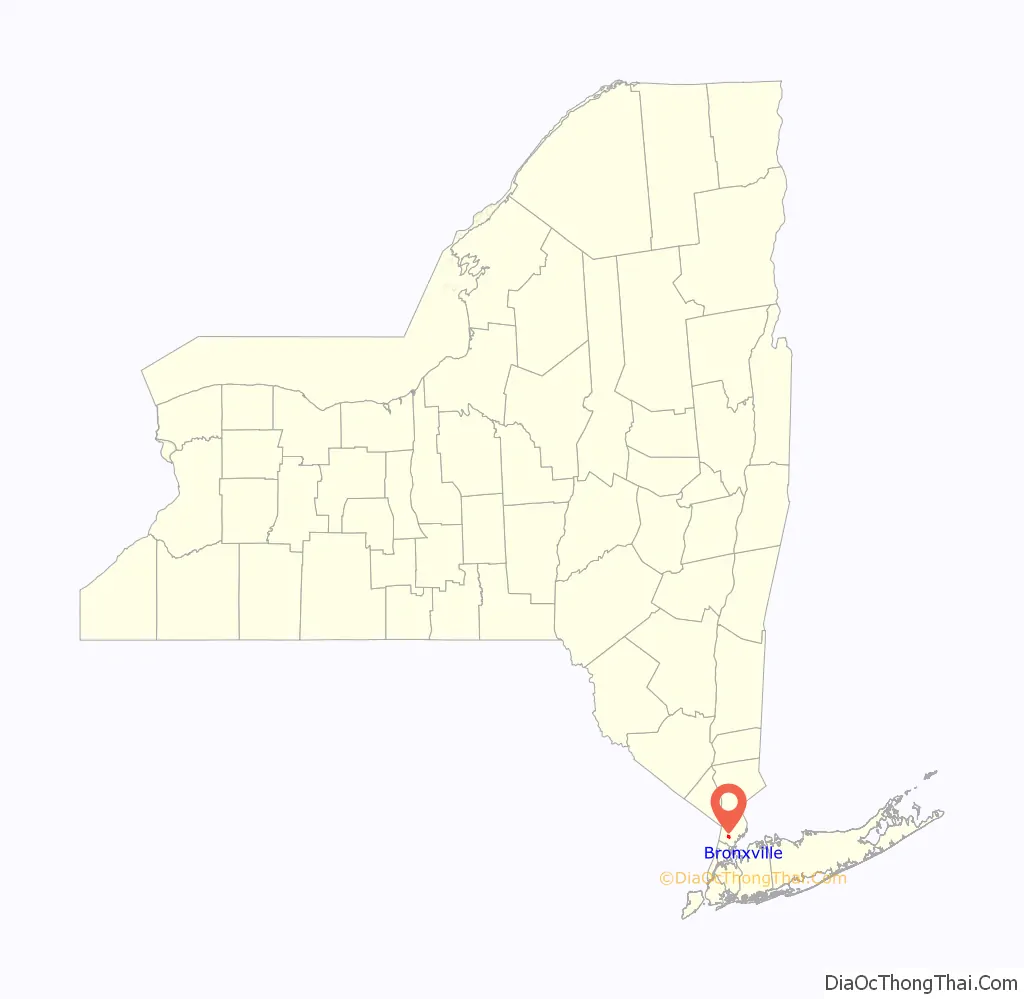
Bronxville location map. Where is Bronxville village?
History
The region that includes the contemporary village of Bronxville was deeded to British colonists in 1666, but first settled by Europeans in the early 18th century. The two founding inhabitants were the Underhill and Morgan families. The Underhills built a sawmill and a gristmill, which was the first factory in the area, on the Bronx River. After they built a wooden bridge, the area became known as Underhill’s Crossing.
Millionaire real-estate and pharmaceutical mogul William Van Duzer Lawrence sparked the development of Bronxville as an affluent suburb of New York City by building grand homes in a rustic setting. The area became “Bronxville” when the village was formally established. The population grew in the second half of the 19th century when railroads allowed commuters from Westchester County to work in New York City. Lawrence’s influence can be seen throughout the community, including the historic Lawrence Park neighborhood, the Houlihan Lawrence Real Estate Corporation, and Lawrence Hospital.
The village was home to an arts colony in the early 20th century, when many noteworthy houses were built by prominent and casual architects. After the Bronx River Parkway was completed in 1925, the village expanded rapidly with the construction of several apartment buildings and townhouses, many of them built by the Lawrence family. As of 1959, the family continued to own or manage 97% of the rental market.
The Gramatan Hotel on Sunset Hill was a residence hotel in the late 19th century and early 20th century. Gramatan was the name of the chief of the local Siwanoy Indian tribe that was centered in the Gramatan Rock area above Bronxville Station. Chief Gramatan sold the land to the settlers. The hotel was demolished in 1970, and a complex of townhouses was built on the site in 1980.
Elizabeth Clift Bacon, General George Armstrong Custer’s widow, lived in Bronxville, and her house still stands to this day.
St. Joseph’s Catholic Church, located in the downtown area, was attended by the Kennedys when they were residents from 1929 to about 1938 before moving to London; Edward Kennedy returned to St. Joseph’s in 1958 for his wedding to Joan Bennett. Two years later, in the 1960 Presidential Election voters in the Village overwhelmingly chose Richard Nixon over Edward’s brother, John, by a 5-to-1 margin.
The US Post Office–Bronxville was listed on the National Register of Historic Places in 1988. Other sites on the National Register are the Bronxville Women’s Club, Lawrence Park Historic District, and Masterton-Dusenberry House.
Bronxville Public Library
“Owl House” in the Gramatan Hill section of Bronxville (1898)
Gramatan Hotel
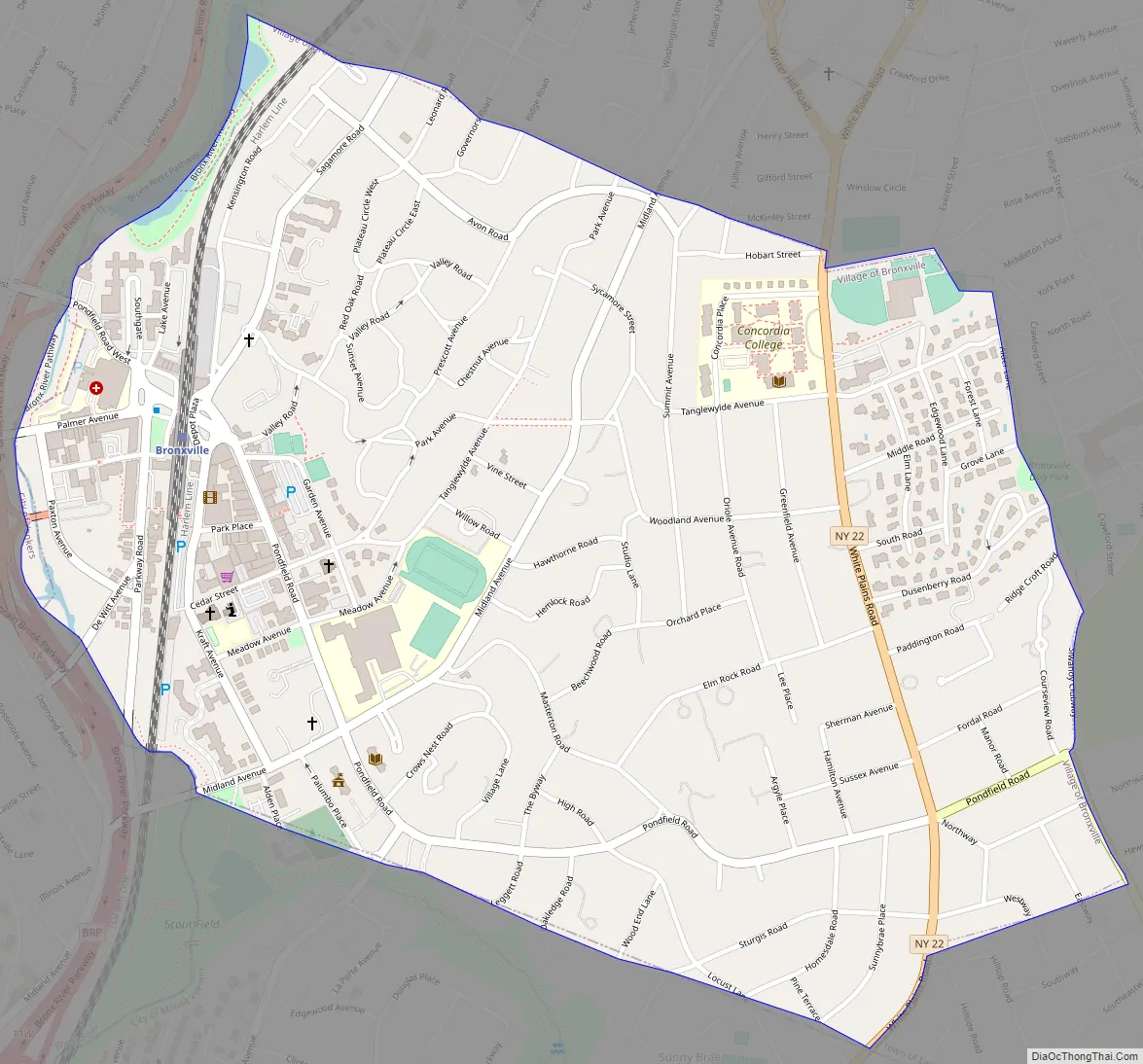
Bronxville Road Map
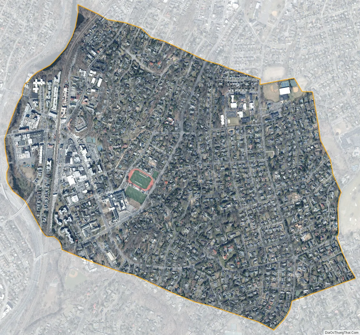
Bronxville city Satellite Map
See also
Map of New York State and its subdivision:- Albany
- Allegany
- Bronx
- Broome
- Cattaraugus
- Cayuga
- Chautauqua
- Chemung
- Chenango
- Clinton
- Columbia
- Cortland
- Delaware
- Dutchess
- Erie
- Essex
- Franklin
- Fulton
- Genesee
- Greene
- Hamilton
- Herkimer
- Jefferson
- Kings
- Lake Ontario
- Lewis
- Livingston
- Madison
- Monroe
- Montgomery
- Nassau
- New York
- Niagara
- Oneida
- Onondaga
- Ontario
- Orange
- Orleans
- Oswego
- Otsego
- Putnam
- Queens
- Rensselaer
- Richmond
- Rockland
- Saint Lawrence
- Saratoga
- Schenectady
- Schoharie
- Schuyler
- Seneca
- Steuben
- Suffolk
- Sullivan
- Tioga
- Tompkins
- Ulster
- Warren
- Washington
- Wayne
- Westchester
- Wyoming
- Yates
- Alabama
- Alaska
- Arizona
- Arkansas
- California
- Colorado
- Connecticut
- Delaware
- District of Columbia
- Florida
- Georgia
- Hawaii
- Idaho
- Illinois
- Indiana
- Iowa
- Kansas
- Kentucky
- Louisiana
- Maine
- Maryland
- Massachusetts
- Michigan
- Minnesota
- Mississippi
- Missouri
- Montana
- Nebraska
- Nevada
- New Hampshire
- New Jersey
- New Mexico
- New York
- North Carolina
- North Dakota
- Ohio
- Oklahoma
- Oregon
- Pennsylvania
- Rhode Island
- South Carolina
- South Dakota
- Tennessee
- Texas
- Utah
- Vermont
- Virginia
- Washington
- West Virginia
- Wisconsin
- Wyoming


