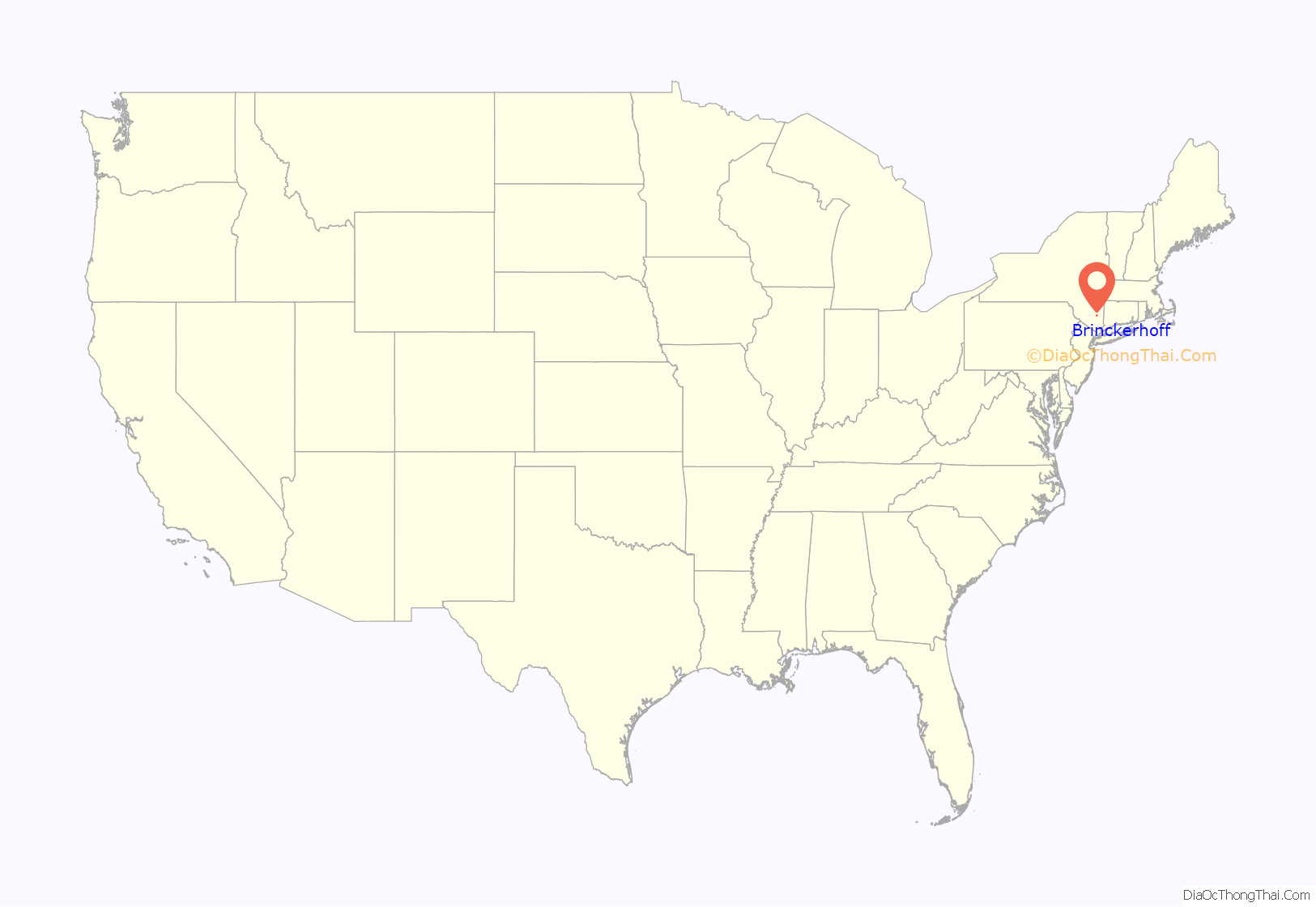
Brinckerhoff is a hamlet and census-designated place (CDP) in Dutchess County, New York, United States. The population was 2,900 at the 2010 census. It is part of the Poughkeepsie–Newburgh–Middletown, NY Metropolitan Statistical Area as well as the larger New York–Newark–Bridgeport, NY-NJ–CT–PA Combined Statistical Area.
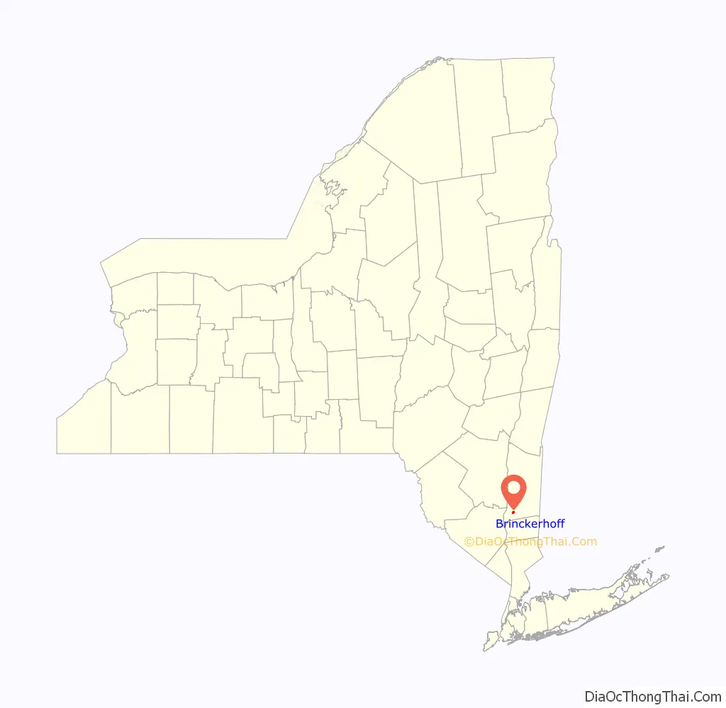
Brinckerhoff is in the northeastern corner of the town of Fishkill, northeast of the village of Fishkill.
| Name: | Brinckerhoff CDP |
|---|---|
| LSAD Code: | 57 |
| LSAD Description: | CDP (suffix) |
| State: | New York |
| County: | Dutchess County |
| Elevation: | 220 ft (67 m) |
| Total Area: | 1.76 sq mi (4.57 km²) |
| Land Area: | 1.76 sq mi (4.56 km²) |
| Water Area: | 0.01 sq mi (0.01 km²) |
| Total Population: | 3,377 |
| Population Density: | 1,918.75/sq mi (740.73/km²) |
| FIPS code: | 3608334 |
| GNISfeature ID: | 0972261 |
Online Interactive Map
Click on ![]() to view map in "full screen" mode.
to view map in "full screen" mode.
Brinckerhoff location map. Where is Brinckerhoff CDP?
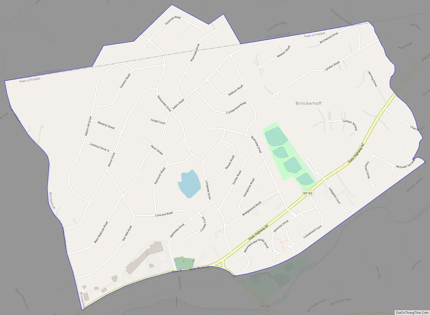
Brinckerhoff Road Map
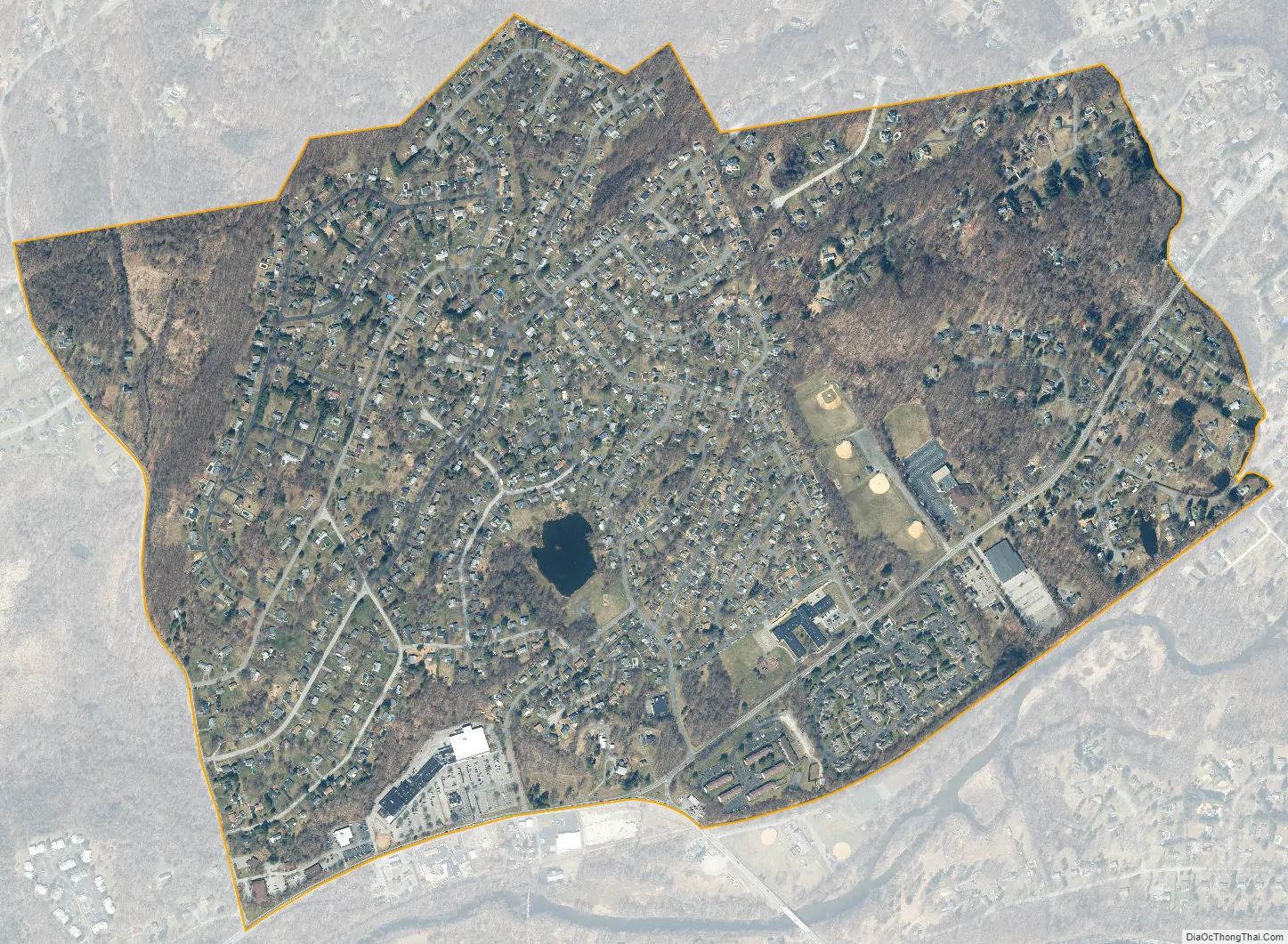
Brinckerhoff city Satellite Map
Geography
Brinckerhoff is located in southwestern Dutchess County at 41°33′1″N 73°52′10″W / 41.55028°N 73.86944°W / 41.55028; -73.86944 (41.550393, -73.869501). Most of the community is in the northeastern section of the town of Fishkill, but a small part extends north into the southeastern corner of the town of Wappinger.
According to the United States Census Bureau, the CDP has a total area of 1.1 square miles (2.9 km), of which 0.004 square miles (0.01 km), or 0.47%, is water.
See also
Map of New York State and its subdivision:- Albany
- Allegany
- Bronx
- Broome
- Cattaraugus
- Cayuga
- Chautauqua
- Chemung
- Chenango
- Clinton
- Columbia
- Cortland
- Delaware
- Dutchess
- Erie
- Essex
- Franklin
- Fulton
- Genesee
- Greene
- Hamilton
- Herkimer
- Jefferson
- Kings
- Lake Ontario
- Lewis
- Livingston
- Madison
- Monroe
- Montgomery
- Nassau
- New York
- Niagara
- Oneida
- Onondaga
- Ontario
- Orange
- Orleans
- Oswego
- Otsego
- Putnam
- Queens
- Rensselaer
- Richmond
- Rockland
- Saint Lawrence
- Saratoga
- Schenectady
- Schoharie
- Schuyler
- Seneca
- Steuben
- Suffolk
- Sullivan
- Tioga
- Tompkins
- Ulster
- Warren
- Washington
- Wayne
- Westchester
- Wyoming
- Yates
- Alabama
- Alaska
- Arizona
- Arkansas
- California
- Colorado
- Connecticut
- Delaware
- District of Columbia
- Florida
- Georgia
- Hawaii
- Idaho
- Illinois
- Indiana
- Iowa
- Kansas
- Kentucky
- Louisiana
- Maine
- Maryland
- Massachusetts
- Michigan
- Minnesota
- Mississippi
- Missouri
- Montana
- Nebraska
- Nevada
- New Hampshire
- New Jersey
- New Mexico
- New York
- North Carolina
- North Dakota
- Ohio
- Oklahoma
- Oregon
- Pennsylvania
- Rhode Island
- South Carolina
- South Dakota
- Tennessee
- Texas
- Utah
- Vermont
- Virginia
- Washington
- West Virginia
- Wisconsin
- Wyoming


