Buchanan is a village located in the town of Cortlandt in Westchester County, New York, United States. The population was 2,230 as of the 2010 census.
The now decommissioned Indian Point nuclear power facility is located in Buchanan. The 2000 Rockefeller Center Christmas tree also came from Buchanan. The 80-foot tall Norway spruce was donated by Bill and Frances Heady after its execution. Bill Heady planted the tree in 1950.
| Name: | Buchanan village |
|---|---|
| LSAD Code: | 47 |
| LSAD Description: | village (suffix) |
| State: | New York |
| County: | Westchester County |
| Elevation: | 39 ft (12 m) |
| Total Area: | 1.75 sq mi (4.53 km²) |
| Land Area: | 1.42 sq mi (3.67 km²) |
| Water Area: | 0.33 sq mi (0.87 km²) |
| Total Population: | 2,302 |
| Population Density: | 1,626.86/sq mi (627.92/km²) |
| ZIP code: | 10511 |
| Area code: | 914 |
| FIPS code: | 3610341 |
| GNISfeature ID: | 0945006 |
| Website: | http://www.villageofbuchanan.com |
Online Interactive Map
Click on ![]() to view map in "full screen" mode.
to view map in "full screen" mode.
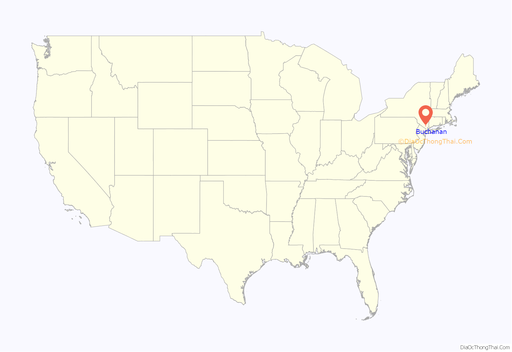
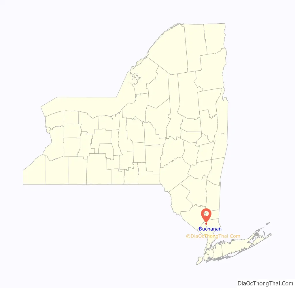
Buchanan location map. Where is Buchanan village?
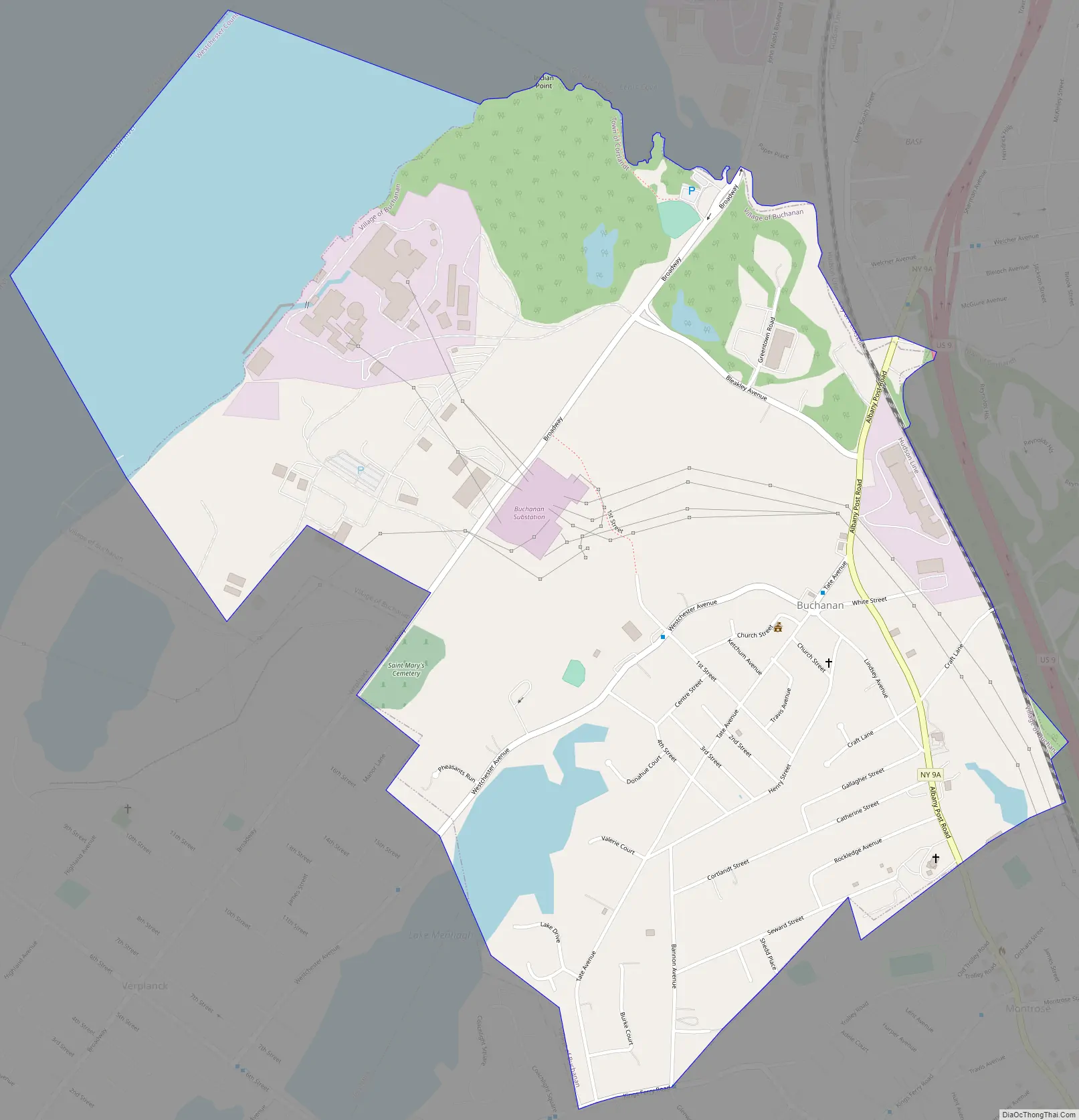
Buchanan Road Map
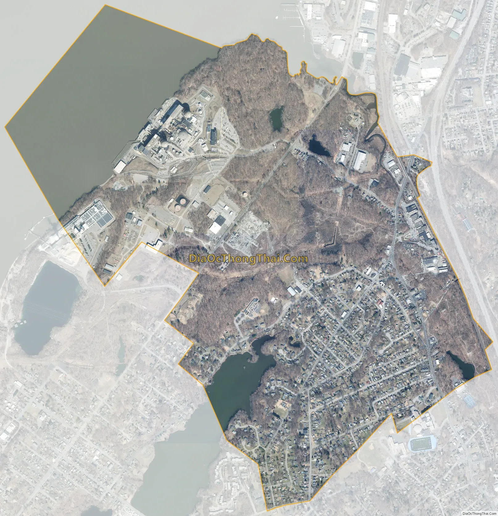
Buchanan city Satellite Map
Geography
Buchanan is located at 41°15′39″N 73°56′30″W / 41.26083°N 73.94167°W / 41.26083; -73.94167Coordinates: 41°15′39″N 73°56′30″W / 41.26083°N 73.94167°W / 41.26083; -73.94167.
According to the United States Census Bureau, the village has a total area of 1.7 square miles (4.4 km), of which 1.4 square miles (3.6 km) are land and 0.3 square miles (0.78 km), or 17.86%, is water.
See also
Map of New York State and its subdivision:- Albany
- Allegany
- Bronx
- Broome
- Cattaraugus
- Cayuga
- Chautauqua
- Chemung
- Chenango
- Clinton
- Columbia
- Cortland
- Delaware
- Dutchess
- Erie
- Essex
- Franklin
- Fulton
- Genesee
- Greene
- Hamilton
- Herkimer
- Jefferson
- Kings
- Lake Ontario
- Lewis
- Livingston
- Madison
- Monroe
- Montgomery
- Nassau
- New York
- Niagara
- Oneida
- Onondaga
- Ontario
- Orange
- Orleans
- Oswego
- Otsego
- Putnam
- Queens
- Rensselaer
- Richmond
- Rockland
- Saint Lawrence
- Saratoga
- Schenectady
- Schoharie
- Schuyler
- Seneca
- Steuben
- Suffolk
- Sullivan
- Tioga
- Tompkins
- Ulster
- Warren
- Washington
- Wayne
- Westchester
- Wyoming
- Yates
- Alabama
- Alaska
- Arizona
- Arkansas
- California
- Colorado
- Connecticut
- Delaware
- District of Columbia
- Florida
- Georgia
- Hawaii
- Idaho
- Illinois
- Indiana
- Iowa
- Kansas
- Kentucky
- Louisiana
- Maine
- Maryland
- Massachusetts
- Michigan
- Minnesota
- Mississippi
- Missouri
- Montana
- Nebraska
- Nevada
- New Hampshire
- New Jersey
- New Mexico
- New York
- North Carolina
- North Dakota
- Ohio
- Oklahoma
- Oregon
- Pennsylvania
- Rhode Island
- South Carolina
- South Dakota
- Tennessee
- Texas
- Utah
- Vermont
- Virginia
- Washington
- West Virginia
- Wisconsin
- Wyoming


