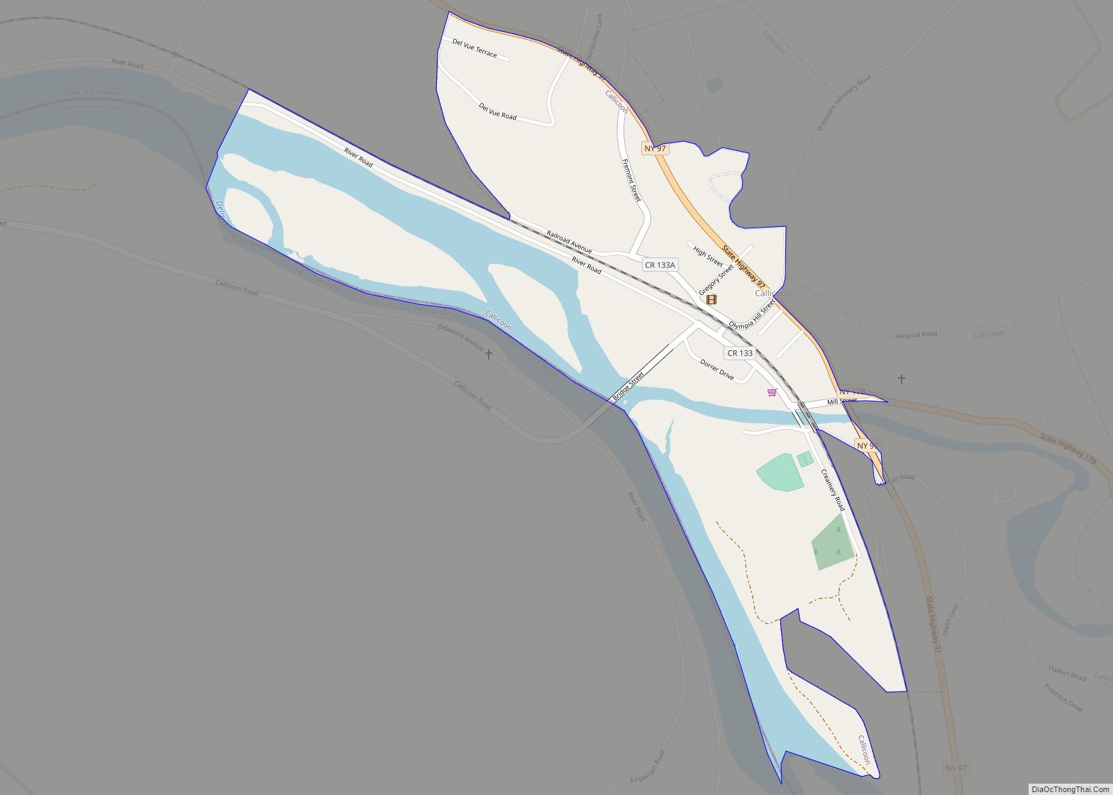
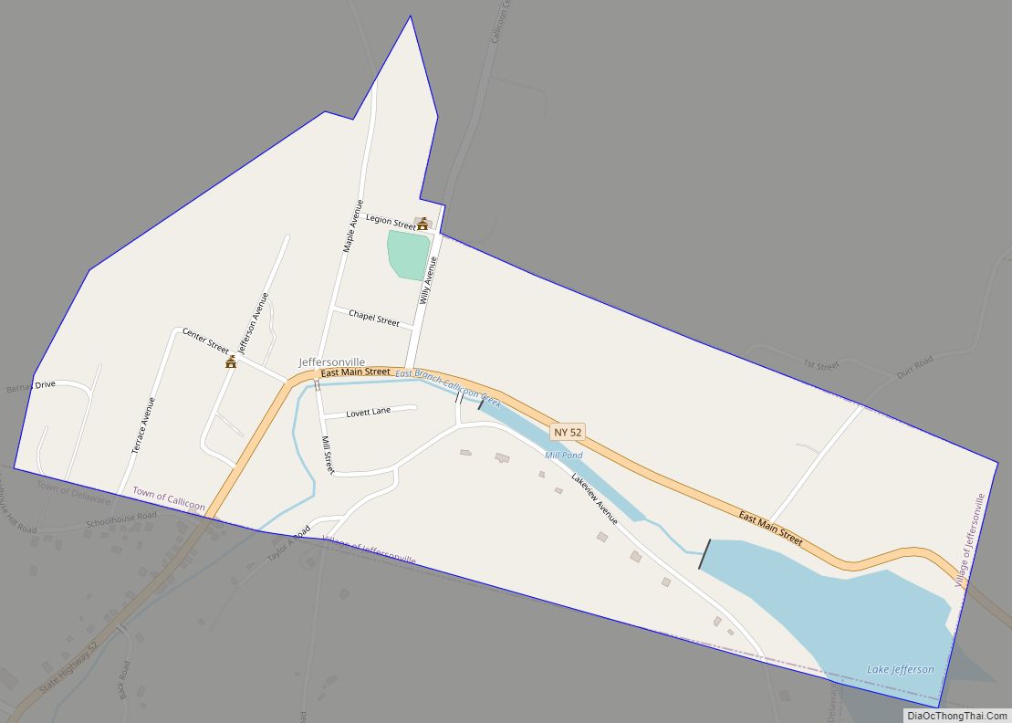
Callicoon is a hamlet and census-designated place in the Town of Delaware, Sullivan County, New York, United States. The population was 206 at the 2020 census.
Callicoon is in the western part of the county in the Town of Delaware.
| Name: | Callicoon CDP |
|---|---|
| LSAD Code: | 57 |
| LSAD Description: | CDP (suffix) |
| State: | New York |
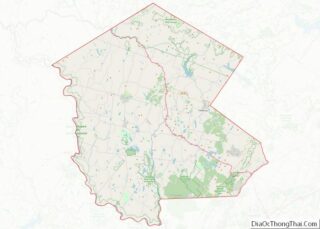
| County: | Sullivan County |
| Elevation: | 846 ft (258 m) |
| Total Area: | 0.71 sq mi (1.84 km²) |
| Land Area: | 0.62 sq mi (1.61 km²) |
| Water Area: | 0.09 sq mi (0.23 km²) |
| Total Population: | 206 |
| Population Density: | 331.19/sq mi (127.80/km²) |
| ZIP code: | 12723 |
| Area code: | 845 |
| FIPS code: | 3611748 |
| GNISfeature ID: | 0945476 |
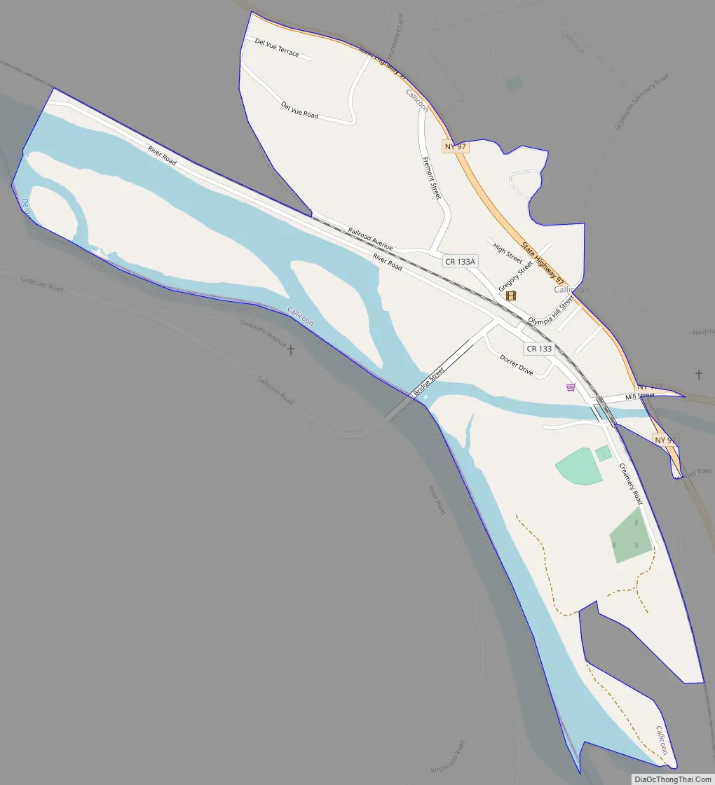
Online Interactive Map
Click on ![]() to view map in "full screen" mode.
to view map in "full screen" mode.
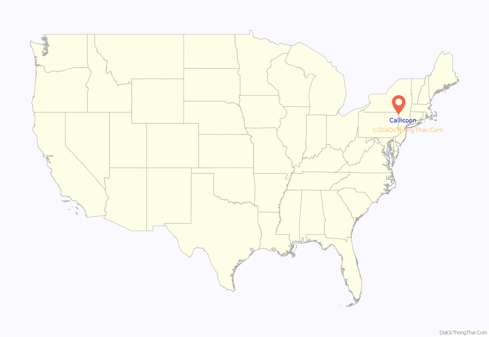
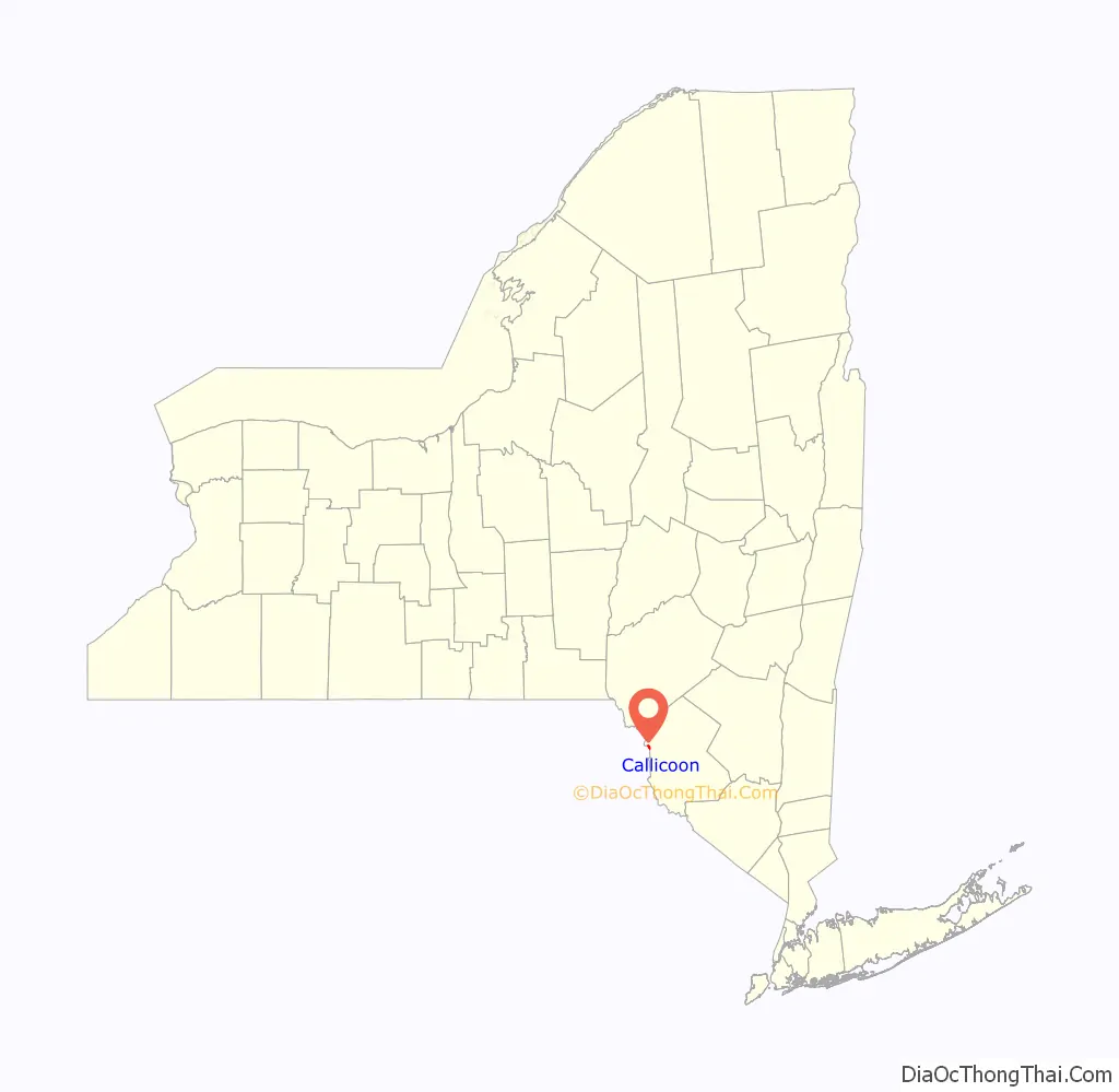
Callicoon location map. Where is Callicoon CDP?
History
Callicoon got its name from Dutch hunters who settled the location in the 17th century. Because of the population of wild turkeys in the area, they named the community Kollikoonkill which translates into Wild Turkey Creek. In addition to animal abundance, the area was a source for lumber and a transport center with the Delaware River offering access to coastal cities to the south and east. In the 1840s, the Erie Railroad added to transportation by passing through along the banks of the Delaware River to link the Great Lakes with the East Coast. Because of the train station’s vital central location, the community was renamed Callicoon Depot.
In 1888, a major fire destroyed much of Callicoon’s business district. The town quickly rebuilt, but lost much of its architectural history prior to the late 19th century. The community’s economy also became badly damaged when railroad travel gave way to the automobile. The last scheduled passenger train left Callicoon on November 27, 1966. By the late 1960s, tourism took over as the main industry as campgrounds and canoes drew a new generation of visitors. Campgrounds and canoe liveries, followed by bed and breakfast inns, drew a new generation of vacationers. The Villa Roma Resort and Conference Center also opened, increasing the number of vacationers to the area. Additionally, the Upper Delaware Scenic and Recreational River was created in 1978 to protect the land of the scenic valley, maintain quality of the Delaware River and enforce environmental sensitivity in the area.
Callicoon Road Map
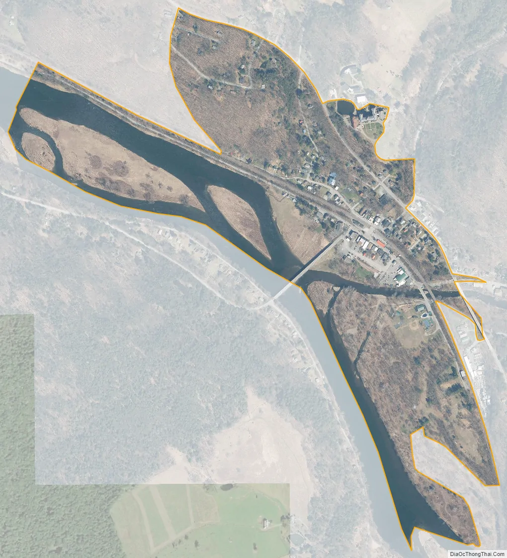
Callicoon city Satellite Map
Geography
Callicoon is located on the east bank of the Delaware River, adjacent to the Catskill Mountains in the southern portion of Upstate New York. The community lies approximately 55 miles (89 km) northeast of Scranton, Pennsylvania, 65 miles (105 km) southeast of Binghamton, 115 miles (185 km) northwest of New York, and 120 miles (190 km) southwest of Albany.
Callicoon is located at 41°45′56″N 75°3′31″W / 41.76556°N 75.05861°W / 41.76556; -75.05861 (41.765831, -75.058682).
According to the United States Census Bureau, the CDP has a total area of 0.5 square mile (1.2 km), of which, 0.4 square mile (1.0 km) is land and 0.1 square mile (0.2 km) (17.39%) is water.
See also
Map of New York State and its subdivision:- Albany
- Allegany
- Bronx
- Broome
- Cattaraugus
- Cayuga
- Chautauqua
- Chemung
- Chenango
- Clinton
- Columbia
- Cortland
- Delaware
- Dutchess
- Erie
- Essex
- Franklin
- Fulton
- Genesee
- Greene
- Hamilton
- Herkimer
- Jefferson
- Kings
- Lake Ontario
- Lewis
- Livingston
- Madison
- Monroe
- Montgomery
- Nassau
- New York
- Niagara
- Oneida
- Onondaga
- Ontario
- Orange
- Orleans
- Oswego
- Otsego
- Putnam
- Queens
- Rensselaer
- Richmond
- Rockland
- Saint Lawrence
- Saratoga
- Schenectady
- Schoharie
- Schuyler
- Seneca
- Steuben
- Suffolk
- Sullivan
- Tioga
- Tompkins
- Ulster
- Warren
- Washington
- Wayne
- Westchester
- Wyoming
- Yates
- Alabama
- Alaska
- Arizona
- Arkansas
- California
- Colorado
- Connecticut
- Delaware
- District of Columbia
- Florida
- Georgia
- Hawaii
- Idaho
- Illinois
- Indiana
- Iowa
- Kansas
- Kentucky
- Louisiana
- Maine
- Maryland
- Massachusetts
- Michigan
- Minnesota
- Mississippi
- Missouri
- Montana
- Nebraska
- Nevada
- New Hampshire
- New Jersey
- New Mexico
- New York
- North Carolina
- North Dakota
- Ohio
- Oklahoma
- Oregon
- Pennsylvania
- Rhode Island
- South Carolina
- South Dakota
- Tennessee
- Texas
- Utah
- Vermont
- Virginia
- Washington
- West Virginia
- Wisconsin
- Wyoming