Elmsford is a village in Westchester County, New York, United States. It is part of the New York metropolitan area. Roughly one mile square, the village is fully contained within the borders of the town of Greenburgh. As of the 2010 census, the population of Elmsford was 4,664.
| Name: | Elmsford village |
|---|---|
| LSAD Code: | 47 |
| LSAD Description: | village (suffix) |
| State: | New York |
| County: | Westchester County |
| Elevation: | 177 ft (54 m) |
| Total Area: | 1.06 sq mi (2.74 km²) |
| Land Area: | 1.06 sq mi (2.74 km²) |
| Water Area: | 0.00 sq mi (0.00 km²) |
| Total Population: | 5,239 |
| Population Density: | 4,956.48/sq mi (1,914.07/km²) |
| ZIP code: | 10523 |
| Area code: | 914 |
| FIPS code: | 3624295 |
| GNISfeature ID: | 0949586 |
| Website: | http://www.elmsfordny.org |
Online Interactive Map
Click on ![]() to view map in "full screen" mode.
to view map in "full screen" mode.
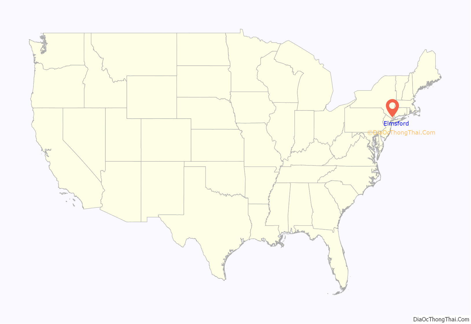
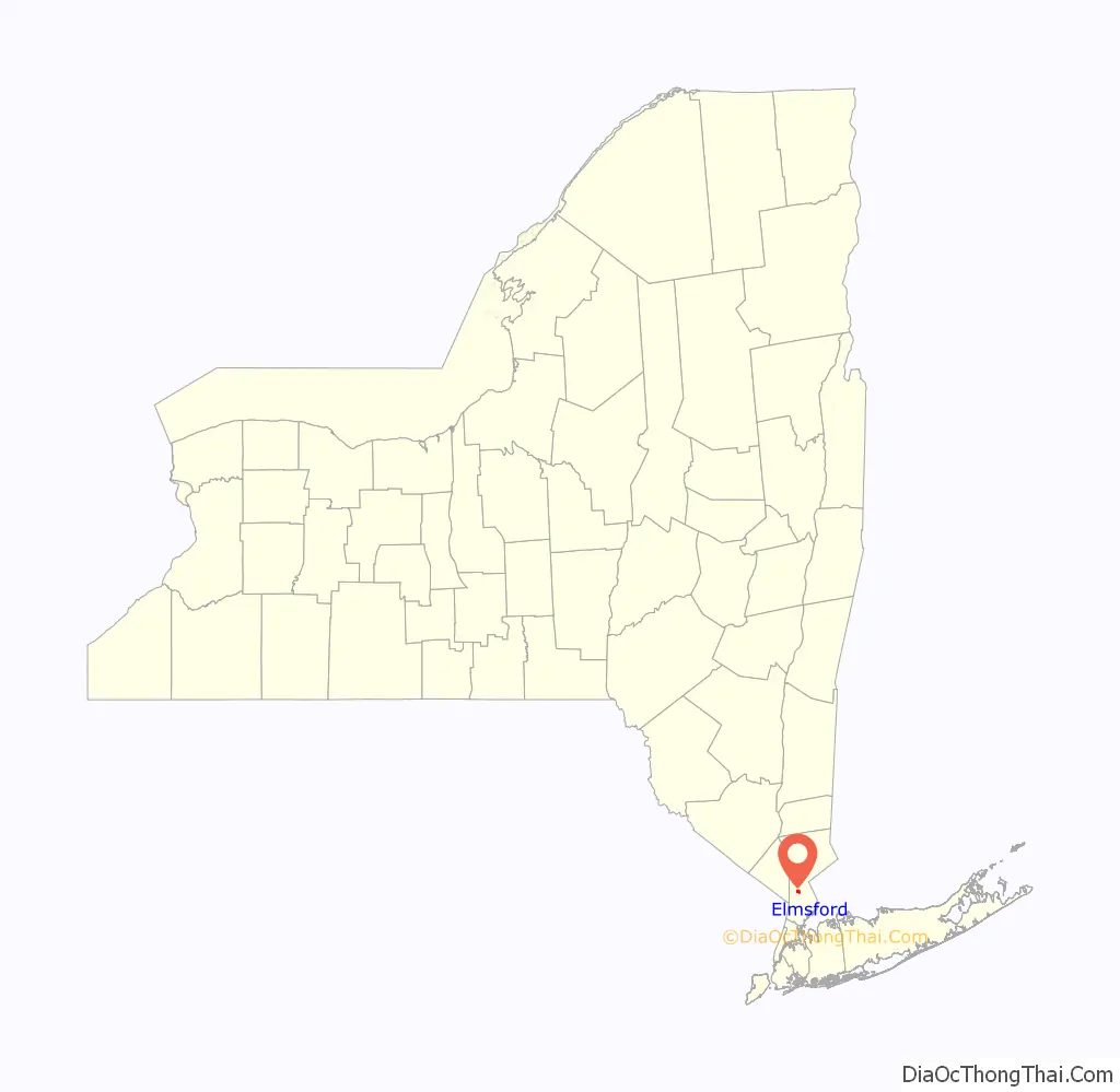
Elmsford location map. Where is Elmsford village?
History
Elmsford was largely farmland throughout its early history. The construction of railroads in the late 19th century brought new prominence to the area, and in 1910 it was incorporated as a village.
The area was known from colonial times as “Storm’s Bridge” and later, “Hall’s Corners”, names derived from the principal landowners of the times. In 1870, the growing village was officially renamed “Elmsford” in honor of a local landmark, a giant elm tree (since deceased). The names Elmsford and Storm’s Bridge are reminders of the nearby Saw Mill River, which once had significant tributaries flowing through the village.
A longstanding legend holds that Elmsford is the birthplace of the term “cocktail”. According to the tale, a local colonial tavern (sometimes said to be established by town father Isaac Storm) had run out of wooden stirrers during the war and started using the quills of roosters’ tailfeathers to stir their drinks; a more embellished version holds that the roosters were plundered from nearby Tory farmers.
Much of Elmsford developed around the New York and Putnam Railroad station, with train service beginning in the 1870s. Commuter rail service ended in 1958, and freight service ended in 1975. The railroad bed is now the South County Trailway and North County Trailway. The train station building is now a restaurant.
The Elmsford Reformed Church and Cemetery was listed on the National Register of Historic Places in 1983.
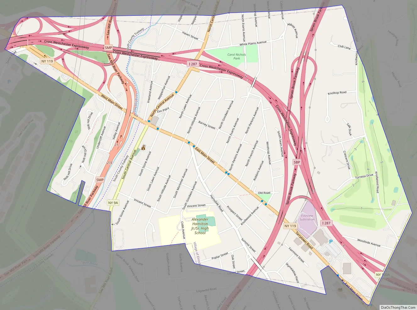
Elmsford Road Map
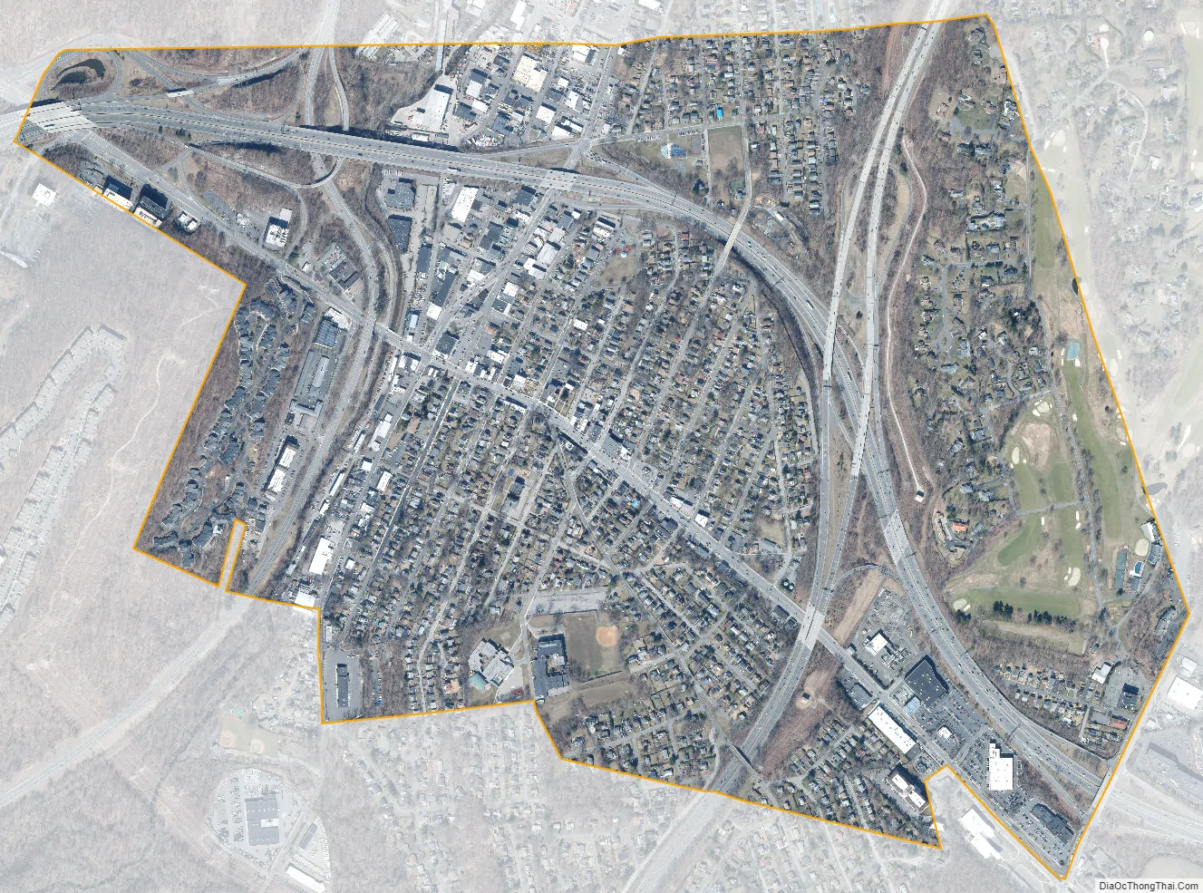
Elmsford city Satellite Map
Geography
Elmsford is located at 41°3′14″N 73°48′57″W / 41.05389°N 73.81583°W / 41.05389; -73.81583 (41.053963, -73.815711) in Westchester County, NY. According to the United States Census Bureau, the village has a total area of 1.1 square miles (2.8 km), all land.
See also
Map of New York State and its subdivision:- Albany
- Allegany
- Bronx
- Broome
- Cattaraugus
- Cayuga
- Chautauqua
- Chemung
- Chenango
- Clinton
- Columbia
- Cortland
- Delaware
- Dutchess
- Erie
- Essex
- Franklin
- Fulton
- Genesee
- Greene
- Hamilton
- Herkimer
- Jefferson
- Kings
- Lake Ontario
- Lewis
- Livingston
- Madison
- Monroe
- Montgomery
- Nassau
- New York
- Niagara
- Oneida
- Onondaga
- Ontario
- Orange
- Orleans
- Oswego
- Otsego
- Putnam
- Queens
- Rensselaer
- Richmond
- Rockland
- Saint Lawrence
- Saratoga
- Schenectady
- Schoharie
- Schuyler
- Seneca
- Steuben
- Suffolk
- Sullivan
- Tioga
- Tompkins
- Ulster
- Warren
- Washington
- Wayne
- Westchester
- Wyoming
- Yates
- Alabama
- Alaska
- Arizona
- Arkansas
- California
- Colorado
- Connecticut
- Delaware
- District of Columbia
- Florida
- Georgia
- Hawaii
- Idaho
- Illinois
- Indiana
- Iowa
- Kansas
- Kentucky
- Louisiana
- Maine
- Maryland
- Massachusetts
- Michigan
- Minnesota
- Mississippi
- Missouri
- Montana
- Nebraska
- Nevada
- New Hampshire
- New Jersey
- New Mexico
- New York
- North Carolina
- North Dakota
- Ohio
- Oklahoma
- Oregon
- Pennsylvania
- Rhode Island
- South Carolina
- South Dakota
- Tennessee
- Texas
- Utah
- Vermont
- Virginia
- Washington
- West Virginia
- Wisconsin
- Wyoming


