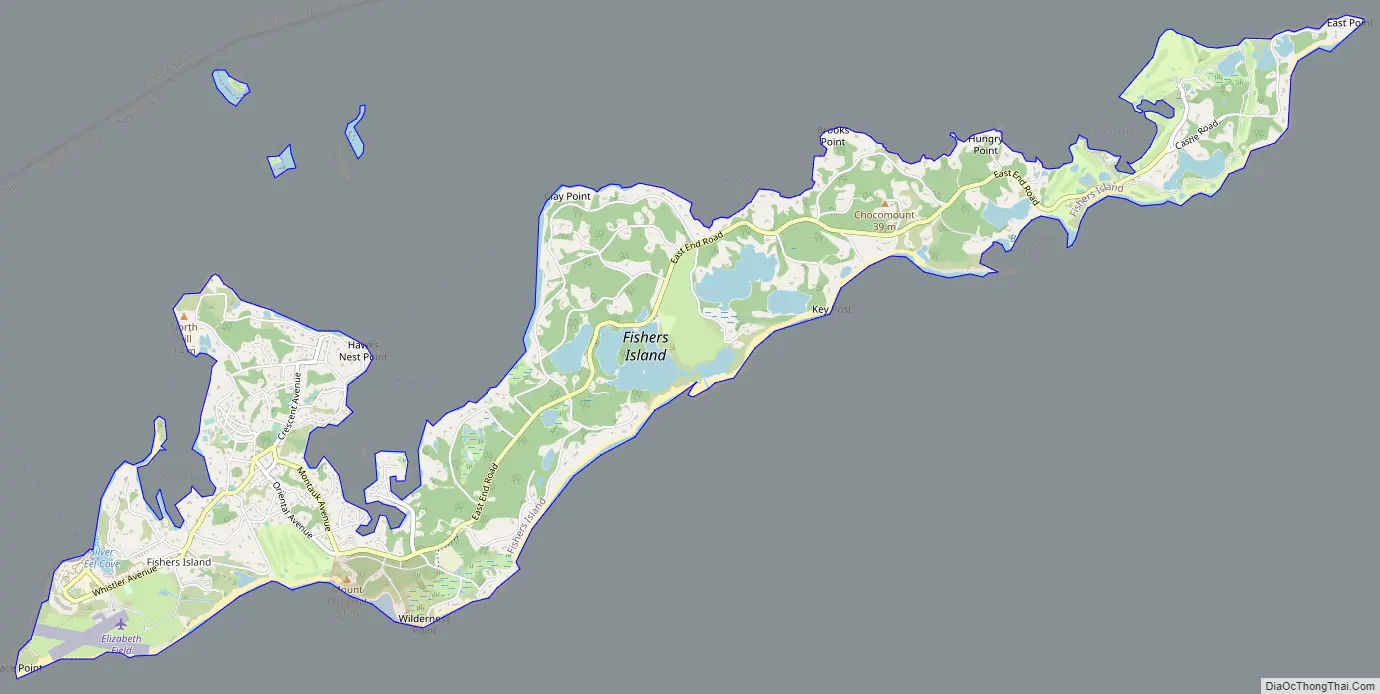
Fishers Island (Pequot: Munnawtawkit) is an island that is part of Southold, New York, United States at the eastern end of Long Island Sound, 2 miles (3 km) off the southeastern coast of Connecticut across Fishers Island Sound. About 9 miles (14 km) long and 1 mile (1.6 km) wide, it is about 11 miles (18 km) from the tip of Long Island at Orient Point, 2 miles (3 km) each from Napatree Point at the southwestern tip of Rhode Island and Groton Long Point in Connecticut, and about 7 miles (11 km) southeast of New London, Connecticut. It is accessible from New London by plane and regular ferry service.
The island is part of the town of Southold in Suffolk County. It is a census-designated place (CDP). As of the 2010 census, there were 236 people living year-round on 4.1 square miles (10.6 km) of land. The population rises to about 2,000 during peak summer weekends, as throngs disembark on the island from Connecticut.
| Name: | Fishers Island CDP |
|---|---|
| LSAD Code: | 57 |
| LSAD Description: | CDP (suffix) |
| State: | New York |
| County: | Suffolk County |
| Elevation: | 16 ft (5 m) |
| Total Area: | 4.97 sq mi (12.86 km²) |
| Land Area: | 4.06 sq mi (10.50 km²) |
| Water Area: | 0.91 sq mi (2.36 km²) |
| Total Population: | 424 |
| Population Density: | 104.54/sq mi (40.36/km²) |
| ZIP code: | 06390 |
| Area code: | 631 |
| FIPS code: | 3625923 |
| GNISfeature ID: | 950166 (populated place) 950165 (island) |
Online Interactive Map
Click on ![]() to view map in "full screen" mode.
to view map in "full screen" mode.
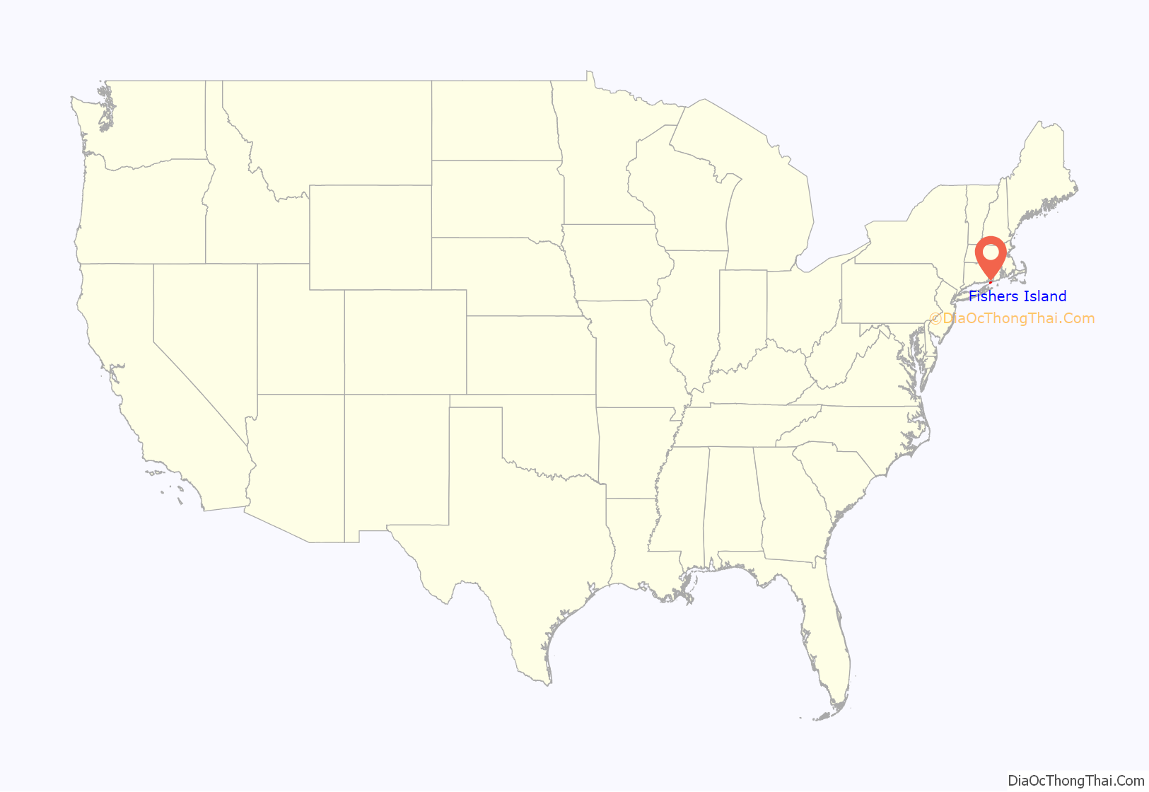
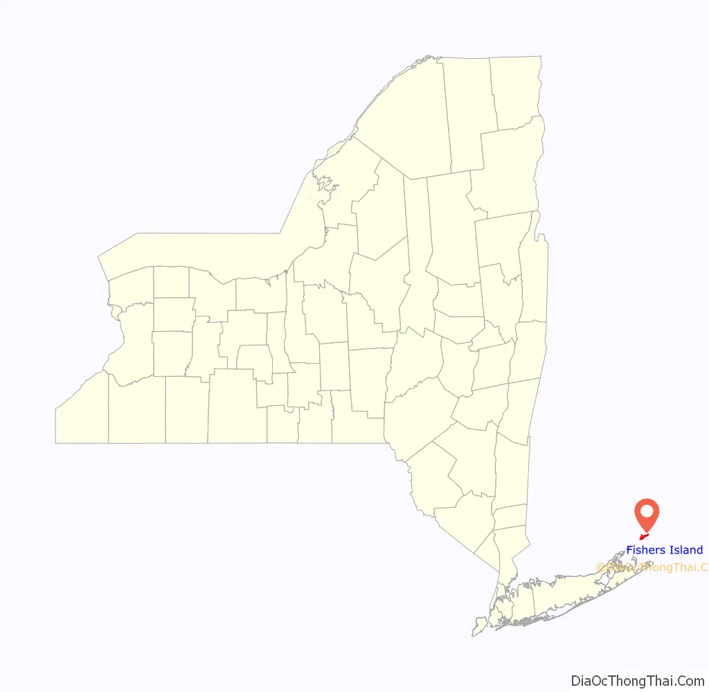
Fishers Island location map. Where is Fishers Island CDP?
History
The island was called Munnawtawkit by the Pequot Natives. Adriaen Block, the first recorded European visitor, named it Vischer’s Island in 1614 after one of his companions. For the next 25 years, it remained a wilderness, visited occasionally by Dutch traders.
John Winthrop the Younger obtained a grant of Fisher’s Island in 1640 from the Massachusetts Bay Colony, “reserving the right of Connecticut if it should be decided to be theirs.” He simultaneously applied to the Connecticut General Court for a similar grant in order that there might be no flaw in his title. The title was given to him in the following words, which are copied from the records of a General Court held at Hartford, Connecticut, April 9, 1641:
Winthrop lived only one winter on the island. He was named governor of the Connecticut Colony 1657–58 and 1659–76, and he used the island to raise sheep for food and wool. He died in 1676 and his son Fitz-John installed a lessee farmer from England on the island named William Walworth. Walworth brought a system of cultivation that was continued on the island for nearly 200 years. He established farmland out of the heavily forested island. Walworth and his family vacated the island nine years later due to the threat of pirates. Fishers Island remained in the Winthrop family of Connecticut until 1863, when ownership passed to Robert R. Fox, and then to Edmund and Walton Ferguson, also of Connecticut.
The island was the subject of a border dispute between New York and Connecticut. The states of New York, Connecticut, and Rhode Island meet in the waters east of Fishers Island. Before the British took possession of New York City from the Dutch in 1664, all of Suffolk County was claimed by Connecticut, with British settlers there accepting its jurisdiction. A 1664 land patent given to the Duke of York included all islands in Long Island Sound, apparently thus granting Fishers Island also to the Province of New York. The Duke of York held a grudge against Connecticut, as the New Haven settlers had hidden three of the judges who sentenced his father King Charles I to death in 1649. Settlers throughout Suffolk County pressed to stay part of Connecticut, but Governor Sir Edmund Andros threatened to eliminate their rights to land if they did not yield, which they did by 1676. A joint commission from Connecticut and New York in 1879 reiterated that New York has legal title to Fishers Island.
The island was a target of British soldiers during the Revolutionary War, who raided islands in Long Island Sound for supplies. Many of the residents of Fishers Island took their herds to the relative safety of Connecticut in 1776. The raids continued, though, and the British burned many of the island’s homes in 1779.
In 1783, brick-making was established as the island’s only industry, using the vast amounts of available clay. This business was discontinued in 1889. In 1870, a lifesaving station was erected at the western end of the island by the State of Connecticut, which overlooked the waters between Fishers Island and Little Gull Island. The Race Rock Light was constructed in 1878 as a navigational aid for travel in the Race, located about 1 mile (1.6 km) west of Fishers Island. In the early 1900s, a permanent Coast Guard station was built on the west end. In 1898, the Fergusons sold 216 acres (0.9 km) on the western end to the federal government. This land was developed as Fort H.G. Wright, which was named after the Civil War Union commander who was born in Clinton, Connecticut. The fort was established as part of the Endicott Program, a large coastal defense project. It was largely abandoned following World War II. Over the years, Fort Wright drew a large number of residents to the island. The 1890s brought a growing summer population and the construction of the Fishers Island Yacht Club.
The E.W. & W. Ferguson business was established to manage the Mansion House Hotel and Cottages, a ferry service, and the electricity, water, and telephone enterprises. It was renamed Fishers Island Farms in 1918, then the Fishers Island Utility Company in 1965, following the death of a company president. As of 2022, the firm still owns and operates the water, telephone service (area code 631, exchange 788), and electrical utilities. The ferry is operated by the Fishers Island Ferry District, a public entity financed through a special tax district. The town has contracts with the Ferry District to operate Elizabeth Field airport and to manage other structures that were part of Fort Wright.
Hurricanes have played an important role in the island’s history, with the Great September Gale of 1815 and the New England Hurricane of 1938 causing widespread damage. The 1815 storm destroyed nearly of the trees with powerful winds and a 17-foot (5.2 m) storm surge that flooded coastal towns. The consequences for Fishers Island were visible for almost a century and a half. A 1910 panoramic photograph shows more boats in Hay and West harbors than there are mature trees. Until the 1950s, Fishers Island had the look of Ireland: stone walls, few trees, and windswept moors.
The 1938 storm blew in seeds, returning Fishers to its pre-1815 foliage. The damage from this storm was less severe than the 1815 storm, with only a few local residences destroyed, primarily by wind. (Most Fishers Island residences have sitings above sea level that protect them from storm surge.) Winds in excess of 120 mph (190 km/h) ripped off the roof of John Nicholas Brown’s ultra-modern residence Windshield, designed by Richard Neutra, which had only recently been completed. The Browns rebuilt Windshield, but it was destroyed by fire in the early 1970s.
Fishers Island Road Map
Fishers Island city Satellite Map

Geography
According to the United States Census Bureau, the CDP has a total area of 4.2 square miles (10.9 km), of which 4.1 square miles (10.6 km) is land and 0.15 square miles (0.4 km), or 3.48%, is water.
Fishers Island represents a section of the same terminal moraine that formed the North Fork of Long Island, which comes ashore at Watch Hill, Rhode Island. During the late phase of the Wisconsin glaciation, glacial Lake Connecticut formed at the retreating fore edge of the ice sheet, over what now is Long Island Sound; it formed an outlet in its moraine dam at The Race, famous for rip currents, which still separates Fishers Island from the North Fork. Fishers Island is essentially a long barrow of rocky till scoured from the surface of southern Connecticut.
Neighboring islands
Wicopesset Island is a small, unoccupied island just off East Point on Fisher’s Island, closer to the water boundary with Rhode Island and Connecticut than to Montauk Point. However, Montauk gets the title of New York’s easternmost land point because it is 2.9 miles (4.7 km) farther east. Wicopesset Island is the northernmost area of Suffolk County, New York, and previously the southernmost area of New London County, Connecticut.
North Dumpling Island is a small, privately owned island north of the coast of North Hill, that also serves as the home of the North Dumpling Lighthouse.
South Dumpling Island is another small island north of the coast of North Hill, that is located southeast of North Dumpling Island. It is privately owned by the Audubon Society and is managed as a bird sanctuary. Angelica (Angelica lucida), a plant species that is endangered in New York state, has been documented on South Dumpling Island.
Flat Hammock is located slightly east of South Dumpling and is owned by the United States Government.
Mason’s Island (Algonquin: Chippachaug, meaning a separated place) is an inhabited island at the mouth of the Mystic River in Stonington, Connecticut. The island was named after Major John Mason who was granted the island in recognition of his military services in the 1637 Pequot War in nearby Mystic.
Enders Island is an inhabited island located in Stonington, Connecticut, used as a Catholic retreat center, owned and operated by the Society of Saint Edmund. The island is connected to neighboring Mason’s Island by a causeway, and Mason’s Island is connected to the mainland by another causeway.
Goat Island is in Wequetequock Cove northeast of Sandy Point Island and Elihu Island.
Ram Island is close in proximity to Fishers Island. However, Ram Island still remains within the political jurisdiction of Connecticut.
Elihu Island of Stonington, Connecticut, is also close to Fishers Island. It is just south of Goat Island in Wequetequock Cove.
Climate
Fishers Island’s weather is influenced by the proximity of Long Island Sound and the ocean, and prevailing winds that generally blow offshore. The climate is one of only a few locations on an east coast in the Northern Hemisphere that is oceanic (Koppen Cfb). Because the ocean stays warm during the fall and winter months, Fishers Island stays warmer than the mainland (Connecticut) during this time. Although summer days can be hot on Fishers Island, because of its oceanic climate, temperatures are lower than on the mainland in nearby Connecticut and Rhode Island. For example, the July and August, average daytime temperature on the island usually range in mid- to upper 70s when they average in the low to mid-80s in nearby areas of New England.
See also
Map of New York State and its subdivision:- Albany
- Allegany
- Bronx
- Broome
- Cattaraugus
- Cayuga
- Chautauqua
- Chemung
- Chenango
- Clinton
- Columbia
- Cortland
- Delaware
- Dutchess
- Erie
- Essex
- Franklin
- Fulton
- Genesee
- Greene
- Hamilton
- Herkimer
- Jefferson
- Kings
- Lake Ontario
- Lewis
- Livingston
- Madison
- Monroe
- Montgomery
- Nassau
- New York
- Niagara
- Oneida
- Onondaga
- Ontario
- Orange
- Orleans
- Oswego
- Otsego
- Putnam
- Queens
- Rensselaer
- Richmond
- Rockland
- Saint Lawrence
- Saratoga
- Schenectady
- Schoharie
- Schuyler
- Seneca
- Steuben
- Suffolk
- Sullivan
- Tioga
- Tompkins
- Ulster
- Warren
- Washington
- Wayne
- Westchester
- Wyoming
- Yates
- Alabama
- Alaska
- Arizona
- Arkansas
- California
- Colorado
- Connecticut
- Delaware
- District of Columbia
- Florida
- Georgia
- Hawaii
- Idaho
- Illinois
- Indiana
- Iowa
- Kansas
- Kentucky
- Louisiana
- Maine
- Maryland
- Massachusetts
- Michigan
- Minnesota
- Mississippi
- Missouri
- Montana
- Nebraska
- Nevada
- New Hampshire
- New Jersey
- New Mexico
- New York
- North Carolina
- North Dakota
- Ohio
- Oklahoma
- Oregon
- Pennsylvania
- Rhode Island
- South Carolina
- South Dakota
- Tennessee
- Texas
- Utah
- Vermont
- Virginia
- Washington
- West Virginia
- Wisconsin
- Wyoming


