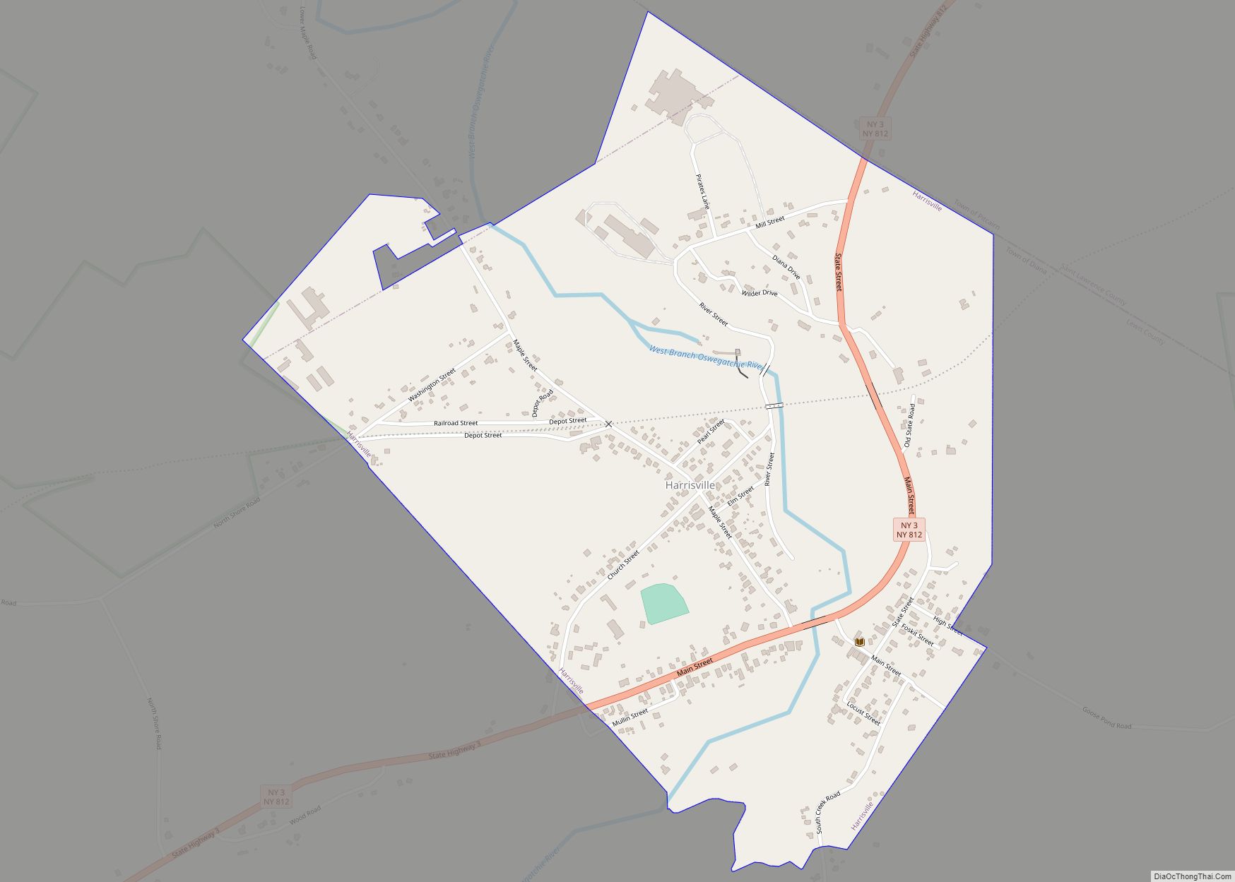
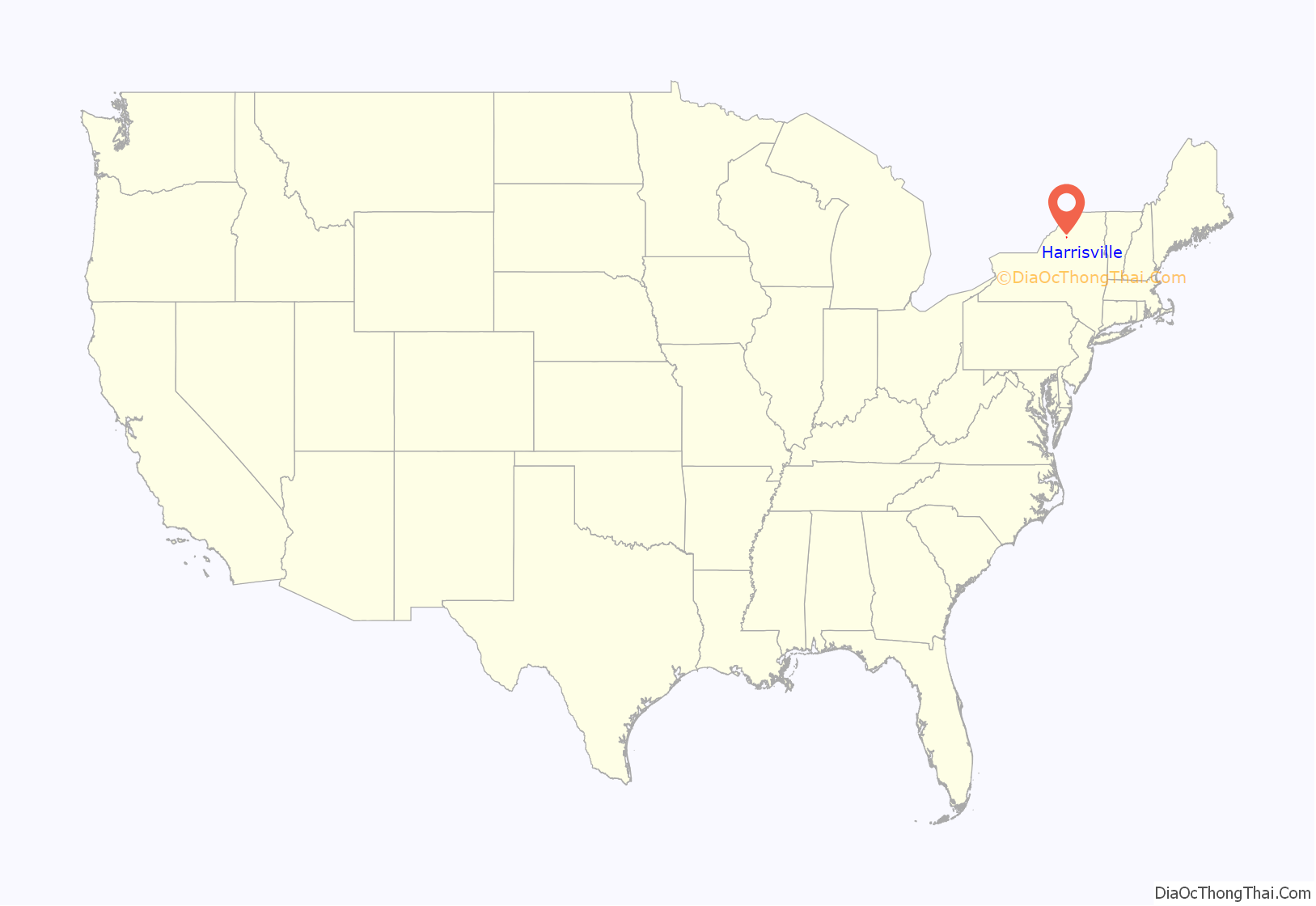
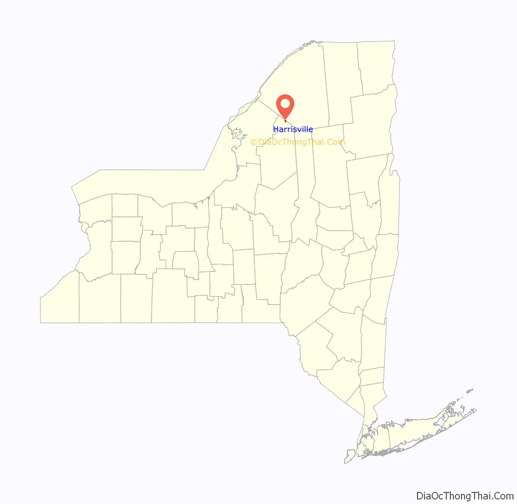
Harrisville is a hamlet and former village in Lewis County, New York, United States. The community is now a census-designated place. The population was 628 at the 2010 census.
Harrisville is in the northeastern part of the town of Diana and is south of Gouverneur.
On May 15, 2018, residents voted to dissolve the village by a vote of 112–70, and it took effect on December 31, 2018. As of the 2019 American Community Survey, the U.S. Census Bureau still lists Harrisville as a village.
| Name: | Harrisville village |
|---|---|
| LSAD Code: | 47 |
| LSAD Description: | village (suffix) |
| State: | New York |
| County: | Lewis County |
| Elevation: | 807 ft (246 m) |
| Total Area: | 0.83 sq mi (2.15 km²) |
| Land Area: | 0.79 sq mi (2.03 km²) |
| Water Area: | 0.05 sq mi (0.12 km²) |
| Total Population: | 628 |
| Population Density: | 768.45/sq mi (296.87/km²) |
| ZIP code: | 13648 |
| Area code: | 315 |
| FIPS code: | 3632424 |
| GNISfeature ID: | 952291 |
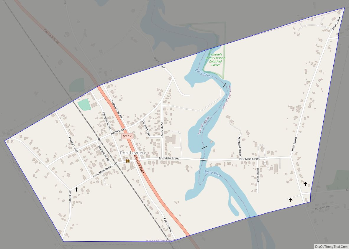
Online Interactive Map
Click on ![]() to view map in "full screen" mode.
to view map in "full screen" mode.
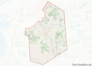
Harrisville location map. Where is Harrisville village?
History
In 1815, Joseph Bonaparte, elder brother of Napoleon I and former King of Spain, purchased a tract of land from James Le Ray, part of which became the town of Diana. Harrisville, the largest community in the town, takes its name from Foskit Harris, who settled there in 1833. Harris constructed a sawmill and gristmill, harnessing the West Branch of the Oswegatchie River for power to operate the mills. When early settlers discovered that the landlord John LaFarge, from whom La Fargeville, New York, takes its name, had acquired title to Bonaparte’s land, they abandoned the area, and Harrisville languished for 20 years.
In 1859, Samuel H. Beach and William R. Dodge built a massive tannery on the east side of the river. The 228-foot-long (69 m) structure had 160 vats and was capable of turning out 40,000 sides of sole leather per year. In 1879, David Botchford and Co. acquired the tannery, which closed in 1902.
By 1880 Harrisville had become the commercial and industrial center of the town of Diana. The abundant natural resource of forests and water shaped industrial development and served to attract investors and residents supported by a chair factory, a sash and door factory, and several active lumber dealers. In addition, carriage makers, blacksmiths, a harness shop, and numerous general merchandise stores and retail service establishments such as barbershops and hotels supported community development.
The Carthage & Adirondack Railroad came to Harrisville in 1887, replacing the earlier, unsuccessful Black River & St. Lawrence Railroad, which had relied on maple rails to support heavy locomotives. The Carthage & Adirondack transported leather, lumber, and paper from Harrisville mills. As a common carrier, the railroad also brought visitors to Lake Bonaparte and other vacation spots in the northern Adirondacks. The depot is now home to the Town of Diana Historical Museum.
Around 1905, the Diana Paper Company built a mill on the Botchford Tannery’s former location. The mill primarily produced paper for magazines and catalogs. During World War I, the company experienced financial difficulty because of unfavorable wood contracts. After years of struggle, the company filed for bankruptcy in 1927. St. Regis Paper Company acquired the mill and ran it until 1954, when the Harrisville Paper Company bought it. The mill ceased operations in 1957.
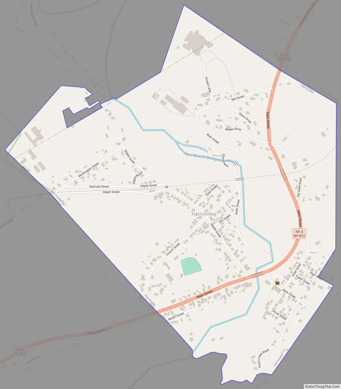
Harrisville Road Map
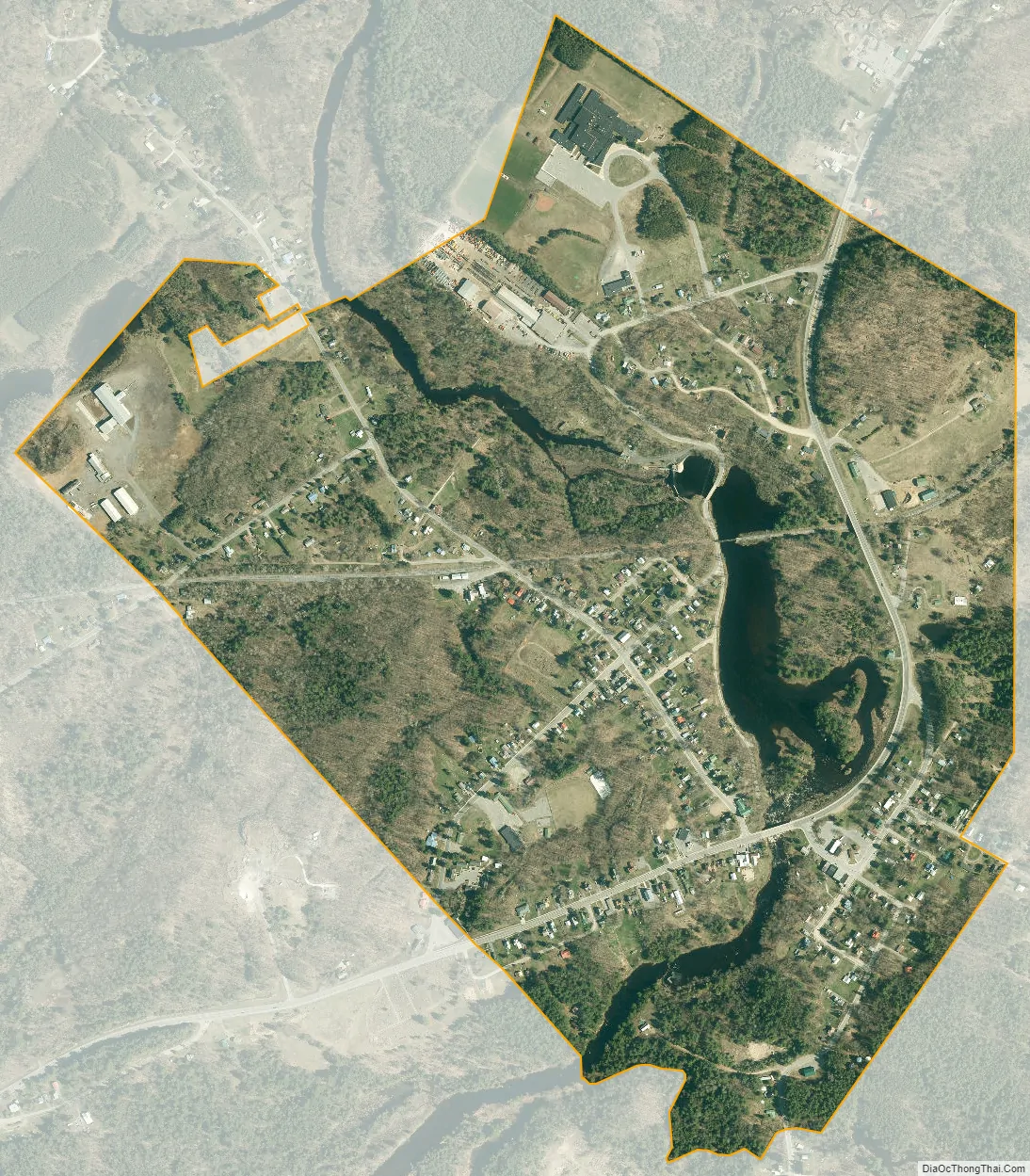
Harrisville city Satellite Map
Geography
Harrisville is located in the northern part of the town of Diana, along the northern boundary of Lewis County at 44°09′08″N 75°19′11″W / 44.152226°N 75.319733°W / 44.152226; -75.319733. It is bordered to the north by the town of Pitcairn in St. Lawrence County.
According to the United States Census Bureau, in 2010 the village had a total area of 0.83 square miles (2.15 km), of which 0.78 square miles (2.03 km) were land and 0.05 square miles (0.12 km), or 5.56%, are water.
Combined New York State Route 812 and New York State Route 3 pass through the community. Route 3 leads east 60 miles (97 km) to Tupper Lake and west 34 miles (55 km) to Watertown, while Route 812 leads south 30 miles (48 km) to Lowville, the Lewis county seat, and north toward Gouverneur, 16 miles (26 km) away. County Road 9 enters Harrisville from the south.
Harrisville is on the West Branch of the Oswegatchie River, which flows north to the St. Lawrence River at Ogdensburg.
See also
Map of New York State and its subdivision:- Albany
- Allegany
- Bronx
- Broome
- Cattaraugus
- Cayuga
- Chautauqua
- Chemung
- Chenango
- Clinton
- Columbia
- Cortland
- Delaware
- Dutchess
- Erie
- Essex
- Franklin
- Fulton
- Genesee
- Greene
- Hamilton
- Herkimer
- Jefferson
- Kings
- Lake Ontario
- Lewis
- Livingston
- Madison
- Monroe
- Montgomery
- Nassau
- New York
- Niagara
- Oneida
- Onondaga
- Ontario
- Orange
- Orleans
- Oswego
- Otsego
- Putnam
- Queens
- Rensselaer
- Richmond
- Rockland
- Saint Lawrence
- Saratoga
- Schenectady
- Schoharie
- Schuyler
- Seneca
- Steuben
- Suffolk
- Sullivan
- Tioga
- Tompkins
- Ulster
- Warren
- Washington
- Wayne
- Westchester
- Wyoming
- Yates
- Alabama
- Alaska
- Arizona
- Arkansas
- California
- Colorado
- Connecticut
- Delaware
- District of Columbia
- Florida
- Georgia
- Hawaii
- Idaho
- Illinois
- Indiana
- Iowa
- Kansas
- Kentucky
- Louisiana
- Maine
- Maryland
- Massachusetts
- Michigan
- Minnesota
- Mississippi
- Missouri
- Montana
- Nebraska
- Nevada
- New Hampshire
- New Jersey
- New Mexico
- New York
- North Carolina
- North Dakota
- Ohio
- Oklahoma
- Oregon
- Pennsylvania
- Rhode Island
- South Carolina
- South Dakota
- Tennessee
- Texas
- Utah
- Vermont
- Virginia
- Washington
- West Virginia
- Wisconsin
- Wyoming