Haviland is a community and census-designated place (CDP) in Dutchess County, New York, United States. The population was 3,634 at the 2010 census. It is part of the Poughkeepsie–Newburgh–Middletown, NY Metropolitan Statistical Area as well as the larger New York–Newark–Bridgeport, NY-NJ–CT–PA Combined Statistical Area.
Haviland is in the southern portion of the town of Hyde Park. The Eleanor Roosevelt National Historic Site is located within the community.
| Name: | Haviland CDP |
|---|---|
| LSAD Code: | 57 |
| LSAD Description: | CDP (suffix) |
| State: | New York |
| County: | Dutchess County |
| Elevation: | 233 ft (71 m) |
| Total Area: | 4.97 sq mi (12.86 km²) |
| Land Area: | 4.93 sq mi (12.76 km²) |
| Water Area: | 0.04 sq mi (0.10 km²) |
| Total Population: | 4,174 |
| Population Density: | 847.17/sq mi (327.07/km²) |
| FIPS code: | 3632776 |
| GNISfeature ID: | 1867406 |
Online Interactive Map
Click on ![]() to view map in "full screen" mode.
to view map in "full screen" mode.
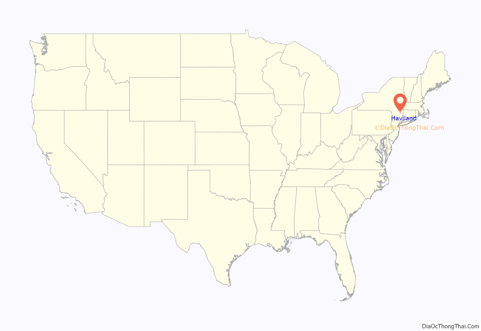
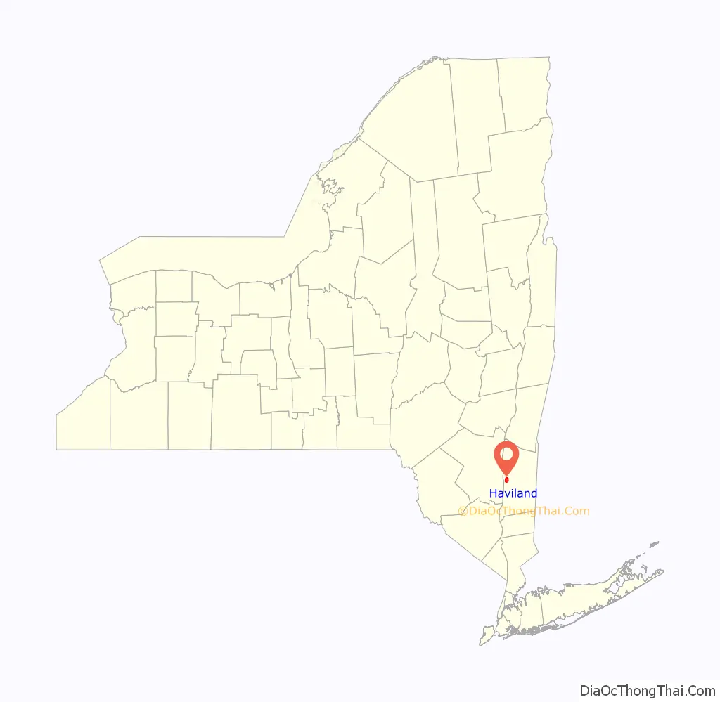
Haviland location map. Where is Haviland CDP?
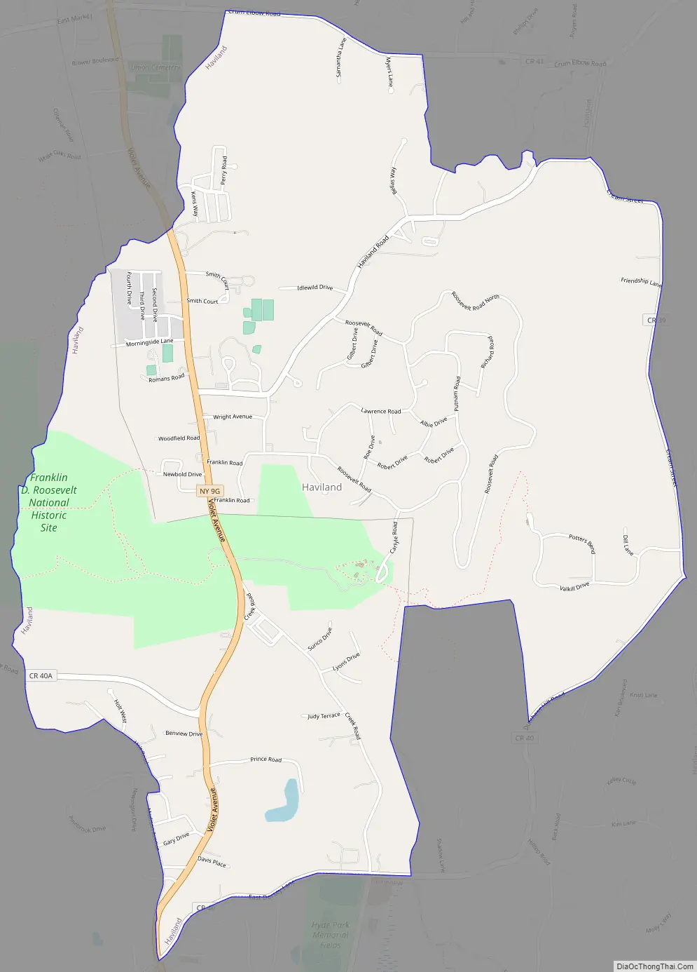
Haviland Road Map
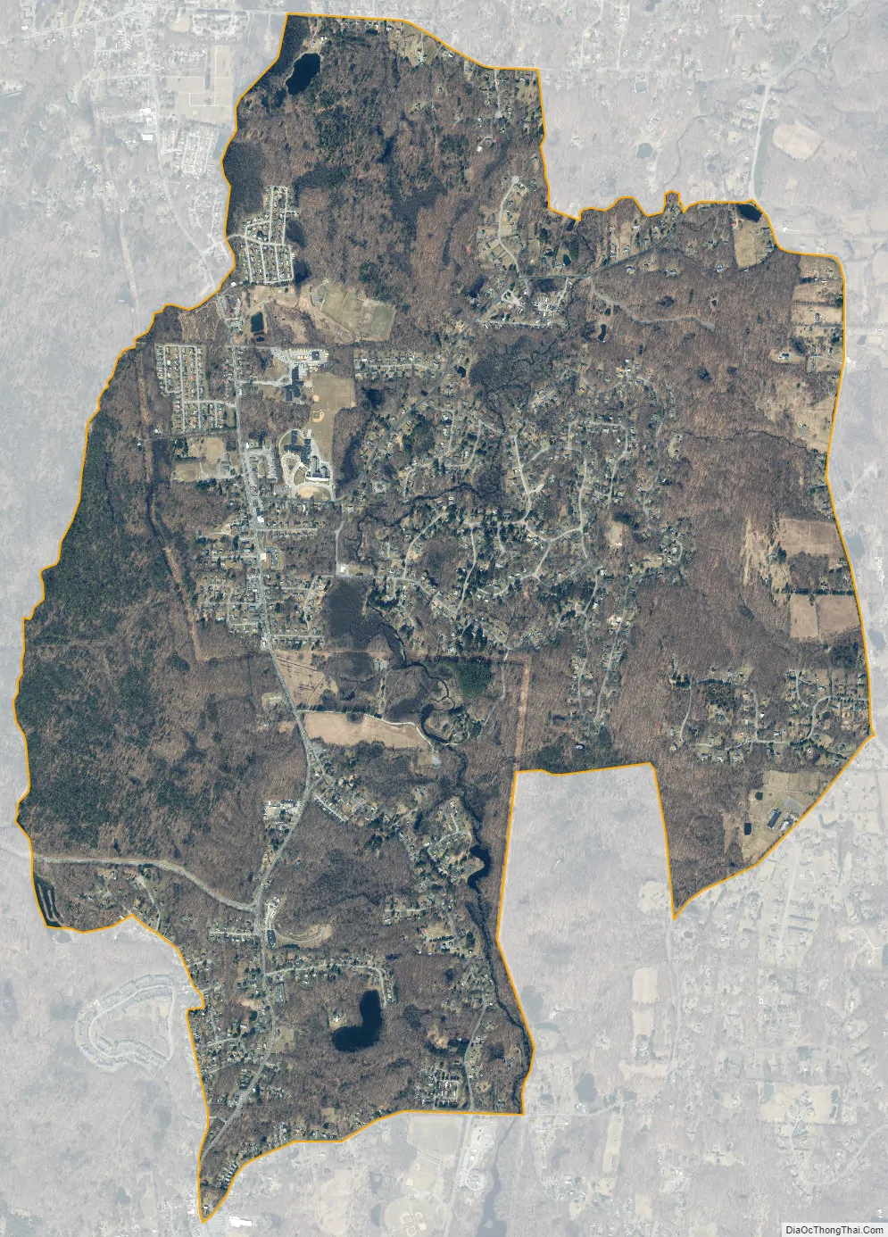
Haviland city Satellite Map
Geography
Haviland is located in west-central Dutchess County at 41°46′0″N 73°54′5″W / 41.76667°N 73.90139°W / 41.76667; -73.90139 (41.7668, -73.9015). New York State Route 9G (Violet Avenue) is the main road through the community, leading south 5 miles (8 km) to Poughkeepsie. The western border of the hamlet is defined by the Maritje Kill.
According to the United States Census Bureau, the CDP has a total area of 3.9 square miles (10.1 km), of which 3.9 square miles (10.0 km) is land and 0.04 square miles (0.1 km), or 0.91%, is water.
See also
Map of New York State and its subdivision:- Albany
- Allegany
- Bronx
- Broome
- Cattaraugus
- Cayuga
- Chautauqua
- Chemung
- Chenango
- Clinton
- Columbia
- Cortland
- Delaware
- Dutchess
- Erie
- Essex
- Franklin
- Fulton
- Genesee
- Greene
- Hamilton
- Herkimer
- Jefferson
- Kings
- Lake Ontario
- Lewis
- Livingston
- Madison
- Monroe
- Montgomery
- Nassau
- New York
- Niagara
- Oneida
- Onondaga
- Ontario
- Orange
- Orleans
- Oswego
- Otsego
- Putnam
- Queens
- Rensselaer
- Richmond
- Rockland
- Saint Lawrence
- Saratoga
- Schenectady
- Schoharie
- Schuyler
- Seneca
- Steuben
- Suffolk
- Sullivan
- Tioga
- Tompkins
- Ulster
- Warren
- Washington
- Wayne
- Westchester
- Wyoming
- Yates
- Alabama
- Alaska
- Arizona
- Arkansas
- California
- Colorado
- Connecticut
- Delaware
- District of Columbia
- Florida
- Georgia
- Hawaii
- Idaho
- Illinois
- Indiana
- Iowa
- Kansas
- Kentucky
- Louisiana
- Maine
- Maryland
- Massachusetts
- Michigan
- Minnesota
- Mississippi
- Missouri
- Montana
- Nebraska
- Nevada
- New Hampshire
- New Jersey
- New Mexico
- New York
- North Carolina
- North Dakota
- Ohio
- Oklahoma
- Oregon
- Pennsylvania
- Rhode Island
- South Carolina
- South Dakota
- Tennessee
- Texas
- Utah
- Vermont
- Virginia
- Washington
- West Virginia
- Wisconsin
- Wyoming


