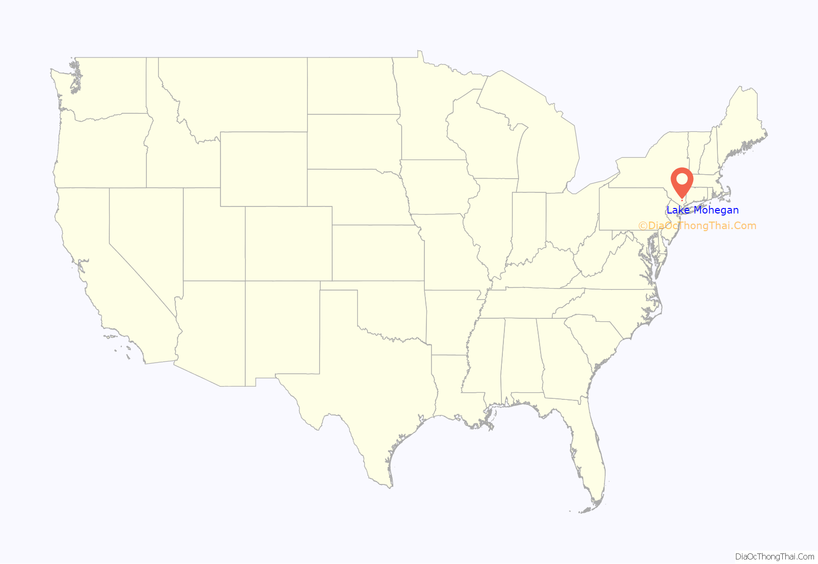
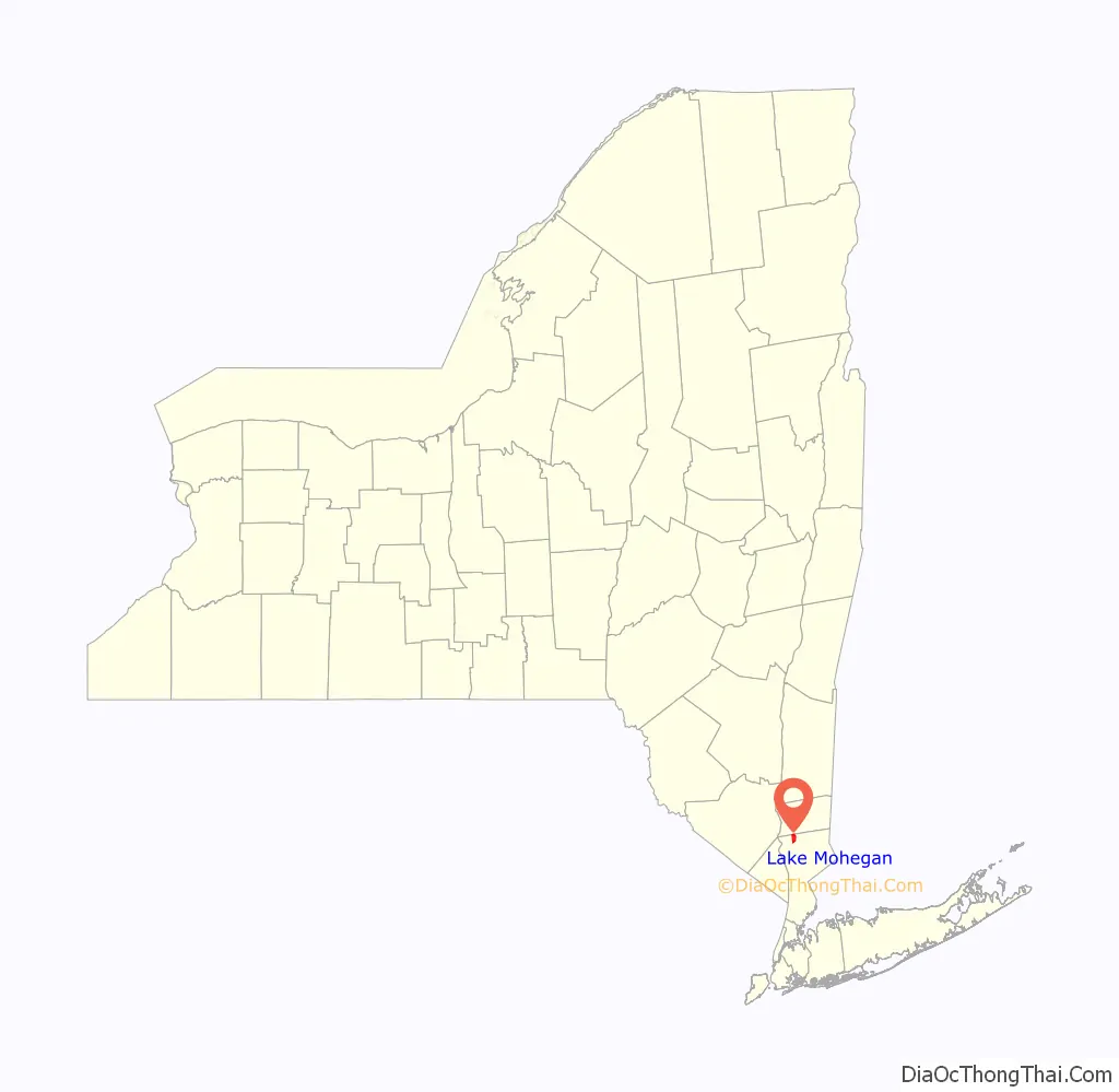
Lake Mohegan, commonly known as Mohegan Lake, is a census-designated place (CDP) located in the Town of Yorktown in Westchester County, New York, United States.
There is a private lake, Mohegan Lake, also known as “Lake Mohegan”, with beaches which are occasionally closed for swimming due to harmful algal blooms.
The town was home to several former summer bungalow colonies in the 1950s and 1960s. They included the Skyview Colony and Lakeview Colony off U.S. Route 6.
| Name: | Lake Mohegan CDP |
|---|---|
| LSAD Code: | 57 |
| LSAD Description: | CDP (suffix) |
| State: | New York |
| County: | Westchester County |
| Elevation: | 522 ft (159 m) |
| Total Area: | 3.08 sq mi (7.98 km²) |
| Land Area: | 2.89 sq mi (7.48 km²) |
| Water Area: | 0.19 sq mi (0.50 km²) |
| Total Population: | 5,896 |
| Population Density: | 2,042.26/sq mi (788.51/km²) |
| ZIP code: | 10547 |
| Area code: | 914 |
| FIPS code: | 3640689 |
| GNISfeature ID: | 1852903 |
Online Interactive Map
Click on ![]() to view map in "full screen" mode.
to view map in "full screen" mode.
Lake Mohegan location map. Where is Lake Mohegan CDP?
Lake Mohegan Road Map
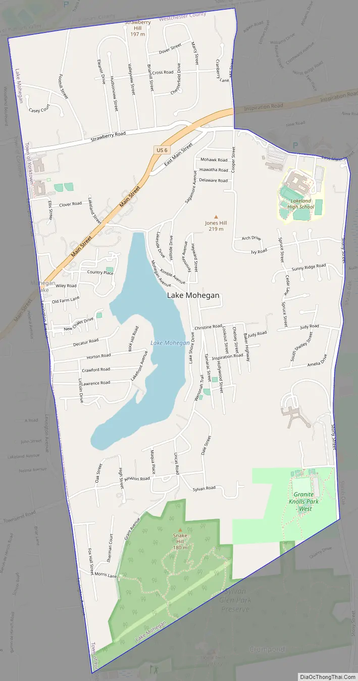
Lake Mohegan city Satellite Map

Geography
Mohegan Lake is located at 41°19′7″N 73°50′53″W / 41.31861°N 73.84806°W / 41.31861; -73.84806 (41.318568, -73.848029). According to the United States Census Bureau, the CDP has a total area of 3.1 square miles (8.0 km), of which 2.9 square miles (7.5 km) is land and 0.2 square miles (0.52 km), or 5.52%, is water.
See also
Map of New York State and its subdivision:- Albany
- Allegany
- Bronx
- Broome
- Cattaraugus
- Cayuga
- Chautauqua
- Chemung
- Chenango
- Clinton
- Columbia
- Cortland
- Delaware
- Dutchess
- Erie
- Essex
- Franklin
- Fulton
- Genesee
- Greene
- Hamilton
- Herkimer
- Jefferson
- Kings
- Lake Ontario
- Lewis
- Livingston
- Madison
- Monroe
- Montgomery
- Nassau
- New York
- Niagara
- Oneida
- Onondaga
- Ontario
- Orange
- Orleans
- Oswego
- Otsego
- Putnam
- Queens
- Rensselaer
- Richmond
- Rockland
- Saint Lawrence
- Saratoga
- Schenectady
- Schoharie
- Schuyler
- Seneca
- Steuben
- Suffolk
- Sullivan
- Tioga
- Tompkins
- Ulster
- Warren
- Washington
- Wayne
- Westchester
- Wyoming
- Yates
- Alabama
- Alaska
- Arizona
- Arkansas
- California
- Colorado
- Connecticut
- Delaware
- District of Columbia
- Florida
- Georgia
- Hawaii
- Idaho
- Illinois
- Indiana
- Iowa
- Kansas
- Kentucky
- Louisiana
- Maine
- Maryland
- Massachusetts
- Michigan
- Minnesota
- Mississippi
- Missouri
- Montana
- Nebraska
- Nevada
- New Hampshire
- New Jersey
- New Mexico
- New York
- North Carolina
- North Dakota
- Ohio
- Oklahoma
- Oregon
- Pennsylvania
- Rhode Island
- South Carolina
- South Dakota
- Tennessee
- Texas
- Utah
- Vermont
- Virginia
- Washington
- West Virginia
- Wisconsin
- Wyoming


