Long Beach is an oceanfront city in Nassau County in New York, United States. It takes up a central section of the Long Beach Barrier Island, which is the westernmost of the outer barrier islands off Long Island’s South Shore. As of the 2020 Census, the city’s population was 35,029, up from the 2019 estimate of 33,454. It was incorporated in 1922, and is nicknamed “The City by the Sea” (the Latin form, Civitas ad mare, is the city’s motto). The Long Beach Barrier Island is surrounded by Reynolds Channel to the north, east and west, and the Atlantic Ocean to the south.
In 2022, Long Beach was named the best East Coast beach town for a summer getaway by Time Out magazine.
| Name: | Long Beach city |
|---|---|
| LSAD Code: | 25 |
| LSAD Description: | city (suffix) |
| State: | New York |
| County: | Nassau County |
| Elevation: | 0 ft (0 m) |
| Total Area: | 3.90 sq mi (10.09 km²) |
| Land Area: | 2.22 sq mi (5.74 km²) |
| Water Area: | 1.68 sq mi (4.34 km²) |
| Total Population: | 35,029 |
| Population Density: | 15,793.06/sq mi (6,098.69/km²) |
| ZIP code: | 11561 |
| Area code: | 516 |
| FIPS code: | 3643335 |
| GNISfeature ID: | 0955835 |
| Website: | www.longbeachny.org |
Online Interactive Map
Click on ![]() to view map in "full screen" mode.
to view map in "full screen" mode.
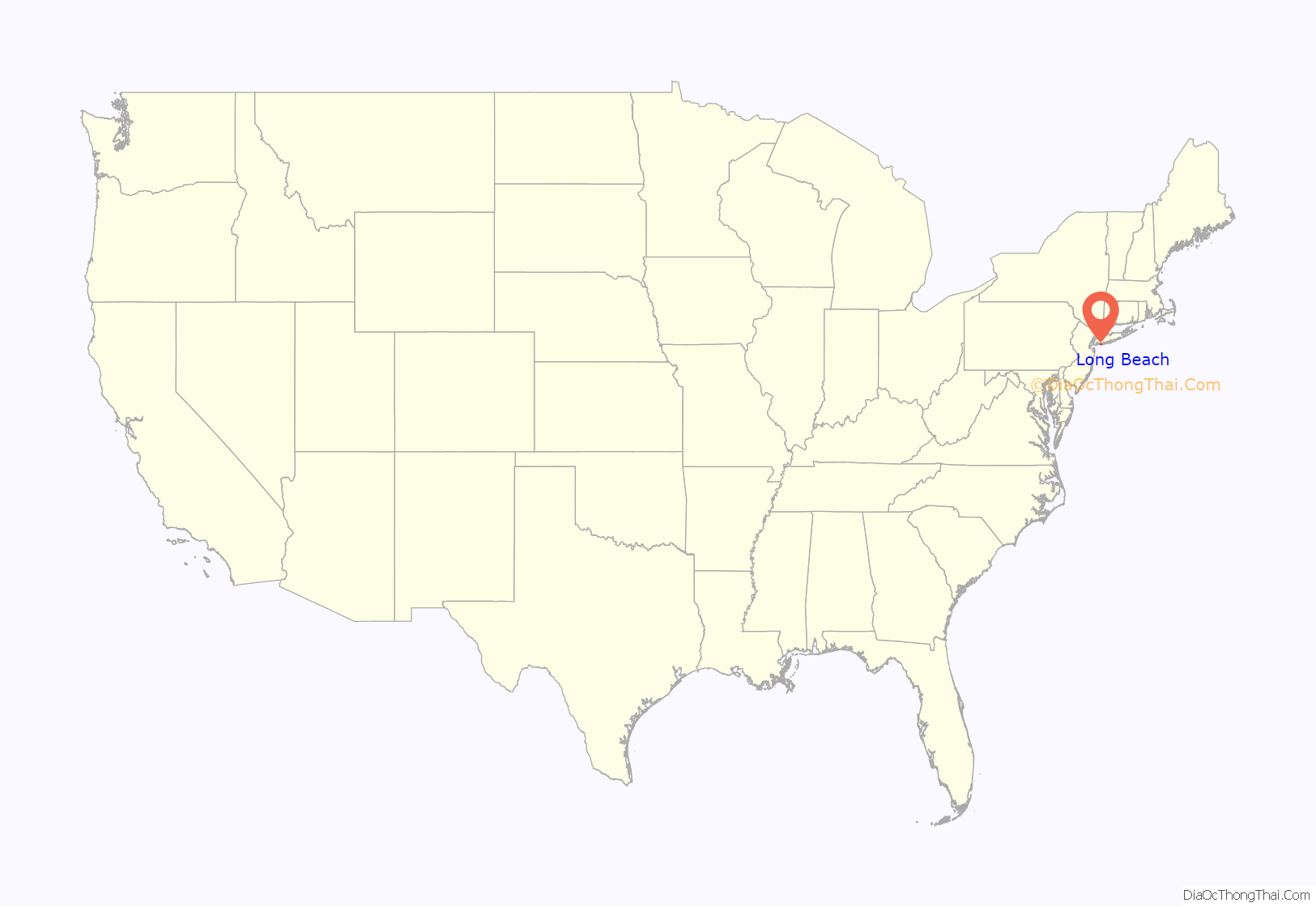
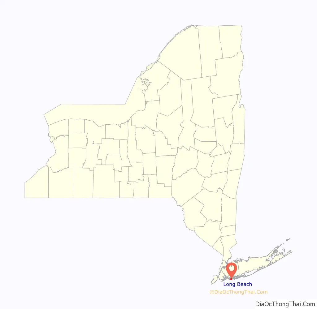
Long Beach location map. Where is Long Beach city?
History
Pre-settlement
The city of Long Beach’s first inhabitants were the Algonquian-speaking Lenape, who sold the area to English colonists in 1643. From that time, while the barrier island was used by baymen and farmers for fishing and harvesting salt hay, no one lived there year-round for more than two centuries. The bark Mexico, carrying Irish immigrants to New York, ran ashore on New Year’s Day.
Austin Corbin, a builder from Brooklyn, was the first to attempt to develop the island as a resort. He formed a partnership with the Long Island Rail Road (LIRR) to finance the New York and Long Beach Railroad Co., which laid track from Lynbrook to Long Beach in 1880. That same year, Corbin opened Long Beach Hotel, a row of 27 cottages along a 1,100-foot (340 m) strip of beach, which he claimed was the world’s largest hotel. In its first season, the railroad brought 300,000 visitors to Long Island. By the next spring, tracks had been laid the length of the island, but they were removed in 1894 after repeated washouts from winter storms.
20th century
In 1906, William H. Reynolds, a 39-year-old real estate developer and former state senator, became involved in the area. Reynolds had already developed four Brooklyn neighborhoods (Bedford–Stuyvesant, Borough Park, Bensonhurst, and South Brownsville), as well as Coney Island’s Dreamland, the world’s largest amusement park at the time. Reynolds also owned a theatre and produced plays.
He gathered investors, and acquired the oceanfront from private owners and the rest of the island from the Town of Hempstead in 1907; he planned to build a boardwalk, homes, and hotels. Reynolds had a herd of elephants marched in from Dreamland, ostensibly to help build the Long Beach Boardwalk; he had created an effective publicity stunt. Dredges created a channel 1,000 feet (300 m) wide on the north side of the island to provide access by large steamboats and seaplanes to transport more visitors; the new waterway was named Reynolds Channel. To ensure that Long Beach lived up to his billing it “The Riviera of the East”, he required each building to be constructed in an “eclectic Mediterranean style”, with white stucco walls and red-clay tile roofs. He built a theatre called Castles by the Sea, with the largest dance floor in the world, for dancers Vernon and Irene Castle.
After Reynolds’ corporation went bankrupt in 1918, the restrictions were lifted. The new town attracted wealthy business people and entertainers from New York and Hollywood.
On July 29, 1907, a fire broke out at the Long Beach Hotel and burned it to the ground. Of the 800 guests, eight were injured by jumping from windows, and one woman died. The fire was blamed on defective electric wiring. A church, several cottages, and the bathing pavilion were also destroyed. Trunks belonging to the guests, which had been piled on the sand to form “dressing rooms”, were looted by thieves. A dozen waiters and others were apprehended by the police, who recovered $20,000 worth of jewelry and other stolen property.
The community became an incorporated village in 1913 and a city in 1922.
In 1923, the prohibition agents known simply as Izzy and Moe raided the Nassau Hotel and arrested three men for bootlegging. In 1930, five Long Beach Police officers were charged with offering a bribe to a United States Coast Guard officer to allow liquor to be landed. The police had another problem a year later in the summer of 1931, when a beachcomber found the body of a young woman named Starr Faithfull, who had drowned. She had left behind a suicide note, but others believed she had been murdered, and the circumstances of her death were never resolved. Corruption became rampant in Long Beach by then; in 1922, the state Legislature designated Long Beach a city, and William H. Reynolds was elected the first mayor. Soon afterward, Reynolds was indicted on charges of misappropriating funds. When he was found guilty, the clock in the tower at city hall was stopped in protest. When a judge released Reynolds from jail later that year on appeal, almost the entire population turned out to greet him, and the clock was turned back on.
On November 15, 1939, Mayor Louis F. Edwards was fatally shot by a police officer in front of his home. Officer Alvin Dooley, a member of the police motorcycle squad and the mayor’s own security detail, killed Edwards after losing his bid for PBA president to a candidate the mayor supported. Jackson Boulevard was later renamed Edwards Boulevard in honor of the late mayor. After the murder, the city residents passed legislation to adopt a city manager system, which still exists to this day. The city manager is hired by and reports to the City Council.
In the 1940s, José Ferrer, Zero Mostel, Mae West, and other famous actors performed at local theaters. John Barrymore, Humphrey Bogart, Clara Bow, James Cagney, Cab Calloway, Jack Dempsey, Lillian Roth, Rudolph Valentino, and Florenz Ziegfeld lived in Long Beach for decades.
By the 1940s and 1950s, with the advent of cheap air travel attracting tourists to more distant places, and air-conditioning to provide year-round comfort, Long Beach had become primarily a bedroom community for commuters to New York City. It still attracted many summer visitors into the 1970s. The rundown boardwalk hotels were used for temporary housing for welfare recipients and the elderly until a scandal around 1970 led to many of the homes losing their licenses. At that time, government agencies were also “warehousing” in such hotels many patients released from larger mental hospitals. They were supposed to be cared for in small-scale community centers. The 2.2-mile (3.5 km) boardwalk had a small amusement park at the foot of Edwards Boulevard until the 1980s. In the late 1960s, the boardwalk and amusement park area was a magnet for youth from around Long Island, until a police crackdown on drug trafficking ended that. A few businesses remained on the boardwalk, attracting bicyclists, joggers, walkers, and people-watchers.
Beginning in the 1980s and accelerating in the 1990s, Long Beach began an urban renewal, with new housing, new businesses, and other improvements. Today, the city is again a popular bedroom community, for people working in New York who want the quiet beach atmosphere. With summer come local youths and college students and young adults who rent bungalows on the West End; they frequent the local bars and clubs along West Beech Street. Just behind the boardwalk near the center of the city, however, vacant lots now occupy several blocks that once housed hotels, bathhouses, and the amusement park. Because attempts to attract development (including, at one time, Atlantic City-style casinos) to this potential “superblock” have not yet borne fruit, the lots constitute the city’s largest portion of unused land.
21st century
On October 29, 2012, Hurricane Sandy struck Long Beach. As a result of flooding, hundreds of vehicles were destroyed and houses suffered various levels of damage. The estimated cost of all the damage was over $250 million. The city was without power and running water for two weeks after the storm. The boardwalk was also destroyed during the storm. The city began rebuilding the boardwalk with grants from FEMA and the State of New York. The first two-block section of the new Long Beach boardwalk reopened on July 26, 2013, and the entire boardwalk opened on October 25, 2013. The final costs of rebuilding the boardwalk were $44 million, of which ca. $39 million were FEMA grants and the final $4.4 million were reimbursed by the state.
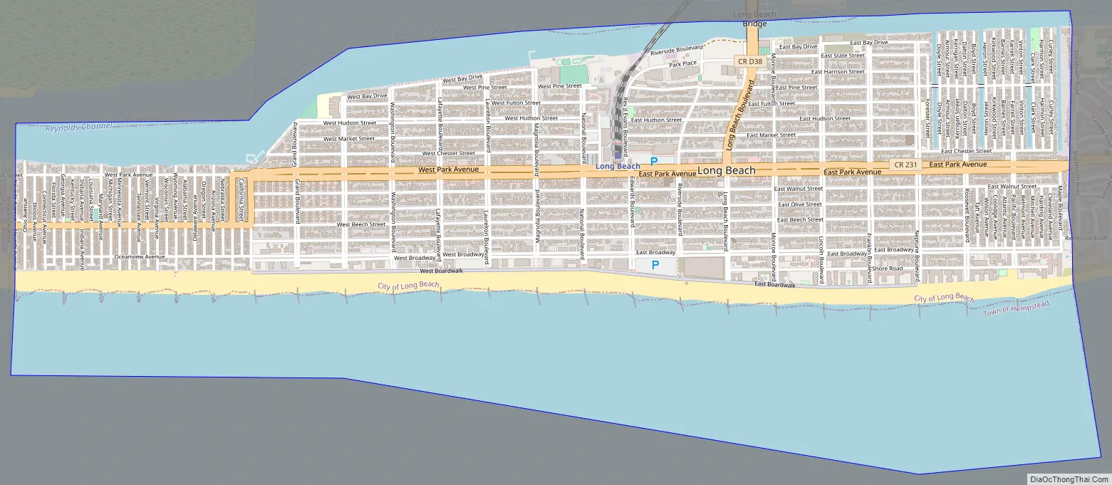
Long Beach Road Map
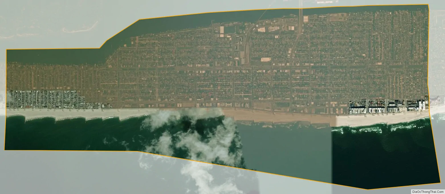
Long Beach city Satellite Map
Geography
According to the United States Census Bureau, the city has a total area of 3.90 square miles (10.1 km). Of its total area, 2.22 square miles (5.7 km) is land, and the rest is water.
Long Beach Barrier Island
The city is on a barrier island of the South Shore of Long Island. It shares the island with East Atlantic Beach, Atlantic Beach to the west and Lido Beach and Point Lookout to the east.
Climate
Long Beach has a humid subtropical climate (Cfa) under the Köppen climate classification, with humid hot summers and cool winters. It is one of the northernmost locations in this climate zone, allowing for the growth of warmer climate plants like Mimosa, Crape Myrtle, Southern Magnolia, and Sweetgum often seen further south. It is in plant hardiness zone 7b, like coastal Maryland. Precipitation is evenly distributed year-round, mostly in the form of rain although snowfall occurs each winter. Long Beach is vulnerable to tropical cyclones. Its climate is tempered by the influence of the Atlantic Ocean.
Cityscape
Unlike most suburban communities near New York City, Long Beach is a high-density community. Fewer than 40% of the homes are detached houses, and the city ranks as the 35th-densest community in the United States. The city is less than 1 mile (1.6 km) wide from ocean to bay and about 3.5 miles (5.6 km) long. The city is divided into the West End, home to many small bungalow and some large houses, and the East End. West of New York Avenue, the barrier island is less than 0.5 miles (800 m) wide and West Beech Street is the main east/west commercial street.
East of New York Avenue, the island is wider between the bay and ocean and is home to larger more expansive family houses. There is the city’s boardwalk, which begins at New York Avenue and ends at Neptune Boulevard. Along the boardwalk are many apartment buildings and condos. The main commercial strip is Park Avenue, which narrows into a small residential strip west of New York Avenue.
The city of Long Beach contains the following neighborhoods:
- Central District – The area between Magnolia Boulevard and Monroe Boulevard, known for its diverse population and historical hip hop scene. Long Beach’s City Hall is located in this area as well as the Martin Luther King Center and Emergency Department at Long Beach.
- North Park – The area north of Park Avenue, between the LIRR Station and Monroe Boulevard. Home to the Long Beach Housing Authority, M Block, and Pine Houses.
- The East End – The neighborhood between Monroe Boulevard and Maple Boulevard or Curley Street, significant for its historical immigrant population.
- The Canals – The area comprising several streets running north-south, with 4 parallel canals originating from Reynolds Channel. The canals begin on Forrester Street and end on Curley Street, each canal except for Bob Jones Canal is traversed by a short bridge carrying East Pine Street.
- The President Streets – The area comprising 9 north-south avenues of which 5 are named after former U.S. presidents, with the 4 exceptions of Atlantic, Belmont, and Mitchell Avenues, and Pacific Boulevard; Pacific Boulevard connects directly from Park Avenue to East Broadway, a parallel road to the south.
- Kennedy Plaza – An area in the Central District, at the intersection of National Boulevard and West Chester Street.
- The Walks – An area comprising extremely narrow sidewalks between houses. Each walk is named after a month.
- The West End – This area is home to many small bungalows and large houses close to one other, along small narrow streets. These streets, named after U.S. states, run from the beach to the bay, until they meet East Atlantic Beach at Nevada Avenue.
- Westholme – The neighborhood between New York Avenue and Magnolia Boulevard.
- Pine Houses – Popularly known as “P Block,”it is the housing project complex quartered in East Pine Street between Rev JJ Evans Blvd and Long Beach Road. It is infamous for being the historical breeding and battle ground for Long Beach hip hop artists, and is home to the P Block Bloods.
- M Block – Area in the Central district consisting of Monroe Blvd, the partition of East Bay Drive where the Urgentcare building and abandoned hospital are located, and the area between Pine Houses and Market Street. This area is known for its notable population of Caribbean and Latino migrants that moved to the neighborhood around the 1960s. It is infamous for housing the M Block faction of the Almighty Latin Kings, Trinitarios, and Mara Salvatruchas street gangs from the late 70s to modern times, though the latter 2 have been inactive since the 2010s.
National Register of Historic Places
Multiple sites in Long Beach are listed on the National Register of Historic Places, including:
- Barkin House
- Cobble Villa
- Granada Towers
- House at 226 West Penn Street
- Pauline Felix House
- Samuel Vaisberg House
- United States Post Office
Landmarks and historic districts
The city of Long Beach contains the following landmarks and historic district:
- 9/11 Memorial
- Holocaust Memorial at Kennedy Plaza
- John F. Kennedy Memorial
- Red Brick District
- Shine’s Bar on the West End
- House of Maguire
Museums and community centers
- House at 226 West Penn Street (also known as Long Beach Historical & Preservation Society Museum)
- Martin Luther King Community Center
See also
Map of New York State and its subdivision:- Albany
- Allegany
- Bronx
- Broome
- Cattaraugus
- Cayuga
- Chautauqua
- Chemung
- Chenango
- Clinton
- Columbia
- Cortland
- Delaware
- Dutchess
- Erie
- Essex
- Franklin
- Fulton
- Genesee
- Greene
- Hamilton
- Herkimer
- Jefferson
- Kings
- Lake Ontario
- Lewis
- Livingston
- Madison
- Monroe
- Montgomery
- Nassau
- New York
- Niagara
- Oneida
- Onondaga
- Ontario
- Orange
- Orleans
- Oswego
- Otsego
- Putnam
- Queens
- Rensselaer
- Richmond
- Rockland
- Saint Lawrence
- Saratoga
- Schenectady
- Schoharie
- Schuyler
- Seneca
- Steuben
- Suffolk
- Sullivan
- Tioga
- Tompkins
- Ulster
- Warren
- Washington
- Wayne
- Westchester
- Wyoming
- Yates
- Alabama
- Alaska
- Arizona
- Arkansas
- California
- Colorado
- Connecticut
- Delaware
- District of Columbia
- Florida
- Georgia
- Hawaii
- Idaho
- Illinois
- Indiana
- Iowa
- Kansas
- Kentucky
- Louisiana
- Maine
- Maryland
- Massachusetts
- Michigan
- Minnesota
- Mississippi
- Missouri
- Montana
- Nebraska
- Nevada
- New Hampshire
- New Jersey
- New Mexico
- New York
- North Carolina
- North Dakota
- Ohio
- Oklahoma
- Oregon
- Pennsylvania
- Rhode Island
- South Carolina
- South Dakota
- Tennessee
- Texas
- Utah
- Vermont
- Virginia
- Washington
- West Virginia
- Wisconsin
- Wyoming


