Mohawk is a village in Herkimer County, New York, United States. The population was 2,731 at the 2010 census. The village was named after the adjacent Mohawk River.
The village is at the northern border of the town of German Flatts and adjacent to the Erie Canal. Mohawk is southeast of Utica.
| Name: | Mohawk village |
|---|---|
| LSAD Code: | 47 |
| LSAD Description: | village (suffix) |
| State: | New York |
| County: | Herkimer County |
| Elevation: | 410 ft (125 m) |
| Total Area: | 0.90 sq mi (2.34 km²) |
| Land Area: | 0.88 sq mi (2.27 km²) |
| Water Area: | 0.03 sq mi (0.07 km²) |
| Total Population: | 2,415 |
| Population Density: | 2,753.71/sq mi (1,062.67/km²) |
| ZIP code: | 13407 |
| Area code: | 315 |
| FIPS code: | 3647823 |
| GNISfeature ID: | 0957470 |
| Website: | mohawk-ny.org |
Online Interactive Map
Click on ![]() to view map in "full screen" mode.
to view map in "full screen" mode.
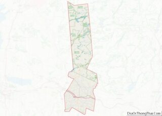
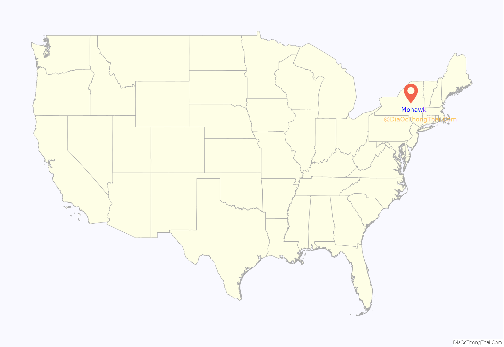
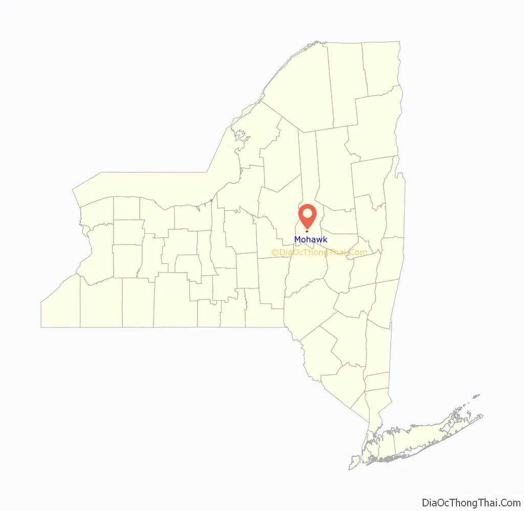
Mohawk location map. Where is Mohawk village?
History
The area was settled by Palatine Germans after 1722. In 1725, the King of Great Britain and Governor Burnet granted Mohawk to the Palatine Germans in what was known as the Burnetsfield Patent.
George Washington was known to stop in Mohawk to have lunch at the Shoemaker Tavern on his way to and from Fort Stanwix in Rome.
Mohawk became known as “Bennetts Corners” after a hotel stand that was located here in 1826. In 1838, the village became known as “Mohawk”.
The village was incorporated on April 16, 1844. The first president of the village, Frederick Bellinger, came into office on May 4 of that year.
The first mayor of Mohawk was James V. Casey, who was elected in 1960. The current mayor is Jim Baron.
Mohawk is one of only twelve villages in New York still incorporated under a municipal charter, the other villages having incorporated or re-incorporated under the provisions of Village Law.
The Herkimer County shootings took place partially in Mohawk on March 13, 2013.
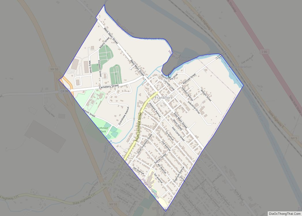
Mohawk Road Map
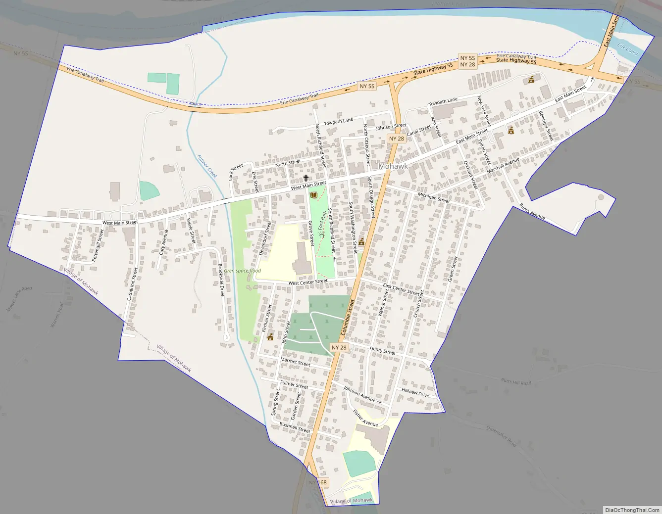
Mohawk city Satellite Map
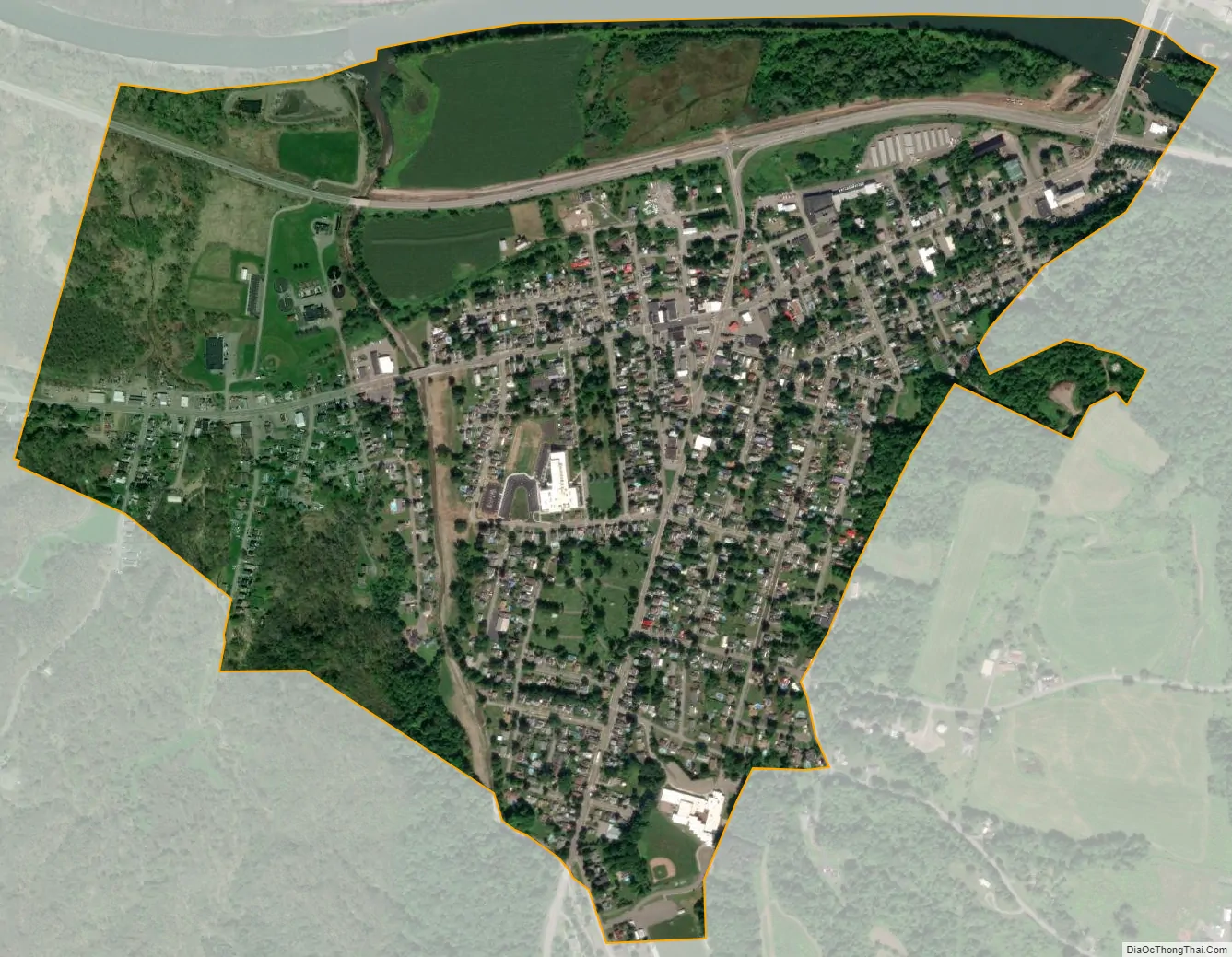
Geography
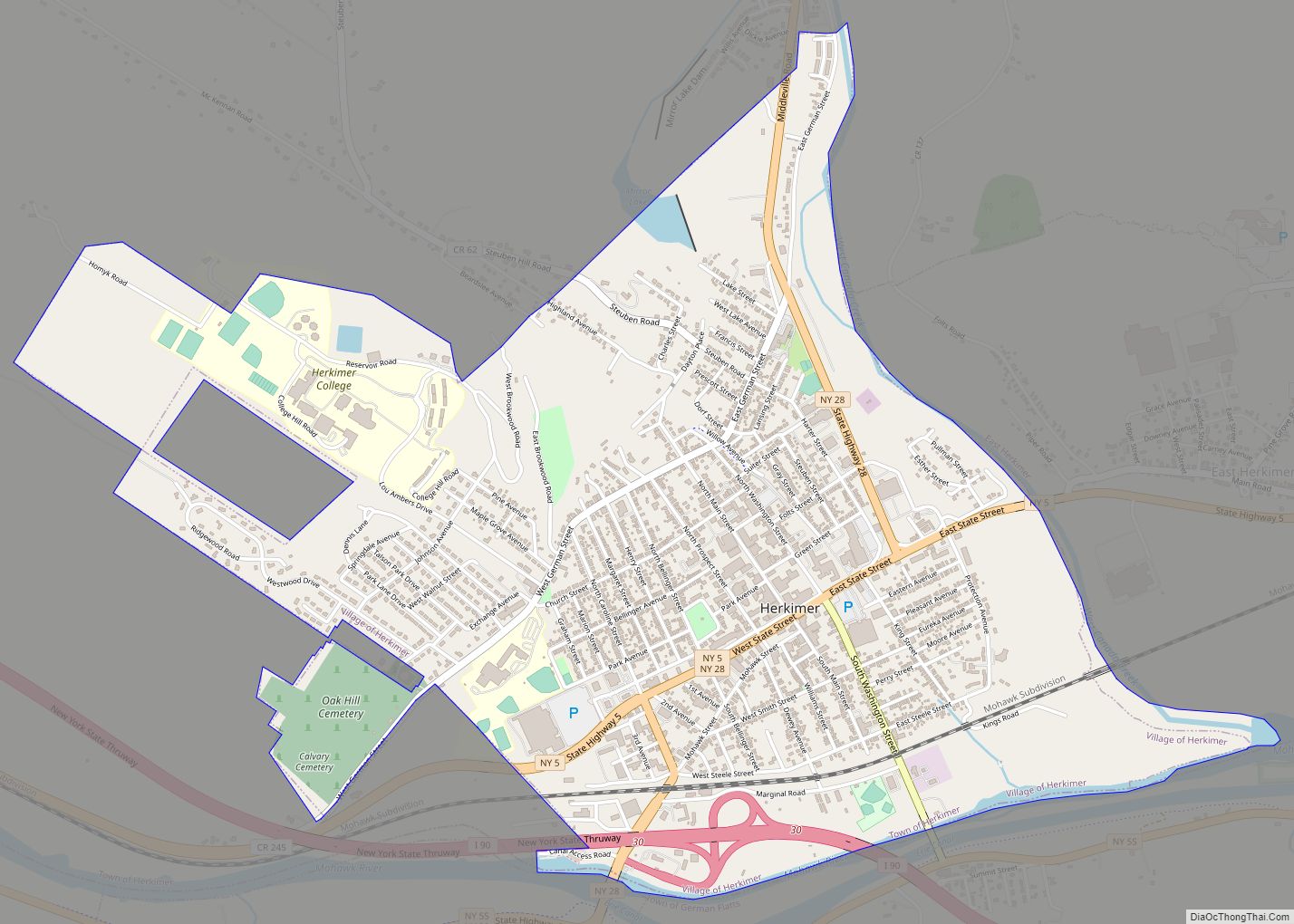
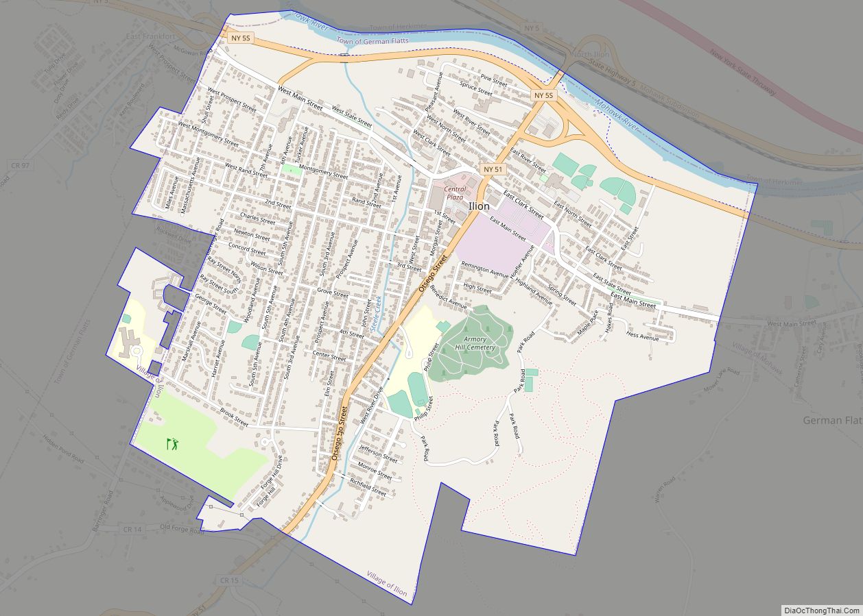
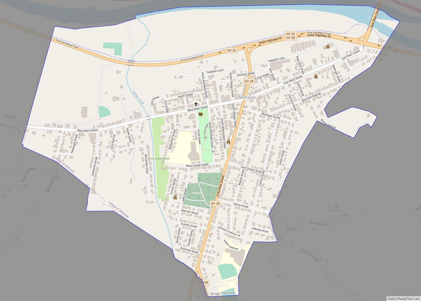
Mohawk is located in the northern part of the town of German Flatts at 43°0′37″N 75°0′18″W / 43.01028°N 75.00500°W / 43.01028; -75.00500 (43.010194, -75.005022), on the south side of the Mohawk River. It is bordered to the west by the village of Ilion and to the northeast, across the river, by the village of Herkimer.
According to the United States Census Bureau, Mohawk has a total area of 0.89 square miles (2.3 km), of which 0.03 square miles (0.07 km), or 2.94%, are water.
New York State Route 5S, an east-west highway, runs through the northern part of the village, leading east (downriver) 23 miles (37 km) to Fort Plain and west (upriver) 14 miles (23 km) to Utica. New York State Route 28 (Warren Street/Columbia Street) is a north-south highway through the village center, leading northeast 1.5 miles (2.4 km) to Herkimer and south 12 miles (19 km) to Richfield Springs. New York State Route 168 (Hammond Street) has its western terminus in the village and leads southeast 14 miles (23 km) to Starkville.
See also
Map of New York State and its subdivision:- Albany
- Allegany
- Bronx
- Broome
- Cattaraugus
- Cayuga
- Chautauqua
- Chemung
- Chenango
- Clinton
- Columbia
- Cortland
- Delaware
- Dutchess
- Erie
- Essex
- Franklin
- Fulton
- Genesee
- Greene
- Hamilton
- Herkimer
- Jefferson
- Kings
- Lake Ontario
- Lewis
- Livingston
- Madison
- Monroe
- Montgomery
- Nassau
- New York
- Niagara
- Oneida
- Onondaga
- Ontario
- Orange
- Orleans
- Oswego
- Otsego
- Putnam
- Queens
- Rensselaer
- Richmond
- Rockland
- Saint Lawrence
- Saratoga
- Schenectady
- Schoharie
- Schuyler
- Seneca
- Steuben
- Suffolk
- Sullivan
- Tioga
- Tompkins
- Ulster
- Warren
- Washington
- Wayne
- Westchester
- Wyoming
- Yates
- Alabama
- Alaska
- Arizona
- Arkansas
- California
- Colorado
- Connecticut
- Delaware
- District of Columbia
- Florida
- Georgia
- Hawaii
- Idaho
- Illinois
- Indiana
- Iowa
- Kansas
- Kentucky
- Louisiana
- Maine
- Maryland
- Massachusetts
- Michigan
- Minnesota
- Mississippi
- Missouri
- Montana
- Nebraska
- Nevada
- New Hampshire
- New Jersey
- New Mexico
- New York
- North Carolina
- North Dakota
- Ohio
- Oklahoma
- Oregon
- Pennsylvania
- Rhode Island
- South Carolina
- South Dakota
- Tennessee
- Texas
- Utah
- Vermont
- Virginia
- Washington
- West Virginia
- Wisconsin
- Wyoming