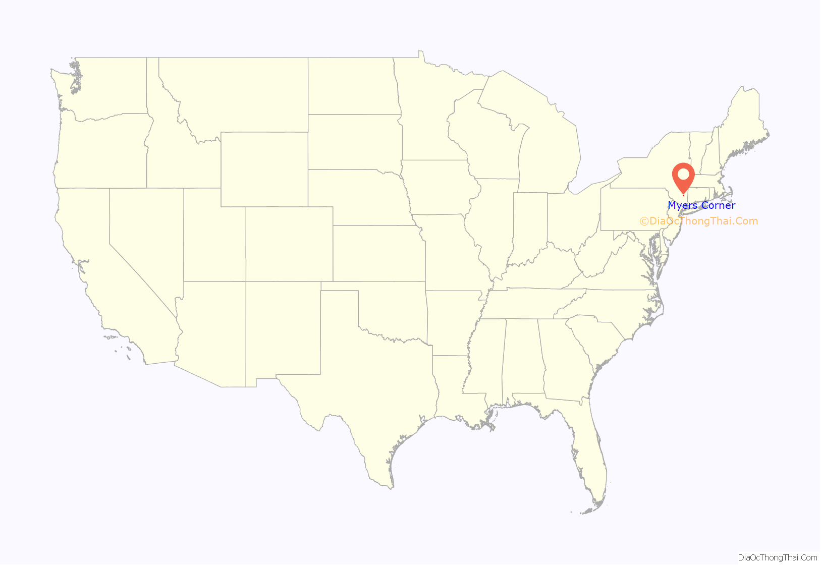
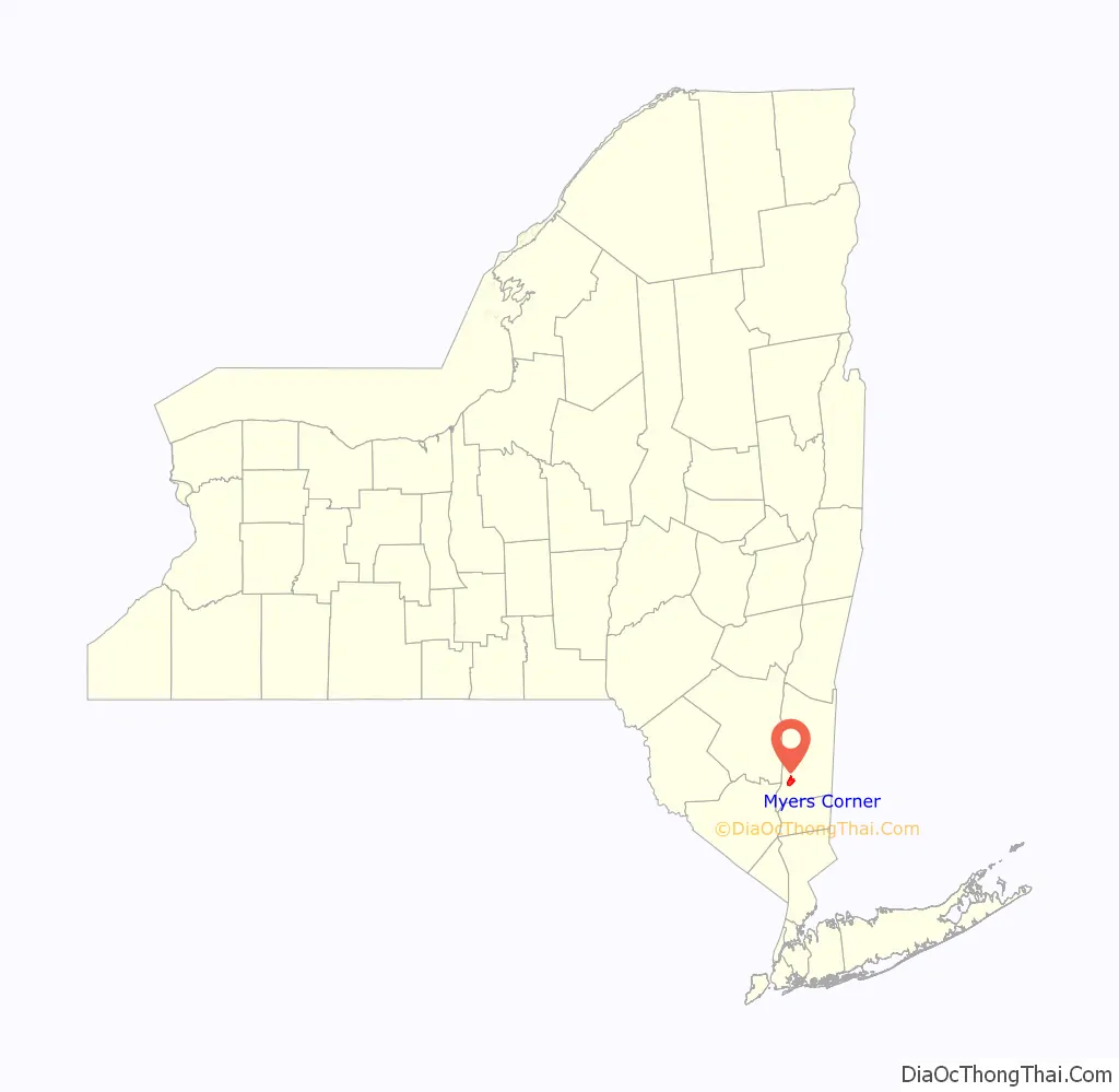
Myers Corner is a hamlet and census-designated place (CDP) in the town of Wappinger, Dutchess County, New York, United States. The population was 6,790 at the 2010 census. It is part of the Poughkeepsie–Newburgh–Middletown, NY Metropolitan Statistical Area as well as the larger New York–Newark–Bridgeport, NY-NJ–CT–PA Combined Statistical Area.
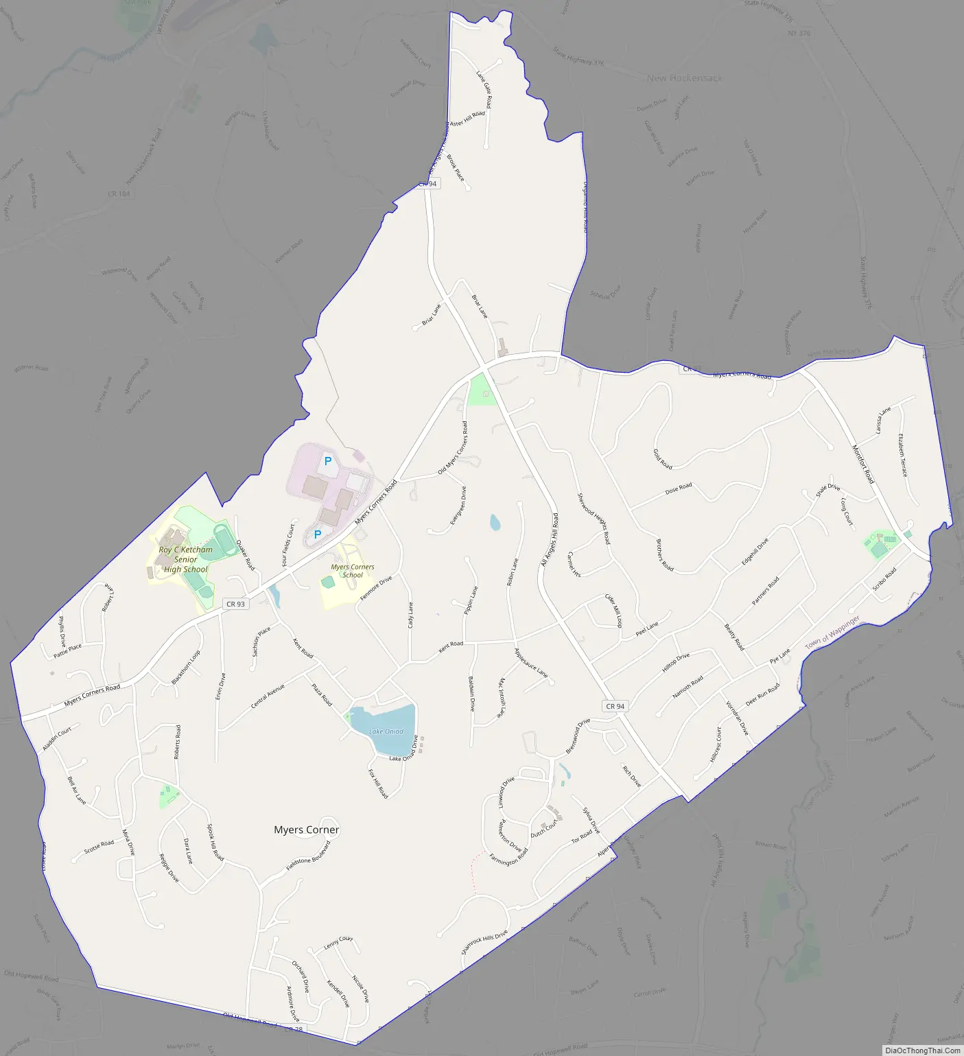
Myers Corner is in the town of Wappinger on County Route 93 and County Route 94. Myers Corners School is also located here.
| Name: | Myers Corner CDP |
|---|---|
| LSAD Code: | 57 |
| LSAD Description: | CDP (suffix) |
| State: | New York |
| County: | Dutchess County |
| Elevation: | 217 ft (66 m) |
| Total Area: | 8.59 sq mi (22.24 km²) |
| Land Area: | 8.54 sq mi (22.12 km²) |
| Water Area: | 0.05 sq mi (0.12 km²) |
| Total Population: | 10,598 |
| Population Density: | 1,240.98/sq mi (479.12/km²) |
| FIPS code: | 3649363 |
| GNISfeature ID: | 0958227 |
Online Interactive Map
Click on ![]() to view map in "full screen" mode.
to view map in "full screen" mode.
Myers Corner location map. Where is Myers Corner CDP?
Myers Corner Road Map
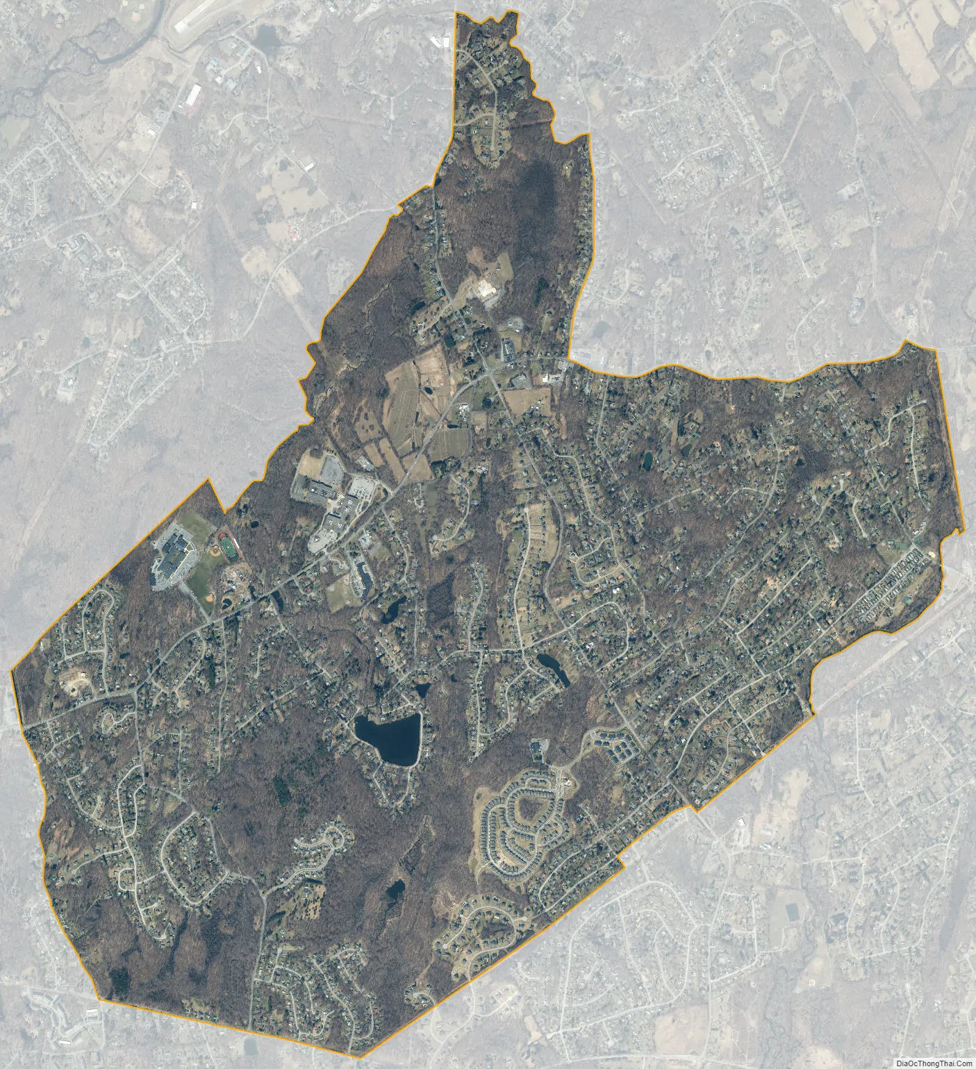
Myers Corner city Satellite Map
Geography
Myers Corner is located in the eastern part of the town of Wappinger at 41°35′34″N 73°52′21″W / 41.59278°N 73.87250°W / 41.59278; -73.87250 (41.592776, -73.872365). It is bordered on its farthest western extent by the village of Wappingers Falls and to the east by Sprout Creek, which forms the border with the town of East Fishkill. Myers Corner is 8 miles (13 km) south of the city of Poughkeepsie and 10 miles (16 km) northeast of the city of Beacon.
According to the United States Census Bureau, the Myers Corner CDP has a total area of 5.1 square miles (13.1 km), of which 5.0 square miles (13.0 km) is land and 0.04 square miles (0.1 km), or 0.76%, is water.
See also
Map of New York State and its subdivision:- Albany
- Allegany
- Bronx
- Broome
- Cattaraugus
- Cayuga
- Chautauqua
- Chemung
- Chenango
- Clinton
- Columbia
- Cortland
- Delaware
- Dutchess
- Erie
- Essex
- Franklin
- Fulton
- Genesee
- Greene
- Hamilton
- Herkimer
- Jefferson
- Kings
- Lake Ontario
- Lewis
- Livingston
- Madison
- Monroe
- Montgomery
- Nassau
- New York
- Niagara
- Oneida
- Onondaga
- Ontario
- Orange
- Orleans
- Oswego
- Otsego
- Putnam
- Queens
- Rensselaer
- Richmond
- Rockland
- Saint Lawrence
- Saratoga
- Schenectady
- Schoharie
- Schuyler
- Seneca
- Steuben
- Suffolk
- Sullivan
- Tioga
- Tompkins
- Ulster
- Warren
- Washington
- Wayne
- Westchester
- Wyoming
- Yates
- Alabama
- Alaska
- Arizona
- Arkansas
- California
- Colorado
- Connecticut
- Delaware
- District of Columbia
- Florida
- Georgia
- Hawaii
- Idaho
- Illinois
- Indiana
- Iowa
- Kansas
- Kentucky
- Louisiana
- Maine
- Maryland
- Massachusetts
- Michigan
- Minnesota
- Mississippi
- Missouri
- Montana
- Nebraska
- Nevada
- New Hampshire
- New Jersey
- New Mexico
- New York
- North Carolina
- North Dakota
- Ohio
- Oklahoma
- Oregon
- Pennsylvania
- Rhode Island
- South Carolina
- South Dakota
- Tennessee
- Texas
- Utah
- Vermont
- Virginia
- Washington
- West Virginia
- Wisconsin
- Wyoming


